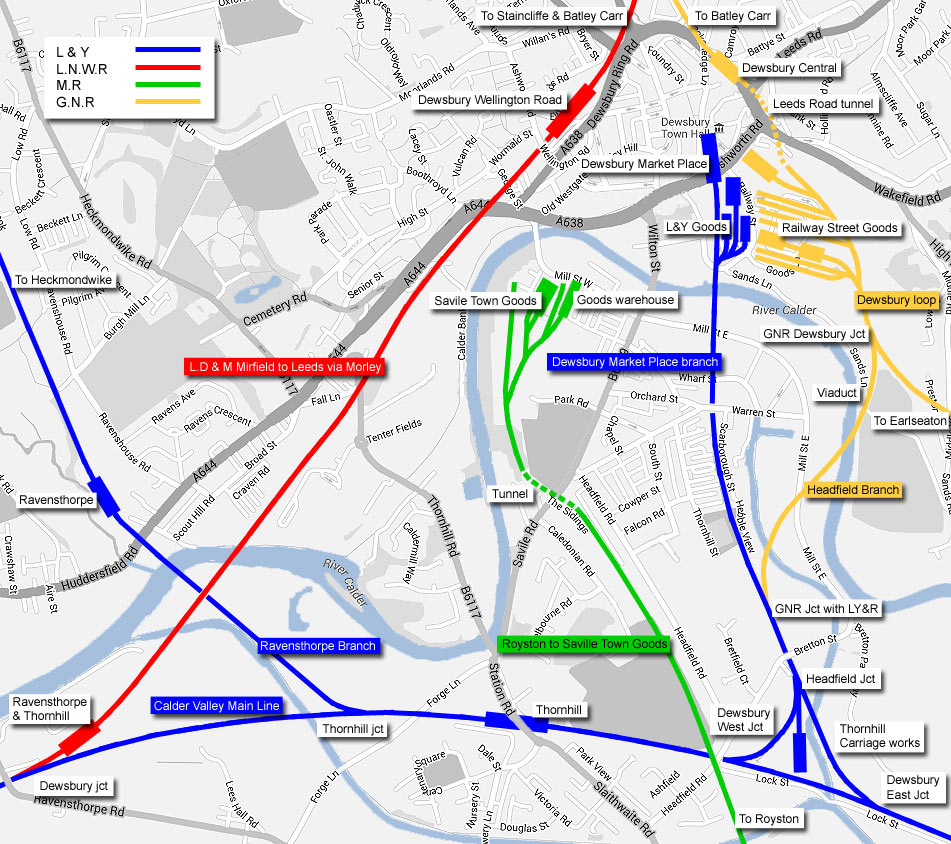
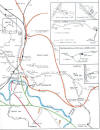
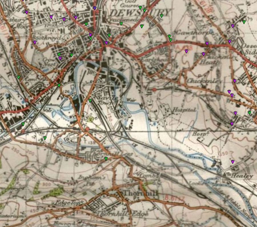
Dewsbury Hybrid map Rails 1910 roads 2013
|
 Dewsbury
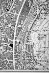
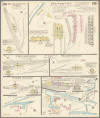
& Batley Map c1900 : Ralph Rawlinson Dewsbury
& Batley Map c1900 : Ralph Rawlinson |
2/6A_0006_small.jpg) 2/7A_0007_small.jpg) Dewsbury maps (1890) : Malcolm
Mallison Dewsbury maps (1890) : Malcolm
Mallison |
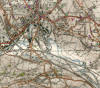
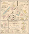
 Dewsbury
(c1931) : Malcolm Mallison Dewsbury
(c1931) : Malcolm Mallison
From the 1931 survey- Batley, Dewsbury, Woodkirk |
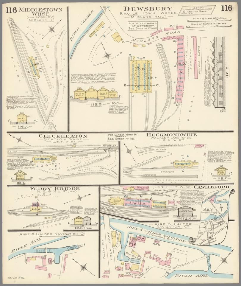
  Dewsbury
maps :
Ralph Rawlinson Dewsbury
maps :
Ralph Rawlinson |
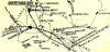
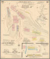
2/8A_0008_small.jpg) 2/9A_0009_small.jpg) Ravensthorpe & Thornhill maps (1890)
: Malcolm Mallison Ravensthorpe & Thornhill maps (1890)
: Malcolm Mallison
See also Calder Valley |
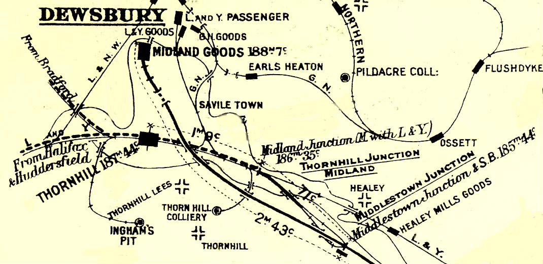
   Layout
Plans : Keith Looker Layout
Plans : Keith Looker
Dewsbury. |
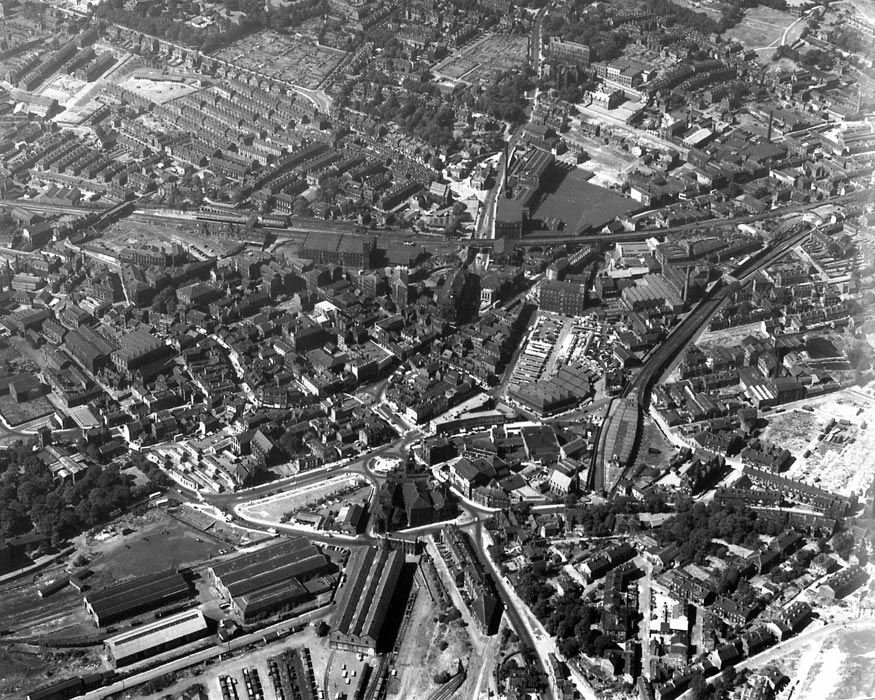
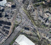
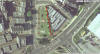
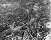  Dewsbury
Aerial : Stephen Helm Dewsbury
Aerial : Stephen Helm
My mate found the photo's dumped on the floor in a
corner of an empty office he took over for his business and passed them
on to me. I was born in Dewsbury in 1952 and can recall the Old Central
station and Dewsbury Goods quite clearly. |
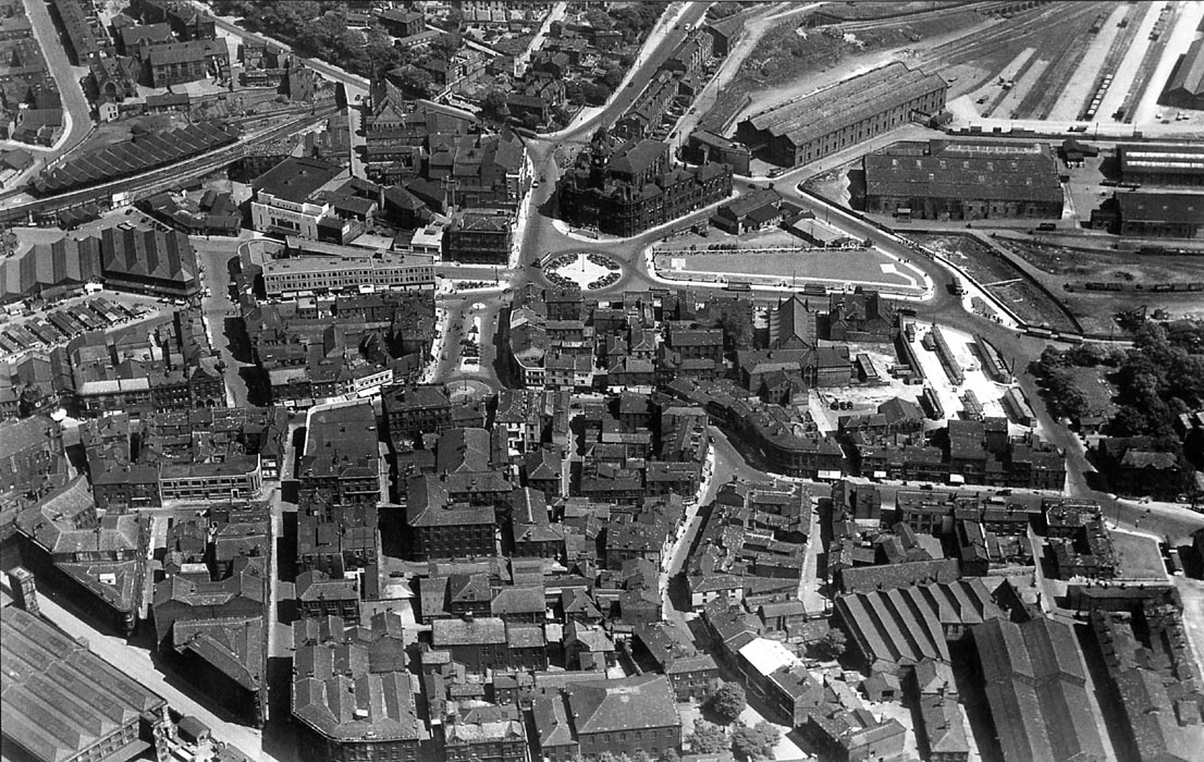
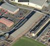
 Dewsbury
Aerial : Keith Looker Dewsbury
Aerial : Keith Looker
Photo of Dewsbury showing Lancashire and Yorkshire
Station by the Town Hall and the Lancashire Yorkshire station by what
people now call the covered market. |
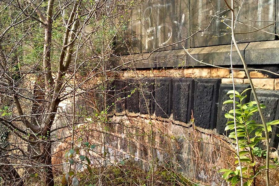
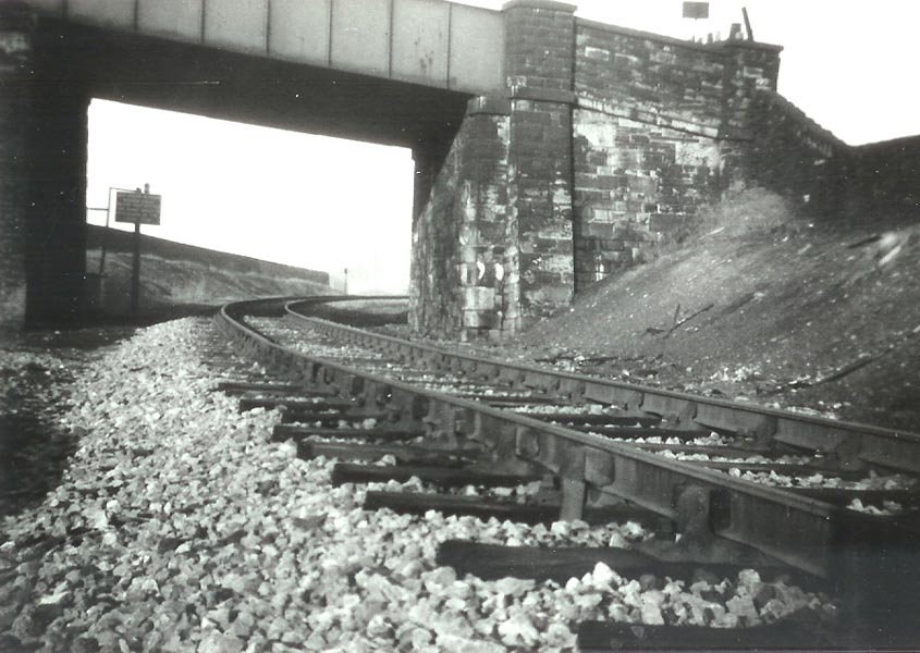
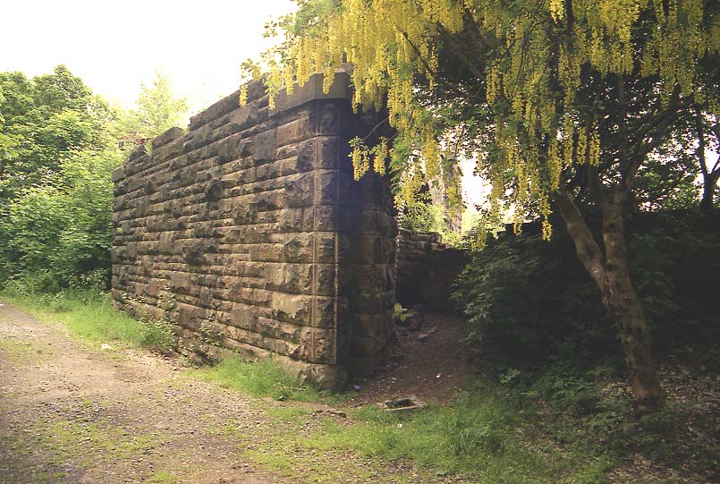
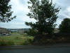
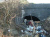
Leeds road (Dewsbury) tunnel (213 yards) GNR
 Leeds
road tunnel (23-03-12) : Graeme Bickerdike Leeds
road tunnel (23-03-12) : Graeme Bickerdike
I was out walking this afternoon and stumbled across the eastern portal
of Leeds Road/Dewsbury Tunnel, which everyone seemed to have assumed was
completely buried. Landfill has claimed half of it, but the top and
western part remains. I need to go back to get some better pictures but
attached is one I took on my camera phone.
Note : Hugh Mcsherry
About 23 years ago, I drove a bull douser and back filled a tunnel on
Leeds road Dewsbury. This is the photo of where the tunnel was. |
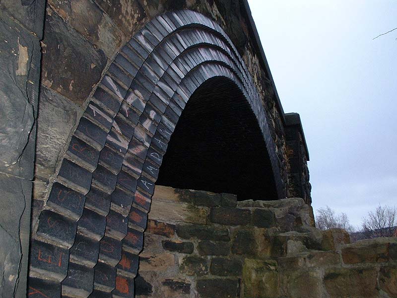
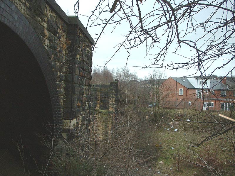
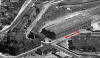
Leeds
road tunnel (1890 /2013) : Graeme Bickerdike
 The
attached aerial shows today’s Dewsbury with the 1890 Town Plan overlayed.
This suggests that any parapet/retaining wall associated with the tunnel
probably disappeared with the realignment of the local roads. The
north-west portal was beneath what is now the ring road. The plan does
however indicate that the tunnel had two ventilation shafts, which I
didn’t previously know. Although partly buried, the south-east portal
can still be found in the undergrowth. It’s pretty clear though that the
central and northern sections of the tunnel were opened out and removed
when the ring road was constructed. The
attached aerial shows today’s Dewsbury with the 1890 Town Plan overlayed.
This suggests that any parapet/retaining wall associated with the tunnel
probably disappeared with the realignment of the local roads. The
north-west portal was beneath what is now the ring road. The plan does
however indicate that the tunnel had two ventilation shafts, which I
didn’t previously know. Although partly buried, the south-east portal
can still be found in the undergrowth. It’s pretty clear though that the
central and northern sections of the tunnel were opened out and removed
when the ring road was constructed. |
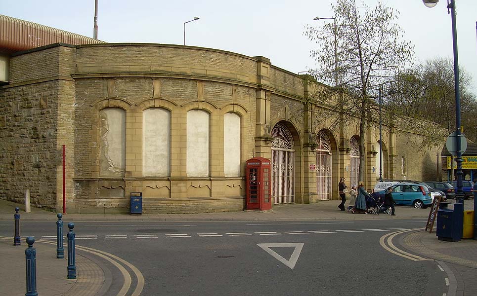
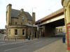
Dewsbury
Central GNR
 Opened
1874. Closed 07-09-1964. Opened
1874. Closed 07-09-1964.
GNR Dewsbury Central Station (12-03-07) :
David Webdale
The entrances to the station from road level. Taken from
Whitehall Way. See Dewsbury Loop |
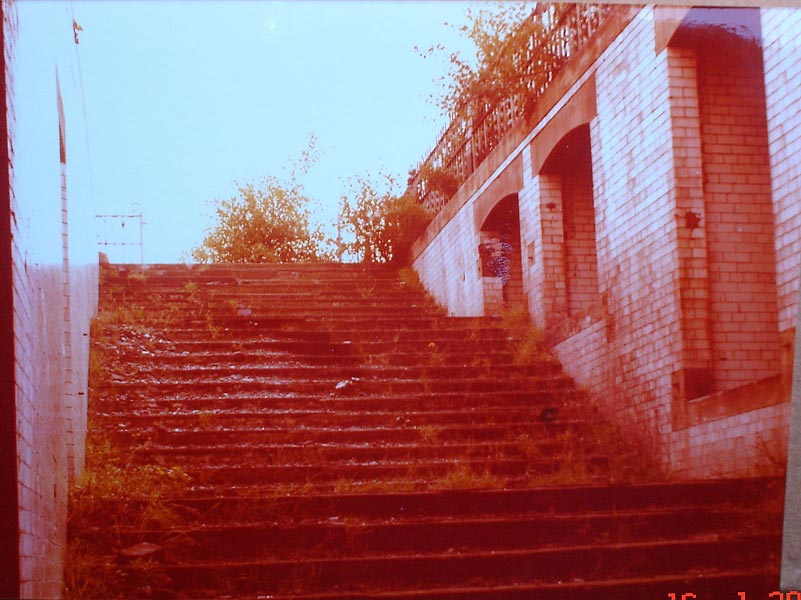
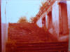 GNR
Dewsbury Central Station (1978) : Tony Geering GNR
Dewsbury Central Station (1978) : Tony Geering
Dewsbury Central station - the steps which led up to the
platform. |
 GNR
Dewsbury Central Station (1978) : Tony Geering GNR
Dewsbury Central Station (1978) : Tony Geering
Taken on the platform in 1978 looking north. |
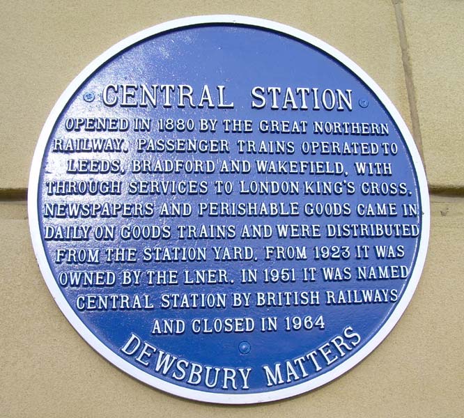
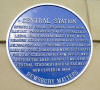 Plaque
(12-03-07) : David Webdale Plaque
(12-03-07) : David Webdale
Spotted this blue plaque on the side of the
building, good idea we thought.
See Pinzac55s photo's on flickr |
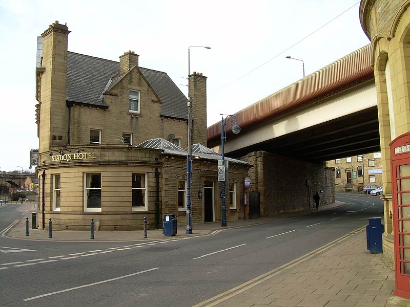
 Station
Hotel (12-03-07) : David Webdale Station
Hotel (12-03-07) : David Webdale
Looking across Corporation Street, tasty hotel
building.
Dewsbury ring road flies over where the tracks once were, original bridge
stonework survives beneath.
Viaduct carrying existing Dewsbury Wellington Street to Batley line
visible in the background on extreme left. |
 GNR
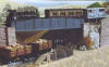
Crackenedge Lane bridge (1978) : Tony Geering GNR
Crackenedge Lane bridge (1978) : Tony Geering
The bridge which carried the station over Crackenedge Lane. The photo is
taken from Crackenedge Lane and shows the junction with Battye Street.
This was an unusual shaped bridge with a single central pillar on this
side of the bridge rising from the pavement corner. The bridge was
re-built to carry the ring road. |
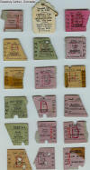 Dewsbury Central
tickets (c1960s) : Alan Sedgwick Dewsbury Central
tickets (c1960s) : Alan Sedgwick
Memento's of just a few Schoolboy Railway Journeys in the
last days of 'sixties' steam.
The Dewsbury Central ticket is from Sept 63, the Thornhil Lees WM was
1967.
August '65 Leeds Central-Retford, the others are mostly from 1965/66. |
Dewsbury Headfield Junction L&Y
 Headfield
Junction L&Y (13-02-07) : Andrew Stopford Headfield
Junction L&Y (13-02-07) : Andrew Stopford
Facing south, looking towards Dewsbury East
junction.
The siding into
cement works was the line to Dewsbury West junction which is now
disconnected at that end. |
 Headfield
Junction L&Y Dewsbury
Tripper (n.d) : C/O Michael Kaye with permission from Paul Corrie Headfield
Junction L&Y Dewsbury
Tripper (n.d) : C/O Michael Kaye with permission from Paul Corrie
Facing south, class 08 heading towards Dewsbury.
The line on the right, through the cement works, connected to the Calder
Valley mainline at Dewsbury west junction, now disconnected.
The line on the left connects to the Calder Valley mainline at Dewsbury
east junction. Originally a carriage & wagon works was situated within
the triangle. |
Dewsbury Headfield Branch GNR
Headfield Junction (13-02-07) : Andrew Stopford
 Market
Place Branch looking north towards Dewsbury - Market Place Branch went through
the partially obscured left arch. Line to right was the spur to the GNR
line which went over the big Calder Viaduct. I think the existing line
(now just a siding from Dewsbury East junction for the cement works and
stone depot) finishes just out of shot. Compare this pic with bottom shot
page 74 Railway Memories no. 11. The spur line had been lifted at the time
of the shot in the book and was relaid later before being closed and
lifted again in the early 90s to a point just out of shot round the bend. Market
Place Branch looking north towards Dewsbury - Market Place Branch went through
the partially obscured left arch. Line to right was the spur to the GNR
line which went over the big Calder Viaduct. I think the existing line
(now just a siding from Dewsbury East junction for the cement works and
stone depot) finishes just out of shot. Compare this pic with bottom shot
page 74 Railway Memories no. 11. The spur line had been lifted at the time
of the shot in the book and was relaid later before being closed and
lifted again in the early 90s to a point just out of shot round the bend. |
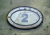 Bridge
Plate No2: Alan Sedgwick Bridge
Plate No2: Alan Sedgwick
From the Bridge seen in the distance in the above
photo. (Thornhill st bridge)
I guess the road bridge that the bridges picture was taken from on your
site, could have been bridge 1. |
 Bridge
No2 (1966) : Alan Sedgwick Bridge
No2 (1966) : Alan Sedgwick
Thornhill st bridge photographed in 1966.
The plate in above photo can be seen on right column arch hanging in 2
pieces. |
Headfield 2 (19-02-07) : Andrew Stopford
 Now
the end of the line on the Dewsbury side of and looking towards Headfield
Junction. The Market Place branch ran to the right towards the camera
under the partially obscured arch. This remaining line rejoins the Market
Place formation at this bridge and then runs to the Calder Valley main
line via Headfield & Dewsbury East junctions and serves a stone products
yard on the left just out of sight round the bend, and a cement works at
Headfield Junction on the right a little further on. The line into the
cement works was the line from Headfield Junction to Dewsbury West
junction. Now
the end of the line on the Dewsbury side of and looking towards Headfield
Junction. The Market Place branch ran to the right towards the camera
under the partially obscured arch. This remaining line rejoins the Market
Place formation at this bridge and then runs to the Calder Valley main
line via Headfield & Dewsbury East junctions and serves a stone products
yard on the left just out of sight round the bend, and a cement works at
Headfield Junction on the right a little further on. The line into the
cement works was the line from Headfield Junction to Dewsbury West
junction. |
 Headfield
1 (19-02-07) : Andrew Stopford Headfield
1 (19-02-07) : Andrew Stopford
looking towards Railway St - looks like the tracklifters
got bored and just left these rails where they lifted them! |
 Headfield
Junction
Bridge (03-02-08) : Andrew Stopford Headfield
Junction
Bridge (03-02-08) : Andrew Stopford
Headfield Junction from the canal - Dewsbury to the right.
Tracks still go
through this bridge in connection with the Blue Circle Cement works just
out of shot to the right. |
 Headfield
Branch Canal Bridge Dewsbury
Tripper (n.d) : C/O Michael Kaye with permission from Paul Corrie Headfield
Branch Canal Bridge Dewsbury
Tripper (n.d) : C/O Michael Kaye with permission from Paul Corrie
Class 08. |
 Headfield
Branch Canal Bridge (03-02-08) : Andrew Stopford Headfield
Branch Canal Bridge (03-02-08) : Andrew Stopford
Iron bridge carrying the connecting line between the
Market Place branch & the GNR at Dewsbury over the short canal spur from the
Calder & Hebble Navigation into Dewsbury Canal Basin. |
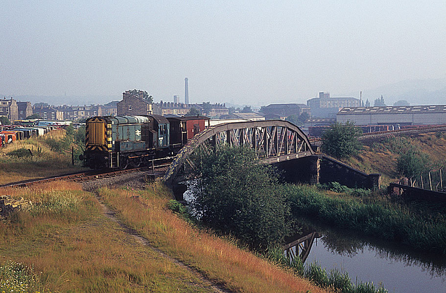
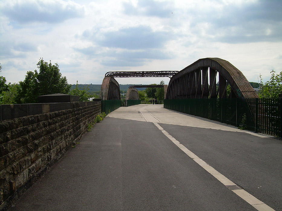
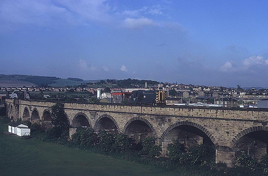
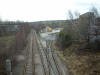
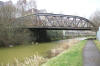
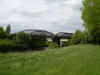
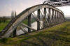
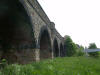
 Headfield
Branch River Calder bridge (13-03-06) : Graeme Bickerdike Headfield
Branch River Calder bridge (13-03-06) : Graeme Bickerdike
The open bow string girder bridge over the Calder. |
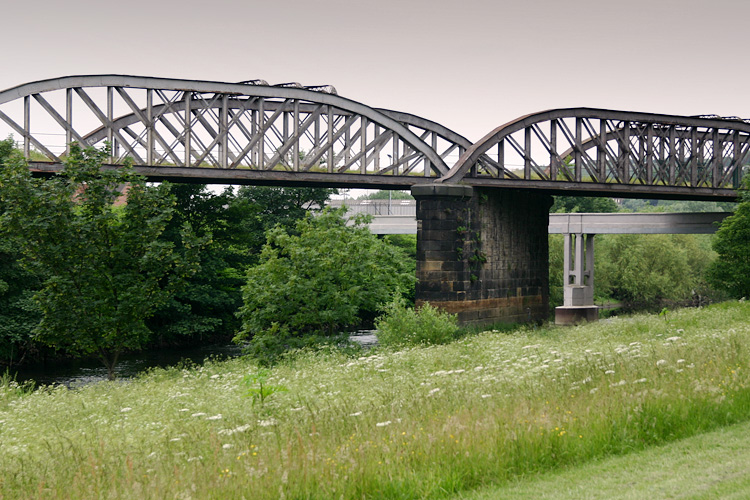
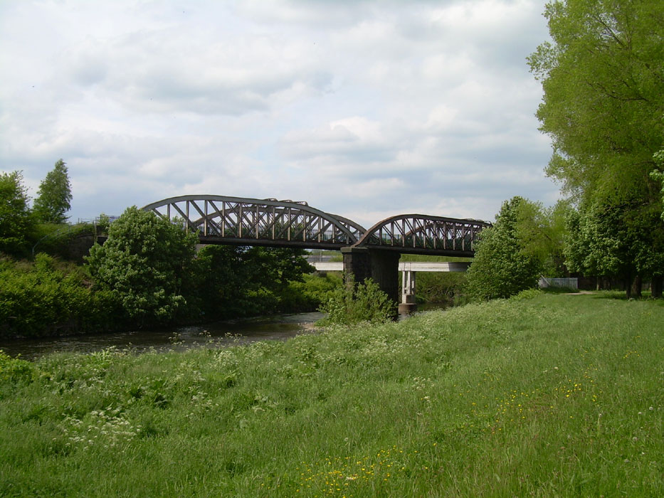
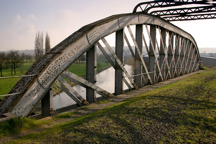
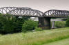
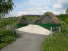
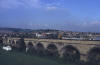
 Headfield
Branch River Calder bridge (27-05-13) : David Webdale Headfield
Branch River Calder bridge (27-05-13) : David Webdale
The open bow string girder bridge over the Calder in 2013. Now forms
part of the Dewsbury to Ossett Greenway. |
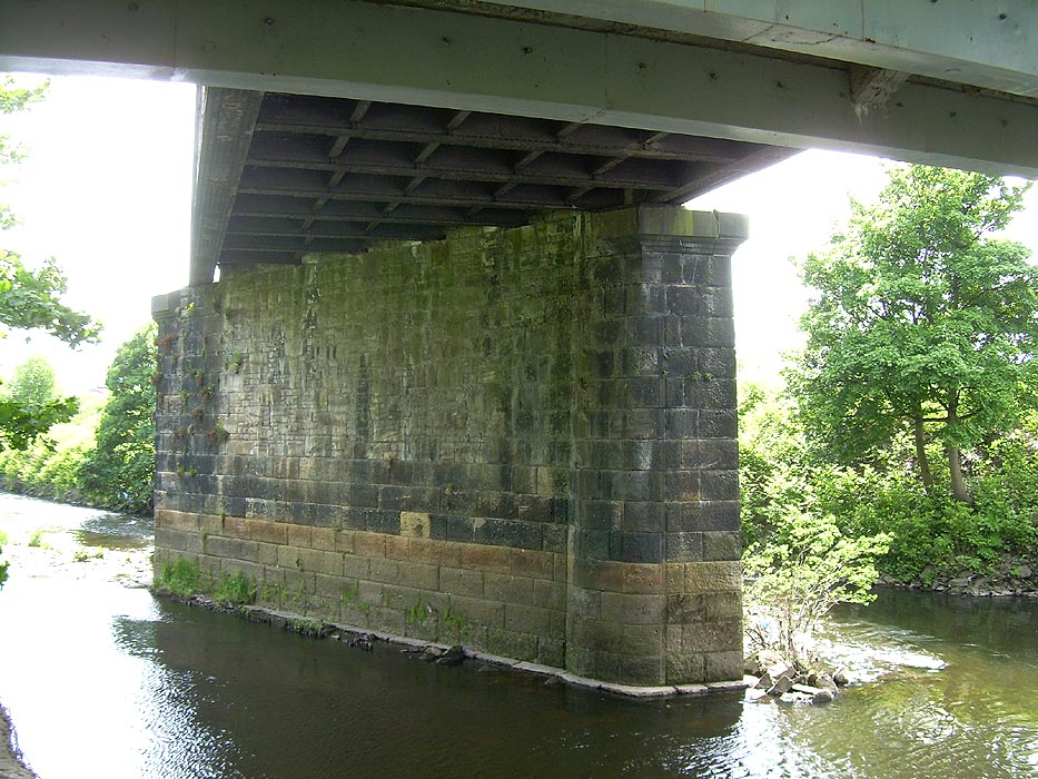
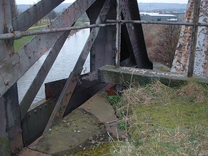
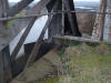
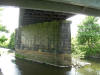 Headfield
Branch River Calder bridge (27-05-13) : David Webdale Headfield
Branch River Calder bridge (27-05-13) : David Webdale
Bridge support from below. |
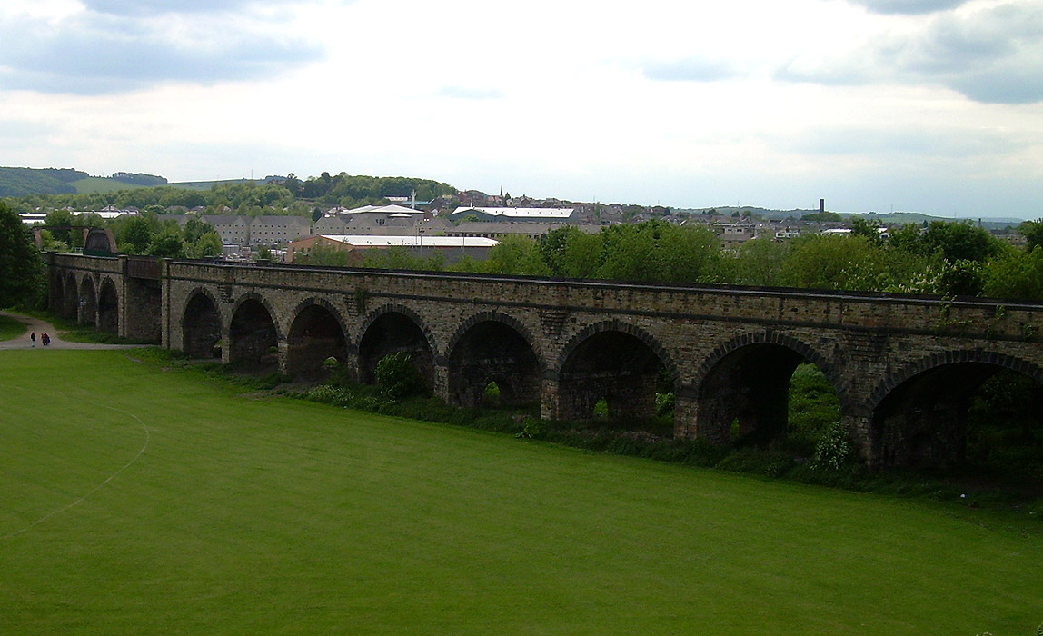
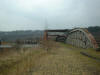
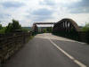  Headfield
Branch River Calder bridge & viaduct (27-05-13) : David Webdale Headfield
Branch River Calder bridge & viaduct (27-05-13) : David Webdale
Views from on top of the viaduct looking south towards the river. |
 Headfield
Branch River Calder bridge (13-03-06) : Graeme Bickerdike Headfield
Branch River Calder bridge (13-03-06) : Graeme Bickerdike
looks out over the river from the bridge. |
 Headfield
Branch River Calder bridge (19-02-07) : Andrew Stopford Headfield
Branch River Calder bridge (19-02-07) : Andrew Stopford
Calder Viaduct looking towards Railway St Yard |
 Headfield
Branch River Calder bridge (27-05-13) : David Webdale Headfield
Branch River Calder bridge (27-05-13) : David Webdale
Same view in 2013. |
 Headfield
Branch River Calder bridge (19-02-07) : Andrew Stopford Headfield
Branch River Calder bridge (19-02-07) : Andrew Stopford
Calder Viaduct signs of decay! |
 Headfield
Branch River Calder bridge (19-02-07) : Andrew Stopford Headfield
Branch River Calder bridge (19-02-07) : Andrew Stopford
Calder Viaduct central iron section - just put it in
because I like it!
|
 Headfield
Branch viaduct Dewsbury
Tripper (n.d) : C/O Michael Kaye with permission from Paul Corrie Headfield
Branch viaduct Dewsbury
Tripper (n.d) : C/O Michael Kaye with permission from Paul Corrie
Class 08 on the Headfield viaduct. |
 Headfield
Branch River Calder bridge (27-05-13) : David Webdale Headfield
Branch River Calder bridge (27-05-13) : David Webdale
Same view in 2013. Now forms part of the Dewsbury to Ossett Greenway. |
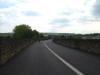
 Headfield
Branch River Calder bridge & viaduct (27-05-13) : David Webdale Headfield
Branch River Calder bridge & viaduct (27-05-13) : David Webdale
The view from Sands lane facing south towards the river. |
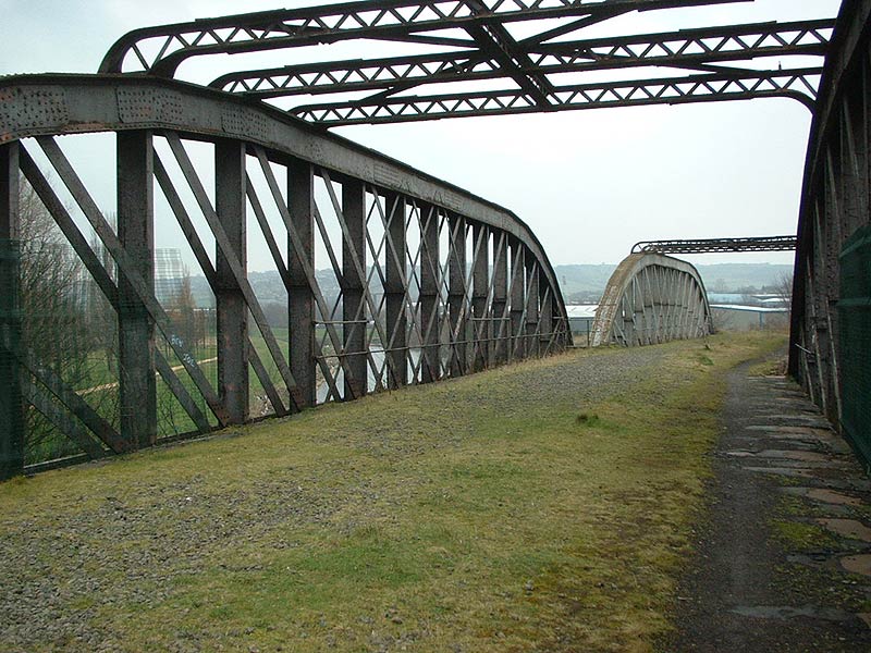
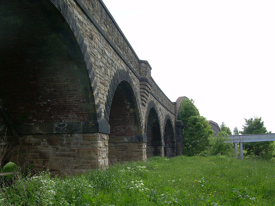
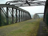
 Headfield
Branch
viaduct (13-03-06)
: Graeme Bickerdike
website - http://www.forgottenrelics.co.uk/ Headfield
Branch
viaduct (13-03-06)
: Graeme Bickerdike
website - http://www.forgottenrelics.co.uk/
Features the northern end of the viaduct on the line to Headfield
Junction. |
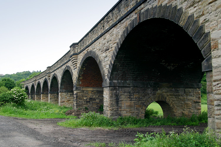
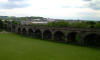
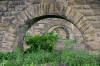 Headfield
Branch
viaduct (13-03-06) : Graeme Bickerdike Headfield
Branch
viaduct (13-03-06) : Graeme Bickerdike
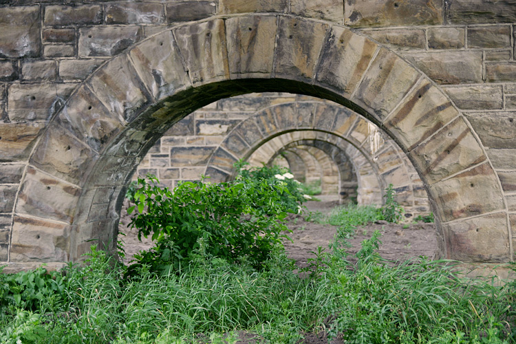
This photo shows the ‘relieving arches’.
Their purpose is to redirect the line of thrust borne from above - in
this case, the actual structure.
It moves the loading to the outer ends of the pier making for a more
concentrated load. |
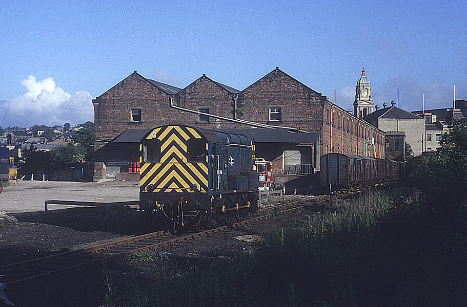
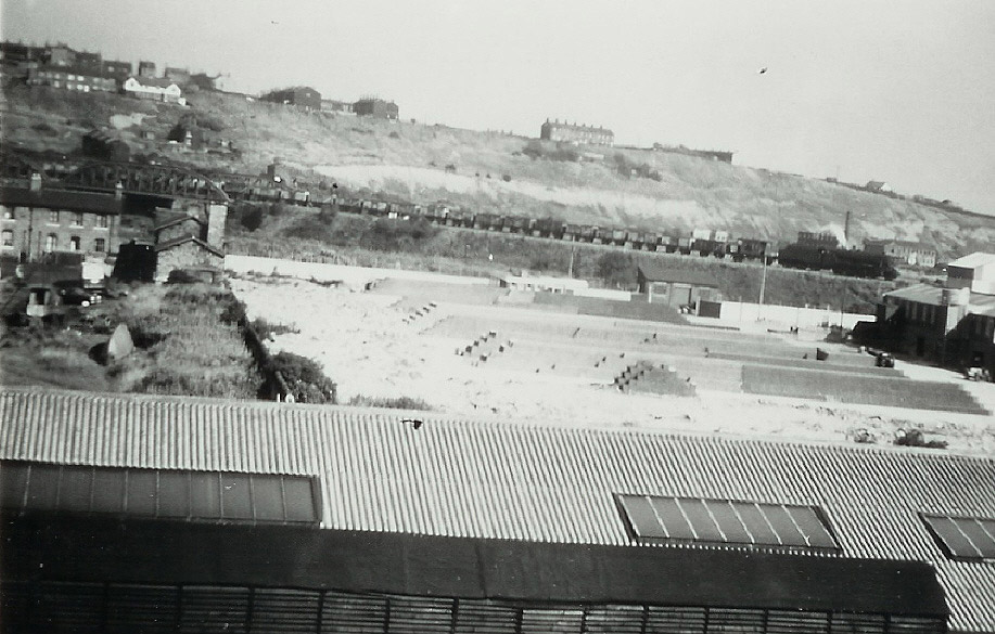
Dewsbury
Railway Street Goods GNR
Opened ?. Closed ?.
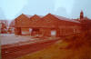 GNR
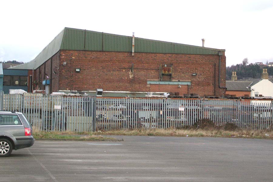
Dewsbury Railway street goods (1978) : Tony Geering GNR
Dewsbury Railway street goods (1978) : Tony Geering
GNR brick goods buildings which were near the Town Hall
on Railway Street. |
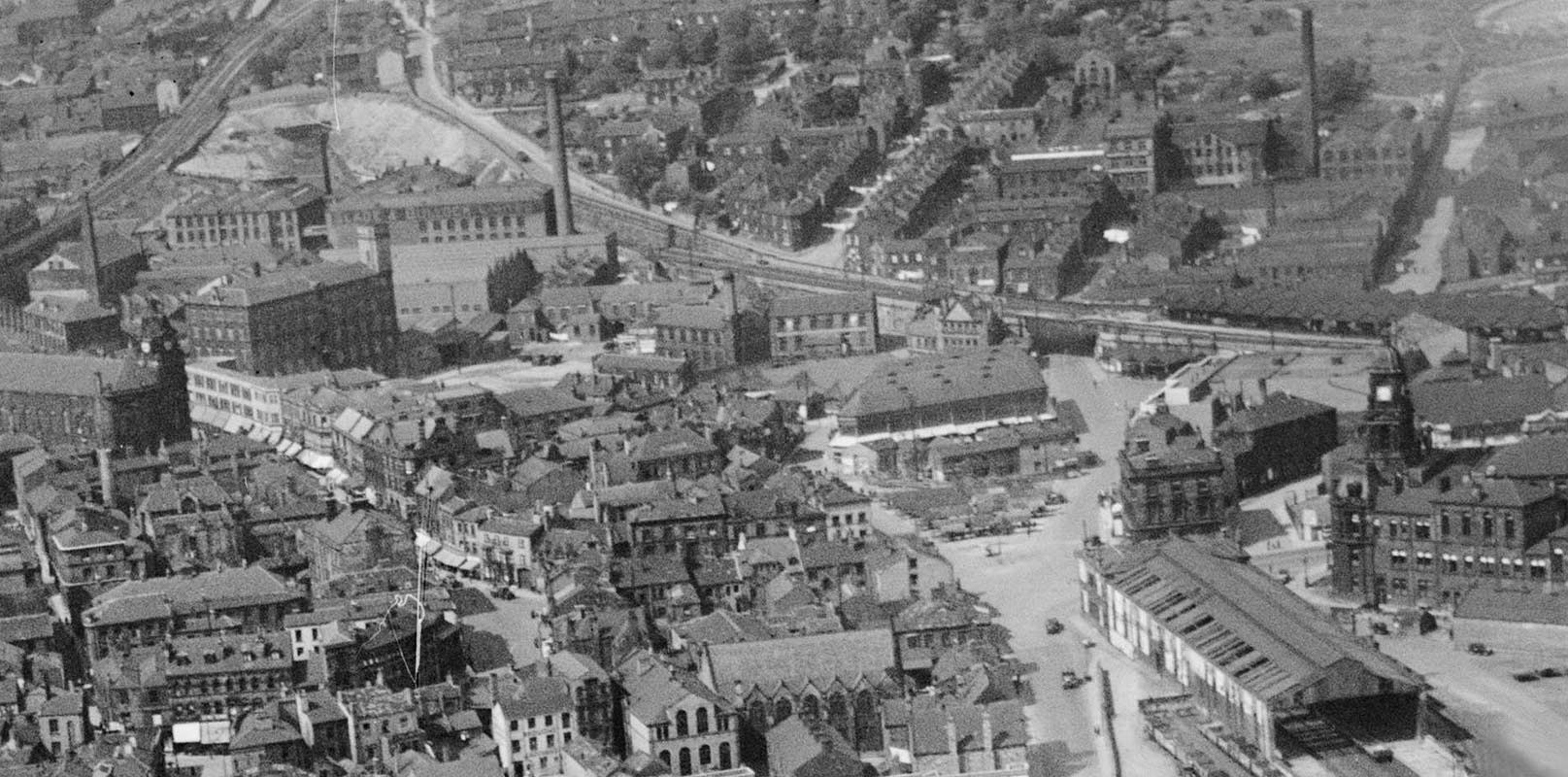
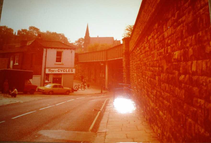
  GNR
Dewsbury Railway street goods (1978) : Tony Geering GNR
Dewsbury Railway street goods (1978) : Tony Geering
Railway Street - it has all been redeveloped and is a car
park for the retail outlets now. The building on the left-hand side is the
brick building in my previous photo. It can be seen clearly in the aerial
photo top of this page. I have attached a copy showing roughly where I was
standing and the direction. |
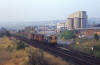
 Dewsbury
Tripper (n.d) : C/O Michael Kaye with permission from Paul Corrie Dewsbury
Tripper (n.d) : C/O Michael Kaye with permission from Paul Corrie
Class 08 at Railway street goods. |
 Dewsbury
Tripper (n.d) : C/O Michael Kaye with permission from Paul Corrie Dewsbury
Tripper (n.d) : C/O Michael Kaye with permission from Paul Corrie
Class 08 at Railway street goods. |
 Dewsbury
Tripper (n.d) : C/O Michael Kaye with permission from Paul Corrie Dewsbury
Tripper (n.d) : C/O Michael Kaye with permission from Paul Corrie
Class 08 at Railway street goods. |
 Dewsbury
Tripper (n.d) : C/O Michael Kaye with permission from Paul Corrie Dewsbury
Tripper (n.d) : C/O Michael Kaye with permission from Paul Corrie
Class 08 at Railway street goods.
Note : Richard Johnson
The Redland Rooftiles wagons were formerly owned or leased by ICI
and were converted at Procor Engineering in late 1985, where I was
apprentice fitter.
When they arrived at Procor, they were in s bit of a state. They had
been stored for some time in Healey Mills yard. One of my first jobs as
apprentice fitter was replacing rotten wooden planks and adjusting the
huge dampers which stopped the doors from dropping too heavily. After
this they were given a rough coat of Redland Rooftiles green and put
into service. Two sources on the web quote closure of the line as 1990,
so that ties it down a bit. I think the Redland traffic was the last on
the branch, although Procor had some 100 tonne oil tanks stored there
for a while. |
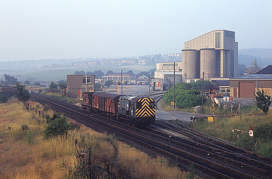
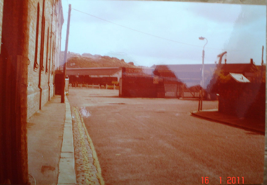
Railway St goods (c1960) : Alan Sedgwick
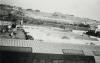 The view from our Attic
on Leamington Terrace, Scarborough Street. Looking over the old & new Hodgsons
yard roofs & Marley Tiles Yard towards Sands Lane with the canal basin
left side. Our house was to the right [East] of the L & Y Market Place line
which after passing us went over a level crossing which split the bus sheds
in two on Mill Street East before it crossed the River. In this photo
an 8f 2-8-0 takes a goods train from Railway Street
towards Thornhill Lees Jncn on the briefly re-laid single track. The view from our Attic
on Leamington Terrace, Scarborough Street. Looking over the old & new Hodgsons
yard roofs & Marley Tiles Yard towards Sands Lane with the canal basin
left side. Our house was to the right [East] of the L & Y Market Place line
which after passing us went over a level crossing which split the bus sheds
in two on Mill Street East before it crossed the River. In this photo
an 8f 2-8-0 takes a goods train from Railway Street
towards Thornhill Lees Jncn on the briefly re-laid single track. |
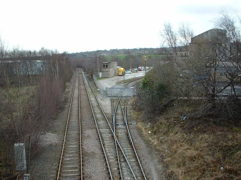
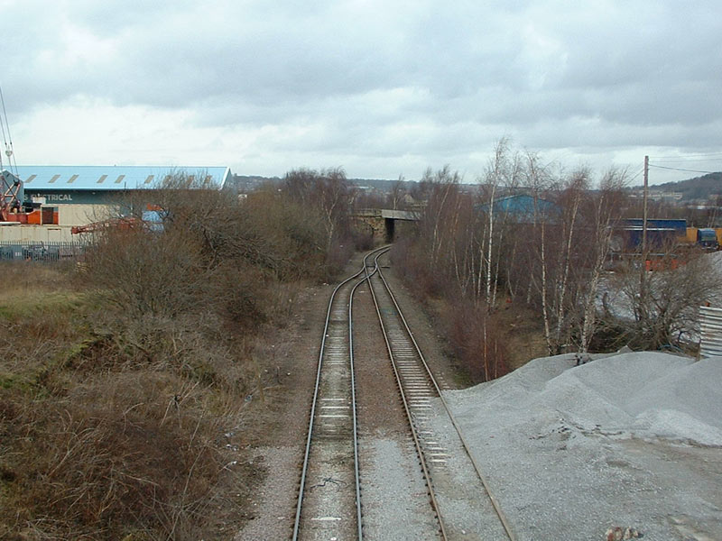
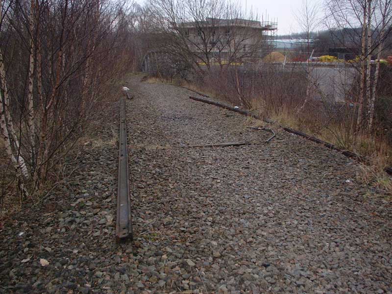
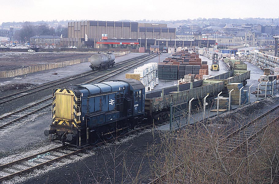
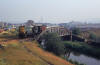
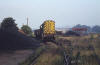
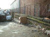
 Railway St yard (19-02-07) : Andrew Stopford Railway St yard (19-02-07) : Andrew Stopford
As far as you can walk and looking towards the Railway St yard (now
the site of a retail park) - the spur line has now joined the main line
which came through Earlesheaton Tunnel from Osset. |
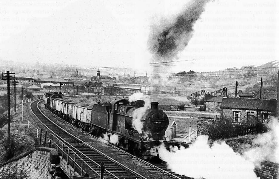
Dewsbury
Market Place L&Y
Opened 1867. Closed 1930. Demolished 1938.
Dewsbury
Market Place : Stephen Helm
 4F 44457 heading out of Dewsbury Market Place Station. 4F 44457 heading out of Dewsbury Market Place Station.
Note :
Alan Sedgwick
I just noticed that the picture mentions leaving Market place station
(ex L&Y) but I am almost certain its out of Dewsbury Central or the
Railway street goods yard this side of the tunnel under Leeds/Wakefield
roads and about to enter Earlsheaton tunnel. |
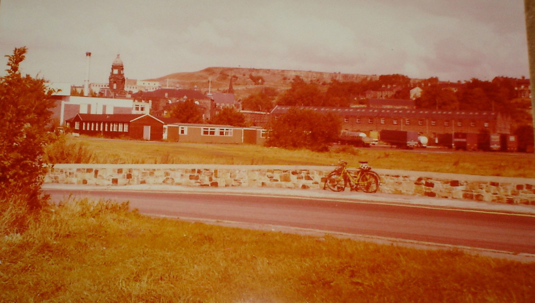
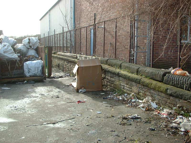
 L&Y
crossing (1978) : Tony Geering L&Y
crossing (1978) : Tony Geering
Sands Lane Crossing - my bicycle marks the approximate position where
Long causeway changed to Sands Lane. At this point there used to be a
level crossing for the L&Y goods yard - this was just over the wall where
the grass and temporary buildings are. Today there is a sports shop and
KFC here.You can see the GNR brick goods buildings in the distance. |
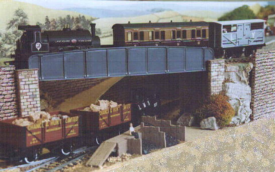
 L&Y
model bridge : Tony Geering L&Y
model bridge : Tony Geering
I have a small model railway based on the Lancashire and Yorkshire
Railway. Here is a photo of the bridge on it.
You can see that I got my inspiration from the seeing many real railway
bridges around the area. |
 Mill street East (13-02-07) : Andrew Stopford Mill street East (13-02-07) : Andrew Stopford
Railway wall at 'platform' height if ever I saw one - Market Place branch
looking from Mill St East (close to Calder crossing point) away from
Dewsbury. Line of branch to right of camera in line with the
wall/platform/loading dock |
 Market
Place (19-02-07) : Andrew Stopford Market
Place (19-02-07) : Andrew Stopford
The line of the Market Place branch looking towards Market Place from
under the bridge in Headfield 2 |
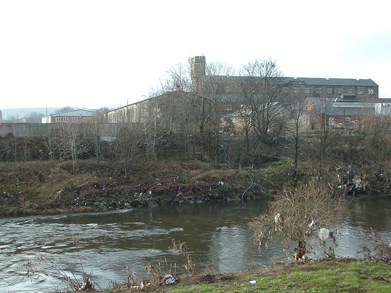
Market Place branch River Calder bridge
(20-02-07) : Andrew Stopford
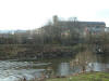 I've
been determined to find some trace of this and finally succeeded! It's a
shot of the Savile Town side abutement of the bridge that brought the
Market Place branch across the River Calder and the final few yards to the
terminus. If you look in the centre of the pictures just above the river
water level you can see some built up stonework. There is an industrial
unit built on the actual line of the branch right on top of the abutement.
There is no trace of anything (unless I eventually uncover it!) on the
Dewsbury side - a retail park has been built and there are some fairly
recent storm drainage outflows where the Dewsbury side abutement would
have been. I've
been determined to find some trace of this and finally succeeded! It's a
shot of the Savile Town side abutement of the bridge that brought the
Market Place branch across the River Calder and the final few yards to the
terminus. If you look in the centre of the pictures just above the river
water level you can see some built up stonework. There is an industrial
unit built on the actual line of the branch right on top of the abutement.
There is no trace of anything (unless I eventually uncover it!) on the
Dewsbury side - a retail park has been built and there are some fairly
recent storm drainage outflows where the Dewsbury side abutement would
have been. |
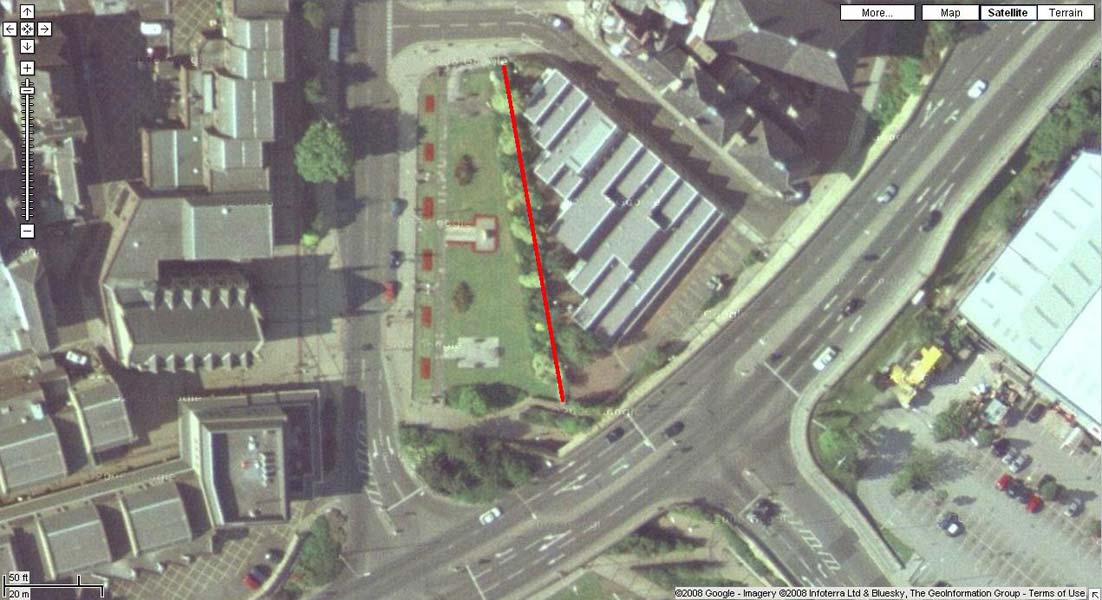
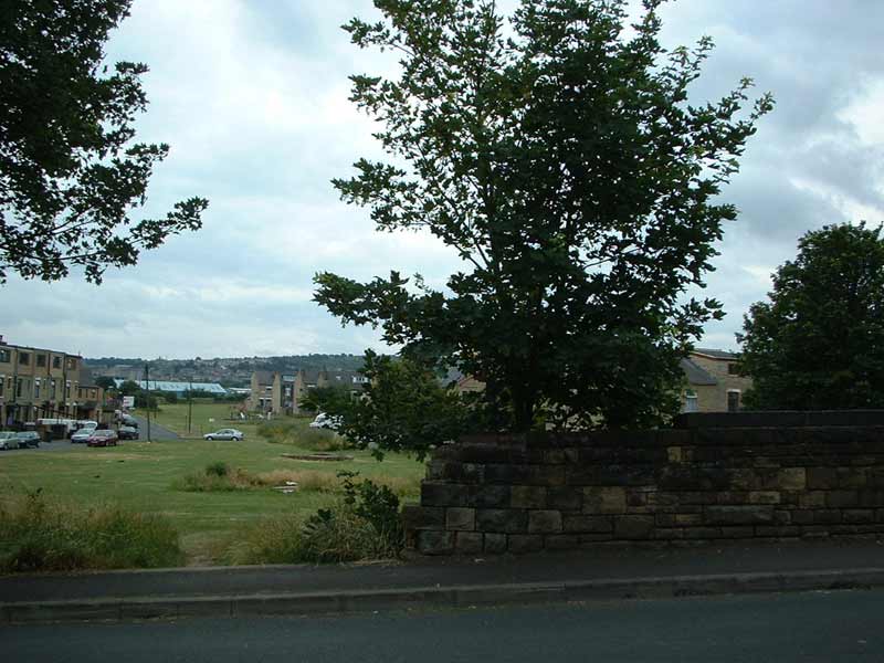
Market Place Google (10-08-08) : Luke
Senior
 Been
taking a look at the approaches to Dewsbury Market place, and I believe I
may have found evidence of the station and a level crossing. Firstly,
running almost parallel to Longcauseway, from near Dewsbury Town Hall,
behind the small public garden and war memorial, is a low wall, which
judging by maps and the one photo of the station I've found is in exactly
the right place for the Eastern wall of the station, and may just be from
the station. One part to the Southern end of the station appear to be show
a transition from internal to external to external, which judging by maps
may indicate the end of building attached to the east side of the station. Been
taking a look at the approaches to Dewsbury Market place, and I believe I
may have found evidence of the station and a level crossing. Firstly,
running almost parallel to Longcauseway, from near Dewsbury Town Hall,
behind the small public garden and war memorial, is a low wall, which
judging by maps and the one photo of the station I've found is in exactly
the right place for the Eastern wall of the station, and may just be from
the station. One part to the Southern end of the station appear to be show
a transition from internal to external to external, which judging by maps
may indicate the end of building attached to the east side of the station. |
Dewsbury
Savile Town Goods MR
Opened 01-03-1906. Closed 18-12-1950.
See Royston Savile Town
  Dewsbury
Saville Town :
Ralph Rawlinson Dewsbury
Saville Town :
Ralph Rawlinson
Saville Town goods yard site now sees light
industrial use, brick built goods warehouse converted. |
 South
Street/Warren Street (07-06) : Andrew
Stopford South
Street/Warren Street (07-06) : Andrew
Stopford
Bridge over the line of the Savile Town goods branch - near South
Street/Warren Street, Savile Town,
looking away from Savile Town. July
06. |
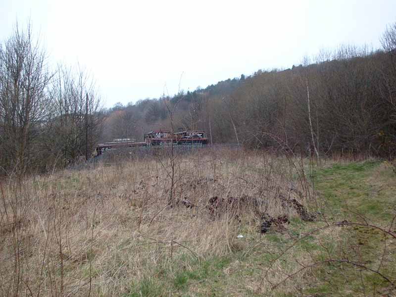
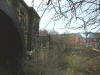
 Savile
road tunnel (06-02-07) : Andrew Stopford Savile
road tunnel (06-02-07) : Andrew Stopford
Managed to find the northern portal of the Savile Town Goods Branch
tunnel under Savile Road, Dewsbury!
I think the southern portal is well and truly buried unless somebody
knows different...! You can see into it through the fence.
It seems fairly dry but there is a lot of rubbish inside. |
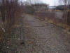
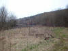
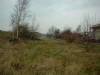
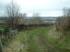
 Trackbed
(03-02-07) : Andrew Stopford Trackbed
(03-02-07) : Andrew Stopford
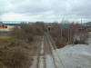
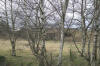
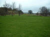
Facing toward Dewsbury Headfield road to the right |
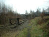
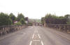
 Bridge
(03-02-07) : Andrew Stopford Bridge
(03-02-07) : Andrew Stopford
Overbridge off the common near Thornhill |
 Headfield
road facing south (31-05-04) : David Webdale Headfield
road facing south (31-05-04) : David Webdale
Bridge buttresses clearly visible on each side of
Headfield road.
To the right the line headed towards Savile town & crossed the Ravensthorpe to Wakefield line,
the Ravensthorpe to Wakefield line passes under
the road here. |
 Right
hand side of
Headfield road facing south. (31-05-04) : David Webdale Right
hand side of
Headfield road facing south. (31-05-04) : David Webdale
Just to the right of above photo, remnants of the
other side of the bridge. |
 Headfield
road bridge (03-02-07) : Andrew Stopford Headfield
road bridge (03-02-07) : Andrew Stopford
Brick detail. |
 Headfield
road bridge facing south (03-02-07) : Andrew Stopford Headfield
road bridge facing south (03-02-07) : Andrew Stopford
looking across the ravine.
The Ravensthorpe to Wakefield line is down in the bottom. |


2/6A_0006.jpg)
2/7A_0007.jpg)

2/8A_0008.jpg)
2/9A_0009.jpg)