 Railway Ramblers gazetteer Railway Ramblers gazetteer
See also the Railway Ramblers gazetteer -
Leeds :
NER Cross Gates - Wetherby east jn |
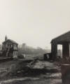
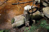
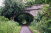
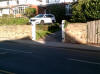
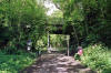
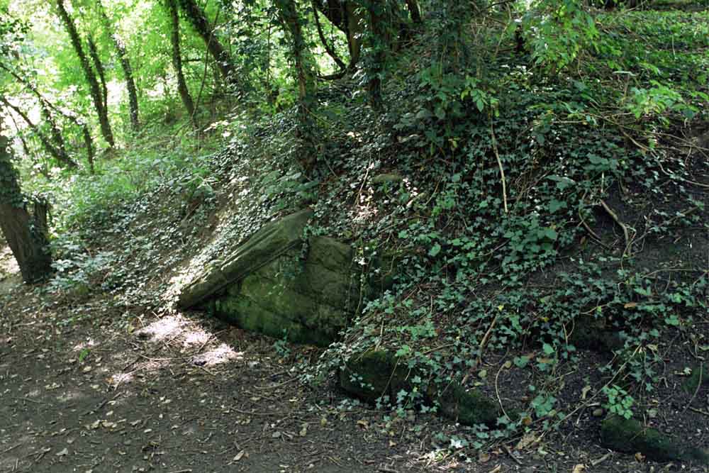
 Occupation
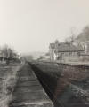
bridge (20-09-06) : Phill Davison Occupation
bridge (20-09-06) : Phill Davison
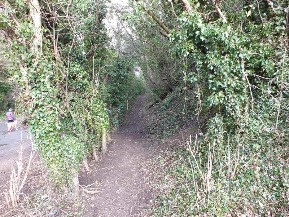
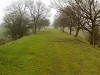
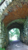
This pic is a farmers occupation bridge located near Barwick, Leeds. |
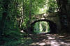
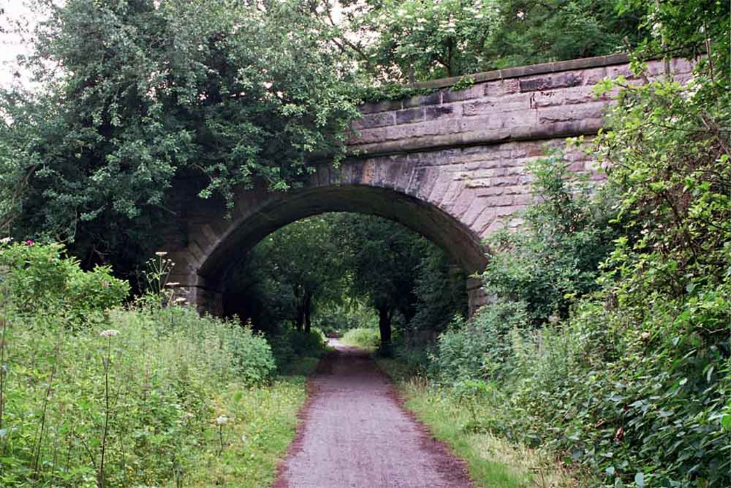
 Bridge
(20-09-06) : Phill Davison Bridge
(20-09-06) : Phill Davison
Scholes station is at the other end of this bridge.
|
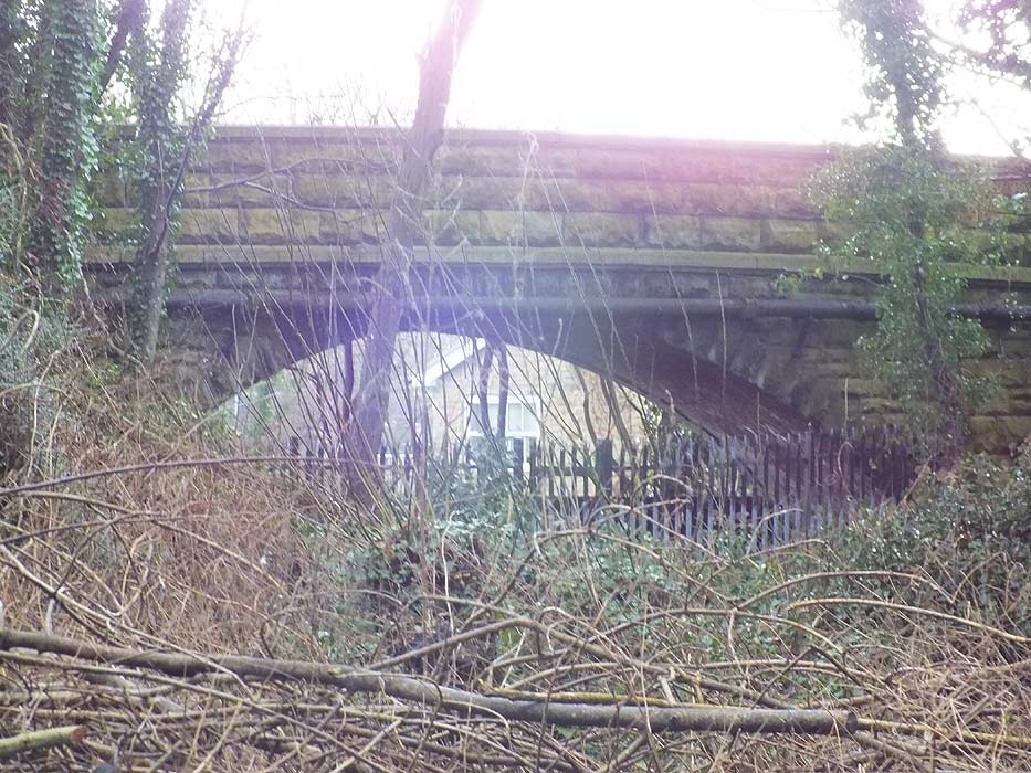
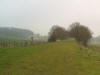
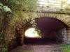
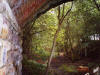
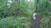
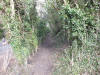
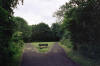
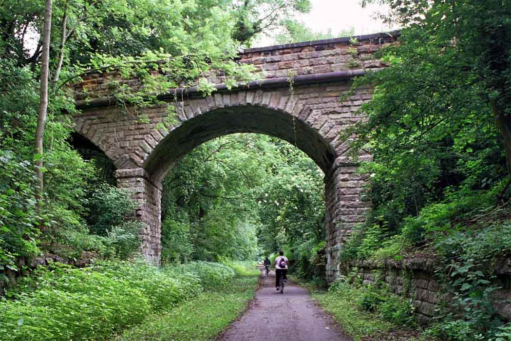
 Bridge
(06-07) : Hugh Griffith Bridge
(06-07) : Hugh Griffith
Approaching old Scholes station site looking north. |
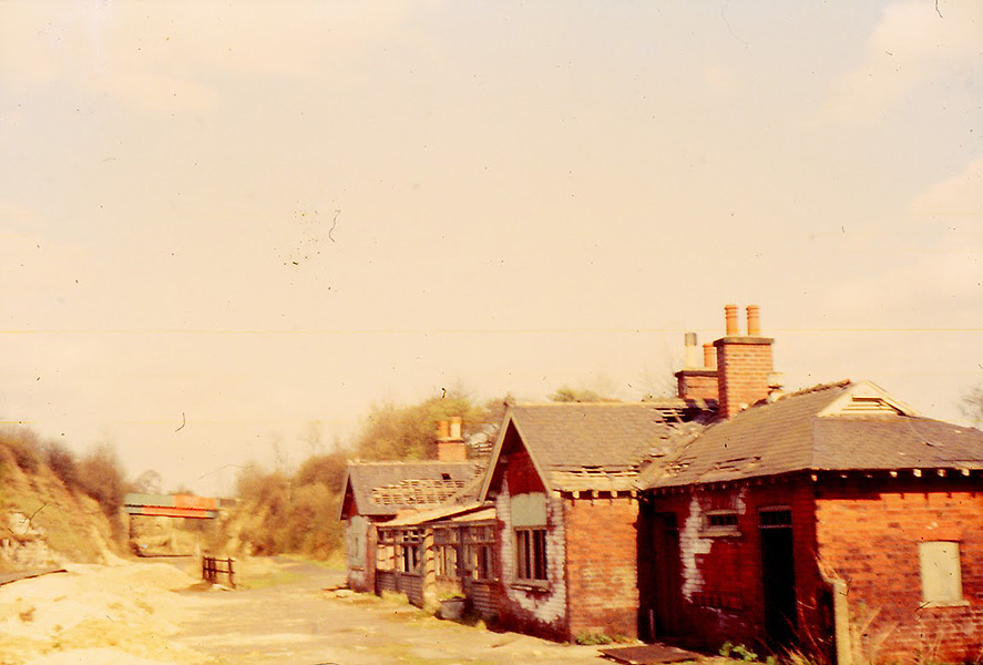
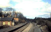
Scholes station
 Opened 01-05-1876. Closed 06-01-1964. Opened 01-05-1876. Closed 06-01-1964.
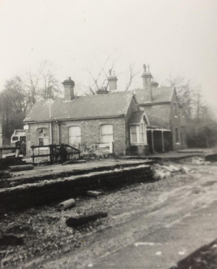
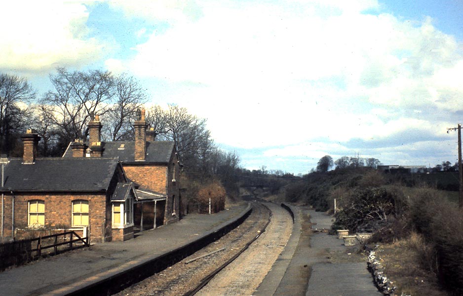
Scholes
station (21-02-66) : Tom Fincham
Scholes station buildings. |
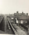
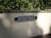
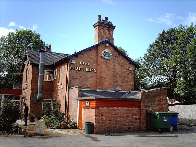
Scholes
station (20-09-06) : Phill Davison
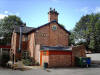 Still standing & is a pub/restaurant called ‘The
buffer’s’ these days. Still standing & is a pub/restaurant called ‘The
buffer’s’ these days.
Note: Paul Holroyd
From 1984 to July 1999 there used to be a railway carriage as part of 'The
Buffers' restaurant,
see
http://www.vintagecarriagestrust.org/se/CarriageInfo.asp?Ref=2743 |
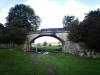
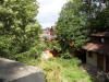 Scholes
station (06-07) : Hugh Griffith Scholes
station (06-07) : Hugh Griffith
Looking down from Scholes Lane onto old Scholes
station site. |
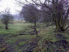
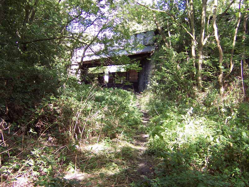
 Penda’s
fields (20-09-06) : Phill Davison Penda’s
fields (20-09-06) : Phill Davison
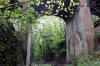
This is a soot blackened foot bridge at the back of penda’s fields, Leeds. |
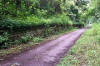
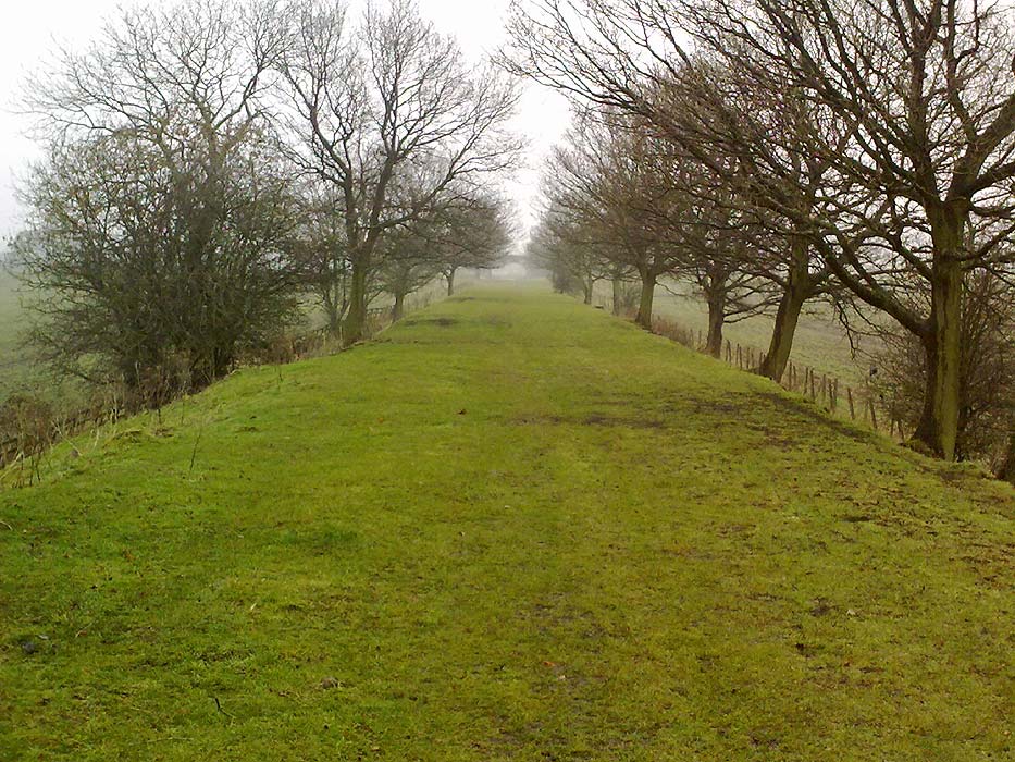
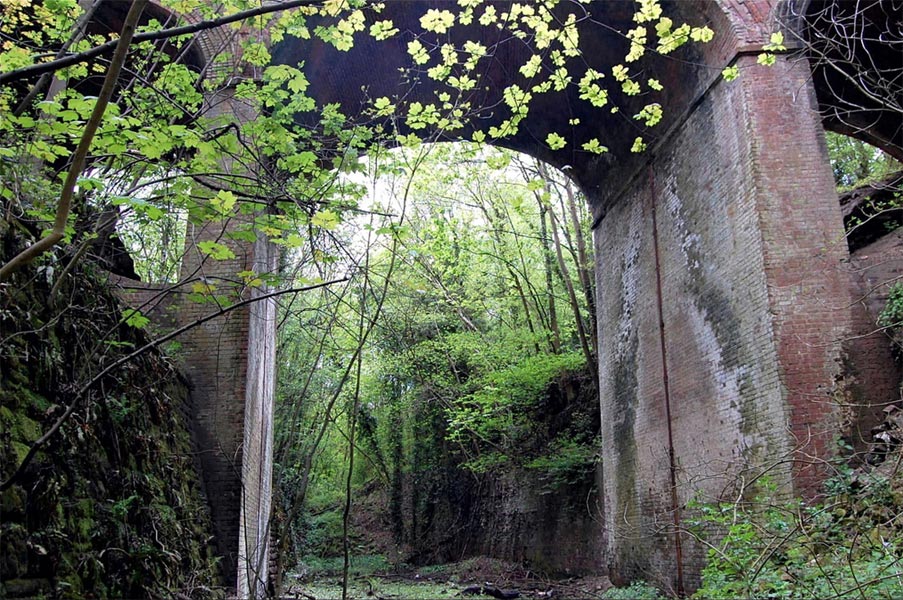
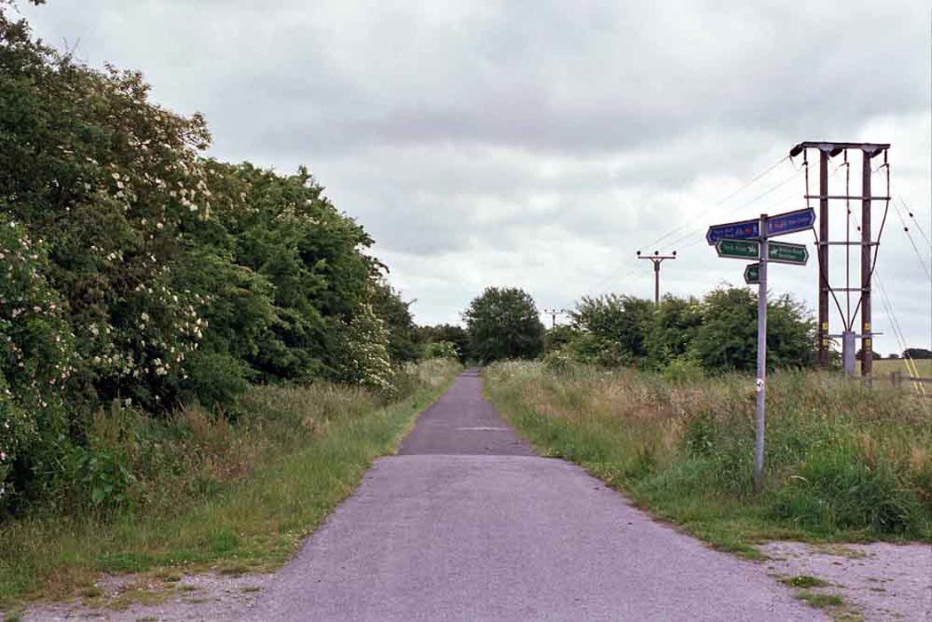
 A64
to Thorner section (23-03-13) : Mark Pennington A64
to Thorner section (23-03-13) : Mark Pennington
The Cross Gates-Wetherby section is not wholly practical to walk,
but following the footpaths from A64 to Thorner is rewarding.
|
 A64
to Thorner section (23-03-13) : Mark Pennington A64
to Thorner section (23-03-13) : Mark Pennington |
 A64
to Thorner section (23-03-13) : Mark Pennington A64
to Thorner section (23-03-13) : Mark Pennington |
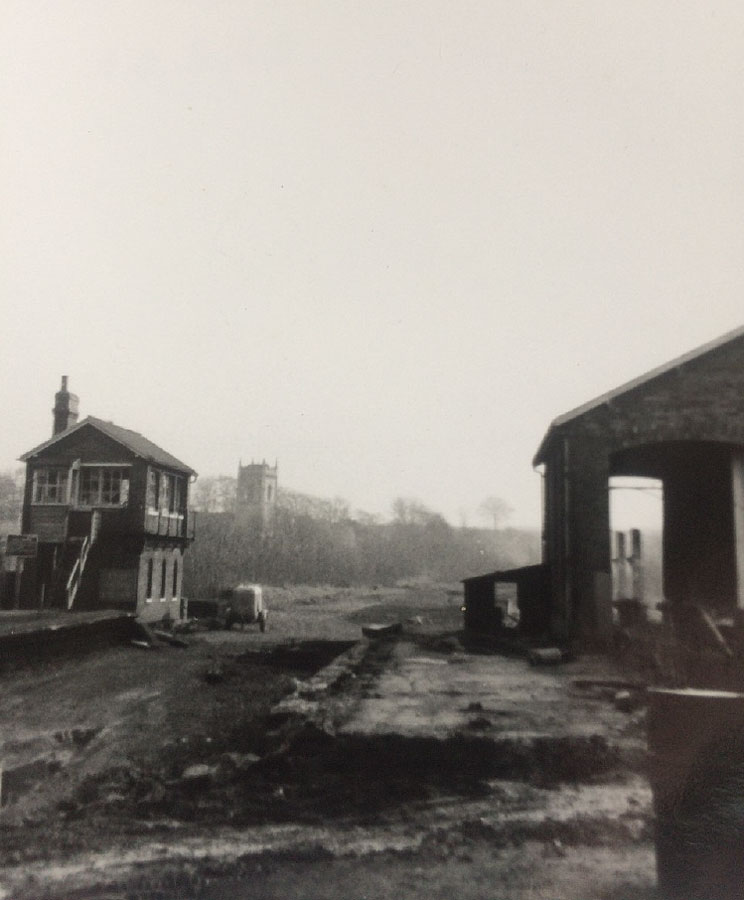
Thorner station
 Opened 01-05-1876. Closed 06-01-1964. Opened 01-05-1876. Closed 06-01-1964.
Thorner
station (c1965) : Ian Willis
Long gone now. |
 Thorner
station (21-02-66) : Tom Fincham Thorner
station (21-02-66) : Tom Fincham
Thorner station buildings. |
 Thorner
station (21-02-66) : Tom Fincham Thorner
station (21-02-66) : Tom Fincham
Thorner signal box. |
Thorner station : Rosemary O'Leary
My dad was the stationmaster at Thorner but left after the decision to
close the line was made. I think a Mr Pennington was in charge for the
last 6 months.
My family lived in the station house and one of my sisters was actually
born there in 1958.
My mum says that the houses you have labeled as the stationmaster's house
most definitely weren't. They were railway cottages and she told me the
names of the blokes who lived there but that was about 6 weeks ago and
I've forgotten what she said now! My family definitely lived in the
station house on the platform. Once when she was cleaning windows
upstairs, their bedroom window overlooked the platform and the sash window
came down and trapped both her hands so she was stuck (and in great
pain!). My big sister who was about 2 at the time thought it was a
hilarious gamed laughed her socks off. My mum was reduced o pleading with
her to "go get your daddy!" to rescue her!
When I was a kid we had an elderly collie called Bob. My dad got Bob as a
pup when they lived at Thorner and as a young dog he used to chase the
trains up and down the platform - biting at the wheels. My eldest two
sisters used to reminisce about playing under the platform and going to
visit the signalman who gave them fox's glacier mints and let them swing
off the big handles that changed the points (I don't know the technical
term, sorry). I missed all this fun cos i wasn't born until 64 but it
always sounds like an idyllic childhood to me.
My parents were offered the option to buy the station house at the end but
the price was way out of their league at the time. Wonder what it would be
worth now!!! |
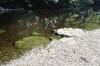
 Thorner
station (20-09-06) : Phill Davison Thorner
station (20-09-06) : Phill Davison
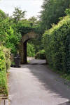
The station entrance bridge to where Thorner station once stood. |
 House
(20-09-06) : Phill Davison House
(20-09-06) : Phill Davison
I found this aptly named house on the site of the former Thorner station. |
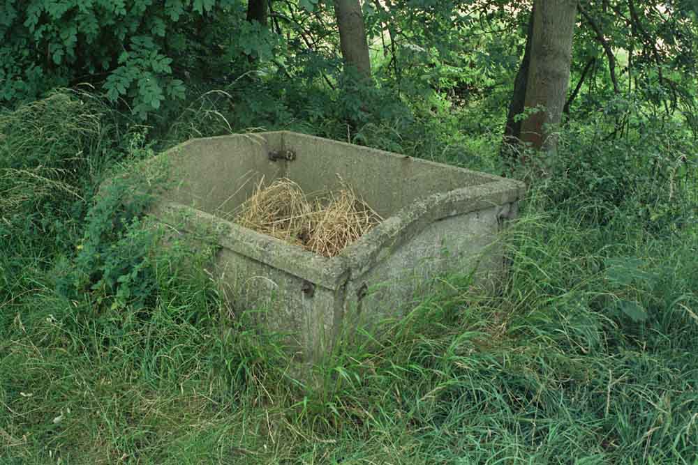
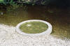
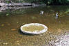
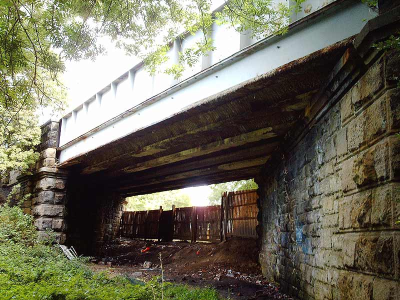
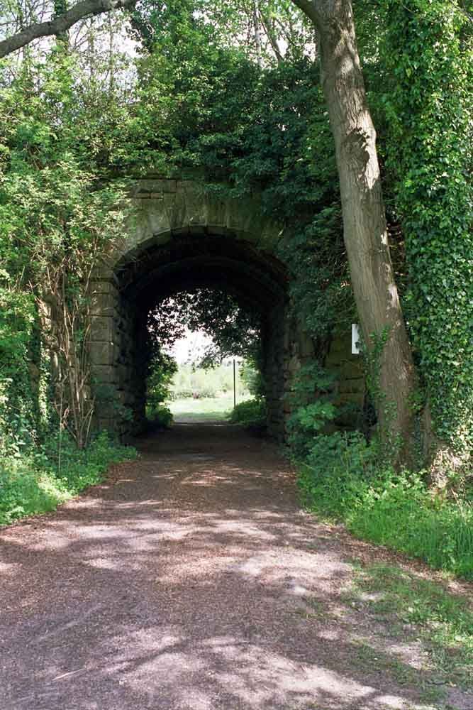
 Occupation
crossing (20-09-06) : Phill Davison Occupation
crossing (20-09-06) : Phill Davison
Occupation crossing approaching Thorner. |
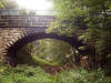
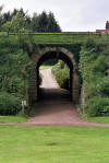
 Thorner
lane bridge (23-05-10) : Phill Davison Thorner
lane bridge (23-05-10) : Phill Davison
See the full set on Flickr -
http://www.flickr.com/photos/thanoz/4631519431/in/pool-leedsrailways |
 Thorner
lane bridge (23-05-10) : Phill Davison Thorner
lane bridge (23-05-10) : Phill Davison |
 Thorner
lane bridge (23-05-10) : Phill Davison Thorner
lane bridge (23-05-10) : Phill Davison |
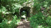
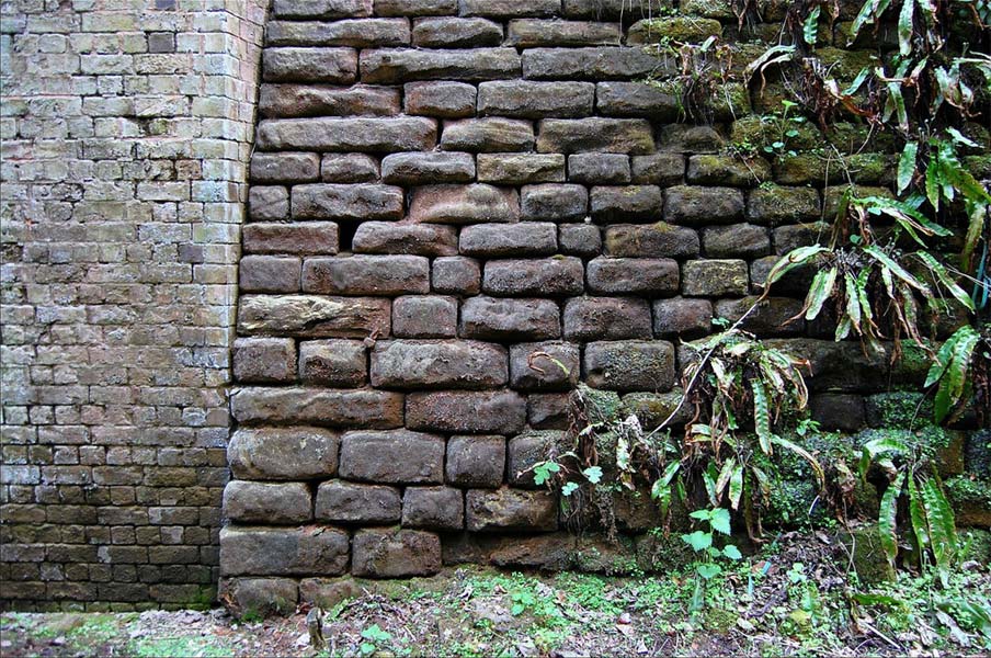
 Thorner
lane bridge (23-05-10) : Phill Davison Thorner
lane bridge (23-05-10) : Phill Davison
Textured stonework more in keeping with a ruined Inca temple than the
suburbs of Leeds.
|
 Thorner
lane bridge (23-05-10) : Phill Davison Thorner
lane bridge (23-05-10) : Phill Davison
This LNER telegraph pole railway relic can be dated back to at least 1948.
The LNER was one of the relatively short lived 'Big four' railway
companies to exist between 1923 and 1948. I'm not sure if this would have
been a standard GPO telegraph pole, or did the LNER markings mean this was
an internal railway form of communication/signals? |
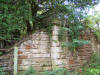
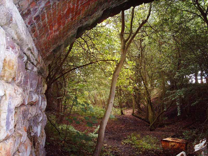
 Footbridge
(20-09-06) : Phill Davison Footbridge
(20-09-06) : Phill Davison
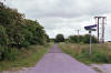
A footbridge looking down the old track bed near the A64 Leeds |
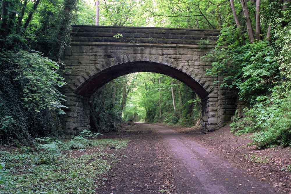
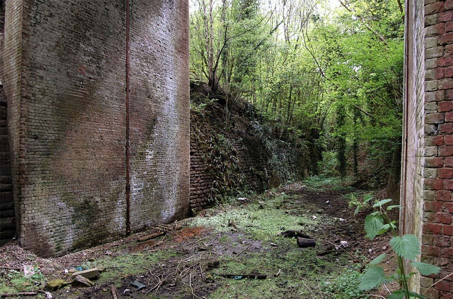
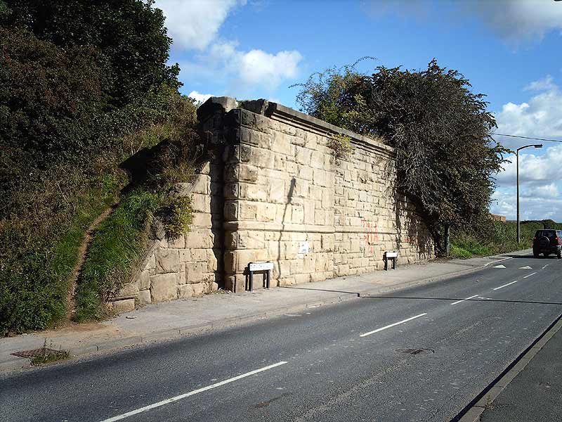
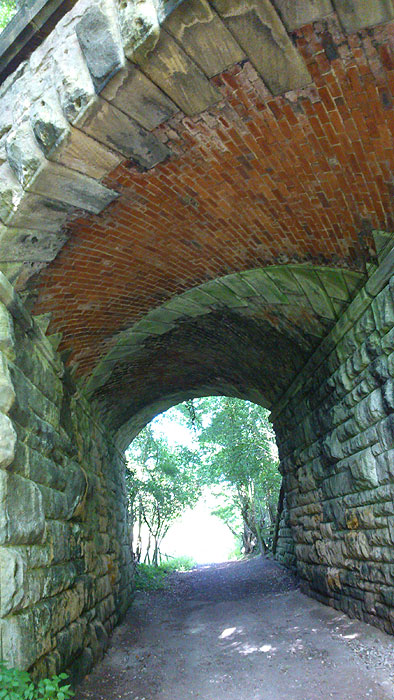
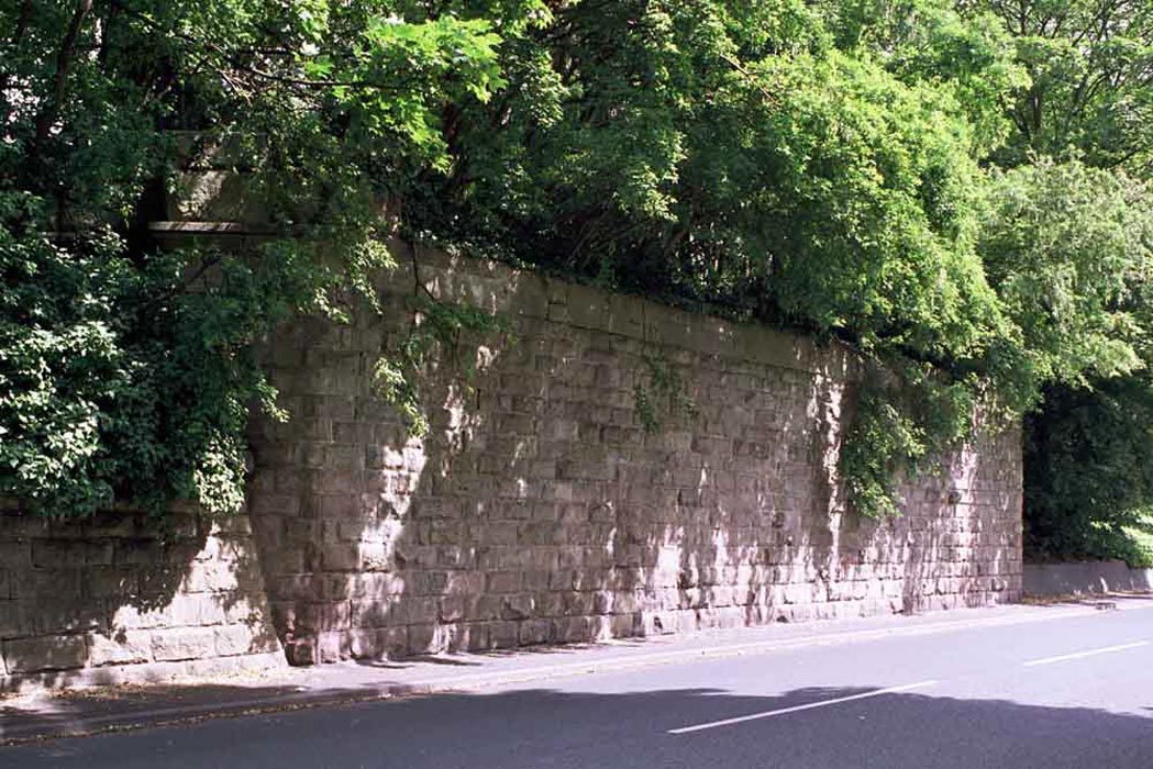
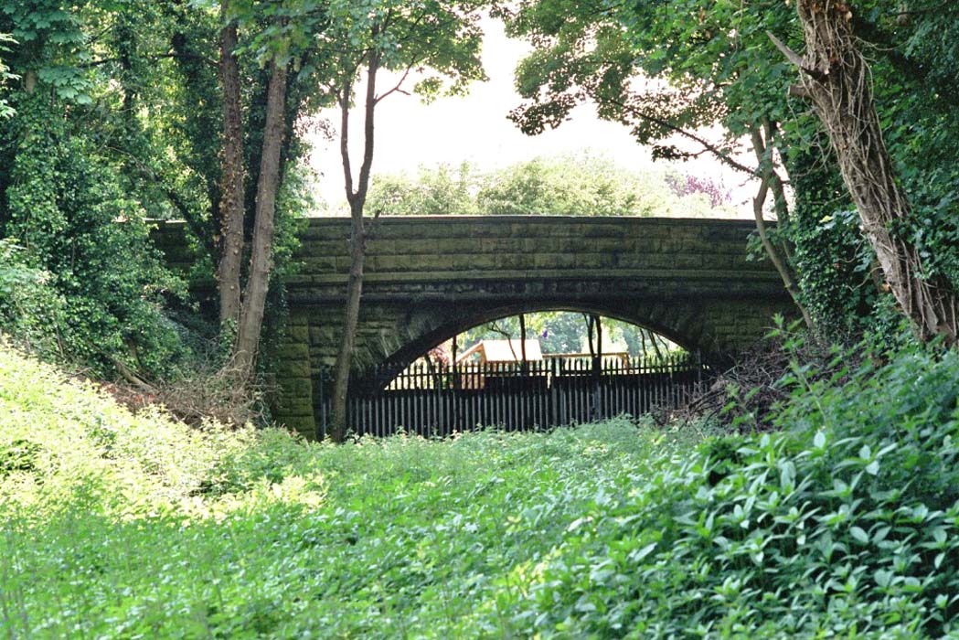
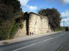 Leeds/Barwick
road bridge (20-09-06) : Phill Davison Leeds/Barwick
road bridge (20-09-06) : Phill Davison
The old rail bridge across the Leeds/Barwick road. The bridge is actually a
split personality. It was built as a single span & then doubled later. You
can see the two different types of stone. Also the road is Leeds road on one
side & Barwick on the other. |
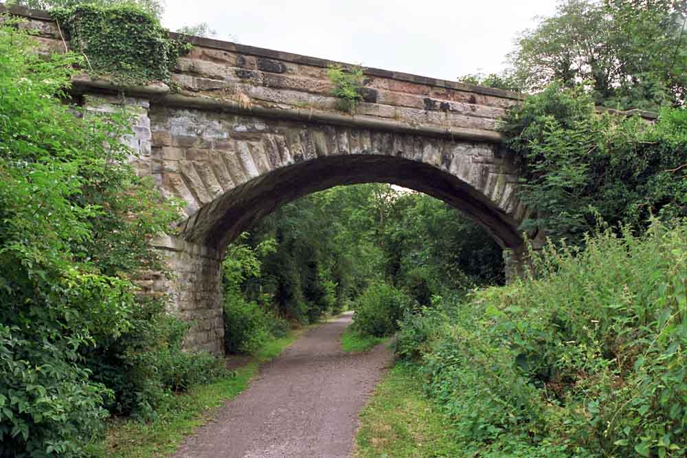
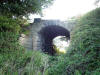
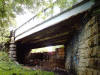
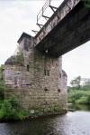
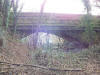
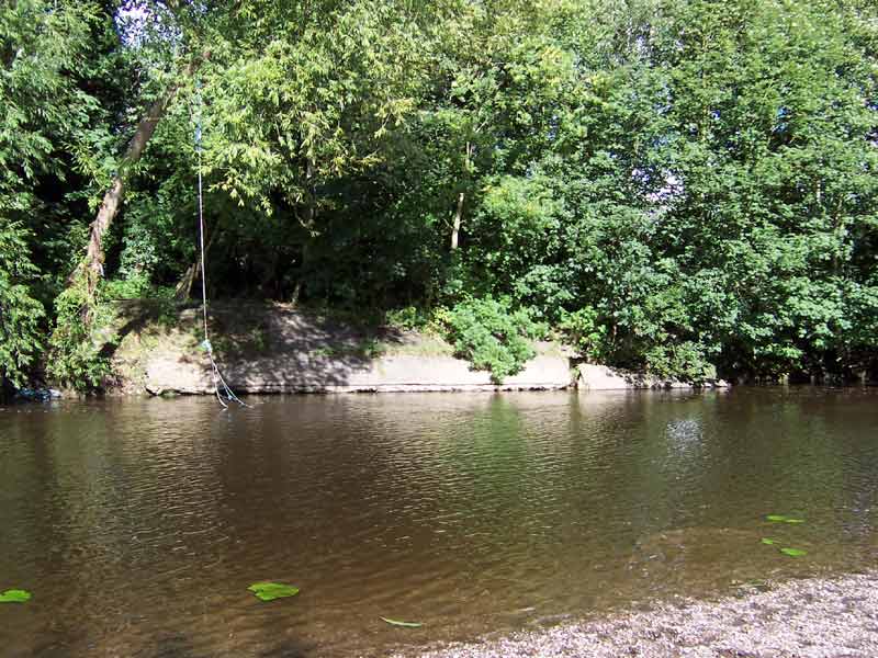
 Bridge
(06-07) : Hugh Griffith Bridge
(06-07) : Hugh Griffith
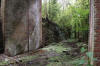
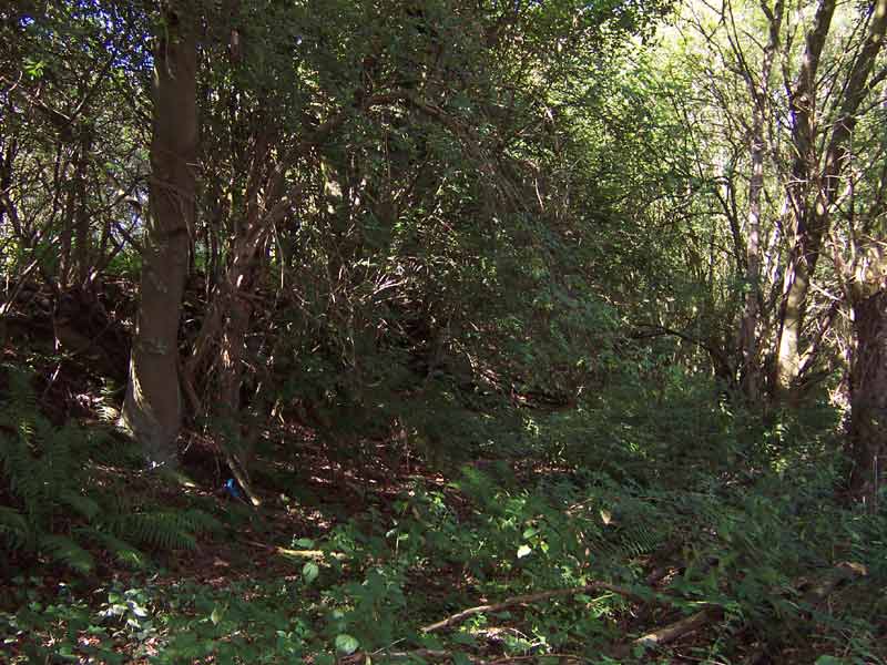
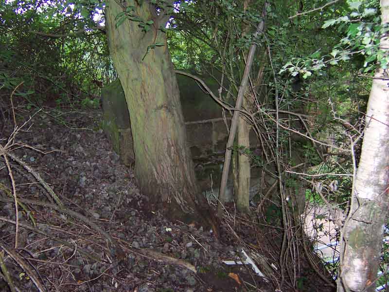
Site of railway bridge over the Wharfe at Collingham. |
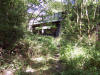
 Wood
lane (06-07) : Hugh Griffith Wood
lane (06-07) : Hugh Griffith
Blocked of near Wood lane, Scholes, looking north |
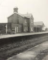
 Bardsey station Bardsey station
Opened 01-05-1876. Closed 06-01-1964
Bardsey
station (21-02-66) : Tom Fincham
Bardsey station buildings. |
Bardsey
(19-11-13) : Paul Needham
  Here
are what i believe to be the only remains of Bardsey station on Wetherby
line, its the entrance on the road that forks off from main road and
comprises the normal crossing gates and slightly unusually the pedestrian
in and out again one, cant recall seeing that this far from the line? at
anywhere else, road is shown on the early maps but wont be visible from
road till after the winter when the undergrowth subsides. Here
are what i believe to be the only remains of Bardsey station on Wetherby
line, its the entrance on the road that forks off from main road and
comprises the normal crossing gates and slightly unusually the pedestrian
in and out again one, cant recall seeing that this far from the line? at
anywhere else, road is shown on the early maps but wont be visible from
road till after the winter when the undergrowth subsides.
Note : Paul Needham
I recently cycled past the modern housing on the station site and noticed
how the grass bank between the main road and the estate didn't flow down
in a flat plane but had a pronounced step in it commensurate with a road
access running from the crossing gates to the house lane, i rather think
this is the old station approach road under the grass. |
 Bardsey
(16-08-13) : David Webdale Bardsey
(16-08-13) : David Webdale
Bridge at Bardsey. With grandson Naiel. |
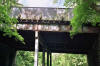
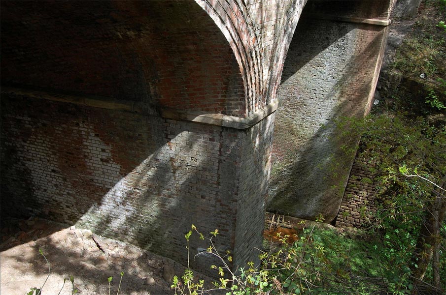
 Bardsey
(16-08-13) : David Webdale Bardsey
(16-08-13) : David Webdale
View of the bridge underside. A brick skew arch with
evidence of track widening. |
 Bardsey
(16-08-13) : David Webdale Bardsey
(16-08-13) : David Webdale
On top of bridge with grandson Naiel. |
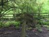
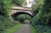
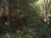 Bardsey
(06-07) : Hugh Griffith Bardsey
(06-07) : Hugh Griffith
Emabankment to farm track bridge east of the road at
Bardsey. |
 Bardsey
(06-07) : Hugh Griffith Bardsey
(06-07) : Hugh Griffith
Track height at farm track crossing east of the road
at Bardsey. |
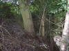
 Bardsey
(06-07) : Hugh Griffith Bardsey
(06-07) : Hugh Griffith
Over a farm track east of the road at Bardsey 1. |
 Bardsey
(06-07) : Hugh Griffith Bardsey
(06-07) : Hugh Griffith
Over a farm track east of the road at Bardsey 2. |
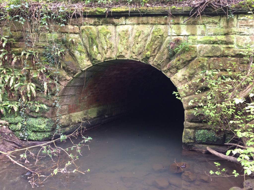
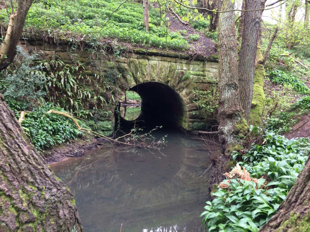
  Bardsey
(20-04-17) : Chris Beaumont Bardsey
(20-04-17) : Chris Beaumont
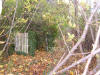
Tunnel for the beck. |
 Bardsey
(20-04-17) : Chris Beaumont Bardsey
(20-04-17) : Chris Beaumont
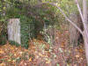
Old railway sign not sure what this was for? |
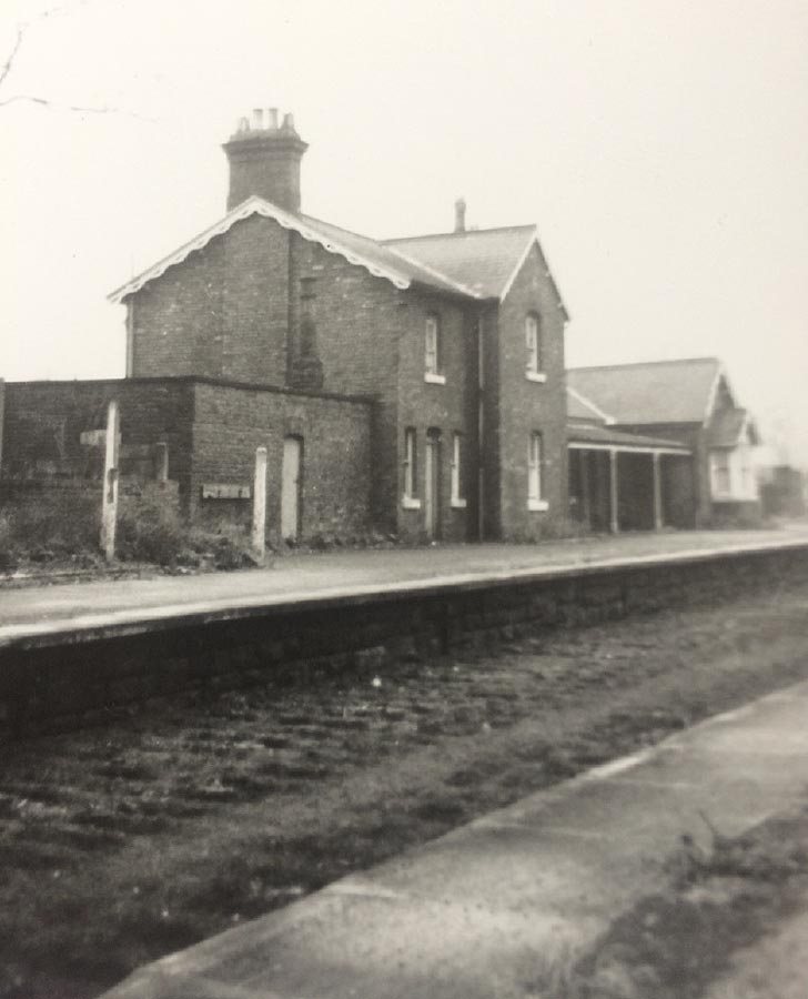
 Collingham
Bridge Station Collingham
Bridge Station
Opened 01-05-1876. Closed 06-01-1964
Collingham Bridge Station (21-02-66) :
Tom Fincham
Collingham Bridge Station buildings. |
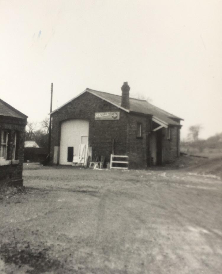
 Collingham
Bridge Goods Buildings (21-02-66) : Tom Fincham Collingham
Bridge Goods Buildings (21-02-66) : Tom Fincham
Collingham Bridge Goods buildings. |
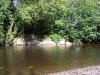
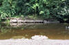
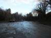
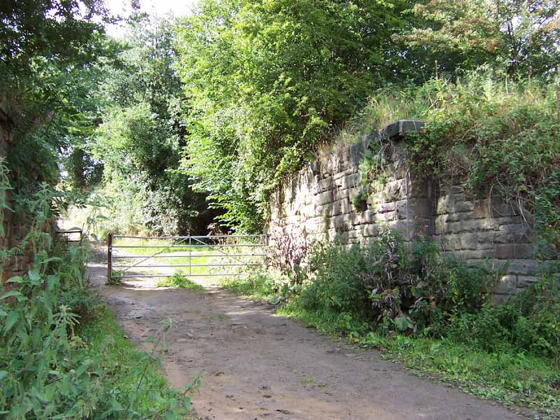
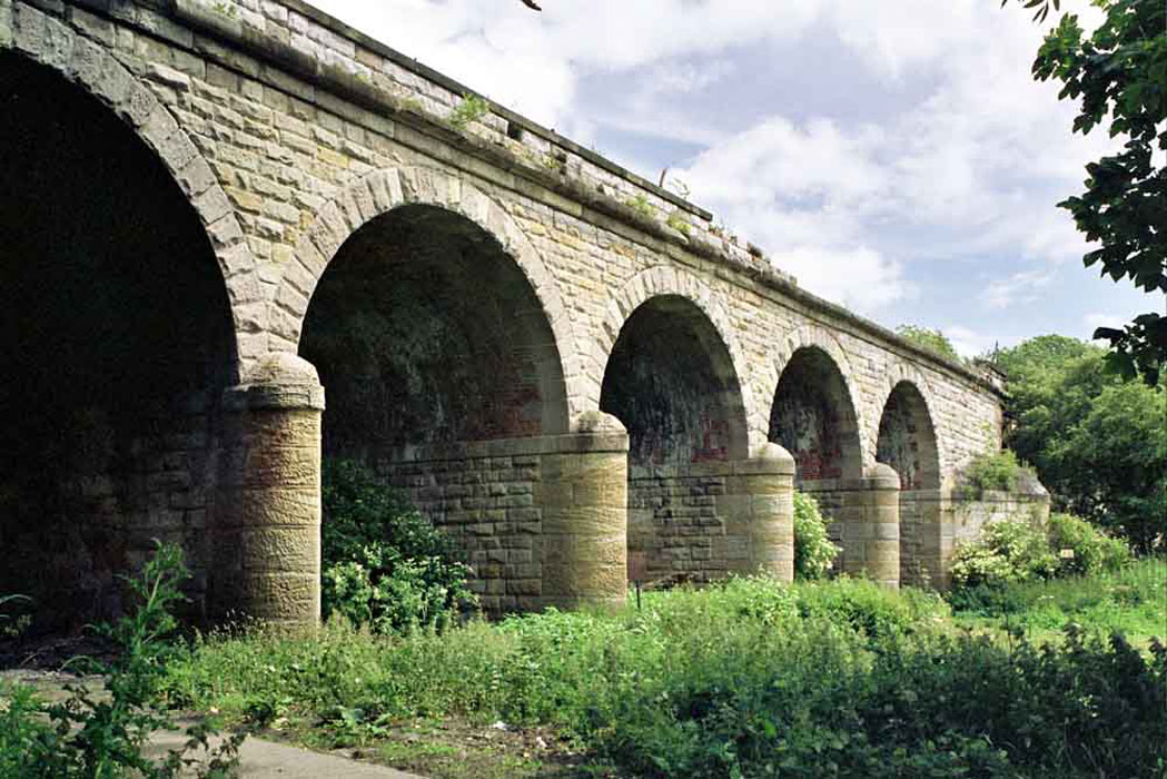
 Collingham
(21-07-14) : Malcolm Mallison Collingham
(21-07-14) : Malcolm Mallison
A short section of railway bed just south of the
Wharfe is now a car park. Remains of structure of some sort. |
   Collingham
(21-07-14) : Malcolm Mallison Collingham
(21-07-14) : Malcolm Mallison
Crossing River Wharfe. Stumps of columns in
shallows. |
 Collingham
(21-07-14) : Malcolm Mallison Collingham
(21-07-14) : Malcolm Mallison
View across to far side of river. |
 Collingham
(21-07-14) : Malcolm Mallison Collingham
(21-07-14) : Malcolm Mallison
Wetherby- bridge just south of crossing Linton Road,
now in a private estate. |
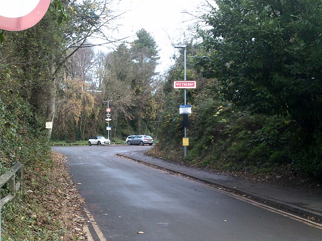
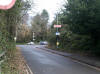
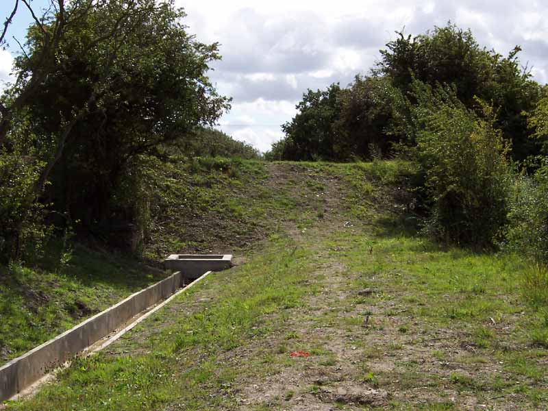
 Wetherby
(03-07-13) : Malcolm Mallison Wetherby
(03-07-13) : Malcolm Mallison
Remains of bridge on north side of York Road |
 Wetherby
(03-07-13) : Malcolm Mallison Wetherby
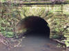
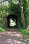
(03-07-13) : Malcolm Mallison
The railway between York Rd and the A1 is entirely
lost under a housing estate (of course, in the Good Old Days the Great
North Road ran up Wetherby High Street). There is a tunnel under the
motorway, and the line beyond is now surfaced as a cycle path. |
 Wetherby
(03-07-13) : Malcolm Mallison Wetherby
(03-07-13) : Malcolm Mallison
As far as I can make out from the 1954 1:25000 map
(see link on Lost Railways to National Library of Scotland, sheet SE44)
there was a level crossing at the junction of Wetherby Rd and Wood Lane. |
 Wetherby
(03-07-13) : Malcolm Mallison Wetherby
(03-07-13) : Malcolm Mallison
Farm access bridge over cutting, grid ref 433473. |
 Wetherby
(03-07-13) : Malcolm Mallison Wetherby
(03-07-13) : Malcolm Mallison
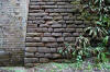
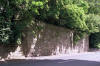
Stone walling along foot of cutting. |
 Wetherby
(03-07-13) : Malcolm Mallison Wetherby
(03-07-13) : Malcolm Mallison
Farm access bridge over cutting, grid ref 435469. |
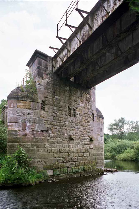
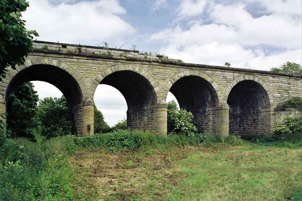
 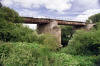   Wetherby
(03-07-13) : Malcolm Mallison Wetherby
(03-07-13) : Malcolm Mallison
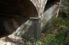
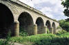
Bridge over River Wharfe. Five arch viaduct on
approach, span over river & central support. |
 Wetherby
(29-05-15) : Malcolm Mallison Wetherby
(29-05-15) : Malcolm Mallison
Embankment between River Wharfe and Wetherby-
footpath below railway, now in middle of golf course. |
 Wetherby
(13-07-16) : Malcolm Mallison Wetherby
(13-07-16) : Malcolm Mallison
Footpath through golf course photographed from other
side. |
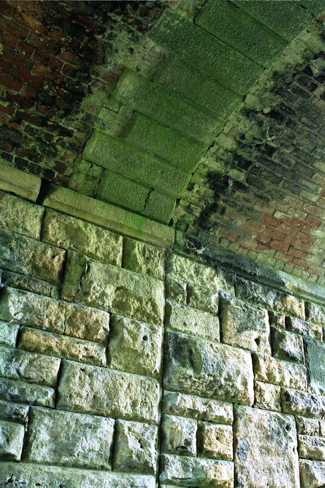
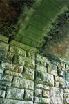 Wetherby
(13-07-16) : Malcolm Mallison Wetherby
(13-07-16) : Malcolm Mallison
Masonry on underside of arch, showing where track
was widened at some point. |
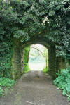
 Wetherby
(13-07-16) : Malcolm Mallison Wetherby
(13-07-16) : Malcolm Mallison
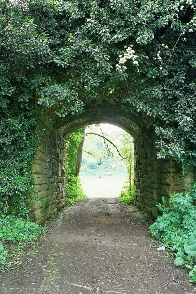
Another archway through embankment, currently access
to golf course from clubhouse. |
 Wetherby
(13-07-16) : Malcolm Mallison Wetherby
(13-07-16) : Malcolm Mallison
Bridge carrying Linton Rd across railway (closer
access not possible due to nettles). |
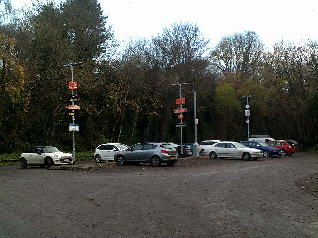
Wetherby station (Second Site)
See
also Church Fenton Harrogate
Note : Mike Bale
The line also had a station at Wetherby which
opened in August 1847 together with those from Church Fenton to Spofforth.
The Wetherby station shown on the above map is the passenger station
opened in 1902 at which time the original station became Wetherby Goods
station. You’ll know
that the lines around Wetherby were the first to close after the Beeching
Report. Apart from 3 overbridges the Goods Transfer Shed at the original
station is the only item of railway architecture remaining in the town.
See below. |
/Wetherby_small.jpg) Wetherby
map
(1909) : Malcolm Mallison Wetherby
map
(1909) : Malcolm Mallison
From 1909 6 inch survey- Wetherby Showing both
station and goods shed, at different apices of the triangle.
The goods shed survives, as a venue under the misappellation “The Engine
Shed”. |
 Wetherby
Station (c1970s) : Gary Fozzard Wetherby
Station (c1970s) : Gary Fozzard
Old pic of Wetherby Station. Think it was early 70s.
Spofforth road bridge is in the background. |
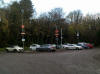
 Wetherby
Station site (29-06-14) : Denis Thomson Wetherby
Station site (29-06-14) : Denis Thomson
Wetherby Station site. Looking towards
Harrogate - the cars are where the Station buildings were. |
  Wetherby
Station site (28-11-20) : Paul Needham Wetherby
Station site (28-11-20) : Paul Needham
Someone would appear to have a soul, here is
the entrance to Wetherby 2nd station last week, been done a year or more,
BR tangerine and repro? platform signs, also road signs and a stone pillar
in the car park with tile views of the old station,
very nice touches I
thought. |
 Wetherby
Station Gate Posts (10-10-22) : Paul
Sutcliffe Wetherby
Station Gate Posts (10-10-22) : Paul
Sutcliffe
Came across these, well ive passed by on push
bike loads of times, guess they were not painted before?
The
Wetherby 2nd station entrance looks little changed
but no gate posts, these are a few houses down same side,
wondering
if they bought them when/after it closed? No other houses have
anything like them nearby. |
 Wetherby
Station (29-06-14) : Denis Thomson Wetherby
Station (29-06-14) : Denis Thomson
Pedestrian footpath entrance from A661
Spofforth Hill (Harrogate
Road). |
 Wetherby
Station (29-06-14) : Denis Thomson Wetherby
Station (29-06-14) : Denis Thomson
To Collingham under the Linton Road. |
Leeds - Wetherby & Church Fenton - Harrogate Triangle junction
See also Church Fenton -
Harrogate
  Wetherby
(29-05-15) : Malcolm Mallison Wetherby
(29-05-15) : Malcolm Mallison
Bridge carrying A661 Spofforth Hill, with close up
of rust and bodge-it-and-run central support. |
 Wetherby
(29-05-15) : Malcolm Mallison Wetherby
(29-05-15) : Malcolm Mallison
Bridge carrying bridlepath across western branch of
triangle. |
 Wetherby
(29-05-15) : Malcolm Mallison Wetherby
(29-05-15) : Malcolm Mallison
Bridge carrying bridlepath across eastern branch of
triangle. |
 Junction
(21-07-14) : Malcolm Mallison Junction
(21-07-14) : Malcolm Mallison
Junction to Leeds (to left). |
 Junction
(21-07-14) : Malcolm Mallison Junction
(21-07-14) : Malcolm Mallison
Looking back at other end of junction. Leeds
to right. |
 Junction
(21-07-14) : Malcolm Mallison Junction
(21-07-14) : Malcolm Mallison
Bridge carrying Barleyfields Rd. http://www.britainfromabove.org.uk/image/epw023534. |
 Junction
(21-07-14) : Malcolm Mallison Junction
(21-07-14) : Malcolm Mallison
Bridge carrying bridleway, grid ref 399489. |
 Junction
(21-07-14) : Malcolm Mallison Junction
(21-07-14) : Malcolm Mallison
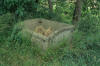
Trackside bunker. |


/Wetherby.jpg)