 Railway Ramblers gazetteer Railway Ramblers gazetteer
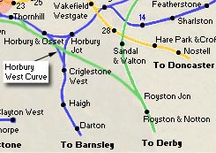
See also the Railway Ramblers gazetteer - Wakefield - Crigglestone junction - Horbury station |
 Crigglestone
Google Earth (30-10-06) : Graeme Bickerdike
website - http://www.forgottenrelics.co.uk/ Crigglestone
Google Earth (30-10-06) : Graeme Bickerdike
website - http://www.forgottenrelics.co.uk/
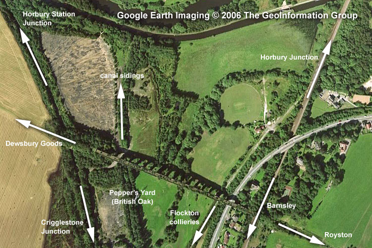
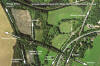
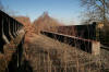
This is a Google Earth snapshot showing the local railway equivalent of
Spaghetti Junction. The Royston-Saville Town line ran east-west across
the viaduct and then under it, from left to right, was Crigglestone
curve (Horbury Station Junction-Crigglestone Junction), the canal
sidings from Pepper’s Yard, the colliery branch serving pits at
Bullcliffe Wood, Denby Grange and Caphouse, and the existing
Wakefield-Barnsley route. |
 Crigglestone
junction (08-02-07) : Graeme Bickerdike Crigglestone
junction (08-02-07) : Graeme Bickerdike
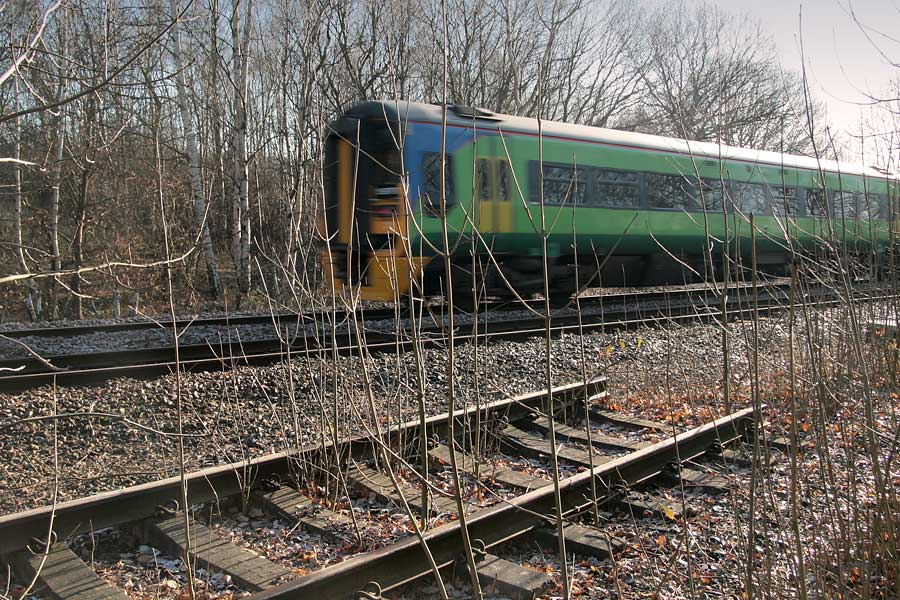
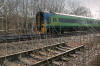
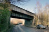
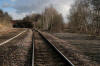
A 158 rattles south past the former Crigglestone junction on the
Wakefield-Barnsley line
Much
of the rusting single line is in situ though its two signalboxes (Crigglestone
junction and
Horbury & Ossett station) have both been demolished.
During
its latter years, the secluded chord often played host to the Royal
Train. |
 Crigglestone
junction (09-85) : Michael Kaye Crigglestone
junction (09-85) : Michael Kaye
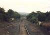
We are just coming off the single line from Horbury
Junction and are heading towards Crigglestone Junction, September 1985. |
 Crigglestone
junction (09-85) : Michael Kaye Crigglestone
junction (09-85) : Michael Kaye
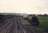
We have just come up the single line from Horbury
and are going 'facing road' ready to cross over at Crigglestone Junction,
we are heading towards Barnsley and just beyond the bridge was
Crigglestone Station. |
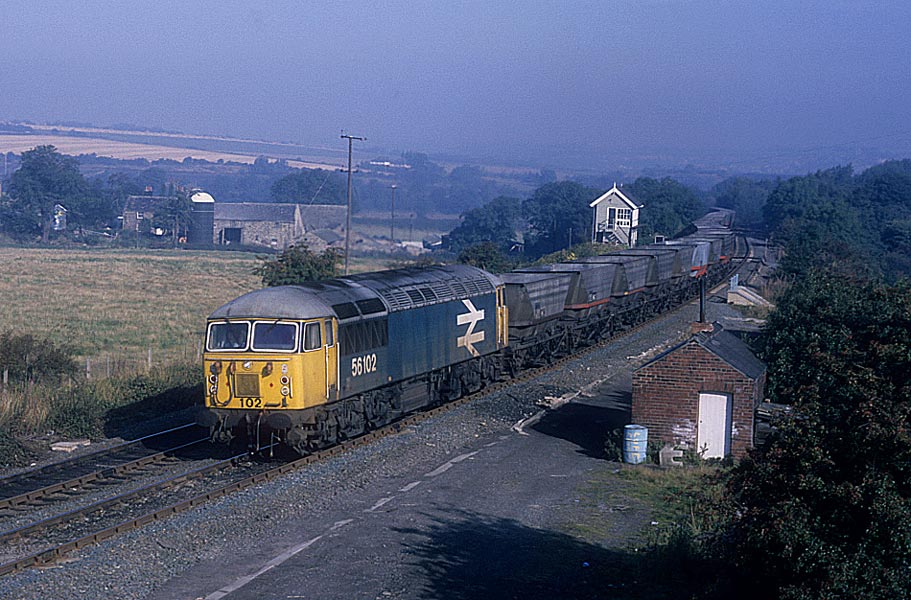
 Crigglestone (c1980) : C/O Michael Kaye with permission from Paul Corrie Crigglestone (c1980) : C/O Michael Kaye with permission from Paul Corrie
56102 at Crigglestone. |
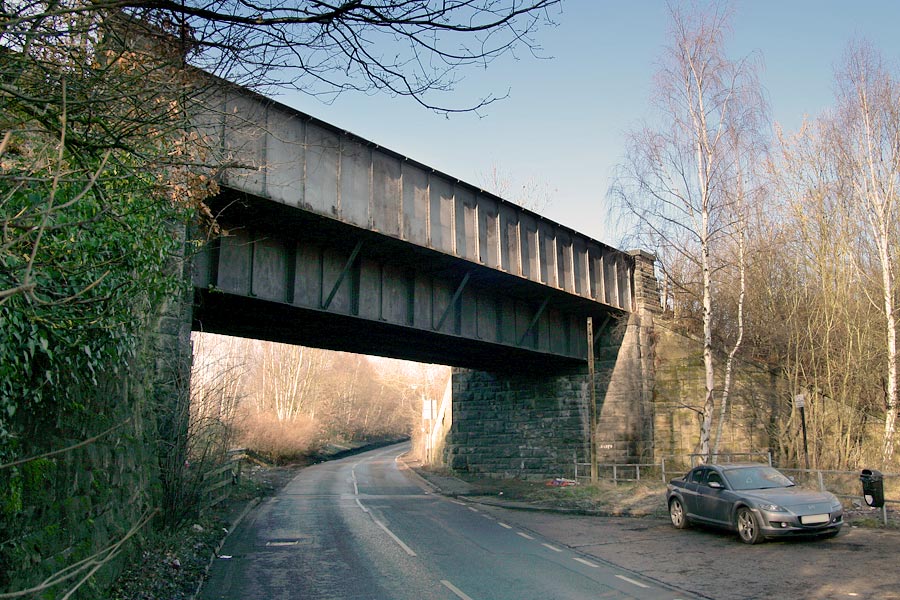
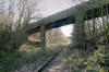
 A636
Wakefield-Denby Dale road (08-02-07) : Graeme Bickerdike A636
Wakefield-Denby Dale road (08-02-07) : Graeme Bickerdike
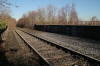
The single line occupies the east side of the formation as it crosses the
A636 Wakefield-Denby Dale road.
Ballast still holds the sleepers of the old Down line. |
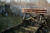
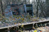 Cabinets
(08-02-07) : Graeme Bickerdike Cabinets
(08-02-07) : Graeme Bickerdike
Two wrecked location cabinets relax in the undergrowth. Nearby are posts
for the Down distant and Up section signals. |
 Blacker
Lane bridge (08-02-07) : Graeme Bickerdike Blacker
Lane bridge (08-02-07) : Graeme Bickerdike
The bridge over Blacker Lane is a serious affair.
A 6-foot section of
track from the old Caphouse colliery branch can just be seen within the
roadway beneath it. |
 Blacker
Lane bridge (08-02-07) : Graeme Bickerdike Blacker
Lane bridge (08-02-07) : Graeme Bickerdike
These ‘minor’ bridges don’t attract the same attention as great viaducts
such as Crigglestone, seen in the background.
But it’s easy to forget the
immense effort which must have gone into building them. |
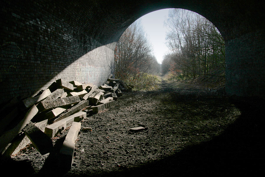
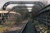
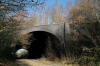 Horbury
tunnel (08-02-07) : Graeme Bickerdike Horbury
tunnel (08-02-07) : Graeme Bickerdike
The track has been removed for a short distance either side of the 40-yard
Horbury tunnel. This took the route through the vast approach embankment
to Crigglestone viaduct, part of the Midland’s Royston-Dewsbury line. |
 Horbury
tunnel (08-02-07) : Graeme Bickerdike Horbury
tunnel (08-02-07) : Graeme Bickerdike
Although they’ve been lifted, many concrete sleepers remain on site.
There’s quite a collection at the southern end of the tunnel. |
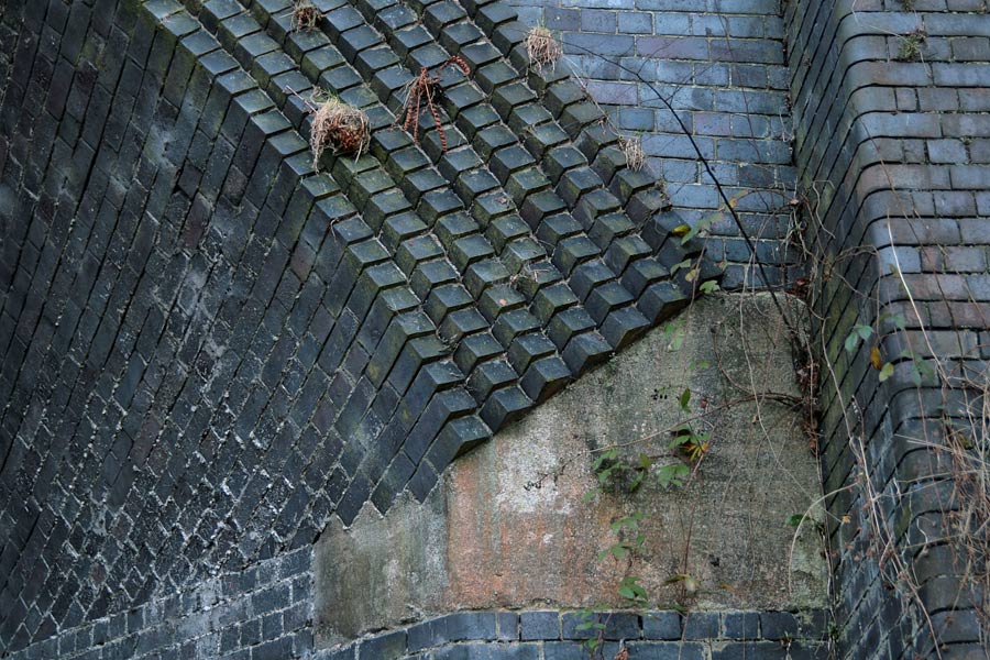
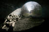
 Horbury
tunnel (08-02-07) : Graeme Bickerdike Horbury
tunnel (08-02-07) : Graeme Bickerdike
The tunnel is not at right-angles to the embankment so skew portals had to
be fashioned.
This must have caused serious headaches for the bricklayers. |
 Footpath
bridge (08-02-07) : Graeme Bickerdike Footpath
bridge (08-02-07) : Graeme Bickerdike
A footpath passes over the line on a three-span bridge.
I’m in two minds
as to whether it might once have carried a wagonway down to the canal.
The
left-hand support pillar has restraining straps made from bullhead rail. |
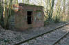 Cabin
(08-02-07) : Graeme Bickerdike Cabin
(08-02-07) : Graeme Bickerdike
Beyond the bridge, the door to an old p-way cabin has been bricked up to
prevent access. There seems to be a flaw in this plan. |
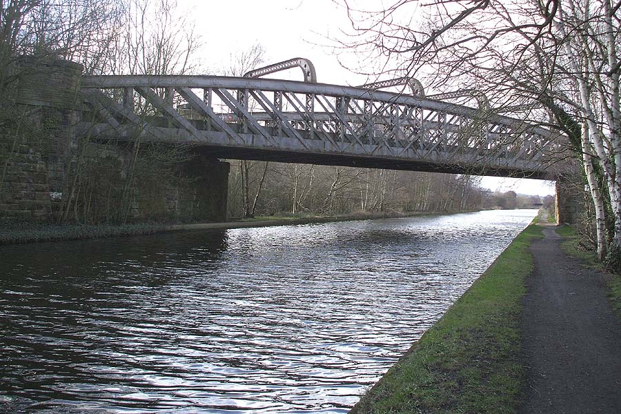
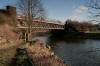
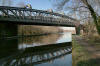 Calder
& Hebble bridge (08-02-07) : Graeme Bickerdike Calder
& Hebble bridge (08-02-07) : Graeme Bickerdike
The skew bridge across the Calder and Hebble Navigation is a grand
structure, including four arched cross-girders which, I guess, help to
secure the two sides. |
 Calder
& Hebble bridge (09-03-08) : Andrew Stopford Calder
& Hebble bridge (09-03-08) : Andrew Stopford
Bridge over the Calder & Hebble Navigation, near
Horbury Bridge. |
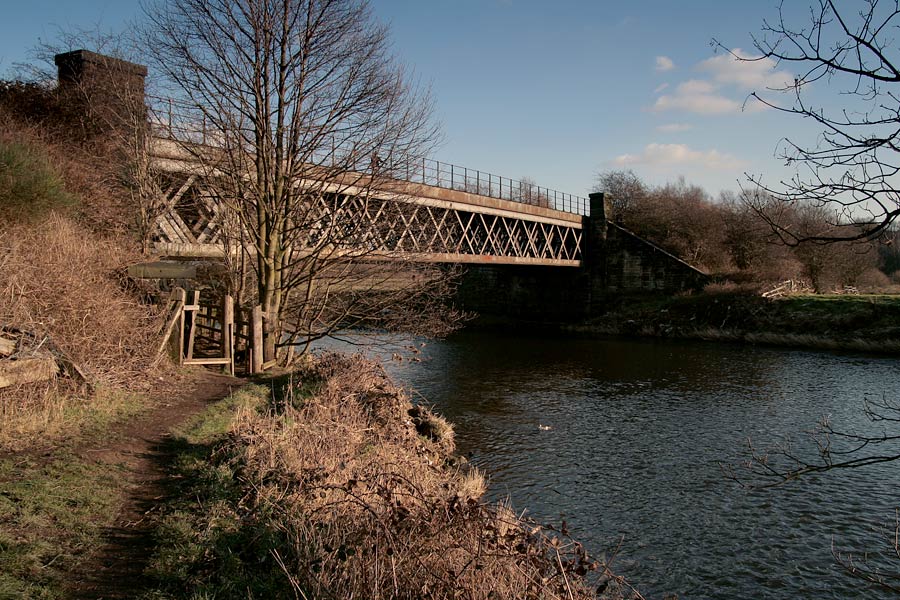
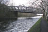
 Calder
& Hebble bridge (08-02-07) : Graeme Bickerdike Calder
& Hebble bridge (08-02-07) : Graeme Bickerdike
Although the line is still owned by BRB and not a public footpath, this
section is explored by many walkers.
New handrails have been installed by
those bubble-wrapped health and safety chaps. |
 Cable
supports (08-02-07) : Graeme Bickerdike Cable
supports (08-02-07) : Graeme Bickerdike
From the canal to the old junction at Horbury & Ossett station, the line
sits on top of an embankment.
Rows of supports for the signalling cables can still be found on the Up
side. |
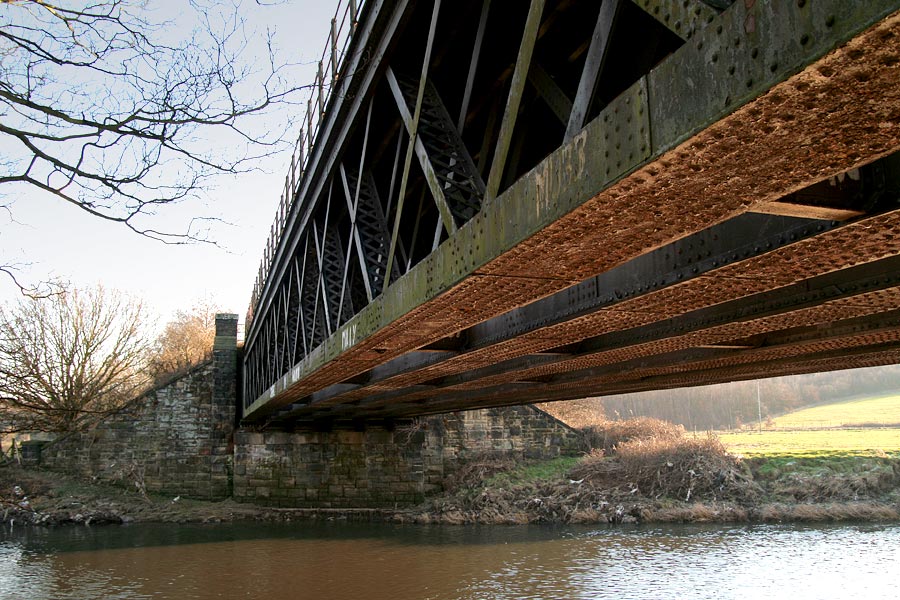
 River
Calder bridge (08-02-07) : Graeme Bickerdike River
Calder bridge (08-02-07) : Graeme Bickerdike
The bridge over the River Calder is a different construction to the canal
crossing. As I’m no engineer, I can only guess at the reason. Perhaps this
was the favoured design (it certainly seems simpler) but was impractical
over the canal because of the need to pass boats underneath it. Answers on
a postcard… |
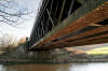 River
Calder bridge (08-02-07) : Graeme Bickerdike River
Calder bridge (08-02-07) : Graeme Bickerdike
Although the structure looks in decent nick, some of the girders are
corroding away to nothing.
The abutments are about 150 feet apart, slightly longer than the canal
span. |
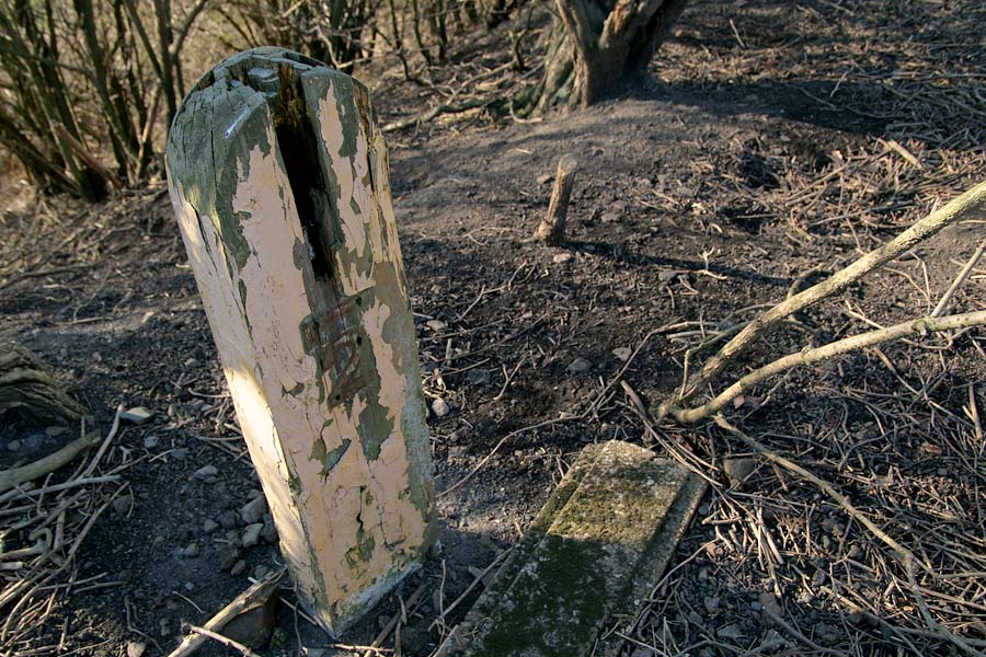
 Milepost
(08-02-07) : Graeme Bickerdike Milepost
(08-02-07) : Graeme Bickerdike
A shabby wooden milepost informs us that we’re 880 yards from the
junction. |
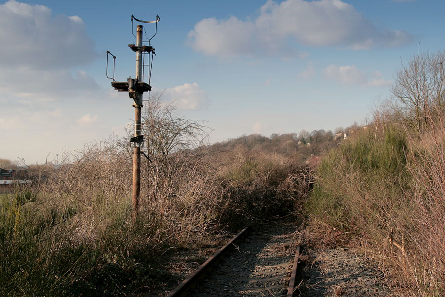
 Down
section signal (08-02-07) : Graeme Bickerdike Down
section signal (08-02-07) : Graeme Bickerdike
The post for the Down section signal - number 247 - looks rather forlorn
without its head. In an effort to deter hikers,
lineside trees have been felled to form barricades across the track, every
50 yards or so. They’re prickly and very effective. |
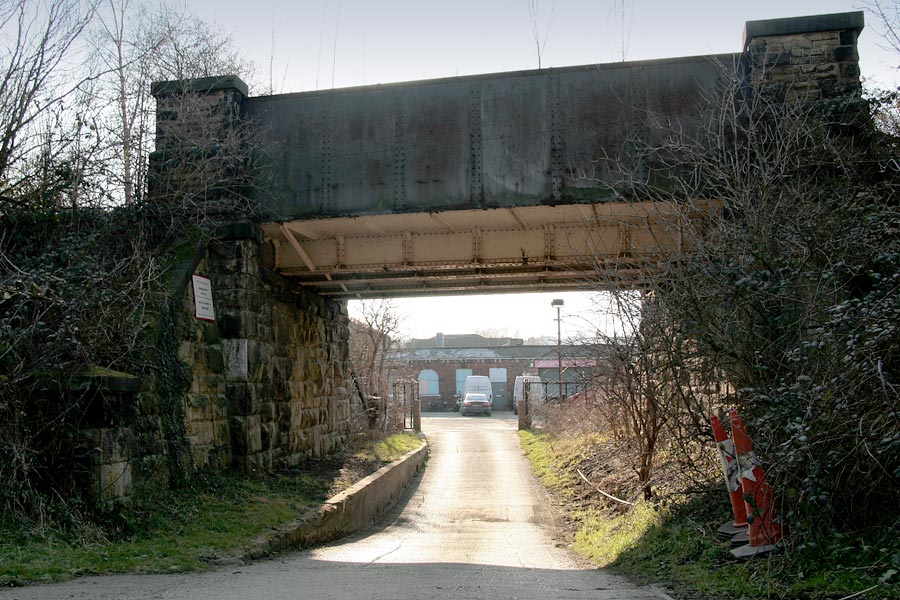
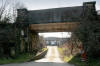 Gateway
(08-02-07) : Graeme Bickerdike Gateway
(08-02-07) : Graeme Bickerdike
Another substantial lump of engineering forms the gateway to a factory at
Horbury Bridge.
Note how the roadway has been dropped to create extra
headroom. |
 Buffer
stops (08-02-07) : Graeme Bickerdike Buffer
stops (08-02-07) : Graeme Bickerdike
The northern end of the line is marked by buffer stops which, given the
breaks and obstructions further back, are completely redundant. |
Horbury
& Ossett station
Opened 05-10-1840. Closed 05-01-1970.
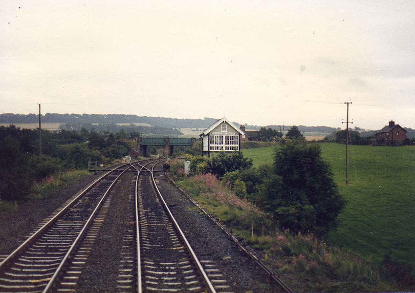
 Horbury
Station Junction (07-03-07) : Graeme Bickerdike
See also Calder Valley Horbury
Station Junction (07-03-07) : Graeme Bickerdike
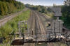
See also Calder Valley
Horbury Station Junction was the line’s connection with the existing
Wakefield-Huddersfield route.
If my memory serves, the cutting on the left
of shot was originally built as a tunnel before the L&Y four-tracked the
section and opened it out. Horbury West Curve joined on the formation to
the right. |
 Horbury
& Ossett station (08-02-07) : Graeme Bickerdike Horbury
& Ossett station (08-02-07) : Graeme Bickerdike
Viewed from the former site of Horbury & Ossett station,
the west curve diverged just beyond the junction of the right-hand two
lines. |
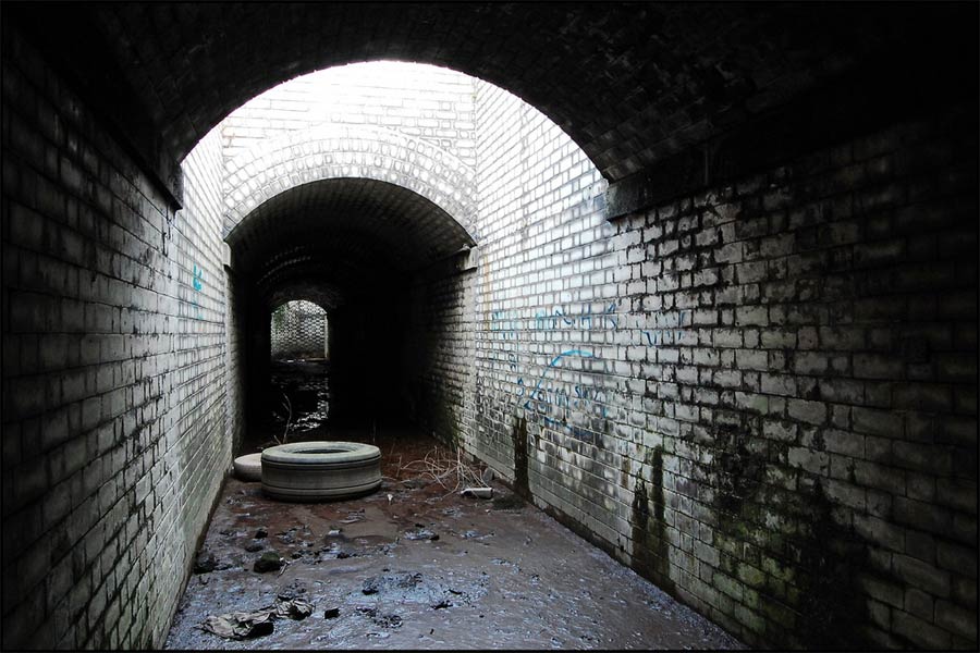
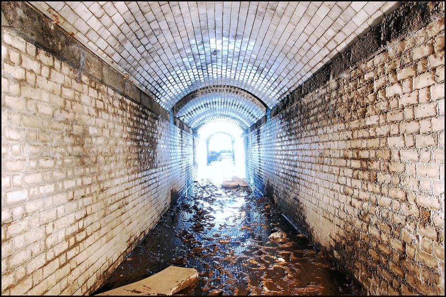
  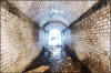 Horbury
& Ossett : Phill Davison Horbury
& Ossett : Phill Davison
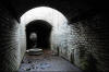
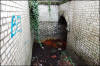
It's hard to believe now, but this was the railway station subway for
the now closed Horbury and Osset station. The station closed in 1970
leaving Osset the largest town in Yorkshire without a railway station.
Click here to see the full photo set on flickr |