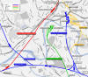
Thornhill Midland Junction
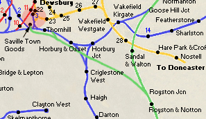
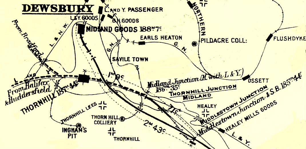
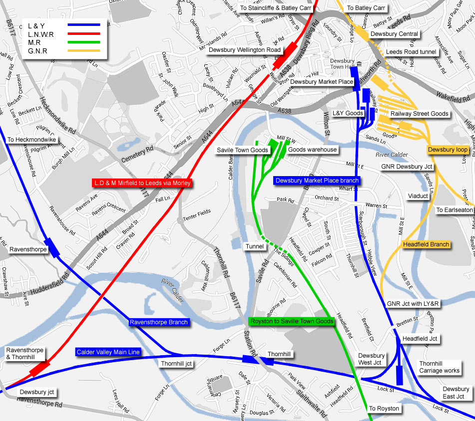
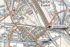
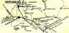 Dewsbury
map :
Ralph Rawlinson Dewsbury
map :
Ralph Rawlinson
Midland connecting line (Thornhill Jn to
Middlestown Jn)
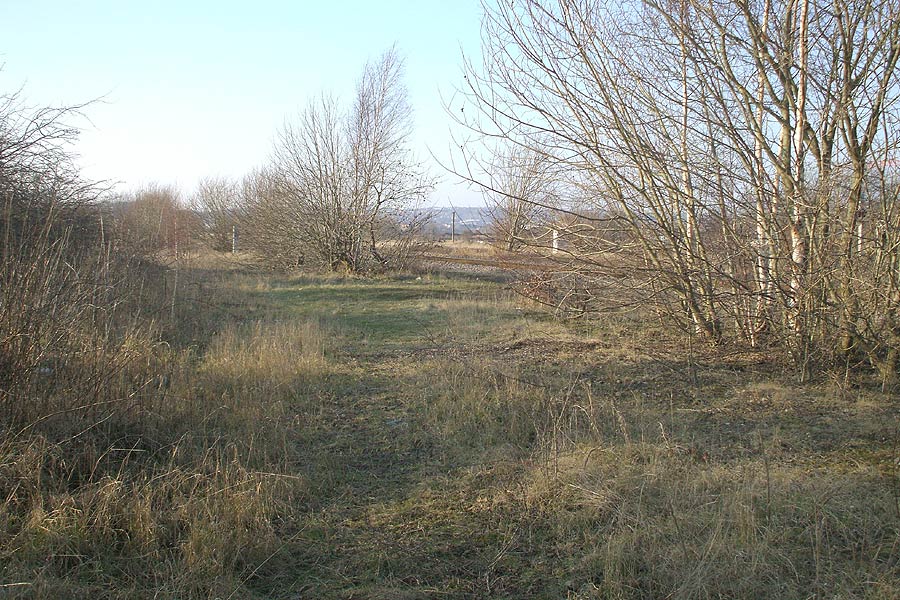
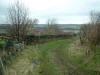
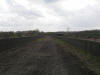
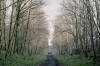
The short Midland connecting line between Middlestown Junction
down to Thornhill Midland Junction on
the L&Y Calder Calley main line.
|
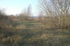 Midland
connecting line, Thornhill Midland Junction
(03-02-08) : Andrew Stopford Midland
connecting line, Thornhill Midland Junction
(03-02-08) : Andrew Stopford
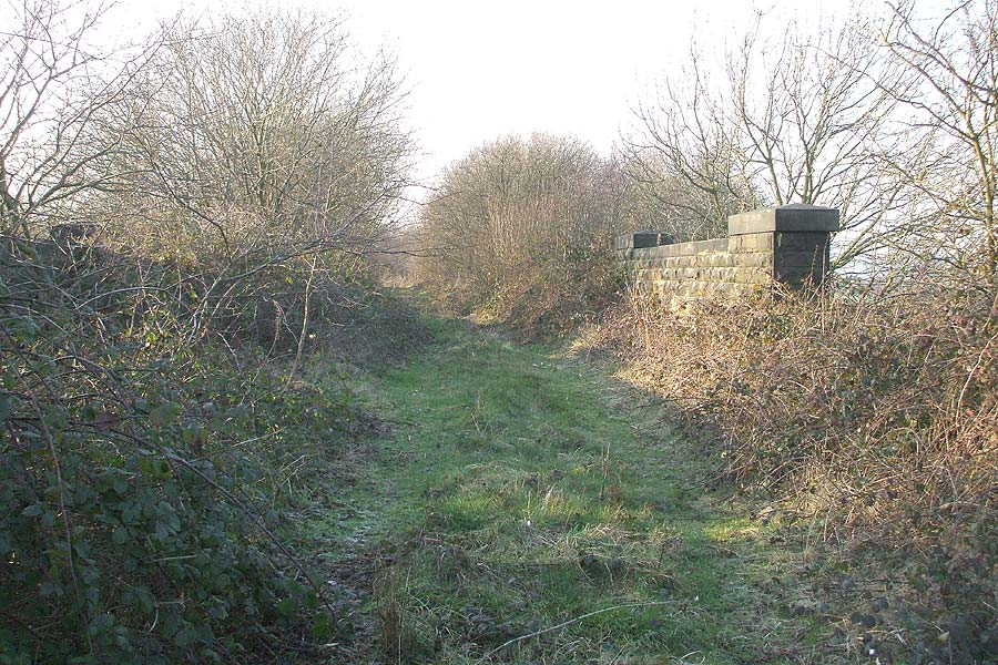
Thornhill Midland Junction. |
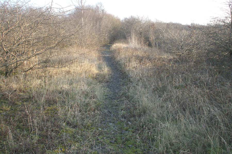
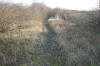 Midland
connecting line, Thornhill Midland Junction
(03-02-08) : Andrew Stopford Midland
connecting line, Thornhill Midland Junction
(03-02-08) : Andrew Stopford
Thornhill Midland Junction looking up the branch. |
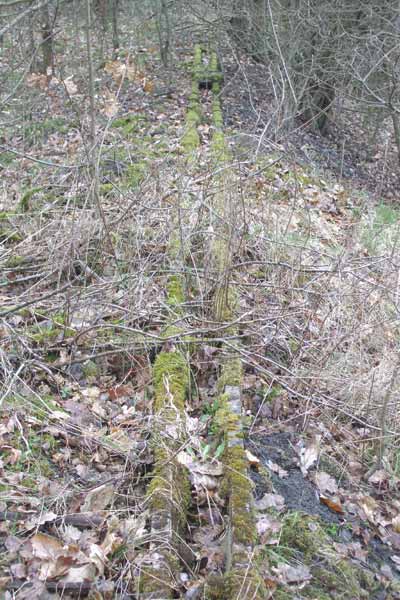
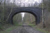
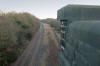
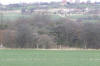 Midland
connecting line, overbridge
(03-02-08) : Andrew Stopford Midland
connecting line, overbridge
(03-02-08) : Andrew Stopford
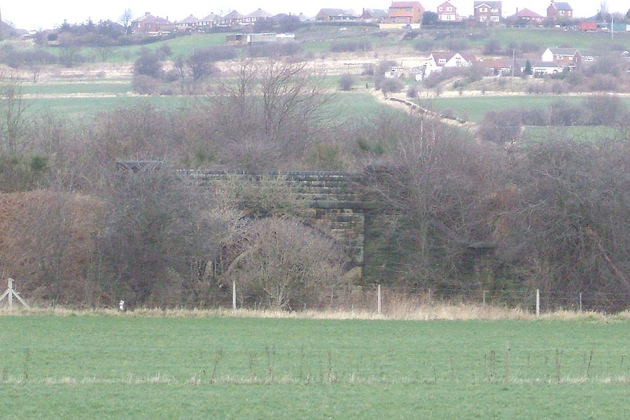
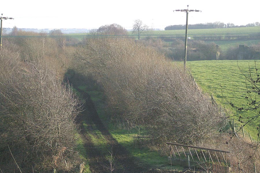
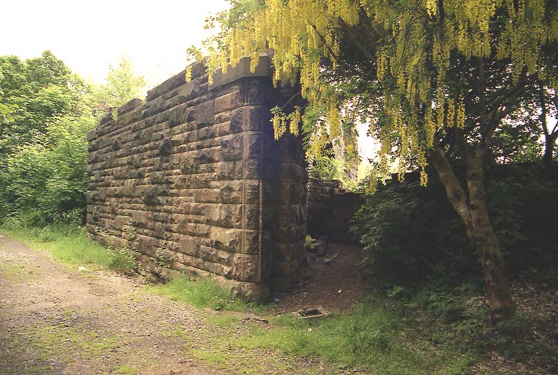
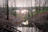
Photo shows overbridge carrying the
line almost at Thornhill Midland Junction (Dewsbury is to the left) |
 Midland
connecting line, Calder & Hebble bridge
(03-02-08) : Andrew Stopford Midland
connecting line, Calder & Hebble bridge
(03-02-08) : Andrew Stopford
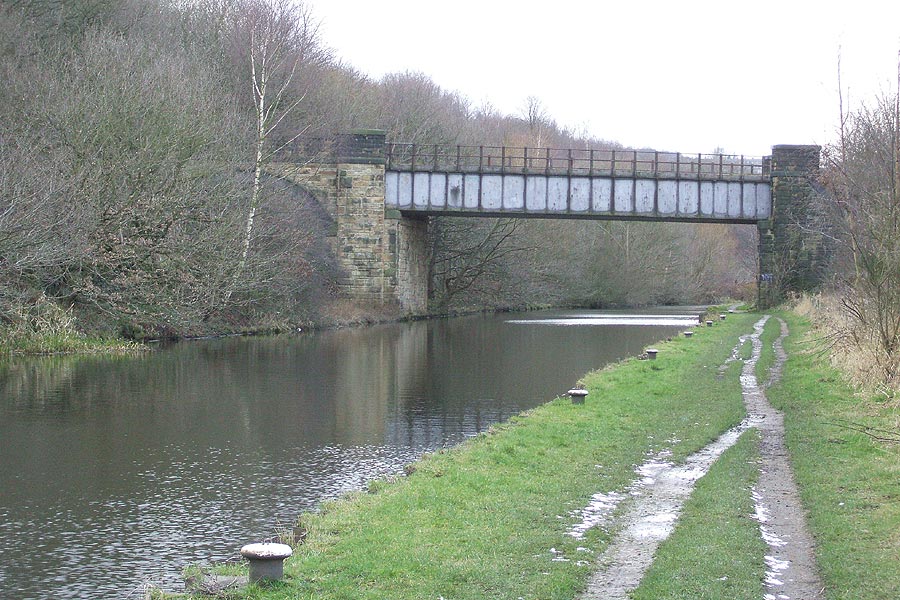
Bridge carrying the branch over the Calder &
Hebble Navigation (Dewsbury is in front of me). |
 Midland
connecting line, Calder & Hebble bridge
(03-02-08) : Andrew Stopford Midland
connecting line, Calder & Hebble bridge
(03-02-08) : Andrew Stopford
Bridge over the Calder & Hebble Navigation - looking towards
Middlestown. |
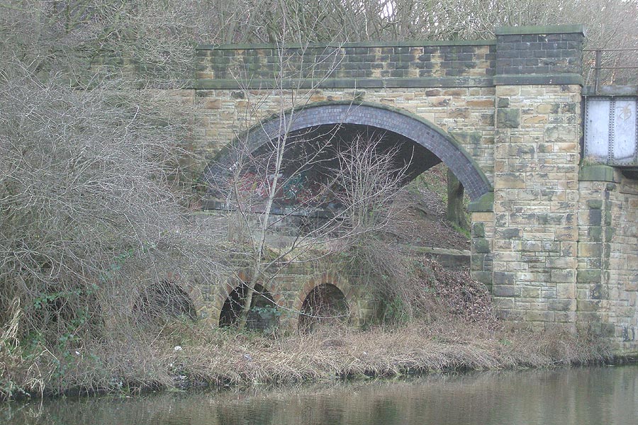
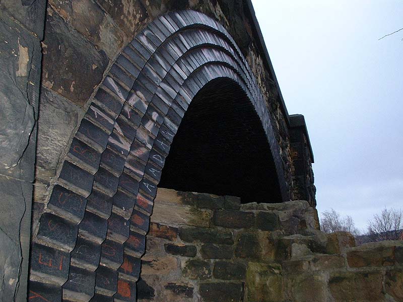
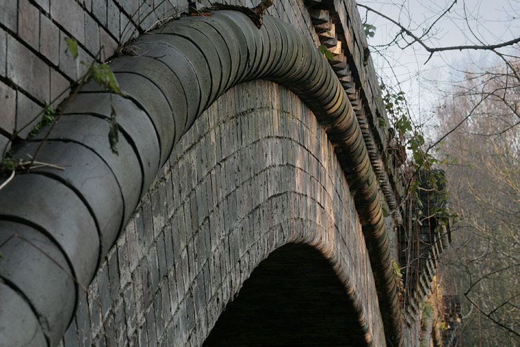
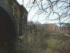
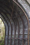
 Midland
connecting line, Stone arch approach
(03-02-08) : Andrew Stopford Midland
connecting line, Stone arch approach
(03-02-08) : Andrew Stopford
Close up of stone arch approach to the main cast iron span. |
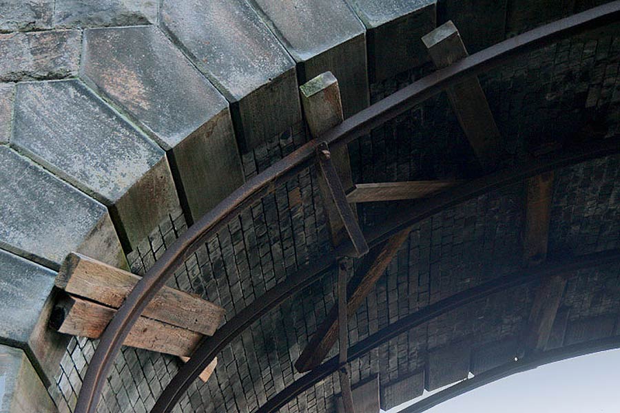
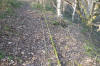 Midland
connecting line, ducting
(03-02-08) : Andrew Stopford Midland
connecting line, ducting
(03-02-08) : Andrew Stopford
cable ducting still in place. |
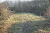
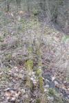
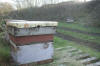 Midland
connecting line, trackbed
(03-02-08) : Andrew Stopford Midland
connecting line, trackbed
(03-02-08) : Andrew Stopford
New use for the trackbed - bee hives! |
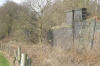
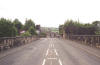
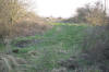 Midland
connecting line, Middlestown Junction
(03-02-08) : Andrew Stopford Midland
connecting line, Middlestown Junction
(03-02-08) : Andrew Stopford
Middlestown Junction - looking east. Savile Town Branch coming in from
right. |
 Midland
connecting line, occupation bridge
(03-02-08) : Andrew Stopford Midland
connecting line, occupation bridge
(03-02-08) : Andrew Stopford
Occupation bridge, Savile Town Branch just east of Middlestown Junction. |
 Midland
connecting line, occupation bridge
(03-02-08) : Andrew Stopford Midland
connecting line, occupation bridge
(03-02-08) : Andrew Stopford
Substantial occupation bridge - note pile of sleepers to deter motor
bikes! |
 Midland
connecting line, occupation bridge
(03-02-08) : Andrew Stopford Midland
connecting line, occupation bridge
(03-02-08) : Andrew Stopford
View from the occupation bridge down onto the branch - Savile Town
Branch visible coming in from right to left towards Middlestown
Junction. |
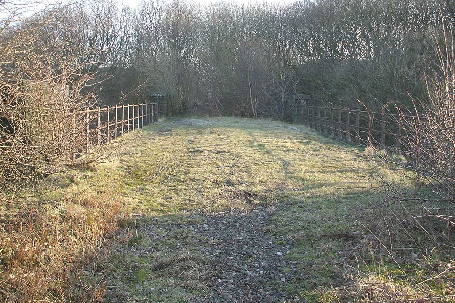
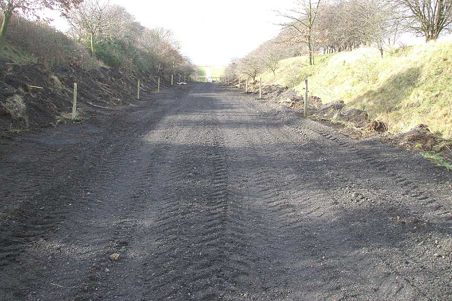
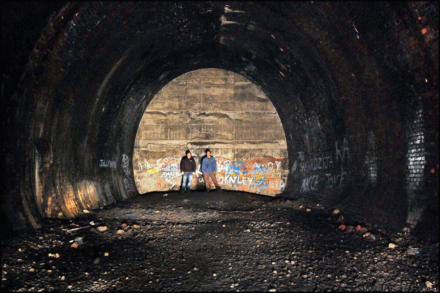
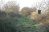
 'Dive under'
(23-02-08) : Andrew Stopford
'Dive under'
(23-02-08) : Andrew Stopford
'Dive under' at Middlestown Junction. Trains going down the bank to
Thornhill Midland Junction went through here. |
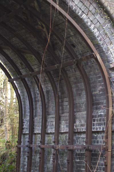
 'Dive
under' (23-02-08) : Andrew Stopford 'Dive
under' (23-02-08) : Andrew Stopford
Looking along the 'dive under' towards Thornhill
Midland Junction -
this would have seemed like a very closely confined
short tunnel. |
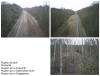
 Branch
to Middlestown Junction
(23-02-08) : Andrew Stopford Branch
to Middlestown Junction
(23-02-08) : Andrew Stopford
Recreation of Railway Memories (No 11 page77) shot - looking at the branch up to Middlestown Junction.
The Savile Town Branch runs right to left near the
top of the shot. |
 Savile
Town Branch near Middlestown Junction
(23-02-08) : Andrew Stopford Savile
Town Branch near Middlestown Junction
(23-02-08) : Andrew Stopford
Savile Town Branch near Middlestown Junction. Work in progress - the
trackbed has been 'scraped' down to its old level.
Is this just for the farmer's access? |
 Occupation
bridge (23-02-08) : Andrew Stopford Occupation
bridge (23-02-08) : Andrew Stopford
Occupation bridge over the Savile Town Branch - just east of Middlestown
Junction. |
Saville Town to Royston
 Dewsbury
map : David Webdale Dewsbury
map : David Webdale
See also Dewsbury page |
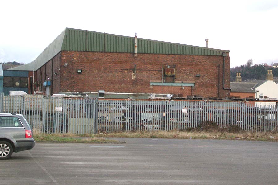
Saville Town warehouse (23-02-08) : Andrew Stopford
 I
think I have 'found' the Savile Town goods warehouse. I
think I have 'found' the Savile Town goods warehouse.
I have passed this
building many times and not given it a thought, but today I was held up
in traffic next to it, and when I looked at the brickwork I realised it
was quite old, although the building has had some work done to the roof
and had a new 'lean to' office grafted on to the side. I had a drive
round it and it slowly dawned on me that it must be the warehouse.
The
'clincher' is the evidence of the 'train sized' bricked up entrance in
the end wall! |
 South
Street/Warren Street (07-06) : Andrew
Stopford South
Street/Warren Street (07-06) : Andrew
Stopford
Bridge over the line of the Savile Town goods branch - near South
Street/Warren Street, Savile Town,
looking away from Savile Town. July
06. |
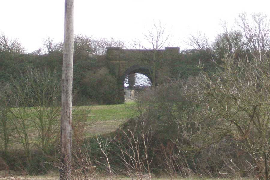
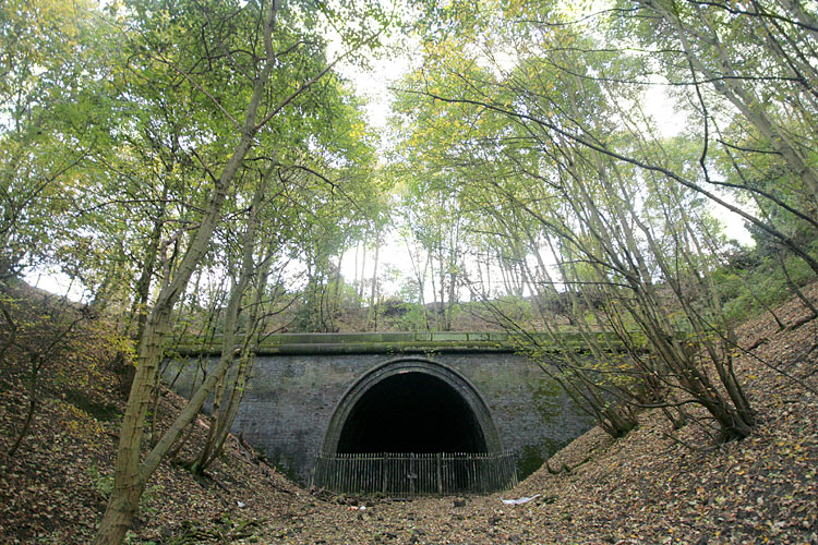
 Savile
road tunnel (06-02-07) : Andrew Stopford Savile
road tunnel (06-02-07) : Andrew Stopford
Managed to find the northern portal of the Savile Town Goods Branch
tunnel under Savile Road, Dewsbury!
I think the southern portal is well and truly buried unless somebody
knows different...! You can see into it through the fence.
It seems fairly dry but there is a lot of rubbish inside. |
 Trackbed
(03-02-07) : Andrew Stopford Trackbed
(03-02-07) : Andrew Stopford
Facing toward Dewsbury Headfield road to the right |
 Bridge
(03-02-07) : Andrew Stopford Bridge
(03-02-07) : Andrew Stopford
Overbridge off the common near Thornhill |
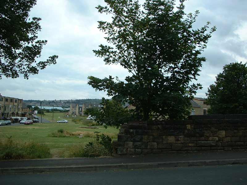
 OS
Map 1980 : Hadfield road & Canal crossing : David Webdale OS
Map 1980 : Hadfield road & Canal crossing : David Webdale |
 Headfield road
facing south (31-05-04) : David Webdale Headfield road
facing south (31-05-04) : David Webdale
Bridge buttresses clearly visible on each side of
Headfield road.
To the right the line headed towards Savile town & crossed the Ravensthorpe to Wakefield line,
the Ravensthorpe to Wakefield line passes under
the road here. |
 Right
hand side of
Headfield road
facing south. (31-05-04) : David Webdale Right
hand side of
Headfield road
facing south. (31-05-04) : David Webdale
Just to the right of above photo, remnants of the
other side of the bridge. |
 Headfield
road bridge (03-02-07) : Andrew Stopford Headfield
road bridge (03-02-07) : Andrew Stopford
Brick detail |
 Headfield
road bridge facing south (03-02-07) : Andrew Stopford Headfield
road bridge facing south (03-02-07) : Andrew Stopford
looking across the ravine.
The Ravensthorpe to Wakefield line is down in the bottom. |
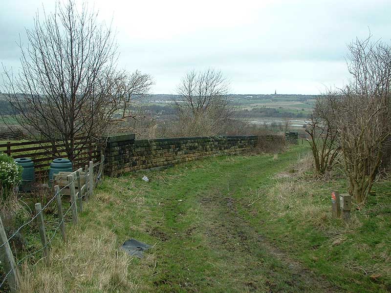
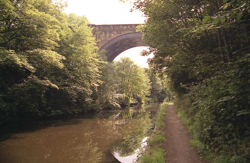
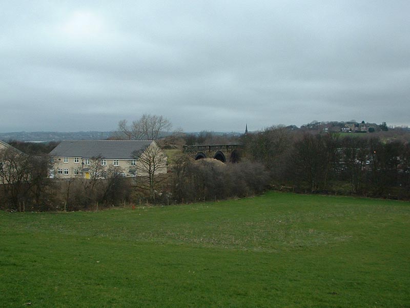
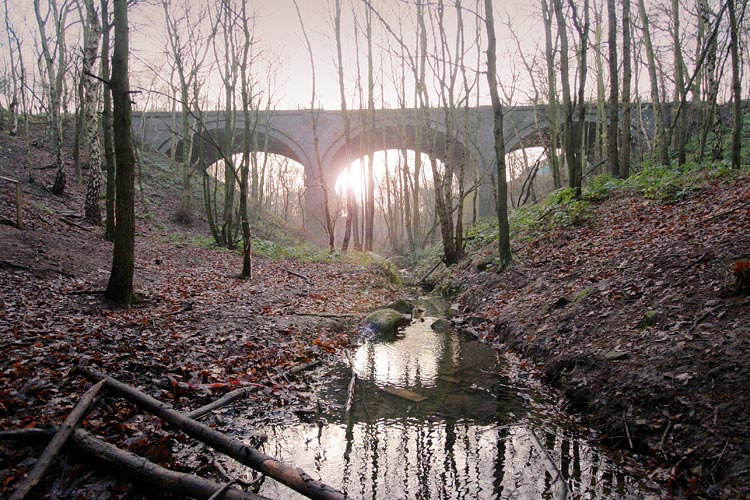
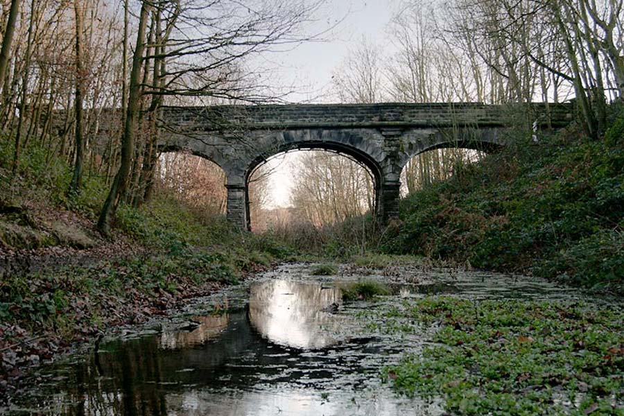
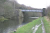
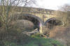
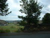
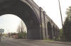
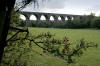
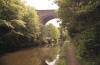 Thornhill
canal crossing
facing south (18-07-04) : David Webdale Thornhill
canal crossing
facing south (18-07-04) : David Webdale
Photographed from the Calder Hebble navigation towpath, a couple of
hundred yards west of the locks.
Found this massive three arch viaduct, obscured by trees. |
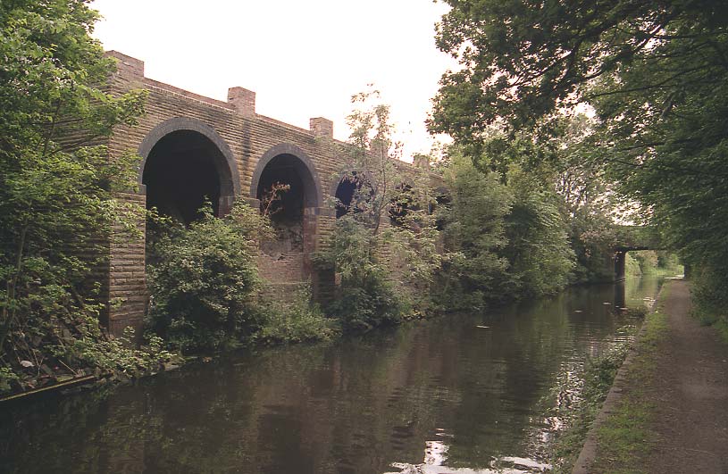
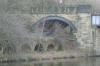
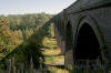
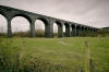
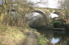 Thornhill
canal crossing
facing north (03-02-08)
: Andrew Stopford Thornhill
canal crossing
facing north (03-02-08)
: Andrew Stopford
Savile Town 004: Shot of the viaduct carrying the Midland's
Savile Town branch over the Calder & Hebble Navigation near Headfield
Junction. |
 Thornhill
canal crossing (03-02-07) : Andrew Stopford Thornhill
canal crossing (03-02-07) : Andrew Stopford |
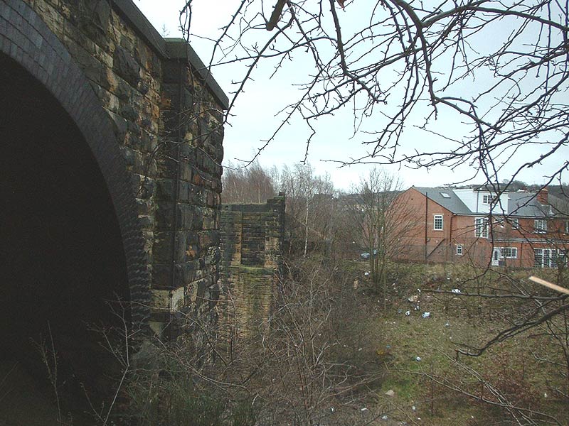
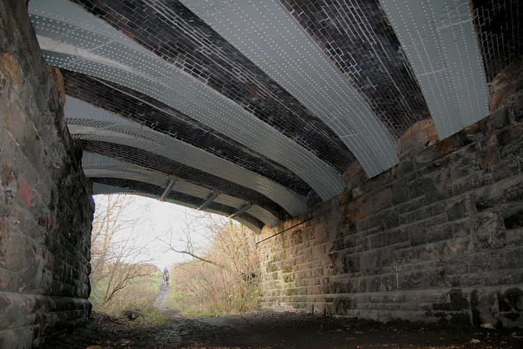
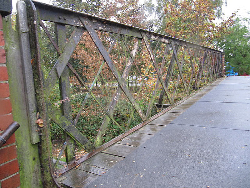
 Underbridge Thornhill (17-05-08) : Andrew Stopford Underbridge Thornhill (17-05-08) : Andrew Stopford
Found another underbridge on the Savile Town
branch, east of the connection down to the Calder Valley line, very
close to Thornhill. Condition is quite poor - part of the parapet wall
has collapsed and some of the brick arch lining has also come away! |
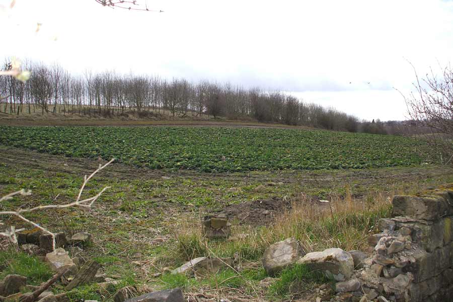
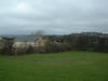
Canal
loading dock.
(06-06-04) : David Webdale
 Found what looks to be some sort of loading
dock,
not sure this has anything to do with railways,
took a picture anyway. Found what looks to be some sort of loading
dock,
not sure this has anything to do with railways,
took a picture anyway.
Bridge in background carries the B6117.
Note : (16-04-08) :
Graham Smith
The Royston to Savile Town MR line is now showing another lost relic of
our industrial past…..
The lovely loading dock type structure that always fascinated me when I
mountain biked past it on the canal bank has now gone forever
to be
replaced by another cheap development of flats or 4 storey town houses.
The developers may even have re-used the stone from this structure to
form the wire-caged canal banking reinforcement that they have replaced
these wonderful arches with. The development is on the land behind the
Lord Nelson pub (I think!) that is by the bridge in the background on
the photo. |
 Horbury
Bridge viaduct on the A 642 from Huddersfield
Facing East.
(25-04-04) : David Webdale Horbury
Bridge viaduct on the A 642 from Huddersfield
Facing East.
(25-04-04) : David Webdale
Driven under this viaduct loads of times, I
think its ace.
|
 Horbury
Bridge viaduct (30-10-06) : Graeme Bickerdike
website -
http://www.forgottenrelics.co.uk/ Horbury
Bridge viaduct (30-10-06) : Graeme Bickerdike
website -
http://www.forgottenrelics.co.uk/
This is an alternative view of Horbury Bridge
viaduct, looking west from the site of a new housing estate.
Like other
structures on the line, it’s built of blue engineering brick and remains
in good condition.
It is, of course, only a youngster in railway terms. |
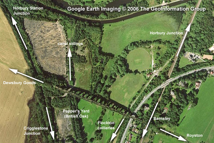
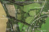 Crigglestone
Google Earth (30-10-06) : Graeme Bickerdike Crigglestone
Google Earth (30-10-06) : Graeme Bickerdike
This is a Google Earth snapshot showing the local railway equivalent of
Spaghetti Junction. The Royston-Saville Town line ran east-west across
the viaduct and then under it, from left to right, was
Crigglestone
curve (Horbury Station Junction-Crigglestone Junction), the canal
sidings from Pepper’s Yard, the colliery branch serving pits at
Bullcliffe Wood, Denby Grange and Caphouse, and the existing
Wakefield-Barnsley route. |
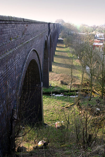
 Crigglestone
viaduct (30-10-06) : Graeme Bickerdike Crigglestone
viaduct (30-10-06) : Graeme Bickerdike
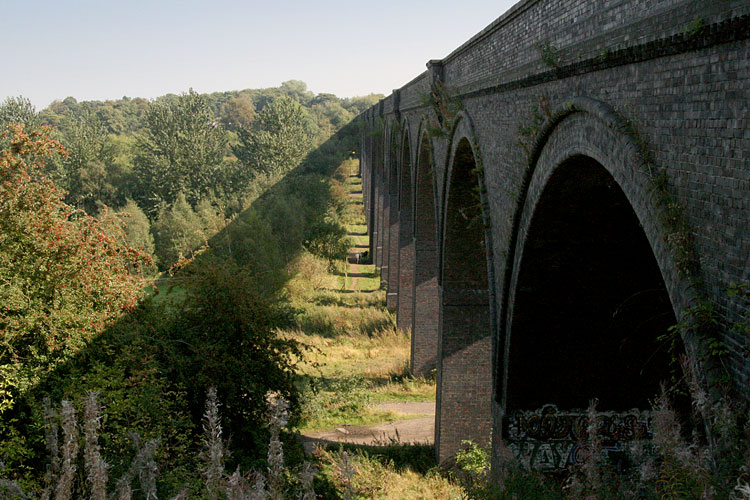
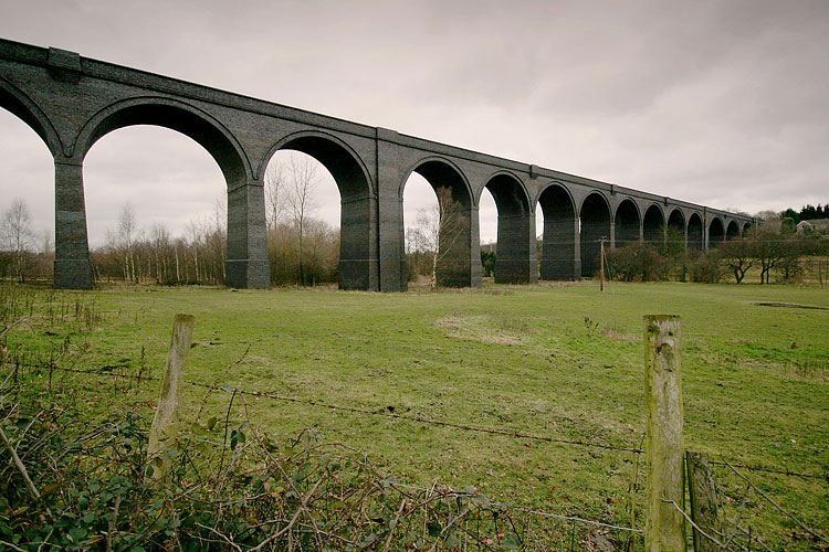
The viaduct at Calder Grove (known as Crigglestone viaduct) has 19
arches and crossed Pepper’s Yard (the British Oak site)
and a colliery
branch up to Midgley and Flockton. |
 Crigglestone
viaduct April 2004 : Richard Sterry Crigglestone
viaduct April 2004 : Richard Sterry
Taken in April 2004, after workmen had cleared a
lot of the vegetation from and around the viaduct. |
 Crigglestone
viaduct April 2004 : Richard Sterry Crigglestone
viaduct April 2004 : Richard Sterry |
 Crigglestone
viaduct April 2004 : Richard Sterry Crigglestone
viaduct April 2004 : Richard Sterry
|
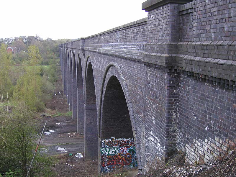
 Crigglestone
viaduct (30-10-06) : Graeme Bickerdike Crigglestone
viaduct (30-10-06) : Graeme Bickerdike
The northern side of the viaduct, viewed from the
former sidings at Calder Grove. It’s a shame there’s so much vegetation
– no more than half the structure can be seen from any vantage point.
|
 Crigglestone
viaduct (19-12-06) : Graeme Bickerdike Crigglestone
viaduct (19-12-06) : Graeme Bickerdike
This is another view of Crigglestone viaduct, this time from the
south side. It shows 14 of the 19 arches and is taken from the former site
of Pepper’s Yard. There are some fabulous colour photos of the sidings,
circa June 1968, on Geoff Plumb’s fotopic page.
http://geoff-plumb.fotopic.net/c853638.html |
 Crigglestone
viaduct (30-10-06) : Graeme Bickerdike Crigglestone
viaduct (30-10-06) : Graeme Bickerdike
Immediately east of the viaduct, the route crossed
over the Wakefield-Barnsley line on a single-arch bridge which, in
practical terms, was a continuation of the viaduct.
The line then ran through fields before diving under the M1 just south
of junction 39. I understand the section from Thornhill Midland Junction
to Crigglestone East was actually closed in August 1968. For the last
three month’s of its life, the line was used by construction traffic for
the motorway. The rest of the route to Royston had closed in May ‘68. |
 Crigglestone
curve (30-10-06) : Graeme Bickerdike Crigglestone
curve (30-10-06) : Graeme Bickerdike
A huge embankment carried the line on its approach to the viaduct at
Calder Grove. Crigglestone curve passed through it in a short tunnel.
This line was severed from the network in February 1991 and part of the
track removed. A stockpile of concrete sleepers remain. |
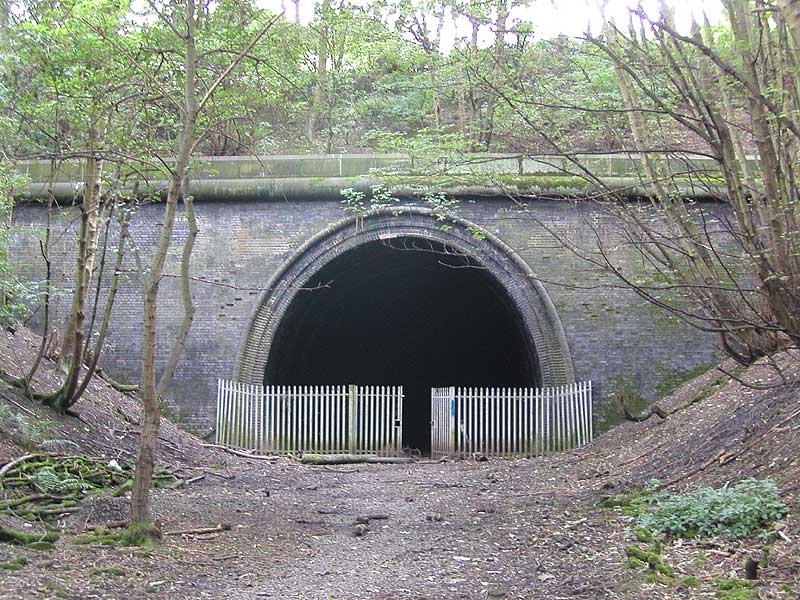
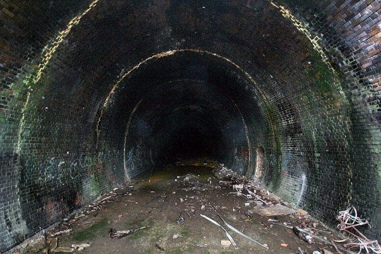
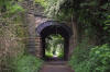
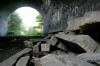
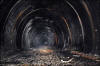
Crigglestone tunnel
 Crigglestone
tunnel (30-10-06) : Graeme Bickerdike Crigglestone
tunnel (30-10-06) : Graeme Bickerdike
The western portal of Crigglestone tunnel looks tiny in this photograph
but is, in fact, quite a monster.
It sits in a quiet cutting just 100 yards east of the M1.
I’m not sure of the tunnel’s exact length but it’s relatively short – no
more than 300 yards. |
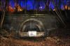
 Crigglestone
tunnel September 2004 : Richard Sterry Crigglestone
tunnel September 2004 : Richard Sterry
Western portal. |
 Crigglestone
tunnel (30-11-08) : Phill Davison Crigglestone
tunnel (30-11-08) : Phill Davison
I was a bit worried we'd left it too late in the day to get any good
daylight shots of the portal. It obviously doesn't matter if It's night
or day once inside the tunnel. I needn't have worried, I think this
light painted shot is far more eerie and atmospheric.
See more at
http://www.flickr.com/photos/phill_dvsn/sets/72157610545342778/detail/ |
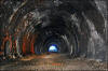
 Crigglestone
tunnel (30-10-06) : Graeme Bickerdike Crigglestone
tunnel (30-10-06) : Graeme Bickerdike
This is the view looking over the palisade
fencing. It’s very wet inside with water pouring from the roof,
especially near the portal. The bore curves slightly to the right as it
reaches the eastern end which is now bricked up and buried by landfill. |
 Crigglestone
tunnel (c1990) : Graeme Bickerdike Crigglestone
tunnel (c1990) : Graeme Bickerdike
I found this shot in a forgotten packet of prints.
It shows the view out from the western end in those enlightened days
(1990…ish) before ‘health n safety’ and the delights of palisade
fencing. |
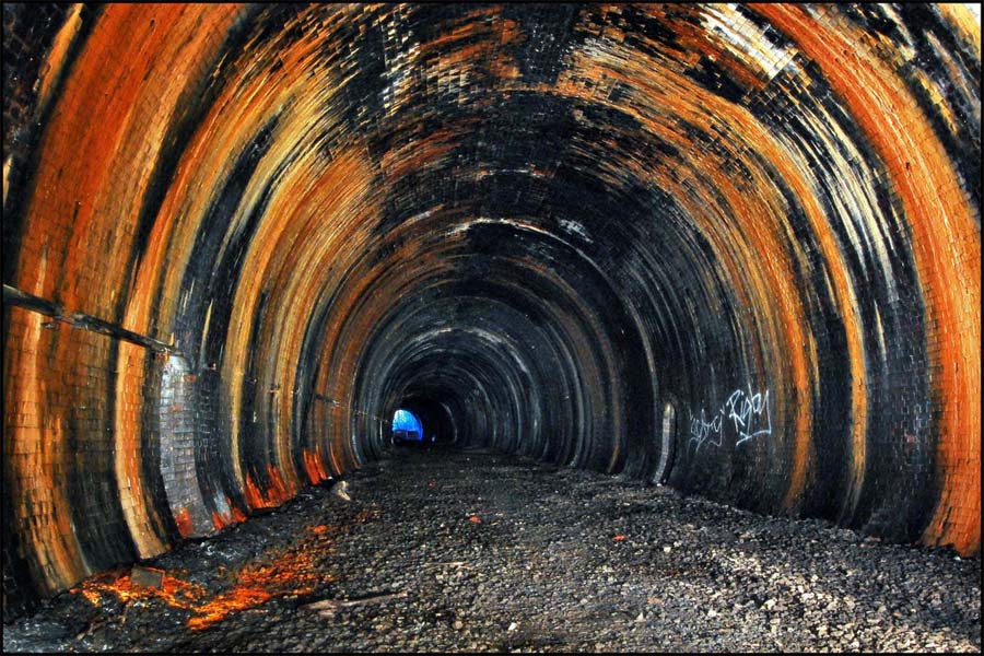
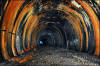
 Crigglestone
tunnel (30-11-08) : Phill Davison Crigglestone
tunnel (30-11-08) : Phill Davison
This is without a doubt the largest bore of any tunnel I've been in. The
painted grafitti reads 'Do not enter' and Crigglestone is certainly well
fortified to keep any undesireables out. Criggleston is a relatively
short tunnel at only 250 yds long. These days it sits in a hard to
reach, secluded cutting with cars passing by on the M1 only a 100 yards
away.
|
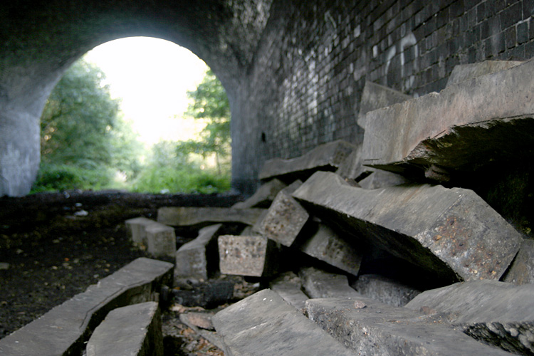
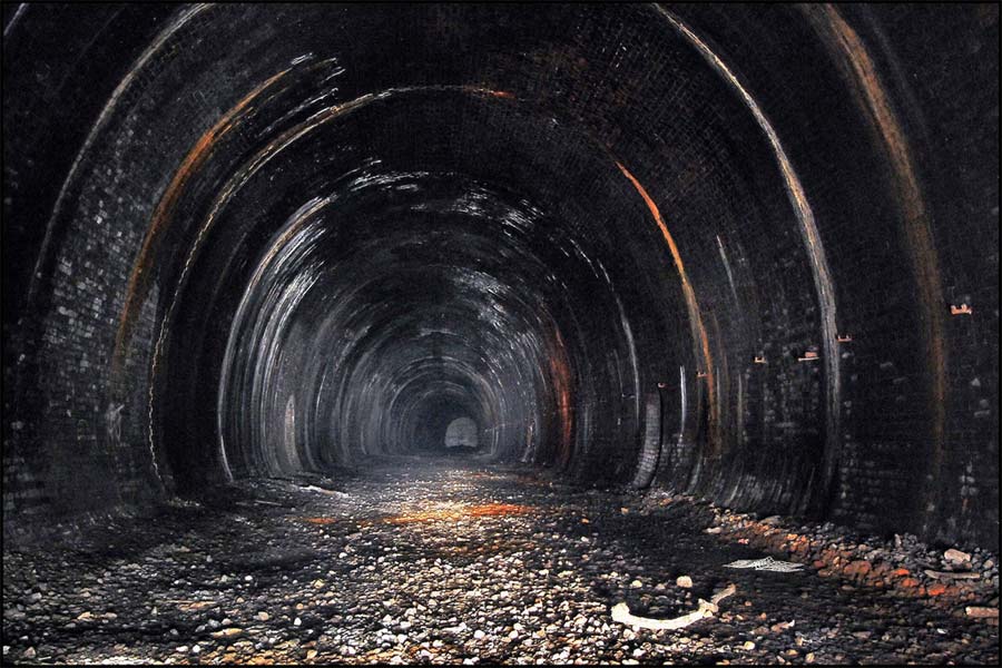
Crigglestone tunnel (30-11-08) : Phill Davison
 Criggleston
tunnel has lots of water ingress running down the walls, coating them
with rich Iron and Calcite deposits. Criggleston
tunnel has lots of water ingress running down the walls, coating them
with rich Iron and Calcite deposits.
In very dry tunnels there is very little atmosphere. In tunnels were
there is lots of water ingress, there is plenty of weird and wonderful
sounds to be had. Drips hitting old tin cans are magnified out of all
proportion. Your voices are played over again. making you think there is
some one else in the tunnel further down. Passing Wagons on the nearby
M1, make an eerie deep rumbling sound within the tunnel at Criggleston. |
 Crigglestone
tunnel (30-11-08) : Phill Davison Crigglestone
tunnel (30-11-08) : Phill Davison
There's always a more of a sinister atmosphere when a tunnel has been
blocked off and filled in from behind. The bore of Crigglestone tunnel
curves to the right, revealing the capped off East portal in the distant
gloom. |
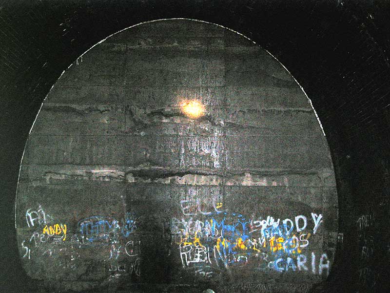
Crigglestone tunnel September 2004 :
Richard Sterry
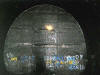 The
capped-off eastern end. Done in concrete very neatly before the cutting
on the far side was backfilled. An idea of the scale can be gained by
how high the graffiti reaches up the capping - you can bet that the
'artists' were standing on tip-toe, possibly helped a little by odd bits
of wood lying around on the track bed, which is just visible at the very
bottom of the photo. The yellowy-orange blob about two-thirds of the way
up the capping is a torch beam, so I could see where to point the
camera! The
capped-off eastern end. Done in concrete very neatly before the cutting
on the far side was backfilled. An idea of the scale can be gained by
how high the graffiti reaches up the capping - you can bet that the
'artists' were standing on tip-toe, possibly helped a little by odd bits
of wood lying around on the track bed, which is just visible at the very
bottom of the photo. The yellowy-orange blob about two-thirds of the way
up the capping is a torch beam, so I could see where to point the
camera! |
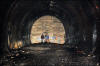 Crigglestone
tunnel (30-11-08) : Phill Davison Crigglestone
tunnel (30-11-08) : Phill Davison
My companions on the day Jordan and Rich, give a good sense of scale to
the size of the blocked off East portal of Crigglestone tunnel. It's
seems a little strange stood on this side of the tunnel, knowing there
is thousands of tonnes of landfill behind the concrete wall. See more at
http://www.flickr.com/photos/phill_dvsn/sets/72157610545342778/detail/
|
 Newmillerdam
Barnsley Road bridge (19-12-06) : Graeme Bickerdike Newmillerdam
Barnsley Road bridge (19-12-06) : Graeme Bickerdike
The trackbed between Crigglestone tunnel and Newmillerdam has largely
been reclaimed and the cutting west of Barnsley Road bridge is infilled.
The bridge itself comprises stone abutments, skew cross-girders with
brick vaulting in-between. |
 Newmillerdam
Country Park (19-12-06) : Graeme Bickerdike Newmillerdam
Country Park (19-12-06) : Graeme Bickerdike
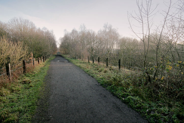
The trackbed, now a public footpath, sits in a shallow cutting and
bisects the Country Park.
|
 Newmillerdam
Viaduct (19-12-06) : Graeme Bickerdike Newmillerdam
Viaduct (19-12-06) : Graeme Bickerdike
Believe it or not, this is the deck of a viaduct. Ground level today is
three or four feet higher than when the railway crossed it, hence the
need for post-and-wire fencing. |
 Newmillerdam
Three arch viaduct (19-12-06) : Graeme Bickerdike Newmillerdam
Three arch viaduct (19-12-06) : Graeme Bickerdike
Viewed from the north, the viaduct has three, flat arches and is of a
similar construction to its big sisters at Horbury Bridge and
Crigglestone, including the blue engineering brick. |
 Newmillerdam
Three arch viaduct (19-12-06) : Graeme Bickerdike Newmillerdam
Three arch viaduct (19-12-06) : Graeme Bickerdike
The brickwork in close-up.
I wonder if there was any purpose to these
features or did the engineer just have designs on being an architect?
|
 Newmillerdam
Three arch bridge (10-01-07) : Graeme Bickerdike Newmillerdam
Three arch bridge (10-01-07) : Graeme Bickerdike
To the east of the viaduct, the route once again passes through a
cutting on the approach to this three arch bridge.
Drainage is clearly
poor nowadays but the footpath is high and dry, just off to the left. |
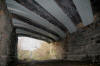
 Newmillerdam
Three arch bridge (10-01-07) : Graeme Bickerdike Newmillerdam
Three arch bridge (10-01-07) : Graeme Bickerdike
It
would appear that the central arch is not in great condition. A
framework has been constructed under it
(good to see old bullhead rail
being put to good use) and timbers inserted to support the masonry.
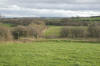
The trackbed then crosses open countryside, mostly on a tree-lined
embankment, as it passes to the north of Notton. |
 Occupation
bridge (21-03-08) : Andrew Stopford Occupation
bridge (21-03-08) : Andrew Stopford
Occupation bridge with 'rail' strengthening -
between Newmillerdam & Royston Junction. |
 Occupation
bridge (21-03-08) : Andrew Stopford Occupation
bridge (21-03-08) : Andrew Stopford
Detail of rudimentary strengthening of occupation bridge, using old
rail! Between Newmillerdam & Royston Junction. |
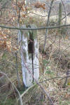 Gradient
post (21-03-08) : Andrew Stopford Gradient
post (21-03-08) : Andrew Stopford
Infrastructure survivor! Gradient post? |
 Cable
conduit (21-03-08) : Andrew Stopford Cable
conduit (21-03-08) : Andrew Stopford
Cable conduit - Royston Junction just after start of the branch. |
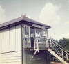
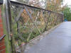 Royston
Footbridge (11-10-09) : Eric Hair Royston
Footbridge (11-10-09) : Eric Hair
There is a Planning application to demolish the above.
I’ve suggested they at least use the old balustrade ironwork on the new
level structure. |
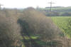
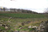 Line
of branch (21-03-08) : Andrew Stopford Line
of branch (21-03-08) : Andrew Stopford
Line of branch (partially covered) follows line of trees and abandoned
fencing just outside Crigglestone
(Crigglestone is to right). |
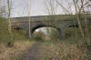 Old
Royston bridge (10-01-07) : Graeme Bickerdike Old
Royston bridge (10-01-07) : Graeme Bickerdike
At Old Royston, another bridge with three flat
arches – again, not in the best of nick.
Note how the left-hand arch has
dipped. There are large cracks in the parapet and some of the brickwork
has fallen away. |
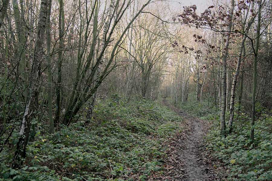
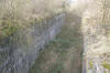
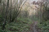 Royston
cutting (10-01-07) : Graeme Bickerdike Royston
cutting (10-01-07) : Graeme Bickerdike
Curving to the south, the line entered a cutting
as it approached the main line. Silver birch have swallowed any remnants
of the railway, but it’s still a pleasant walk – part of the Trans
Pennine Trail. |
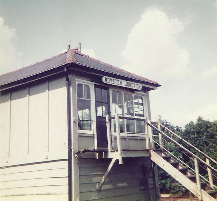
Royston junction
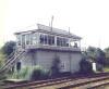  Royston junction
signal box (nd) : John Gorthorpe Royston junction
signal box (nd) : John Gorthorpe
The Midland Railway at Royston Junction. The signal box
controlled the line to Dewsbury Saville Town Goods (Thornhill Line)
and also I believe the sidings into Monkton Coke Works. |
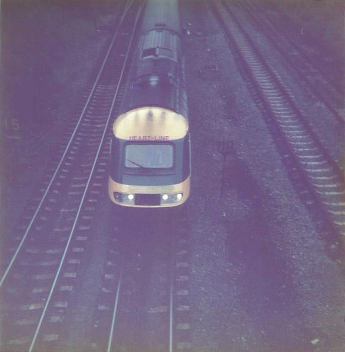
 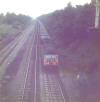 Royston junction (nd)
: John Gorthorpe Royston junction (nd)
: John Gorthorpe
The HST is passing Royston Junction signal box heading
towards Oakenshaw Junction. The empty hoppers are heading towards
Royston, possibly heading for Grimethorpe Colliery. |
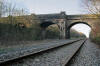 Old Royston junction (10-01-07) : Graeme Bickerdike Old Royston junction (10-01-07) : Graeme Bickerdike
The
junction was at Old Royston, site of yet another three arched bridge. I
can’t explain its rather strange construction, with the deck of the
right-hand arch being half the width of the other two. The
Royston-Dewsbury was on a raised formation and would have passed under
the left-hand arch,
which I guess is a more recent addition. |
 Old
Royston junction (10-01-07) : Graeme Bickerdike Old
Royston junction (10-01-07) : Graeme Bickerdike
The view south from the road bridge, towards the
junction itself. |
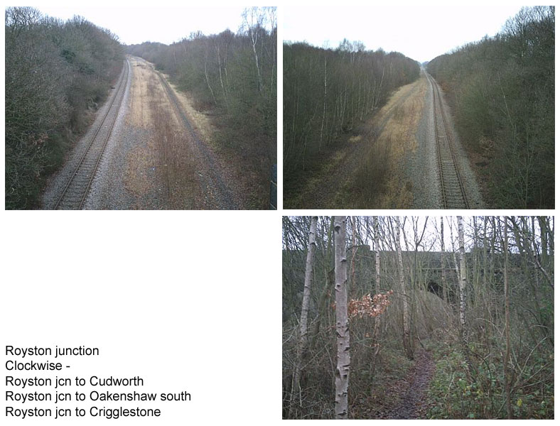
Royston junction (26-08-08) Jonathan
Armitage
 Royston
jcn to Cudworth: This view looking towards cudworth,the former
royston box was on the right. Royston
jcn to Cudworth: This view looking towards cudworth,the former
royston box was on the right.
Royston jcn to Oakenshaw sth jcn: This view looking towards
wakefield shows the remaining line of the former midland mainline.
Royston jcn to crigglestone: This image shows the overbridge at
navvy lane old royston with which the line to crigglestone and
Middlestown junction ran beneath. |
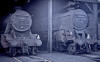
 Royston
(30-07-67) : Roy Lambeth
Website -
www.dmm.org.uk/mindex.htm Royston
(30-07-67) : Roy Lambeth
Website -
www.dmm.org.uk/mindex.htm |
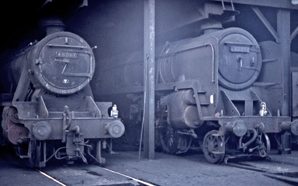
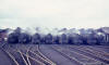
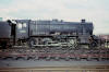
 Royston
(30-07-67) : Roy Lambeth Royston
(30-07-67) : Roy Lambeth
48067 & 92048 |
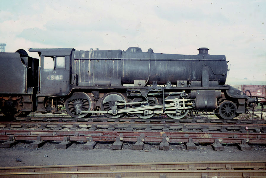
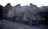
 Royston
(30-07-67) : Roy Lambeth Royston
(30-07-67) : Roy Lambeth
48160 |
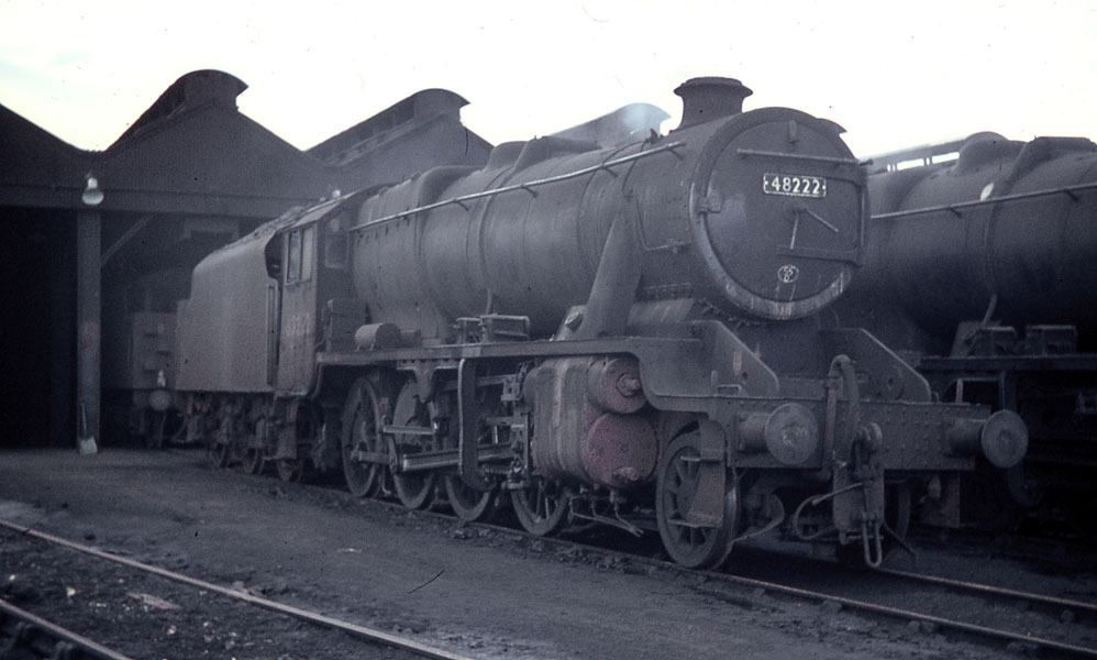
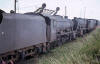
 Royston
(30-07-67) : Roy Lambeth Royston
(30-07-67) : Roy Lambeth
48222 |
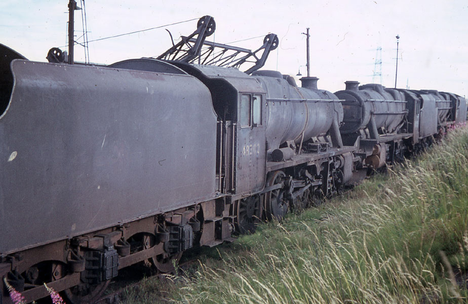
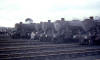
 Royston
(30-07-67) : Roy Lambeth Royston
(30-07-67) : Roy Lambeth
48302 |
 Royston
(30-07-67) : Roy Lambeth Royston
(30-07-67) : Roy Lambeth
48710 & 48473 |