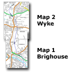
You are here
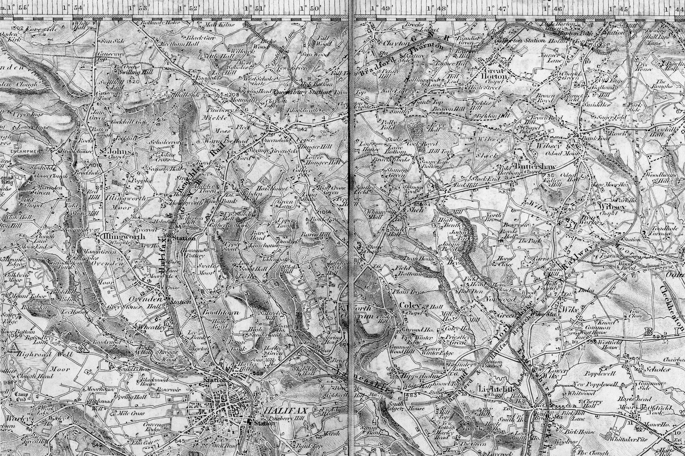
Map 2 Wyke Birkhouse - Wyke & Norwood Green
|
Map 2 Wyke
|
 Halifax,
Queensbury, Low Moor & Wyke map (1843) : John Sutcliffe Halifax,
Queensbury, Low Moor & Wyke map (1843) : John Sutcliffe
One inch to the mile map showing Sowerby Bridge in the west and Dewsbury
in the east. Published by Col. Colby dated 1843.
(This file size is about 1.4 meg, so it may take a while to download) |
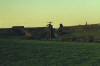
%20(15%20to%2018%20%2023-11-03)%20(19%20to%2024%20%2024-11-03)/20%20footpath%20low%20lane%20east_small.jpg) Footpath
Low lane facing East (24-11-03) David Webdale Footpath
Low lane facing East (24-11-03) David Webdale
Situated at the end of Low lane. Funny little bridge thing, don't really
know what it is. |
%20(15%20to%2018%20%2023-11-03)%20(19%20to%2024%20%2024-11-03)/19A%20birkhouse%20road%20east_small.jpg) Birkhouse
road facing East (24-11-03) David Webdale Birkhouse
road facing East (24-11-03) David Webdale
Solid stone arch bridge over Birkhouse road. Still in good fettle. |
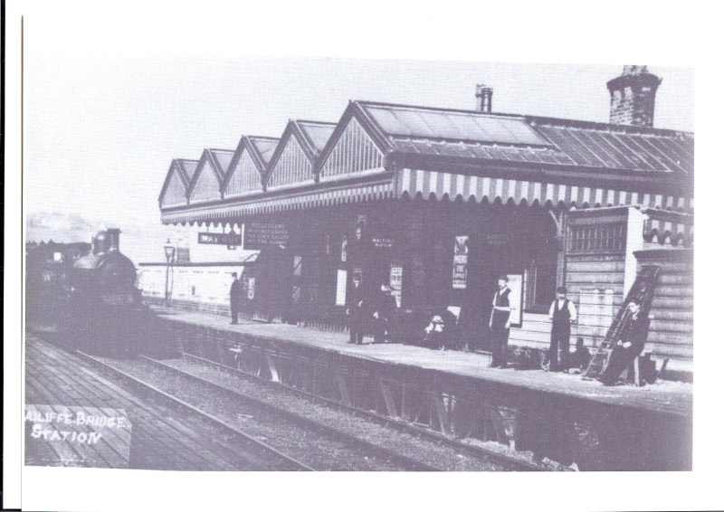
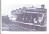 Bailiff Bridge
station Bailiff Bridge
station
Opened 01-03-1881. Closed 14-09-1931. Burned down 1929.
Bailiff bridge Station (c1900) : Steven Wild
I recently met with some local residents and they have supplied me with
an image which I imagine started life as a postcard
of the old Bailiff Bridge station. |
%20(15%20to%2018%20%2023-11-03)%20(19%20to%2024%20%2024-11-03)/22%20birkby%20lane%20west_small.jpg) Birkby
lane facing West (24-11-03) David Webdale Birkby
lane facing West (24-11-03) David Webdale
Panoramic view down Birkby lane, facing towards Bailiff bridge. A few
runaway vehicles down here in the past.
Another solid stone bridge crossing Birkby lane. Bailiff bridge station
was to the left where those green sheds are.
Just to the left of the sheds, remnants of the tiled subway are visible
(close up next photo) |
%20(15%20to%2018%20%2023-11-03)%20(19%20to%2024%20%2024-11-03)/21%20bailiff%20bridge%20station%20south_small.jpg) Bailiff
bridge Station facing South (24-11-03) David Webdale Bailiff
bridge Station facing South (24-11-03) David Webdale
Buildings & platforms were of wooden
construction. The platforms were reached via this tiled subway from the
booking office at road level.
The station gained mainline status in 1900, when a Bradford Exchange to
Marylebone was routed this way. |
%20(15%20to%2018%20%2023-11-03)%20(19%20to%2024%20%2024-11-03)/23%20whitwood%20lane%20east_small.jpg) Whitwood
lane facing East (24-11-03) David Webdale Whitwood
lane facing East (24-11-03) David Webdale
Brick arch on this narrow bridge crossing Whitwood lane. Behind me the
scenery has changed a lot recently, loads of mills demolished. |
%20(15%20to%2018%20%2023-11-03)%20(19%20to%2024%20%2024-11-03)/24%20wike%20old%20lane%20west_small.jpg) Lower Wyke
lane facing West (24-11-03) David Webdale Lower Wyke
lane facing West (24-11-03) David Webdale
Remnants of a bridge crossing Lower Wyke lane. To right of photo, houses
have been built on part of the route. |
/4%20mayfield%20gv%20south_small.jpg) Footbridge Mayfield gv
facing South (28-03-04) David Webdale Footbridge Mayfield gv
facing South (28-03-04) David Webdale
Picked up the route again at the other side of the houses towards the
A641 Huddersfield road.
Foot bridge used as a garden wall.
From here the track bed is easy to follow right up to Huddersfield road
where I nearly fell off. |
/5%20huddersfield%20rd%20north_small.jpg) Huddersfield
Road North (28-03-04) David Webdale Huddersfield
Road North (28-03-04) David Webdale
Bradford road crossing. Probably an iron deck. Wyke viaduct is visible
to the left of photo. |
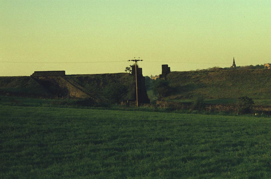
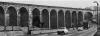 Wyke Viaduct Wyke Viaduct
Wike viaduct 1970s : Matt_uk
This photo was taken in the 70s and formed part of a black & white
postcard to show
Bailiff Bridge and the surrounding areas.
Originally 22 arch, 270 yards
long. |
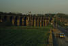 Wike
viaduct : Alan Grange Wike
viaduct : Alan Grange
The Viaduct in its entirety.
Evidence of subsidence, the 4th arch in from the left of the road looks
a bit dodgy,
an impressive structure non the less. |
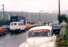
/6%20wyke%20viaduct%20east_small.jpg) Wyke
viaduct facing East on A58 (28-03-04) : David Webdale. Wyke
viaduct facing East on A58 (28-03-04) : David Webdale.
The reason for the sharp curve & viaduct, was due to a failure to buy
land on the original route.
The viaduct has always been affected by subsidence &
by 1947 trains were gradually re-
routed via Halifax or Heckmondwike.
The condition of the viaduct by 1952 contributed, to
the lines complete closure.
In 1986 B.R seeked listed building consent to completely demolish
it.
The northern end has been missing for as long as I can remember. Looks
to have been tidied up recently.
Note : Mike Scargill (19-06-06)
I was looking at your photo of the half remaining viaduct, crossing the
A58 Halifax road. You say you cannot remember the viaduct except as it
is. Well, you are correct about the structural problems, and in the
1970s , as you looked at is, some of the arches, I believe about 3, were
very obviously nipped in the centre, due to the foundations moving.
Eventually this caused some of the (Parapet?) stone to fall, and due to
local pressure, this part of the viaduct was demolished, leaving it as
it is now. I recall it was reported in the local press. |
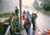
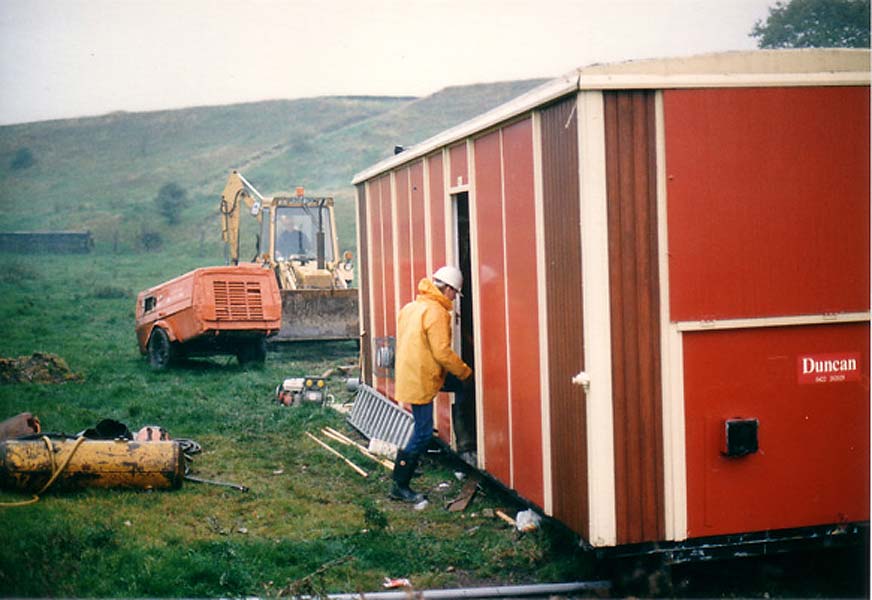
Demolition
of Wyke viaduct (series of 7 photos)
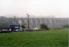
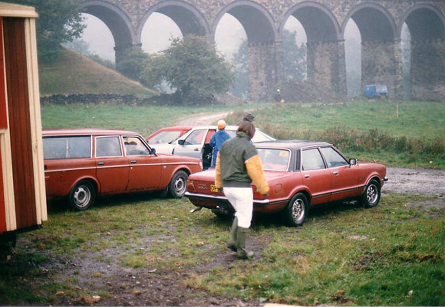
 1 Demolition of Wyke viaduct : Matt_uk 1 Demolition of Wyke viaduct : Matt_uk
A series of 7 photos from the day of demolition.
I can't remember the exact date (still trying to dig up the newspaper
clipping) but I was around 7 years old at the time. We stood in the
field (as you'll see) and the shockwave was enough to throw us back.
First photo is of the temporary hut made for the demolition team.
Behind is the
banking that joined on to the north end of the viaduct. |
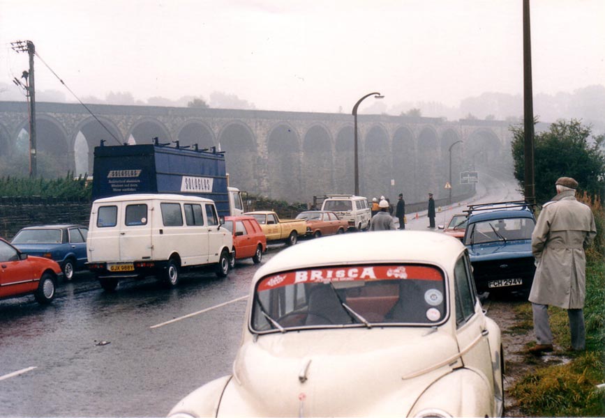
 2
Demolition of Wyke viaduct :
Matt_uk 2
Demolition of Wyke viaduct :
Matt_uk
Shows the old part of the viaduct joined onto the
banking. |
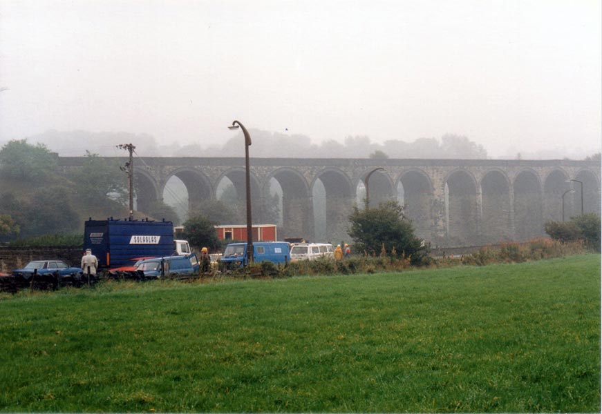
 3
Demolition of Wyke viaduct :
Matt_uk 3
Demolition of Wyke viaduct :
Matt_uk
The view from Whitehall Road.
The police (pictured here) moved people well back from the point they
are stood there, when it was blasted. |
 4
Demolition of Wyke viaduct :
Matt_uk 4
Demolition of Wyke viaduct :
Matt_uk
A nice shot, just before they moved us back to the
field behind the road. |
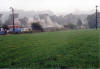
 5
Demolition of Wyke viaduct :
Matt_uk 5
Demolition of Wyke viaduct :
Matt_uk
Quite possibly the last photo that exists of the
entire viaduct... it was literally half a second before it was blasted |
 6
Demolition of Wyke viaduct :
Matt_uk 6
Demolition of Wyke viaduct :
Matt_uk
... well need I say more?! |
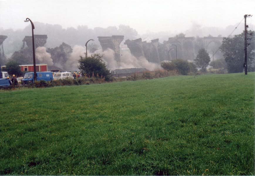
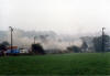 7
Demolition of Wyke viaduct :
Matt_uk 7
Demolition of Wyke viaduct :
Matt_uk
The aftermath. The remaining part of the viaduct
that you see standing did not fall in the blast.
They actually came back a few weeks after and blew that up (without
telling anyone, I might add!) |
/7%20embankment%20north_small.jpg) Embankment
facing North (28-03-04) David Webdale Embankment
facing North (28-03-04) David Webdale
The
viaduct met the embankment here.
|
 Wike
bridges : Alan Grange Wike
bridges : Alan Grange |
/8%20embankment%20east_small.jpg) Embankment
facing East (28-03-04) David Webdale Embankment
facing East (28-03-04) David Webdale
This view shows the missing section of viaduct.
|
/10%20footbridge%20n%20east_small.jpg) Footbridge
N East (28-03-04) David Webdale Footbridge
N East (28-03-04) David Webdale
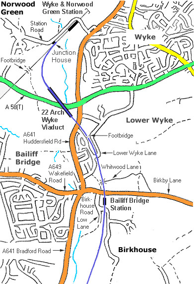
Taken from a footbridge over the Halifax - Bradford line
(see Map)
facing toward Wyke & Norwood Green station.
The Pickle Bridge line branched off to the right, at the point where the
sun goes into shadow, spooky. see photo below. |
Pickle Bridge station
(Junction House)
/11%20junction%20house%20east_small.jpg) Opened
17-08-1850. Renamed Wke station 1852. Closed 1896 & new station opened
at Wyke & Norwood Green. Opened
17-08-1850. Renamed Wke station 1852. Closed 1896 & new station opened
at Wyke & Norwood Green.
Junction House facing East (28-03-04) David Webdale
Don't know much about this building, apparently it was the original
Pickle bridge station,
situated next to the junction. |
/12%20junction%20house%20s%20west_small.jpg) Junction
House facing S West (28-03-04) David Webdale Junction
House facing S West (28-03-04) David Webdale
View from Station road. Junction House
visible on the right.
Footbridge in the distance. |
Wyke & Norwood Green
/13%20wyke%20&%20norwood%20green%20north_small.jpg) Opened
1896. Closed 09-1953. Opened
1896. Closed 09-1953.
Wyke & Norwood Green North (28-03-04)
David Webdale
Stone buildings & platforms,
access from Station road. Behind was a covered footbridge leading down to both platforms.
From old photos I've seen it looks as though the booking office was
situated at road level directly above the tracks. |

%20(15%20to%2018%20%2023-11-03)%20(19%20to%2024%20%2024-11-03)/20%20footpath%20low%20lane%20east.jpg)
%20(15%20to%2018%20%2023-11-03)%20(19%20to%2024%20%2024-11-03)/19A%20birkhouse%20road%20east.jpg)
%20(15%20to%2018%20%2023-11-03)%20(19%20to%2024%20%2024-11-03)/22%20birkby%20lane%20west.jpg)
%20(15%20to%2018%20%2023-11-03)%20(19%20to%2024%20%2024-11-03)/21%20bailiff%20bridge%20station%20south.jpg)
%20(15%20to%2018%20%2023-11-03)%20(19%20to%2024%20%2024-11-03)/23%20whitwood%20lane%20east.jpg)
%20(15%20to%2018%20%2023-11-03)%20(19%20to%2024%20%2024-11-03)/24%20wike%20old%20lane%20west.jpg)
/4%20mayfield%20gv%20south.jpg)
/5%20huddersfield%20rd%20north.jpg)


/6%20wyke%20viaduct%20east.jpg)


/7%20embankment%20north.jpg)
/8%20embankment%20east.jpg)
/10%20footbridge%20n%20east.jpg)
/11%20junction%20house%20east.jpg)
/12%20junction%20house%20s%20west.jpg)
/13%20wyke%20&%20norwood%20green%20north.jpg)