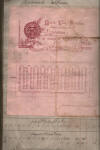
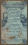
    The
luncheon to celebrate the opening of the railway :
Rosemary Booth The
luncheon to celebrate the opening of the railway :
Rosemary Booth
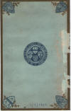
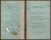
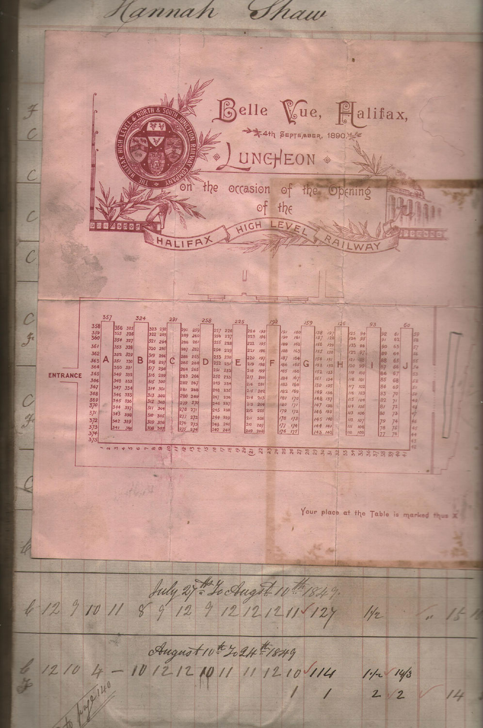
The menu from the luncheon to
celebrate the opening of the railway,
which was in one
of my grandads scrap books. |
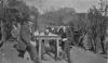 Great
Grandad Ben Pratt : Rosemary Booth Great
Grandad Ben Pratt : Rosemary Booth
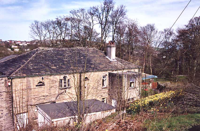
The
photo is of my family who lived at Boy Lane,Wheatley.The
chap in the uniform is my Great Grandad Ben Pratt
who
was a platelayer on the railway and also had an allotment
where the new houses now are. Is this a railway uniform? |
 Halifax
High Level Railway Halifax
High Level Railway
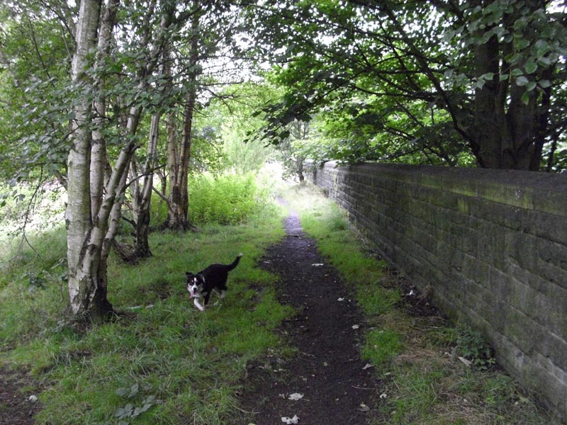
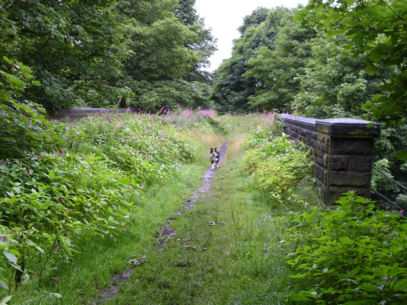
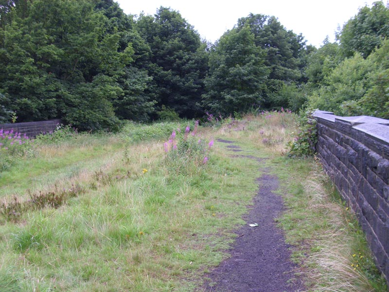
Video of my walk along The Halifax High Level railway.
From NigglePics.
https://www.youtube.com/watch?v=KrWRLK69BP0 |
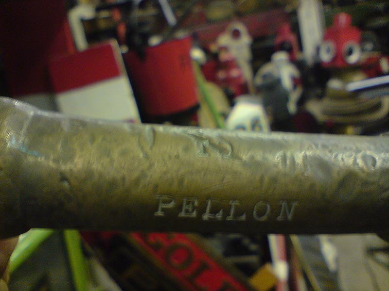
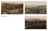
/Pellon_small.jpg) Pellon
Map (1931) : Malcolm Mallison Pellon
Map (1931) : Malcolm Mallison
From the Six inch map 1931 Survey.
|
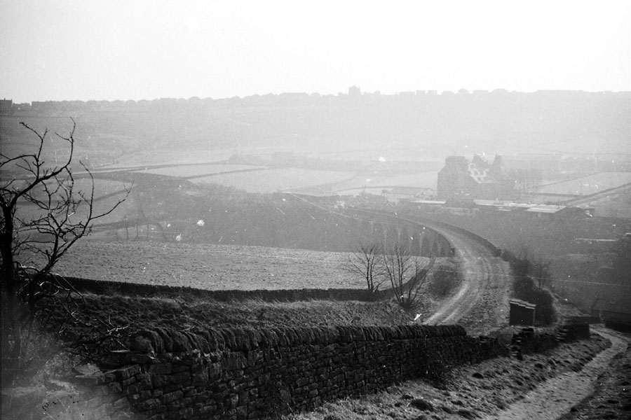
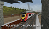 Holmfield
to Halifax St Pauls : Dave Graham Holmfield
to Halifax St Pauls : Dave Graham
Simulation of the rail journey on the Holmfield to Halifax St
Pauls branch using an unbranded Voyager train set.
http://www.youtube.com/watch?v=fYwFVDIAFe0&feature=relmfu |
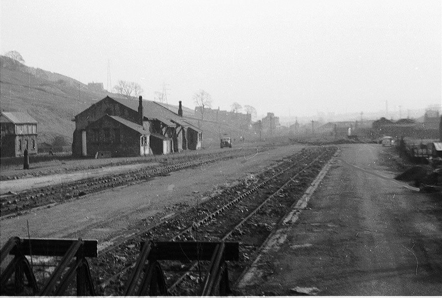
Holmfield Station
Opened 15-12-1879. Closed 21-05-1955..
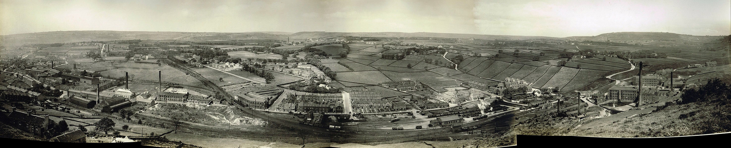
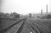
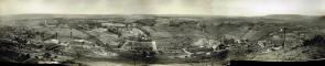 Holmfield Junction & Station
(c.1934) : John Davies Holmfield Junction & Station
(c.1934) : John Davies
A panorama of some shots I have of Holmfield.
I’ve posted a larger
version of the file on the
bygone Lines Yahoo group together with the individual shots. |
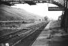
 Holmfield
Station (c1963) : Richard
Barnes
©
copyright on all Richard Barnes Photographs.
See also Queensbury - Halifax Holmfield
Station (c1963) : Richard
Barnes
©
copyright on all Richard Barnes Photographs.
See also Queensbury - Halifax
Approach to Holmfield Station facing towards Queensbury.
You can see the connection to the Pellon branch trailing in on the left,
the track had been lifted the previous week. |
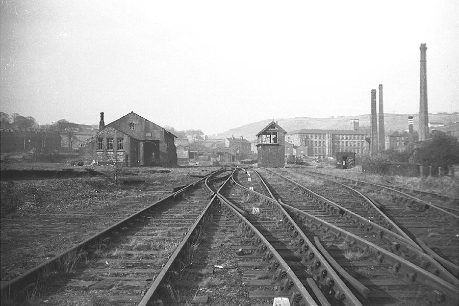
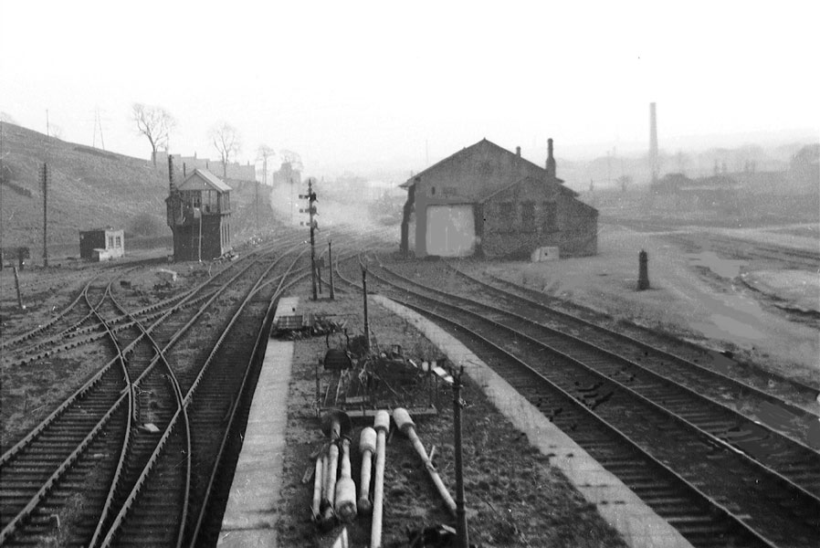
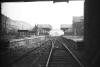 Holmfield
Station (c1963) : Richard Barnes
© Holmfield
Station (c1963) : Richard Barnes
©
Holmfield Station looking towards Halifax. Note the buffer stops
dumped on the platform! It looks as if both tracks were being
used from here, although other pictures I have seen would
indicate that the left hand track was used to travel down to
Halifax, indicating that trains crossed over at this point.
Photo's taken the week before the track was lifted. |
 Holmfield
Station (c1963) : Richard Barnes
© Holmfield
Station (c1963) : Richard Barnes
© |
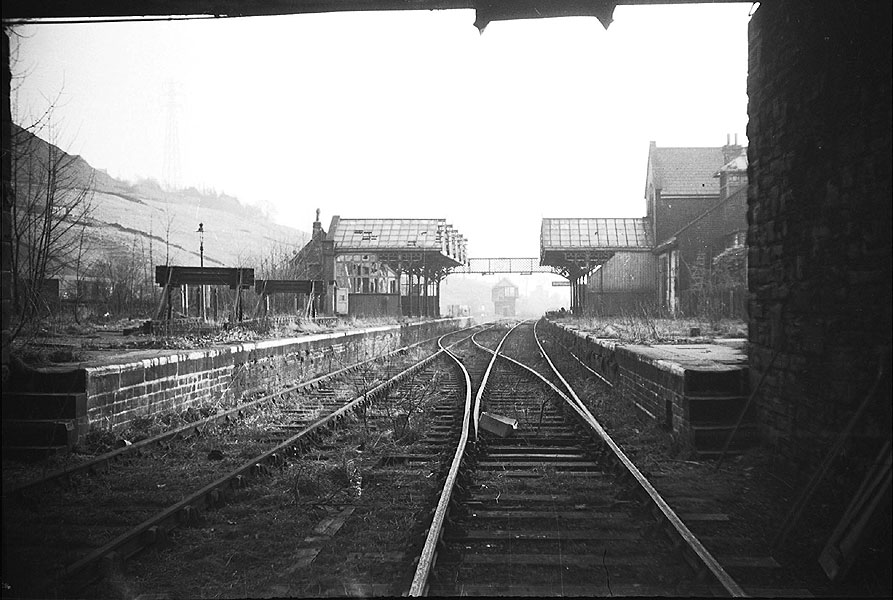
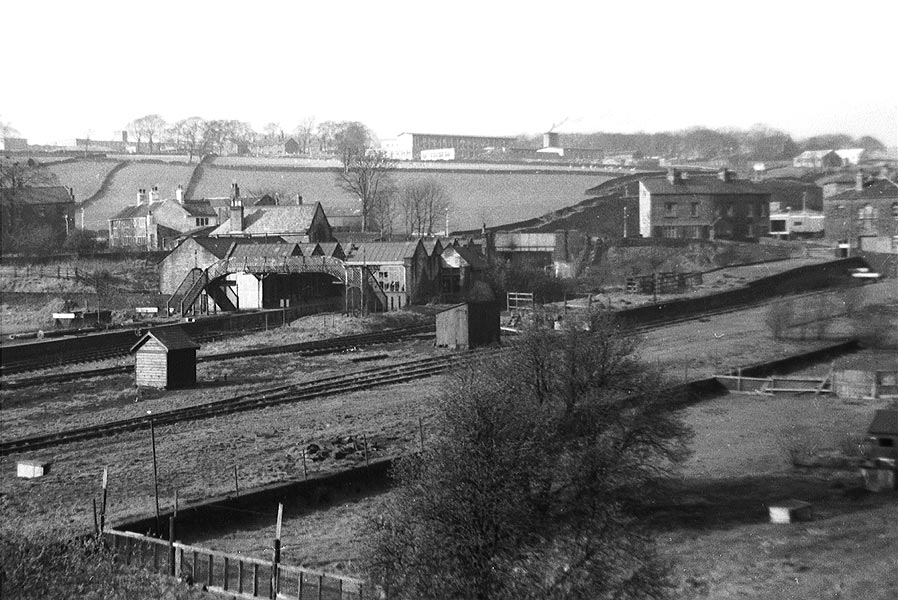
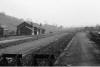 Holmfield
looking SE across goods yard (c1963) : Richard Barnes
© Holmfield
looking SE across goods yard (c1963) : Richard Barnes
©
|
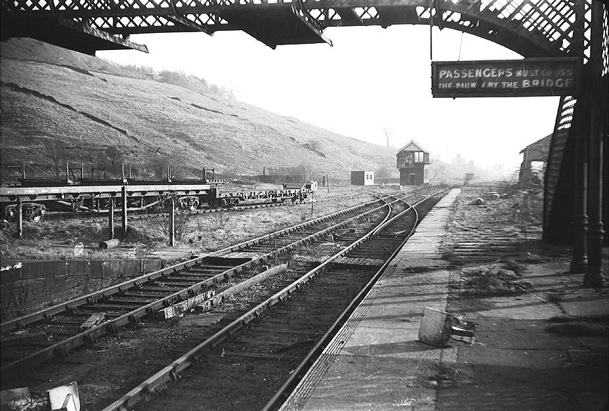
 Holmfield
looking south from footbridge
(c1963) : Richard Barnes
© Holmfield
looking south from footbridge
(c1963) : Richard Barnes
©
|
 Holmfield
general view looking NW (c1963) : Richard Barnes
© Holmfield
general view looking NW (c1963) : Richard Barnes
©
|
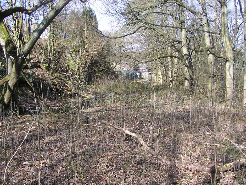
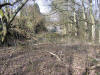
 Holmfield junction facing s west
(19-02-06) : David Webdale see
also Queensbury
to Halifax Holmfield junction facing s west
(19-02-06) : David Webdale see
also Queensbury
to Halifax
To the south of Holmfield station, the site of Holmfield junction facing towards Ovenden.
Bridge remnants crossing Shay lane visible to the left of that big
building near centre of photo. |
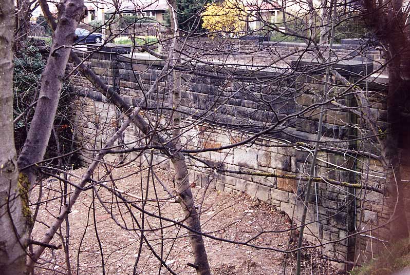
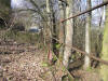
 Shay
lane facing north (19-02-06) : David Webdale Shay
lane facing north (19-02-06) : David Webdale
Bridge remnant & a bit of embankment on left. |
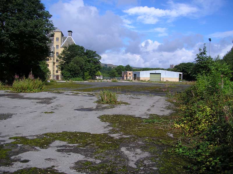
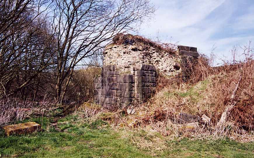
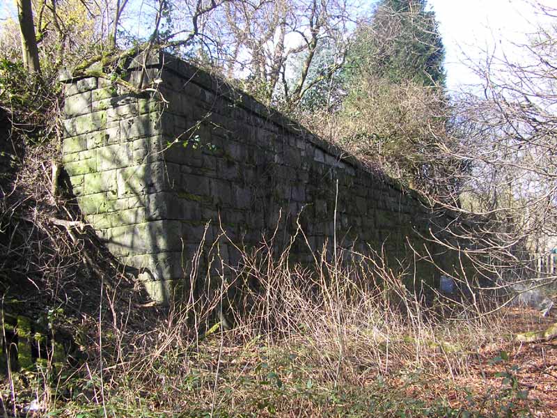
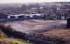
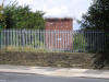
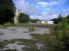
Drake's Industrial Estate
(23-08-06)
: Andrew Stopford
 Drake's
Industrial Estate is home to several businesses, but once it was Drake's
Engineers, and they made retorts and other items involved in the
production of coal/town gas. The site was connected by a short spur from
the High Level/St Paul's branch just after the western side of the
bridge over Shay Lane, this is the only remaining fragment of
track on the site. The track went in a straight line past the vans
towards the trees in the distance, and is probably still there beneath
the concrete. Drake's
Industrial Estate is home to several businesses, but once it was Drake's
Engineers, and they made retorts and other items involved in the
production of coal/town gas. The site was connected by a short spur from
the High Level/St Paul's branch just after the western side of the
bridge over Shay Lane, this is the only remaining fragment of
track on the site. The track went in a straight line past the vans
towards the trees in the distance, and is probably still there beneath
the concrete. |
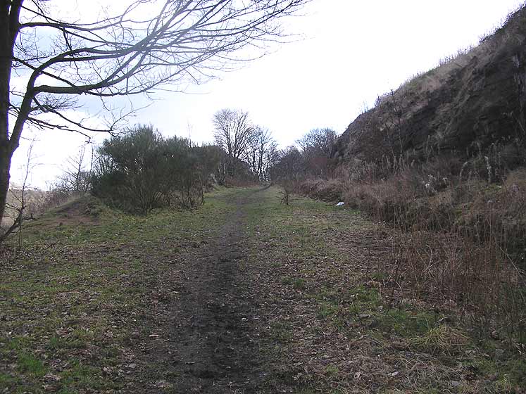
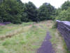
 Keighley
road facing east (22-04-06) : David Webdale Keighley
road facing east (22-04-06) : David Webdale
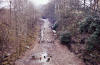
The old trackbed was recently used as an access
road between two industrial estates on either side of Keighley road.
Now
filled in to provide a base for a tacky new housing estate. |
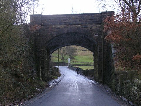
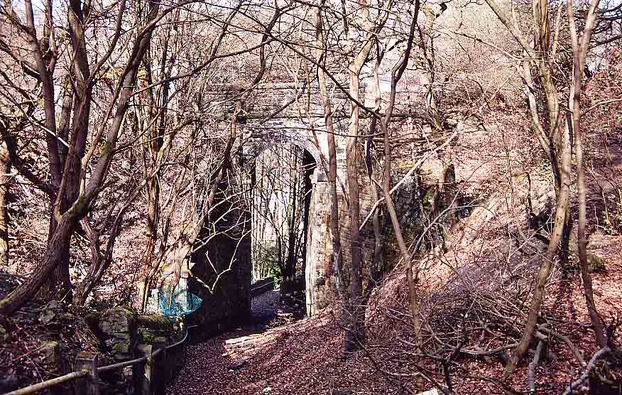
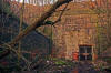
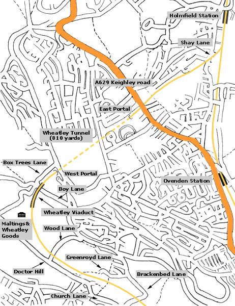
Wheatley tunnel
 Wheatley
tunnel east portal (22-04-06) : David Webdale Wheatley
tunnel east portal (22-04-06) : David Webdale
Taken from Keighley road bridge, as far as I can
work out, from Google earth, the east portal of the
2400 ft Wheatley tunnel is buried under the the corner of this access
road somewhere. |
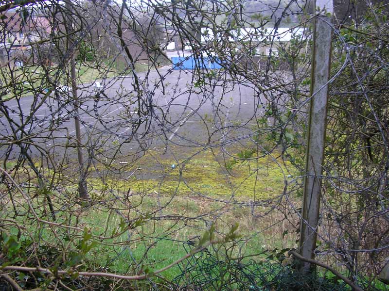
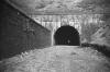
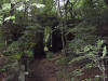
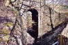
 Wheatley
tunnel east portal (05-03-07) :
Matt c Wheatley
tunnel east portal (05-03-07) :
Matt c
After some searching I have finally found the lost Holmfield portal of
the 819 yard Wheatley tunnel.
I know the picture attached is not clear but this is where it used to be
about 30 years ago.
From the same spot where I have taken the photo, you would be looking
down onto the portal. |
 Wheatley
tunnel air shaft (04-06) Matt C Wheatley
tunnel air shaft (04-06) Matt C
Square brick air shaft on Cousin lane. |
 Wheatley
tunnel west portal (c1963) : Richard Barnes
©
copyright on all Richard Barnes Photographs. Wheatley
tunnel west portal (c1963) : Richard Barnes
©
copyright on all Richard Barnes Photographs.
You could
still see right through Wheatley Tunnel! As I was alone at the time I
chickened out from walking through it!
The track had been lifted the previous week. |
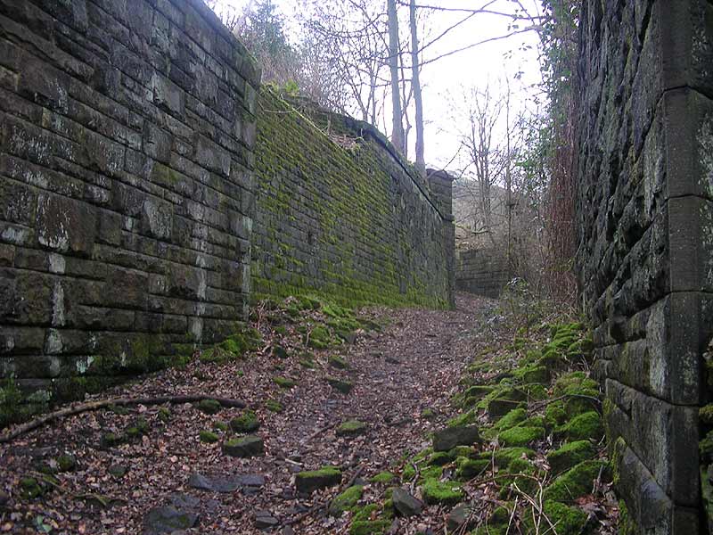
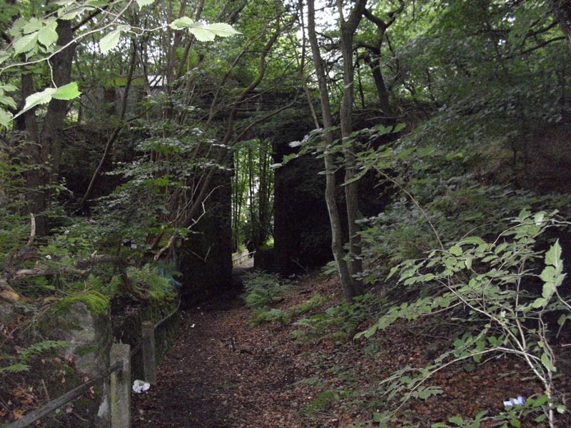
Wheatley tunnel west portal (22-04-06) :
David Webdale
 Same view in 2006. Bricked up tunnel entrance & nice blue brick
retaining wall. Crag lane just visible across top of photo. Same view in 2006. Bricked up tunnel entrance & nice blue brick
retaining wall. Crag lane just visible across top of photo.
This section of line, between tunnel entrance & Wheatley viaduct has
survived reasonably unscathed.
Matt C (03-08)
There seems to have been some work done recently
to the Box Trees Lane footpath which has been turned into a farm track
to the nearby Greystones farm. There have also been some vehicle
tracks left on the approach cutting to Wheatley Tunnel,
though the tunnel portal is in a relatively unscathed condition. Lets
just hope that it stays like this for many years to come. |
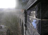
Wheatley tunnel expedition (19-02-08) Graeme
Bickerdike
website -
http://www.forgottenrelics.co.uk/
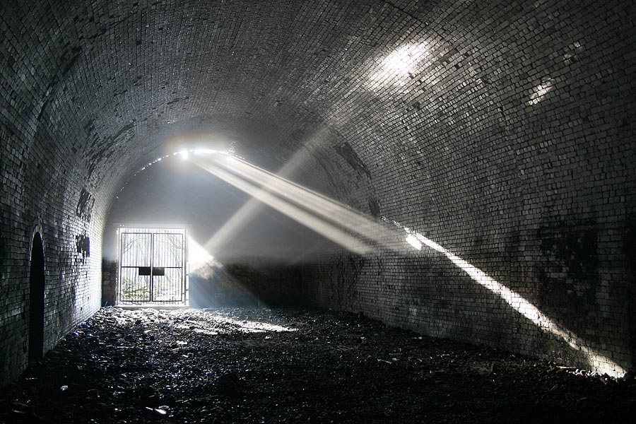
 Wheatley
tunnel west portal (19-02-08) : Graeme Bickerdike Wheatley
tunnel west portal (19-02-08) : Graeme Bickerdike
The orange glow of dusk lights up Wheatley's
remaining portal, at its western end.
The approach cutting boasts a substantial retaining wall of blue
engineering brick. |
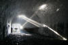 Wheatley
tunnel west portal (19-02-08) : Graeme Bickerdike Wheatley
tunnel west portal (19-02-08) : Graeme Bickerdike
Earlier in the day, shafts of sunlight create an
extraordinary light show.
A thick mist hangs 4-feet above ground level
and persists, in patches, through much of this 819-yard long tunnel. |
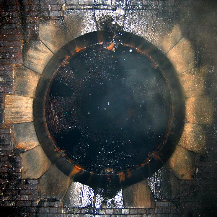
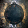 Wheatley
tunnel vent (19-02-08) : Graeme Bickerdike Wheatley
tunnel vent (19-02-08) : Graeme Bickerdike
After 500 yards or so, Wheatley's only ventilation
shaft is reached. There's the usual drip-drip from above.
The white i-shaped blob in the centre is daylight.
At several very localised places within the tunnel, there is considerable water
penetration of the lining.
Some sections show evidence of bulging, both
in the walls and roof. |
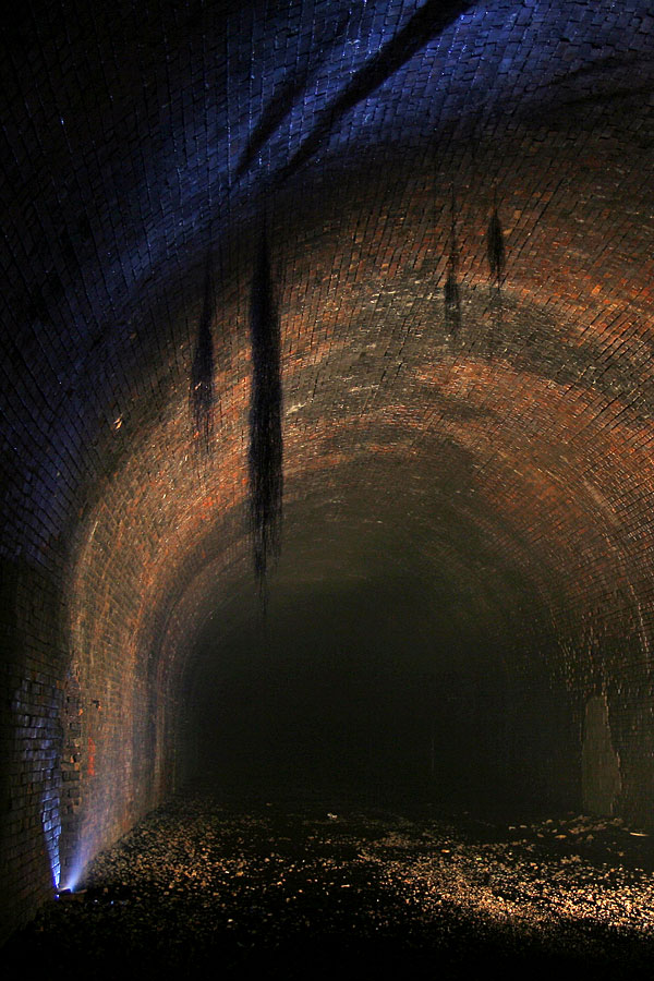
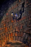
 Wheatley
tunnel vegetation (19-02-08) : Graeme Bickerdike Wheatley
tunnel vegetation (19-02-08) : Graeme Bickerdike
Between the shaft and buried portal is the bizarre
sight of vegetation (possibly a root system) hanging from the roof.
There is also some insect life. To the bottom right of shot is a refuge
which, like a dozen or so others, has been infilled with breezeblock.
The water ingress and recent maintenance work suggests that Wheatley is
not in the best of condition. |
 Wheatley
tunnel telegraph (19-02-08) : Graeme Bickerdike Wheatley
tunnel telegraph (19-02-08) : Graeme Bickerdike
Like most tunnels, Wheatley has a few relics of
its former life. Lengths of telegraph wire still cling to this bracket.
Even fragments of its insulator pots survive, despite being attacked
with an air rifle. |
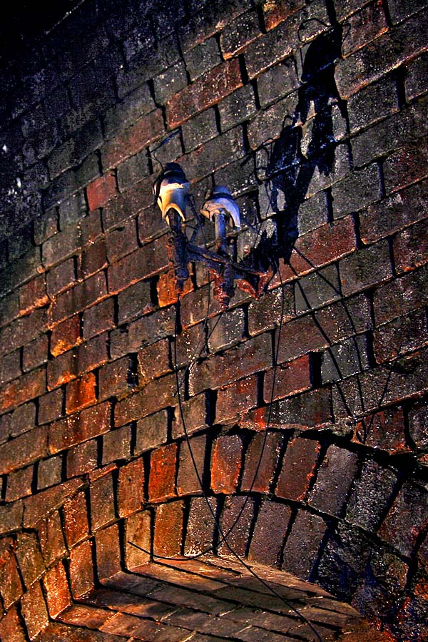
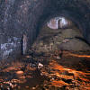 Wheatley
tunnel eastern portal (19-02-08) : Graeme Bickerdike
website -
http://www.forgottenrelics.co.uk/ Wheatley
tunnel eastern portal (19-02-08) : Graeme Bickerdike
website -
http://www.forgottenrelics.co.uk/
For the last 50 yards to the eastern portal, the
floor is covered with thick orange mud. It's more than a foot deep in
places.
The bricked-up entrance has a doorway close to roof level. |
 Wheatley
viaduct Wheatley
viaduct
Wheatley
viaduct (c1963) : Richard Barnes
©
Wheatley Viaduct and “The Maltings” taken from
above the retaining wall to Wheatley Tunnel.
The track had been lifted the previous week. |
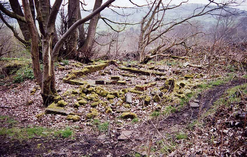
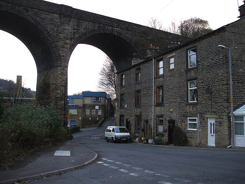
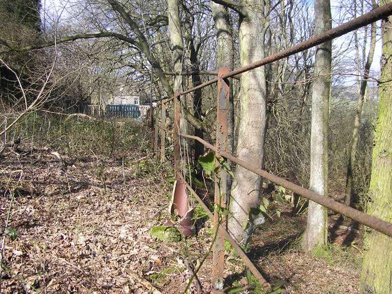
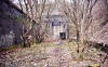
 Platelayers
hut facing west (22-04-06) : David Webdale Platelayers
hut facing west (22-04-06) : David Webdale
Remnants
of platelayers hut. see above photo
|
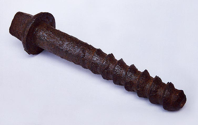
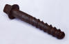 Lag
screw (22-04-06) : David Webdale Lag
screw (22-04-06) : David Webdale
Found this rusty lag screw next to the platelayers
hut. (wire brushed for it's screen debut). |
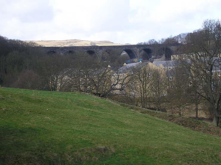
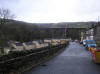
 Wheatley
viaduct facing west (02-06) Matt C Wheatley
viaduct facing west (02-06) Matt C
100 ft high, ten arched Wheatley viaduct. |
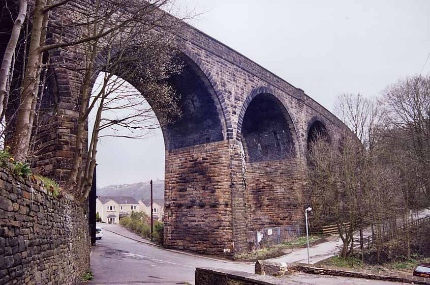
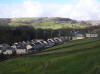
 Wheatley
viaduct facing south (22-04-06) : David Webdale Wheatley
viaduct facing south (22-04-06) : David Webdale
Viaduct photographed from below from Boy lane,
shows a combination of stone & brick arch, nice job.
More than can be said for the shite they build things out of nowadays. |
 Wheatley
viaduct facing west (26-11-07) : Andrew Stopford Wheatley
viaduct facing west (26-11-07) : Andrew Stopford
Slightly 'different' view of Wheatley Viaduct.
It still looks like it belongs if you know what I mean! |
 Wheatley
viaduct : Danny Bradley Wheatley
viaduct : Danny Bradley |
 Wheatley
viaduct (02-06) Matt C Wheatley
viaduct (02-06) Matt C
Some views of viaduct & dolls houses. |
 Wheatley
viaduct (02-06) Matt C Wheatley
viaduct (02-06) Matt C |
 Wheatley
viaduct (02-06) Matt C Wheatley
viaduct (02-06) Matt C |
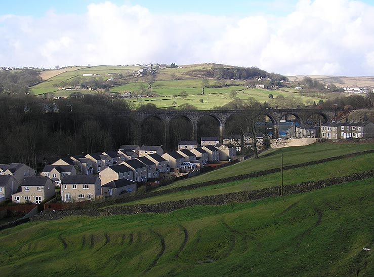
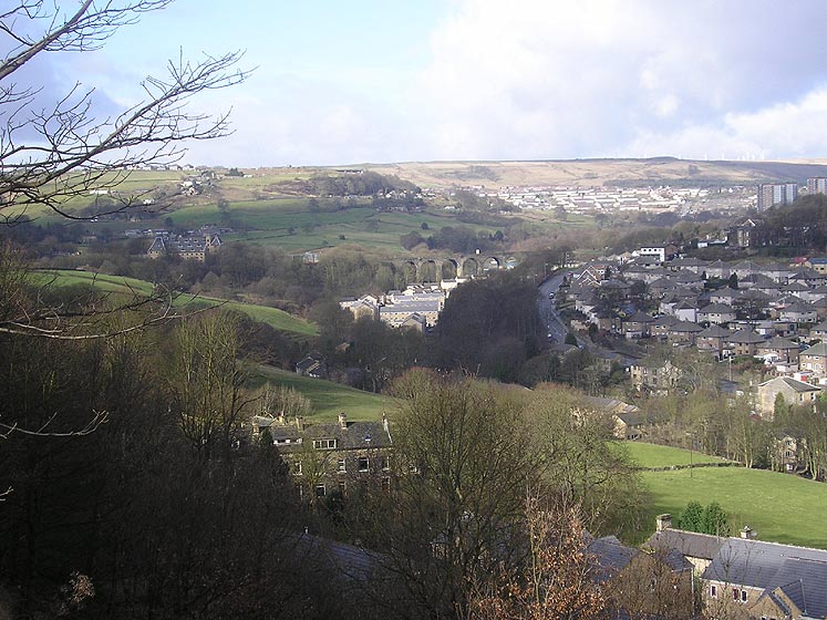
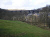
 Wheatley
valley & Wheatley viaduct (02-06) Matt C Wheatley
valley & Wheatley viaduct (02-06) Matt C
Websters Brewery building visible to left of viaduct,
close up next photo. |
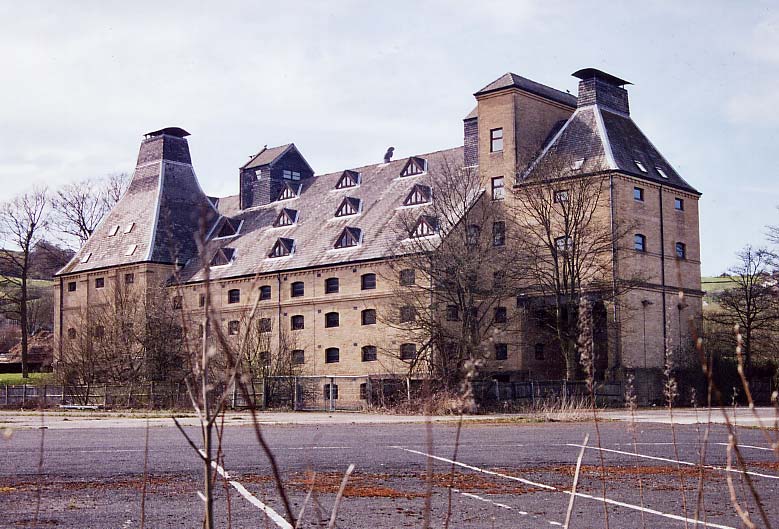
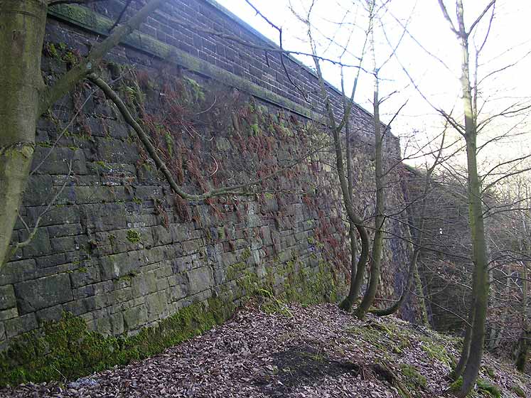
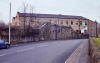
Wheatley goods & Websters Brewery Maltings
Websters Brewery Maltings facing west (22-04-06) : David Webdale
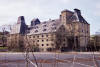 Looking
across the former Wheatley goods yard.
A siding led into the brewery loading bay visible on right hand side of
building, Looking
across the former Wheatley goods yard.
A siding led into the brewery loading bay visible on right hand side of
building,
opened in 1838, closed in 1996.
Now a listed building converted into offices, at no small expense,
they've been empty ever since.
Originally the yard consisted of a loop, an open siding & a small goods
shed.
The L&Y & GNR were compelled to build a goods station but resisted
pressure to build a passenger station here. |
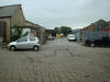
 Wheatley
goods (04-06) Matt C Wheatley
goods (04-06) Matt C
Wider view of the yard. |
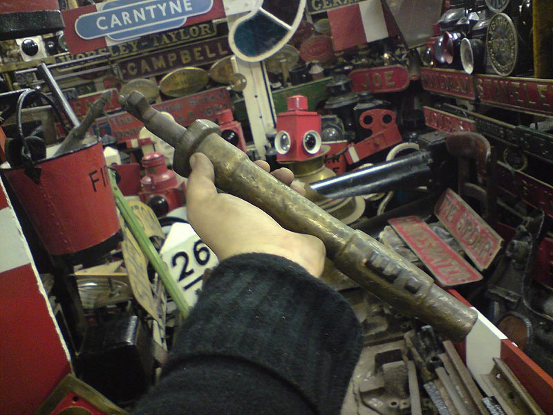
  One
Engine In Steam staff (28-05-10) : Rob Daniels One
Engine In Steam staff (28-05-10) : Rob Daniels
From the Hall Cross collection at Doncaster Grammar School.
The unique One Engine In Steam staff. |
  One
Engine In Steam staff (28-05-10) : Rob Daniels One
Engine In Steam staff (28-05-10) : Rob Daniels
The staff unlocked a ground frame at Wheatley
goods and another at the Pennine Brewery
(Messrs Webster & Co.), also at Wheatley. The staff was in use
from circa 1916 to the line's closure. |
 Bridge
remnant facing west (22-04-06) : David Webdale Bridge
remnant facing west (22-04-06) : David Webdale
Remnant of an iron deck footbridge bridge
crossing the line, originally carried a footpath to the nearby Wheatley Dye works.
Just to the left were the points & signal box leading to Wheatley goods
yard. |
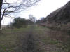 Railway
alignment (02-06) Matt C Railway
alignment (02-06) Matt C
Spin round on the same spot facing towards Pellon,
photo shows the section of the line approaching Wood lane, at a gradient
of 1 in 53. |
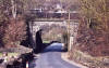
 Wood
lane bridge facing south
Matt C Wood
lane bridge facing south
Matt C |
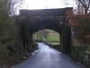
 Wood
lane bridge facing north (22-04-06) : David Webdale Wood
lane bridge facing north (22-04-06) : David Webdale
View from other side. |
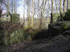
 Grange
farm facing east (22-04-06) : David Webdale Grange
farm facing east (22-04-06) : David Webdale
Photographed from Doctor Hill. These buildings
look older than the railway, the track passed right outside their
windows.
Trackbed visible to right of buildings. |
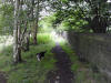   Between Church lane
& Pellon (13-09-10) : David Marshall Between Church lane
& Pellon (13-09-10) : David Marshall |
 Guard
rail near Grange farm (03-08) Matt C Guard
rail near Grange farm (03-08) Matt C |
 Railway
alignment near Grange farm (03-08) Matt C Railway
alignment near Grange farm (03-08) Matt C |
 Retaining
wall near Grange farm (03-08) Matt C Retaining
wall near Grange farm (03-08) Matt C |
 Dismantled
iron deck overbridge (02-06) Matt C Dismantled
iron deck overbridge (02-06) Matt C
Remnants of an iron deck bridge crossing a track
leading from Doctor Hill to Greenroyd lane.
Originally lead to a place called Brackenbed Grange. |
 Dismantled
iron deck overbridge (02-07) Matt C Dismantled
iron deck overbridge (02-07) Matt C
The view from around the other side of the
abandoned bridgeworks at Brackenbed Grange. |
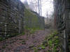
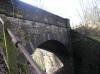
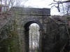 Footpath
overbridge Church lane facing north (02-06) Matt C Footpath
overbridge Church lane facing north (02-06) Matt C
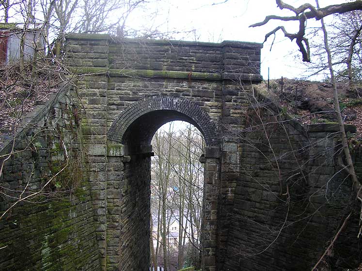
One of the tall skinny bridges. Stone with brick
arch.
Decorative protruding stone corbels visible under the Springers. |
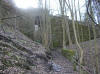
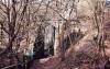 Footpath
overbridge Church lane facing north (22-04-06) : David Webdale Footpath
overbridge Church lane facing north (22-04-06) : David Webdale
Wider view showing very steep footpath between
Church lane & Greenroyd lane |
 Footpath
overbridge Church lane (13-09-10) : David Marshall Footpath
overbridge Church lane (13-09-10) : David Marshall
|
 Railway overbridge
(02-06) Matt C Railway overbridge
(02-06) Matt C
Bridge over Brackenbed lane. |
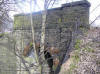
 Footpath
overbridge Pellon New road facing south (02-06) Matt C Footpath
overbridge Pellon New road facing south (02-06) Matt C
Another tall skinny bridge over a footpath
between Pellon New road & Hebble lane.
Looks even higher from on top, don't think you would survive the fall. |
 Footpath
overbridge Pellon New road
(02-06) Matt C Footpath
overbridge Pellon New road
(02-06) Matt C
Couple of photo's from other side, brick skew
arch, decorative stone corbels. |
 Footpath
overbridge Pellon New road facing north (22-04-06) : David Webdale Footpath
overbridge Pellon New road facing north (22-04-06) : David Webdale
Steep footpaths down the valley side. |
 Retaining
wall Brackenbed (02-06) Matt C Retaining
wall Brackenbed (02-06) Matt C
This retaining wall is higher than it looks.
Overbridge in previous photo visible to the right. |


/Pellon.jpg)