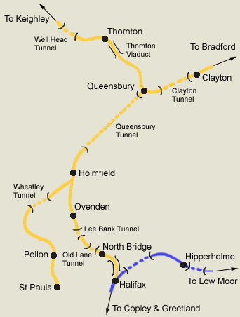
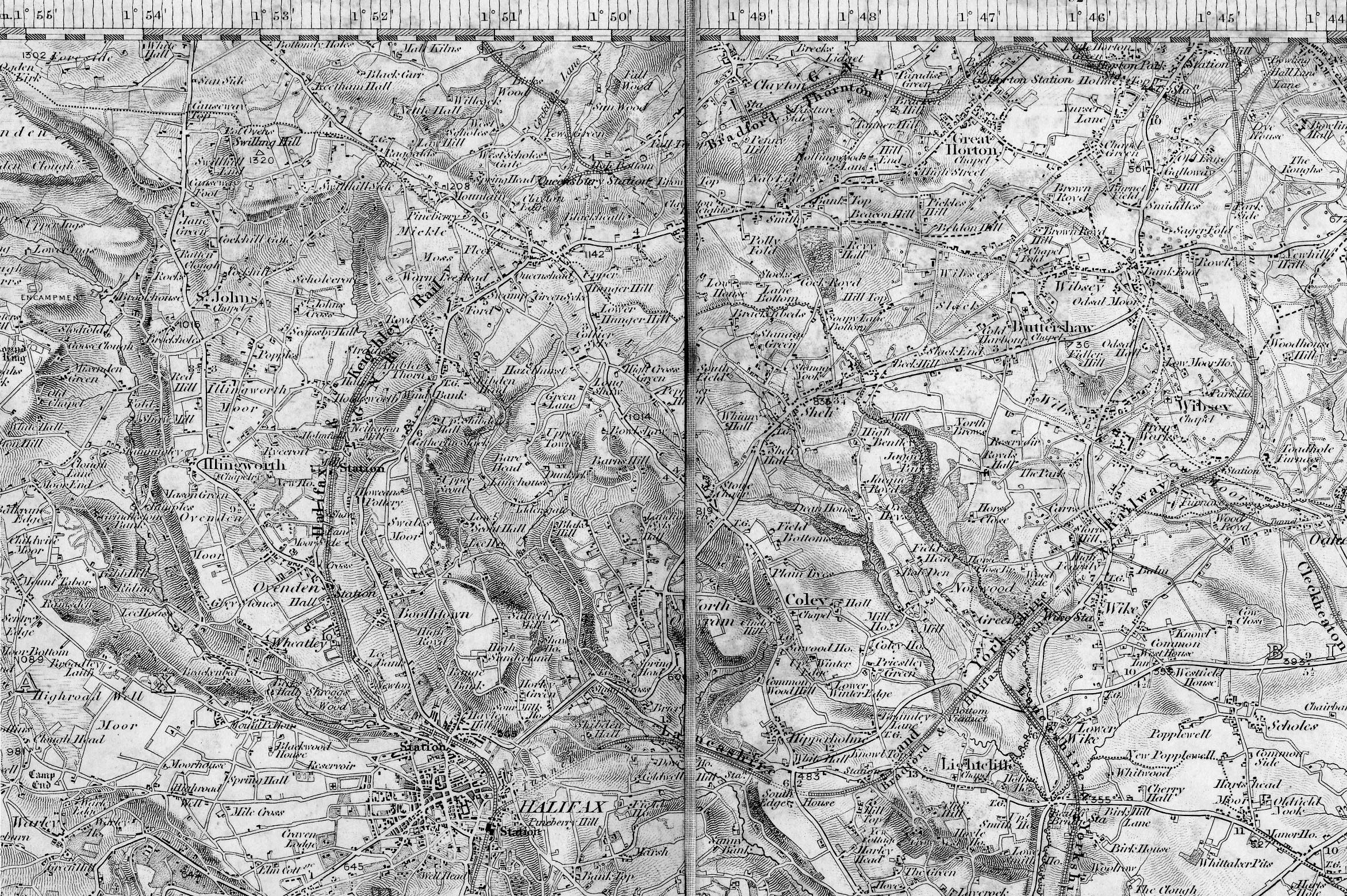
Queensbury to Halifax
The Route
From Queensbury to Halifax via Holmfield
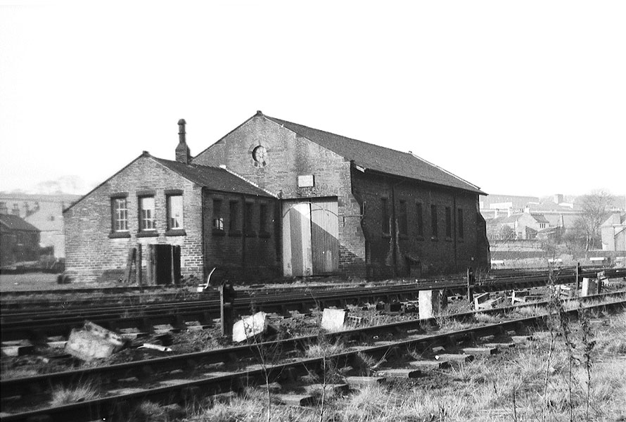
Ovenden & North Bridge.
Lengths
Halifax to Holmfield - 2 3/4 miles.
Holmfield to Queensbury - 2 1/4 miles.
Original Companies
The original company was The Halifax & Ovenden Junction
Railway, incorporated on 30th
June 1864.
The line was
to run 2 3/4 miles from just outside Halifax station to Holmfield.
The L&Y & the GNR each subscribed one third of the cost & would work the
line jointly.
The section of line between Holmfield & Queensbury involved heavy excavation work.
Strines cutting & the Queensbury tunnel take up most of
this 2 1/4 mile stretch.
Openings
Freight - Halifax to North Bridge - 17th August 1874.
Halifax to Holmfield - 1st September 1874.
Holmfield
to Queensbury - 14th October 1878.
Passengers - Halifax to Queensbury -
14th October 1880.
Closures
Passengers -
23rd May 1955, North Bridge station closed, ending the
passenger service
from
Halifax to Queensbury (North Bridge was demolished in 1960)
Freight - May 1956, between Queensbury & Holmfield.
|
 |
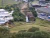
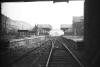
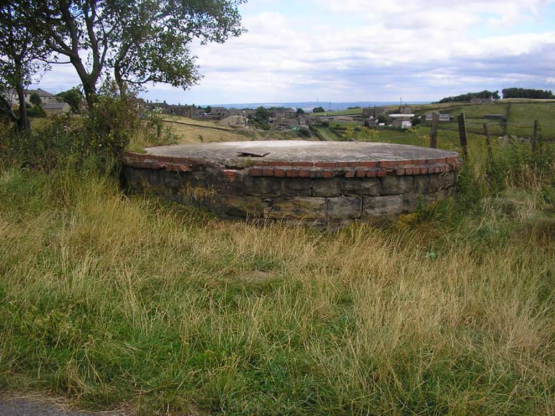
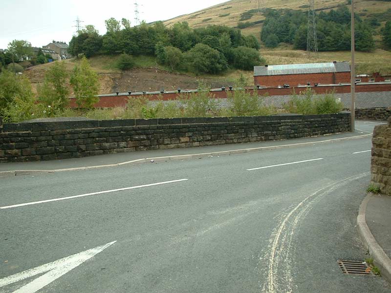
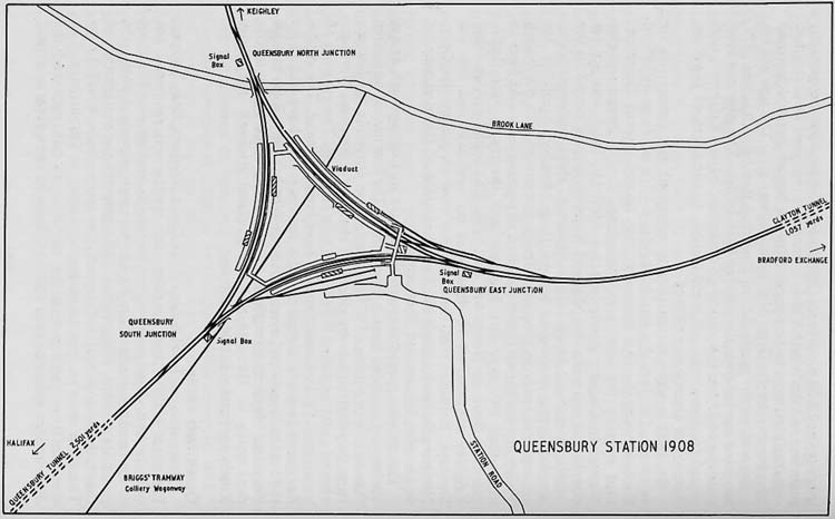 Queensbury
Station Map 1908 Queensbury
Station Map 1908
NIgel Callaghan
Opened 12-07-1879
Closed 21-05-1955
See also
Queensbury Station
|
 Railway Ramblers gazetteer Railway Ramblers gazetteer
See also the Railway Ramblers gazetteer -
Bradford - Queensbury Holmfield |
 Halifax,
Queensbury, Low Moor & Wyke map (1843) : John Sutcliffe Halifax,
Queensbury, Low Moor & Wyke map (1843) : John Sutcliffe
One inch to the mile map showing Sowerby Bridge in the west and
Dewsbury in the east. Published by Col. Colby dated 1843.
(This file size is about 1.4 meg, so it may take a while to
download) |
 Thornton to Halifax via Queensbury : Dave Graham Thornton to Halifax via Queensbury : Dave Graham
Following on from my Keighley to Bradford Exchange rail run on a
class 158,
this video demonstrates the rail journey on the
Thornton to
Halifax section via Queensbury.
http://www.youtube.com/watch?v=e1CdXnyUdYE&feature=relmfu |
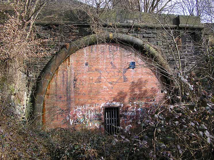
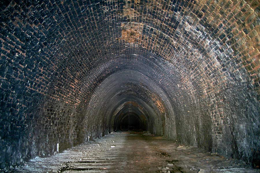
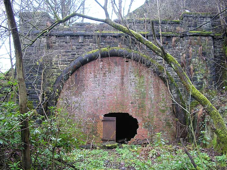
 Queensbury
tunnel Queensbury
tunnel
Queensbury
tunnel exploration - You Tube Video.
By the Leeds Historical Expedition Society
http://www.youtube.com/watch?v=DfzvrJf5eXc
|
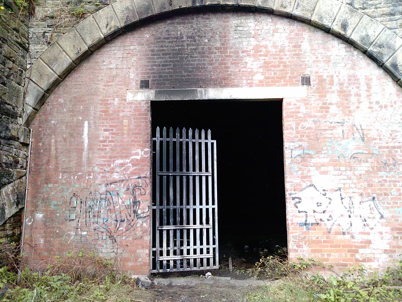
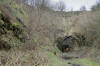
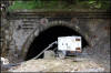
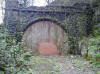
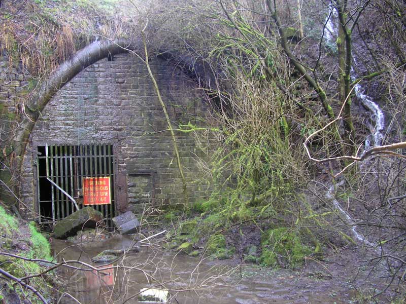
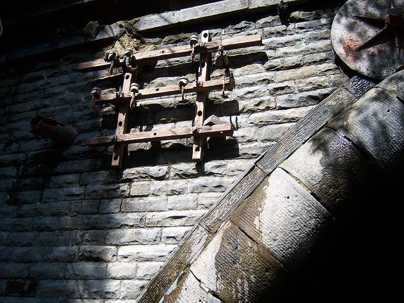
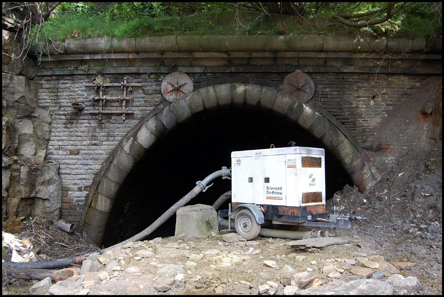
 Queensbury
tunnel north portal 24-02-07 : Matt c
see
also Queensbury station Queensbury
tunnel north portal 24-02-07 : Matt c
see
also Queensbury station
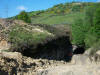
Worsening state of Queensbury tunnel
including water feature.
The tunnel is a straight 2501 yards.
Tunnel entrance is situated about 100 yards from Queensbury
south junction. looks a bit Gothic arch. |
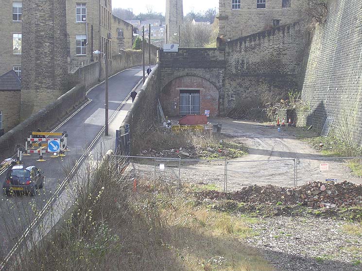
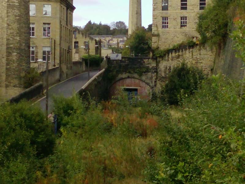
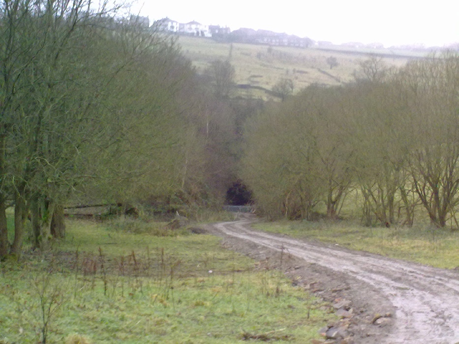
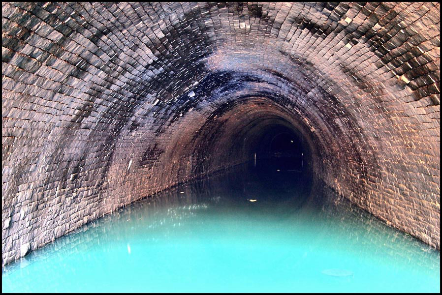
 Queensbury
tunnel (11-01-2013) : Mark Pennington Queensbury
tunnel (11-01-2013) : Mark Pennington
Queensbury tunnel from Queensbury station, 11 Jan 2013. Note that
it is now possible to walk or cycle from Queensbury to Thornton
(behind camera!), as Sustrans has now achieved the opening of
this entire section. |
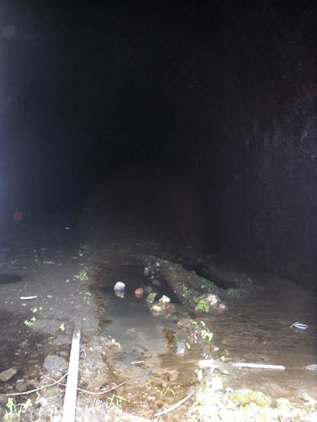
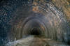
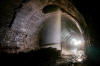
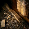
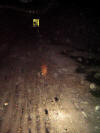
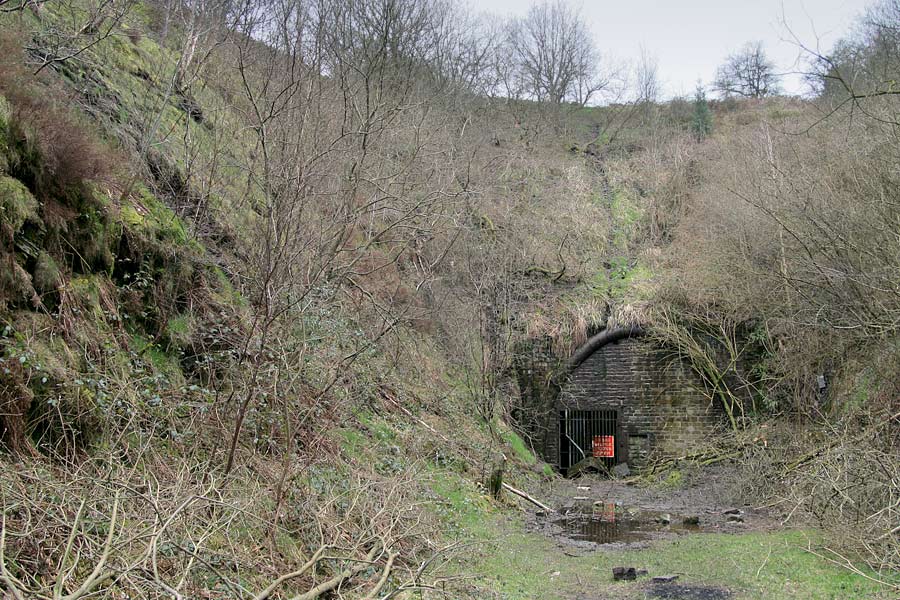
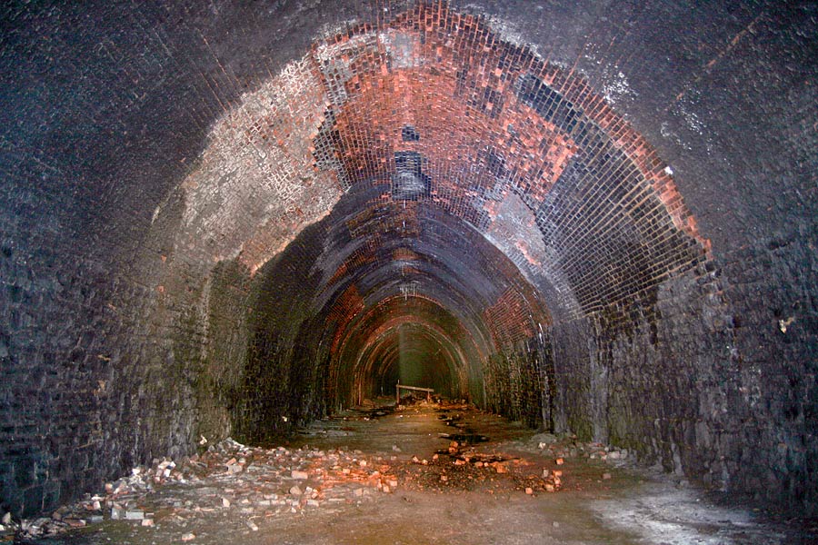
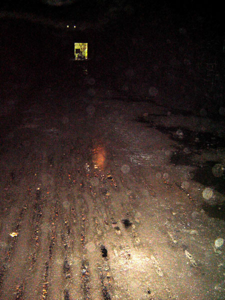
Queensbury tunnel exploration 1
Queensbury tunnel interior (03-04-07)
: Graeme Bickerdike
website - http://www.forgottenrelics.co.uk/
I spent the afternoon getting damp in Queensbury tunnel. I only
went quarter-of-a-mile in but far enough to see the debris which
has fallen from the first shaft.
A few pictures attached which
might complement some of Des Phillips’.
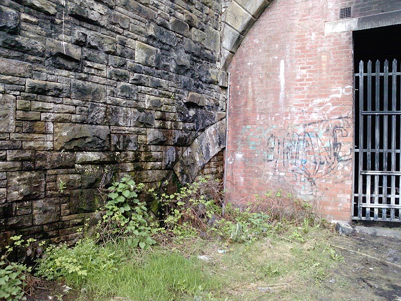
 Queensbury
tunnel -1
: Graeme Bickerdike Queensbury
tunnel -1
: Graeme Bickerdike
The northern portal sits at the end of a short cutting
which is very muddy near the tunnel mouth.
Some of the vegetation seems to have been cleared recently as
part of the works for the Great Northern Trail. |
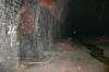
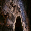
 Queensbury
tunnel -2
: Graeme Bickerdike Queensbury
tunnel -2
: Graeme Bickerdike
The interior is wet for the first few yards and
then drys out. The stonework here appears in fairly good order.
The indentations left by the sleepers on the Halifax-bound side
are still evident. |
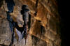
 Queensbury
tunnel -3
: Graeme Bickerdike Queensbury
tunnel -3
: Graeme Bickerdike
Structural conditions are dramatically different approaching the
first ventilation shaft.
Some of the brick lining has fallen away and there’s
considerable damage from water penetration. |
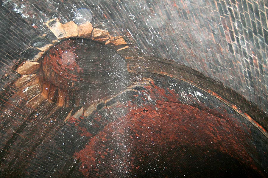
 Queensbury
tunnel -4
: Graeme Bickerdike Queensbury
tunnel -4
: Graeme Bickerdike
Despite the drainpipe, a torrent of water
falls from the shaft which, like the others, is capped. |
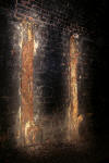
 Queensbury
tunnel -5
: Graeme Bickerdike Queensbury
tunnel -5
: Graeme Bickerdike
A rather feeble attempt has been made to
fence off the debris. The standing water here is 6 inches deep.
Note the failing brickwork beyond the shaft entrance. |
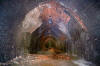
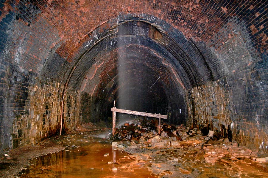
 Queensbury
tunnel -6
: Graeme Bickerdike Queensbury
tunnel -6
: Graeme Bickerdike
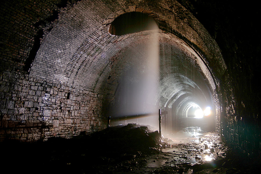
In this 30 second exposure, the vertical
streaks and mist are actually falling water.
In the shadows top-left, the brick lining has succumbed to the
effects of water. |
 Queensbury
tunnel -7
: Graeme Bickerdike Queensbury
tunnel -7
: Graeme Bickerdike
Only after a quarter-mile walk do you
discover the first refuge. Quite a hike to reach a position of
safety! The refuges are more generous than you find in many
other tunnels and would accommodate even the best upholstered
lengthman. I assume that the two small holes in the wall which
seals the portal - seen as dots above the square of daylight –
were cut to allow access for bats. |
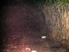
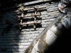
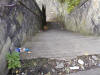
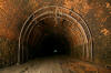
Queensbury tunnel exploration 2
Queensbury tunnel interior (11-04-07)
: Graeme Bickerdike
Well, I found another like-minded adventurer and
spent yesterday afternoon exploring Queensbury’s gloom.
We were underground for almost five hours! Attached is a
collection of pictures which take up the journey from the first
ventilation shaft.
 Queensbury
tunnel -8
: Graeme Bickerdike Queensbury
tunnel -8
: Graeme Bickerdike
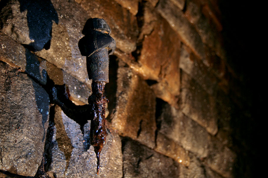
An assortment of signalling relics have survived fifty years of
abandonment.
Might this have supported a telegraph wire once upon a time? |
 Queensbury
tunnel -9
: Graeme Bickerdike Queensbury
tunnel -9
: Graeme Bickerdike
The home signal for Queensbury-bound trains was just beyond the
northern portal.
The distant signal was therefore located in the tunnel and took
the form of a gong attached to the wall.
The mounting brackets are still in place. |
 Queensbury
tunnel -10
: Graeme Bickerdike Queensbury
tunnel -10
: Graeme Bickerdike
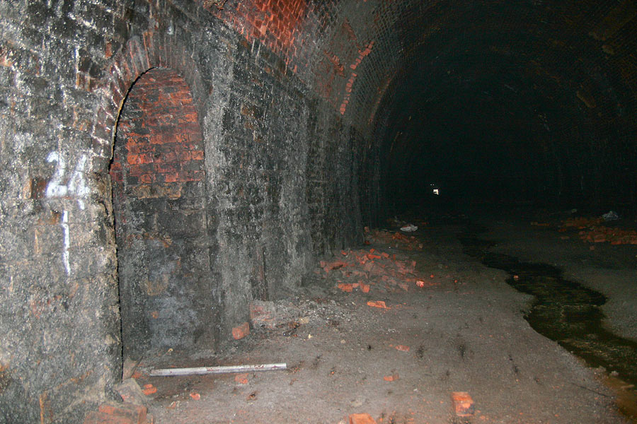
The central section of the tunnel is remarkably
dry. A drain runs down the middle, beneath the trackbed, to take
water away.
But there are areas where the lining has failed or is under
chemical attack. |
 Queensbury
tunnel -11
: Graeme Bickerdike Queensbury
tunnel -11
: Graeme Bickerdike
It appears that cables ran down both sides
of the tunnel, neatly negotiating the refuges. |
 Queensbury
tunnel -12
: Graeme Bickerdike Queensbury
tunnel -12
: Graeme Bickerdike
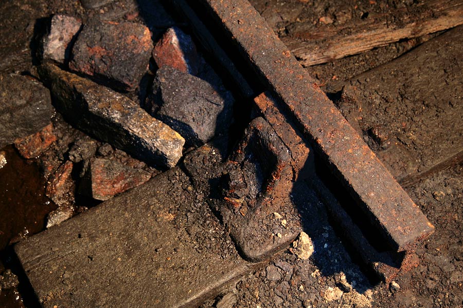
Probably the most remarkable relic is a lone track panel which
is preserved under masonry from the second ventilation shaft. |
 Queensbury
tunnel -13
: Graeme Bickerdike Queensbury
tunnel -13
: Graeme Bickerdike
The shaft was sunk almost 400 feet – one of the
country’s deepest.
It’s ‘pepperpot’ made the journey down before a concrete cap was
attached. It’s wet underfoot but there’s no deluge from above. |
 Queensbury
tunnel -14
: Graeme Bickerdike Queensbury
tunnel -14
: Graeme Bickerdike
One mile in and the floodwater is with us. In the distance, a
pile of debris blocks the ‘canal’ at the base of shaft three.
It’s another 800 yards to the southern portal. By that stage,
thanks to the falling 1 in 100 gradient, the water has reached
the roof. |
 Queensbury
tunnel -15
: Graeme Bickerdike Queensbury
tunnel -15
: Graeme Bickerdike
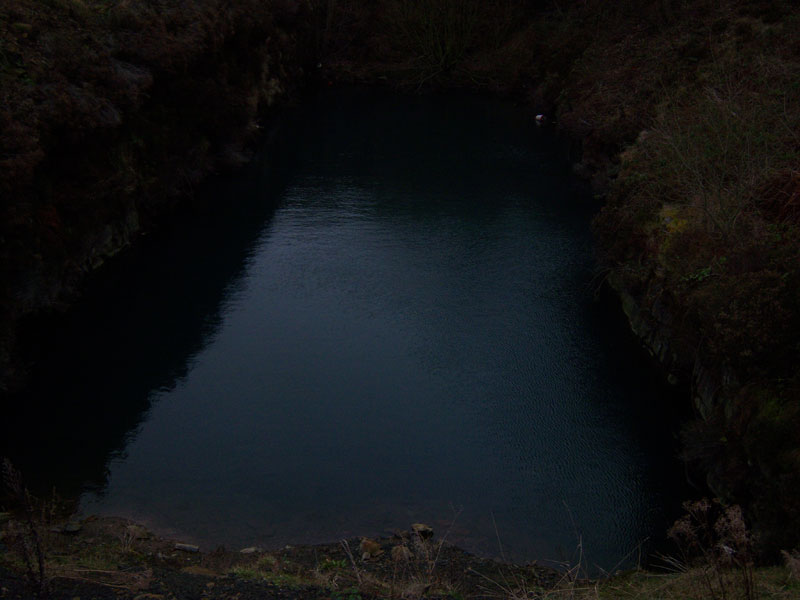
The remarkable cutting at Strines has largely been consumed by
infill. Only an 80-foot pool remains.
The portal is completely underwater – just the top stones are
visible. |
Queensbury tunnel exploration 3
Queensbury tunnel interior (10-06)
: Des Phillips
One afternoon in October 2006, I went on a little exploration of
the Triangle and had a quick recce inside Queensbury Tunnel. I
only went a few hundred yards in,
not wanting to be brained by
bricks from the 379ft airshaft! These photos give a reasonable
impression of the interior & problems with the tunnel.
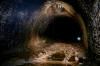
 Queensbury
tunnel ventilation shaft (10-06)
: Des Phillips Queensbury
tunnel ventilation shaft (10-06)
: Des Phillips
The base of the first ventilation shaft about 100 yards in from
the North. Nice masonry to solve the geometrical puzzle of
joining two brick cylinders together. Vertical waterfall from
blocked gloom above! |
 Queensbury
tunnel ventilation shaft (10-06)
: Des Phillips Queensbury
tunnel ventilation shaft (10-06)
: Des Phillips
Pile of bricks at the bottom of the
airshaft. These bricks have probably rotted out from the top of
the shaft after sealing.
Evidence of why BRB, who own the tunnel, want to fill in the
airshafts before the ground swallows up Queensbury town above
(as the H&S bureaucrats would have it). |
 Queensbury
tunnel interior (10-06) : Des Phillips Queensbury
tunnel interior (10-06) : Des Phillips
Looking back to North Portal. The trackbed
has sleeper impressions from the Halfax-bound side and scraper
marks from ballast removal. It is surprisingly dry here because
the drain in the "invert" seems to work and there is 1/100
gradient down to Strines, which was known to be flooded (but not
completely filled) at this date. |
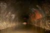
 Queensbury
tunnel interior (10-06) : Des Phillips Queensbury
tunnel interior (10-06) : Des Phillips
Looking into the gloom. A grainy
contrast-corrected photo with flash which gives the right
atmosphere, but fails to catch the end at Strines, 2501 yards
away, which is dimly visible in reality, through the misty murk. |
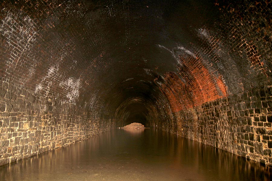
 Queensbury
tunnel interior (10-06) : Des Phillips Queensbury
tunnel interior (10-06) : Des Phillips
A long exposure shot, handheld. I got
multiple images of the Strines (South) end, and used a photo
editor to catch one genuinely authentic "through-tunnel" shot
before landfill is emptied down the shafts. |
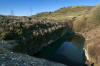
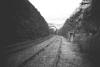
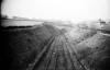
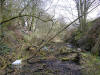
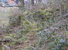
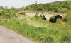
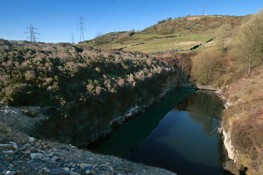
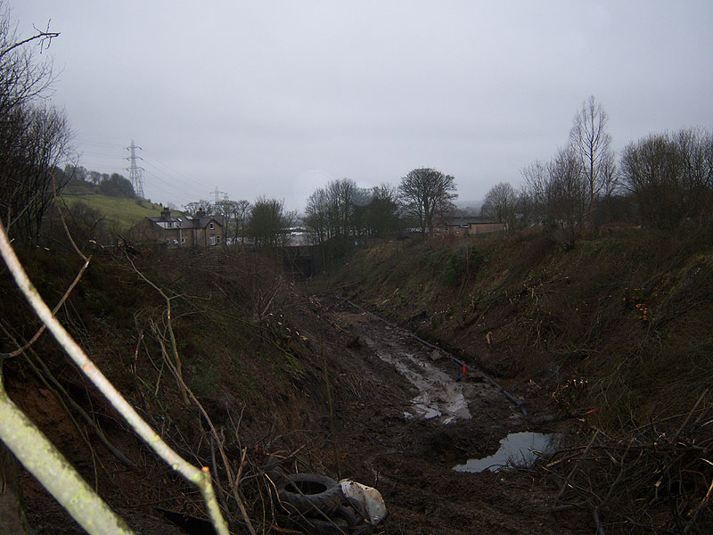
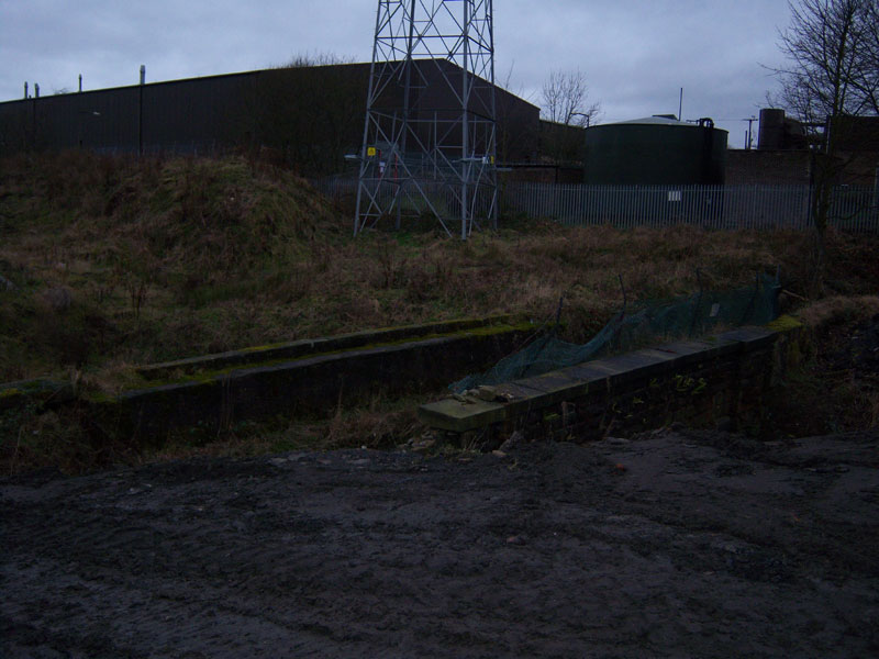
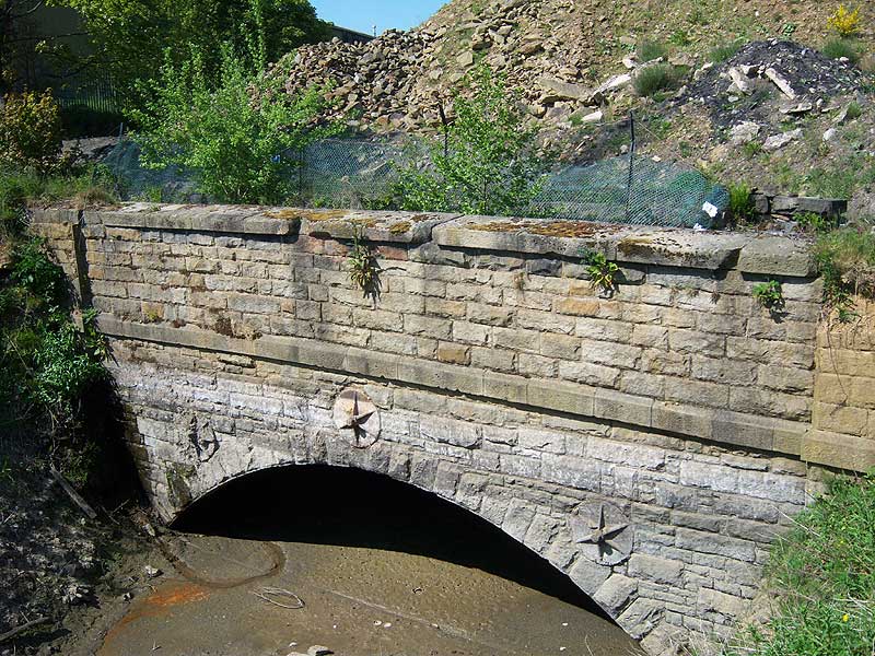
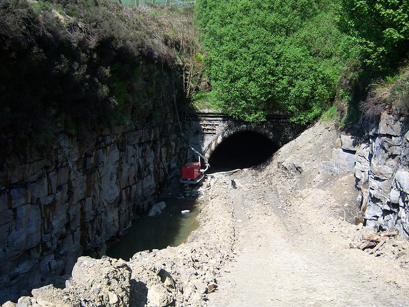
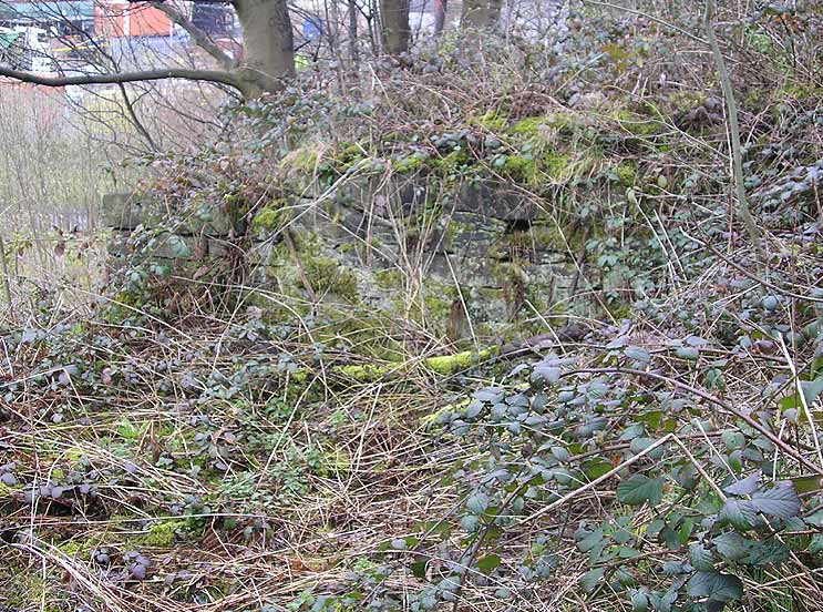
Strines Cutting
 Strines
Cutting (01-12)
: Ed Matejak Strines
Cutting (01-12)
: Ed Matejak
Strines Cutting
facing towards Holmfield Station Bridge. I
took some pictures last week Jan 2012 of lower Strines Cutting
between Holdsworth Road and Holmfield Station Bridge. They have
cleared the cutting just before landfill so sadly this will be
the last we will see of this section of the famous cutting. |
 Strines
Cutting (01-12)
: Ed Matejak Strines
Cutting (01-12)
: Ed Matejak
Facing towards
Holmfield Station from Holdsworth Road Bridge. |
 Strines
Cutting (01-12)
: Ed Matejak Strines
Cutting (01-12)
: Ed Matejak
Strines Cutting looking towards Holdsworth
Road Bridge. |
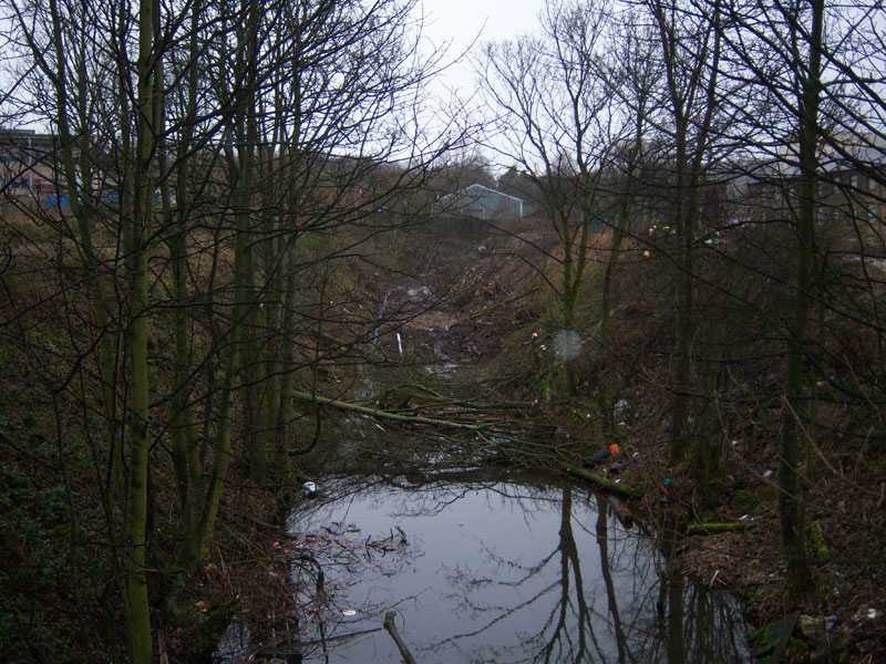
 Strines
Cutting (06-10)
: Ed Matejak Strines
Cutting (06-10)
: Ed Matejak
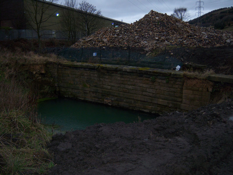
The aquaduct at upper Srines and the flooded lagoon at the
Halifax end of the Queensbury tunnel portal.
This is private land now and had to get permission from the
developer to walk around and take the pictures.
|
 Strines
Cutting (06-10)
: Ed Matejak Strines
Cutting (06-10)
: Ed Matejak
Halifax end of Tunnel portal. |
 Strines
Cutting (06-10)
: Ed Matejak Strines
Cutting (06-10)
: Ed Matejak
Halifax portal under water. |
 Strines
Cutting (06-10)
: Ed Matejak Strines
Cutting (06-10)
: Ed Matejak
The aquaduct Upper Strines. |
 Strines
Cutting (06-10)
: Ed Matejak Strines
Cutting (06-10)
: Ed Matejak
The Strines aqaduct. |
 Strines
Cutting (06-10)
: Ed Matejak Strines
Cutting (06-10)
: Ed Matejak
Trains once went under here. |
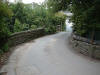
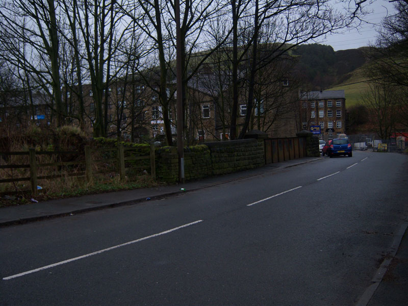
 Holdsworth
Road Bridge (01-12)
: Ed Matejak Holdsworth
Road Bridge (01-12)
: Ed Matejak
Holdsworth Road Bridge, Holmfield to the
right. |
 Strines
Cutting (14-08-06)
: Matt
c Strines
Cutting (14-08-06)
: Matt
c
Strines Cutting and the Halifax side of Queensbury tunnel.
This area will soon be gone forever as the industrial estate is
extending onto the cutting,
which means it will be filled in.
(air shaft visible down on the
left, see next photo) |
 Queensbury
tunnel air shaft (14-08-06)
: Matt
c Queensbury
tunnel air shaft (14-08-06)
: Matt
c
Close up of air
shaft. The photos were take from a lane by
some sheds on the left off Roper Lane, Queensbury. I could only
take the photos of the cutting from above as there is now no
access onto the land where the cutting is, as work has already
begun. |
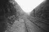 Strines
Cutting (c1963) :
Richard Barnes
©
copyright on all Richard Barnes Photographs Strines
Cutting (c1963) :
Richard Barnes
©
copyright on all Richard Barnes Photographs
Strines Cutting looking towards Holmfield from about halfway to
the tunnel.
Photo's taken the week before the track was lifted. |
 Strines
Cutting (c1963) :
Richard Barnes
© Strines
Cutting (c1963) :
Richard Barnes
©
Ditto, looking towards Queensbury. |
 Holdsworth Road
(23-08-06) : Andrew Stopford Holdsworth Road
(23-08-06) : Andrew Stopford
An old bridge a little further north of Holmfield
Station. |
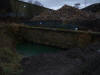
Strines Cutting recently drained
Strines Cutting (26-05-12)
: Ed Matejak
 Aqueduct
with newly revealed archway. Aqueduct
with newly revealed archway.
Went for a walk today and discovered the
Holmfield end of the tunnel has been drained dry just prior to
land fill. Some new and magnificent pictures of the final
section of Strines cutting have been revealed after many
decades, the tunnel portal including well preserved telegraph
and the newly revealed arch on the aqueduct. |
 Strines
Cutting (26-05-12)
: Ed Matejak Strines
Cutting (26-05-12)
: Ed Matejak
Queensbury Tunnel Portal Holmfield. |
_small.jpg) Strines
Cutting (26-05-12)
: Ed Matejak Strines
Cutting (26-05-12)
: Ed Matejak
Strines down to Tunnel. |
 Strines
Cutting (26-05-12)
: Ed Matejak Strines
Cutting (26-05-12)
: Ed Matejak
Towards Queensbury. |
 Strines
Cutting (26-05-12)
: Ed Matejak Strines
Cutting (26-05-12)
: Ed Matejak
Tunnel Brickwork. A fantastic day and
actually managed a few yards into the cold, wet and dark
entrance. |
 Strines
Cutting (26-05-12)
: Ed Matejak Strines
Cutting (26-05-12)
: Ed Matejak
Well preserved Telegraph. |
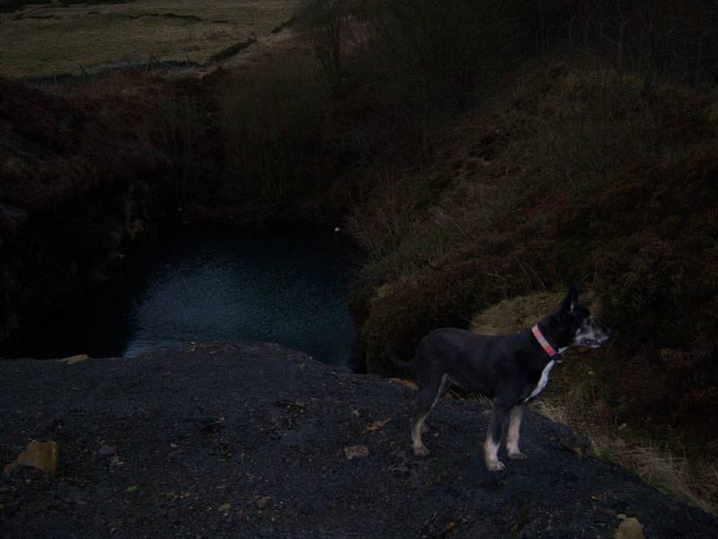
 Strines
Cutting (06-12)
:
Phill Davison
flickr website
http://www.flickr.com/photos/phill_dvsn/ Strines
Cutting (06-12)
:
Phill Davison
flickr website
http://www.flickr.com/photos/phill_dvsn/
I took a look at the Queensbury tunnel
down at the Strines cutting end at the back end of June.
I was hoping the tunnel had been fully drained by now. Sadly the
tunnel isn't quite ready to explore yet, but it soon will be.
|
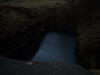
Strines Cutting (06-12)
:
Phill Davison
 I
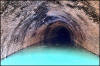
managed to get a shot down the once submerged end of the tunnel,
it was difficult to expose but I managed one decent shot. It
must be the first photo of that end of the tunnel for many
years. It shows the stonework is in very poor condition, many of
the stones are hanging by a thread. The water is around 3' deep
and is a vivid blue colour. As far as I can work out the blue
lagoon is caused by the crushed limestone aggregate they used to
fill in the cutting. The main active ingredient of agricultural
limestone is calcium carbonate, It's the calcium carbonate which
is responsible for turning the water vivid blue. Most blue
lagoons are often to be found in old quarry sites e.t.c. I
managed to get a shot down the once submerged end of the tunnel,
it was difficult to expose but I managed one decent shot. It
must be the first photo of that end of the tunnel for many
years. It shows the stonework is in very poor condition, many of
the stones are hanging by a thread. The water is around 3' deep
and is a vivid blue colour. As far as I can work out the blue
lagoon is caused by the crushed limestone aggregate they used to
fill in the cutting. The main active ingredient of agricultural
limestone is calcium carbonate, It's the calcium carbonate which
is responsible for turning the water vivid blue. Most blue
lagoons are often to be found in old quarry sites e.t.c.
It
can't harm the water too much though, we saw a good few fish
swimming about in it. |
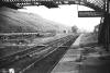
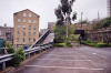
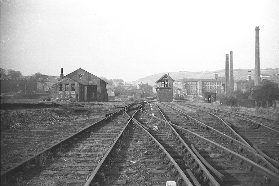
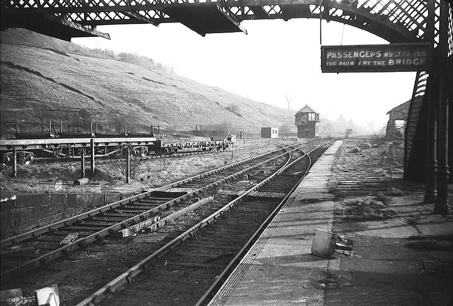
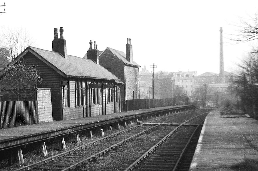
Holmfield station
 Opened 15-12-1879. Closed 23-05-1955. Opened 15-12-1879. Closed 23-05-1955.
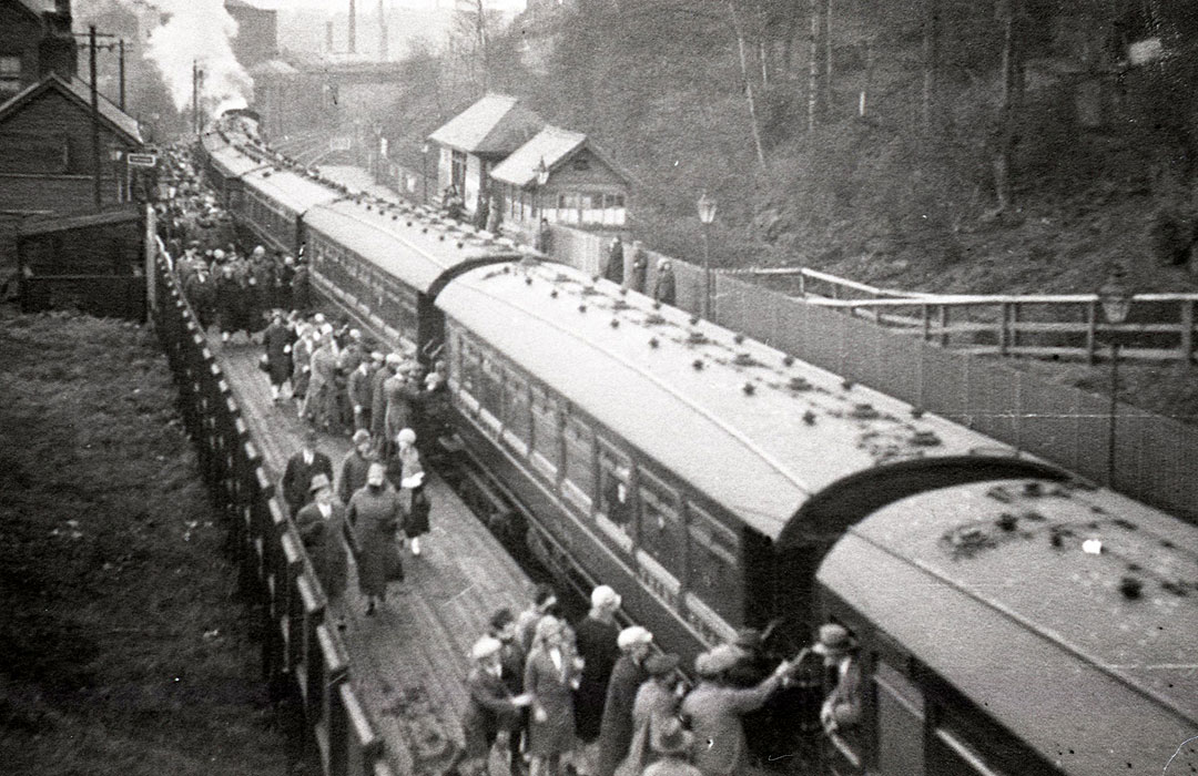
Holmfield Junction & Station (c.1934) : John Davies
A panorama of some shots I have of Holmfield.
I’ve posted a
larger version of the file on the
bygone Lines Yahoo group together with the individual shots. |
 Holmfield Station & junction (c1963) : Richard Barnes
©
copyright on all Richard Barnes
Photographs Holmfield Station & junction (c1963) : Richard Barnes
©
copyright on all Richard Barnes
Photographs
Approach to Holmfield Station facing towards Queensbury. Photo's
taken the week before the track was lifted.
You can see the connection to the Pellon branch trailing in on
the left, the track had been lifted the previous week. |
 Holmfield junction facing s west
(19-02-06) Holmfield junction facing s west
(19-02-06)
The site of Holmfield junction facing towards Ovenden.
The Bridge remnants crossing Shay lane visible to the left of that big
building near centre of photo are part of the old Halifax high level
railway. See
Holmfield to St Pauls. |
 Holmfield
Goods Yard Entrance (01-12)
: Ed Matejak Holmfield
Goods Yard Entrance (01-12)
: Ed Matejak
Holmfield Goods Yard Entrance. |
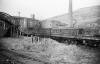
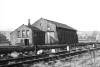 Holmfield
Goods Shed (c1963)
: Richard Barnes
© Holmfield
Goods Shed (c1963)
: Richard Barnes
©
|
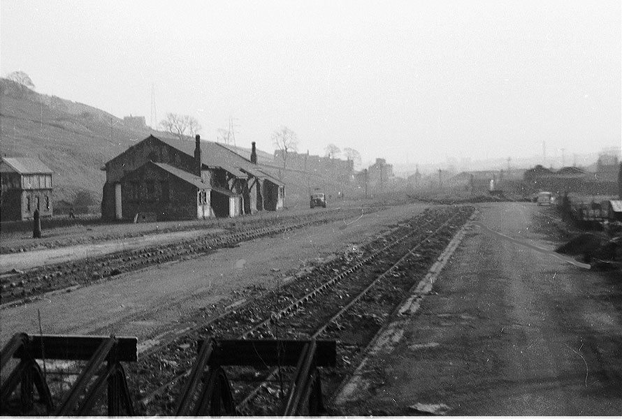
 Holmfield
general view looking NW
(c1963) : Richard Barnes
© Holmfield
general view looking NW
(c1963) : Richard Barnes
©
|
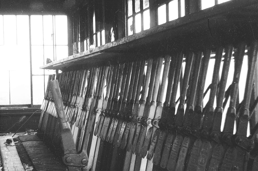
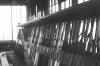 Holmfield
Signal Box lever frame
(c1963) : Richard Barnes
© Holmfield
Signal Box lever frame
(c1963) : Richard Barnes
©
|
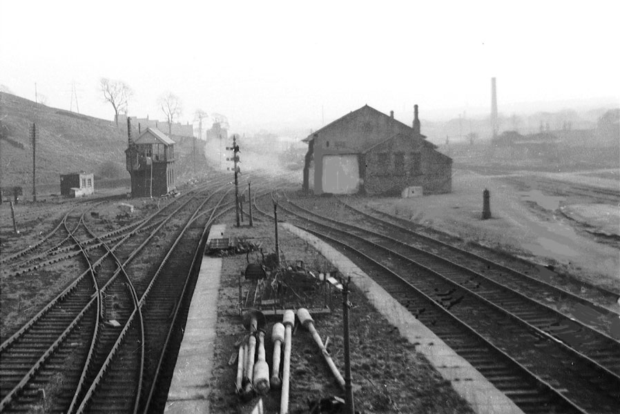
 Holmfield
looking SE across goods yard
(c1963) : Richard Barnes
© Holmfield
looking SE across goods yard
(c1963) : Richard Barnes
©
|
 Holmfield
looking south from footbridge
(c1963) : Richard Barnes
© Holmfield
looking south from footbridge
(c1963) : Richard Barnes
©
|
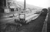
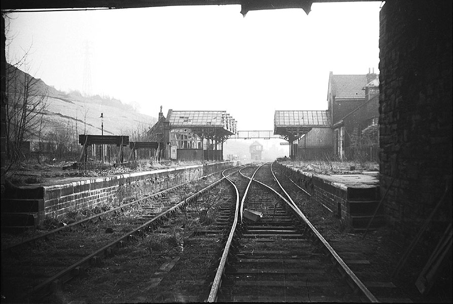
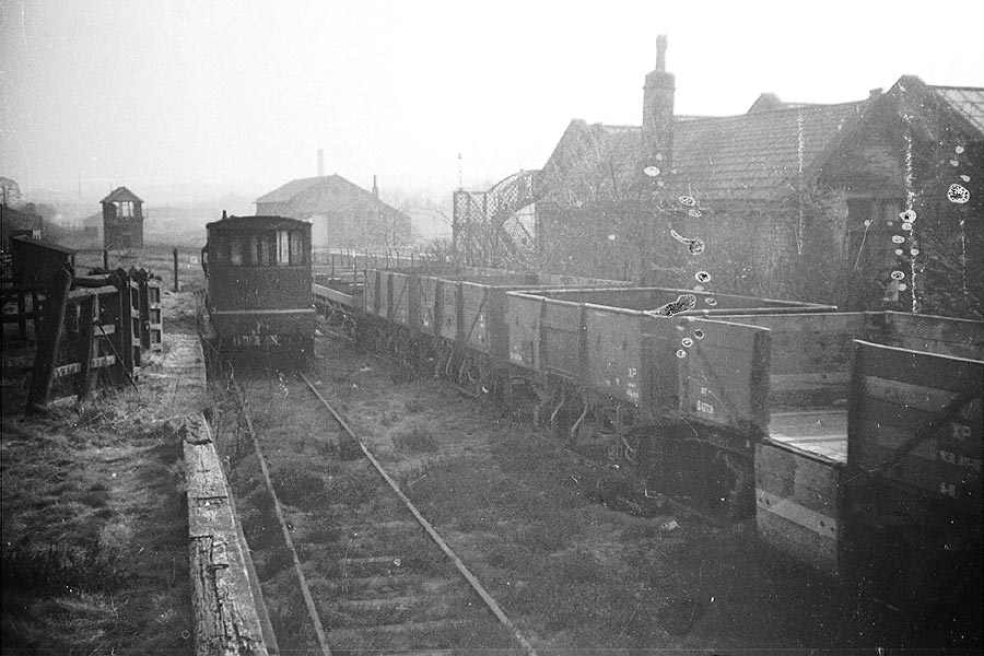
 Holmfield
Station (c1963) : Richard Barnes
© Holmfield
Station (c1963) : Richard Barnes
©
Holmfield Station looking towards Halifax. Note the buffer stops
dumped on the platform! It looks as if both tracks were being
used from here, although other pictures I have seen would
indicate that the left hand track was used to travel down to
Halifax, indicating that trains crossed over at this point.
Photo's taken the week before the track was lifted. |
 Holmfield
Station (c1963) : Richard Barnes
© Holmfield
Station (c1963) : Richard Barnes
© |
 Holmfield
Station (c1963) : Richard Barnes
© Holmfield
Station (c1963) : Richard Barnes
©
Dismantling vehicles parked in the sidings behind Holmfield
Station.
|
   Holmfield
Station cattle dock (c1963) : Richard Barnes
© Holmfield
Station cattle dock (c1963) : Richard Barnes
©
Dismantling vehicles at Holmfield, parked in the cattle dock
area. |
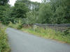
 Holmfield
Holdsworth Road facing north
(c1963) : Richard Barnes
© Holmfield
Holdsworth Road facing north
(c1963) : Richard Barnes
©
Facing north from the bridge next to Holmfield Station, (Holdsworth
Road).
The bridge in the distance is where the same road crosses the
railway again. One of the north Halifax schools visible on the
left. |
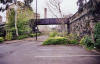
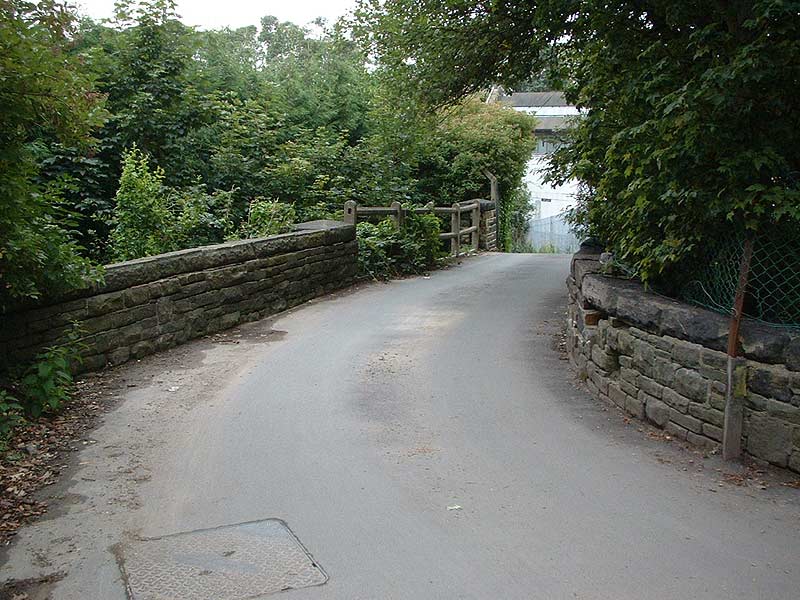
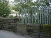 Holmfield Station (23-08-06) : Andrew Stopford Holmfield Station (23-08-06) : Andrew Stopford
The old access to Holmfield Station (note the similarity to the
access to Lightcliffe Station.
(I guess the iron hoop held a lamp) |
 Holmfield
Station (23-08-06) : Andrew Stopford Holmfield
Station (23-08-06) : Andrew Stopford
A shot of the old bridge at the station
site.
|
 Moorside
cutting (04-06) Matt C Moorside
cutting (04-06) Matt C
Leading from Holmfield station. |
 Churn
Milk Lane (23-08-06) : Andrew Stopford Churn
Milk Lane (23-08-06) : Andrew Stopford
An old bridge over the Halifax-Queensbury line
just south of Holmfield Station.
|
 Royd
Lane (23-08-06) : Andrew Stopford Royd
Lane (23-08-06) : Andrew Stopford
A bridge over the same line to a private road
called Royd Lane,
just a few yards further south of Churn Milk Lane. |
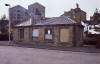
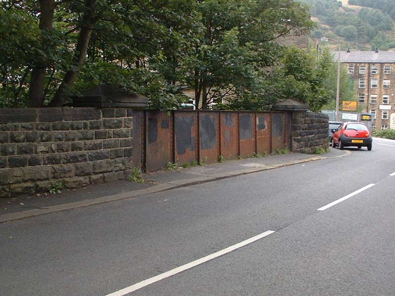
Ovenden
station
Opened
02-06-1881. Closed 23-05-1955.
 Ovenden
Station building (28-07-06) : Andrew
Stopford Ovenden
Station building (28-07-06) : Andrew
Stopford
Ovenden Station on the Halifax-Queensbury line. It's remarkably intact!
(28th July 06).
I guess the stone building is the Station Master's house
and the wooden building would be the platform waiting room/booking
office etc.
After local pressure the additional station at Ovenden was opened in
June 1881. |
 Ovenden
Station (nd) : c/o Darrell Prest Ovenden
Station (nd) : c/o Darrell Prest
Ovenden station excursion trip. |
Ovenden
Station looking towards Halifax (c1962) :
Richard Barnes
©
copyright on all Richard Barnes
Photographs.
Note : Bob Cockcroft
 The only buildings extant on this
line seem to the the station building in wood at Ovenden, which is an
outstanding survival. It is in bad condition but was still used at my
last visit about two years ago by a car scrap yard owner. The station
master's house is also still there The only buildings extant on this
line seem to the the station building in wood at Ovenden, which is an
outstanding survival. It is in bad condition but was still used at my
last visit about two years ago by a car scrap yard owner. The station
master's house is also still there
and in good condition and largely unaltered. The foundations survive of the other platform building which
was a hipped roofed waiting shed.
How long these remain is anyone's
guess. |
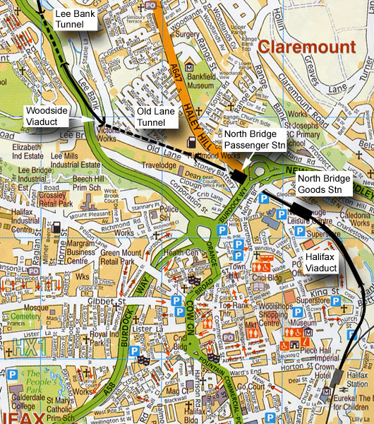 Lee
Bank Tunnel To Halifax Old Station Lee
Bank Tunnel To Halifax Old Station
Hybrid Map - Roads 2010 Rails 1910.
|
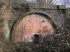
 Lee
Bank Tunnel Lee
Bank Tunnel
Lee
Bank Tunnel north portal (April 06) : Matt C
North portal of the 267 yards Lee Bank tunnel |
 Lee
Bank Tunnel north portal (21/04/07)
: Andrew Booth Lee
Bank Tunnel north portal (21/04/07)
: Andrew Booth
It appears some work has been carried out recently and the portal doors
have been bricked up there are also remnants of a old ground frame hut
or platelayers hut although the photos I took (Mobile phone) lack
detail. |
 Lee
Bank Tunnel south portal (April 06) : Matt C Lee
Bank Tunnel south portal (April 06) : Matt C
The portal was in- filled when the A629 Ovenden
road was widened into a dual carriageway. |
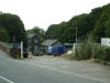
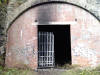
/Halifax%20Queensbury/20210527_125846_small.jpg) Lee
Bank Tunnel south portal (27-05-21) : NigglePics Lee
Bank Tunnel south portal (27-05-21) : NigglePics
This is a pic of the northern portal of Lee Bank
Tunnel Halifax on the North Bridge to Queensbury line, the picture was
taken on 27/05/2021. Taken whilst doing my YouTube video at
https://www.youtube.com/watch?v=TKaienGCWh8&t=318s |
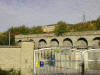
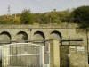
Woodside Viaduct Dean Clough
%20Viaduct_small.jpg) Woodside
Viaduct (17-01-10) : David Webdale Woodside
Viaduct (17-01-10) : David Webdale
Remnant of the south end of the six arch viaduct
at Dean Clough originally Crossley's Mill.
Just beyond is the north portal of Old Lane tunnel,
to the left of the
chimney, see next photo.
The viaduct was demolished when the A629 Ovenden road was widened into a
dual carriageway. |
 Old
Lane Tunnel Old
Lane Tunnel
Old
Lane tunnel north portal (18-04-06) : Matt C
North portal of the 403 yards Old Lane tunnel. |
 Old
Lane tunnel south portal (18-04-06) : Matt C Old
Lane tunnel south portal (18-04-06) : Matt C
Old lane tunnel is located near to the old North Bridge
Station and at the southern portal, there has been some recent work
carried out inside the tunnel, maybe structural defects, but this has
not affected the northern portal which is still intact. |
 Old
Lane tunnel south portal (12-10-09) : Brandon Hatzer Old
Lane tunnel south portal (12-10-09) : Brandon Hatzer
Of course something you will recognise, I just
thought I'd get a recent picture of it with it all overgrown,
which made
it too difficult to walk on from the North Bridge car park which I
originally planned to do a few weeks ago. |
  Old
Lane tunnel south portal (03-05-10) : Brandon Hatzer Old
Lane tunnel south portal (03-05-10) : Brandon Hatzer |
Dean Clough Tunnel
 Old
Lane tunnel south portal / Dean Clough tunnel (03-05-10) : Brandon Hatzer Old
Lane tunnel south portal / Dean Clough tunnel (03-05-10) : Brandon Hatzer
A branch line leading down to Crossley's Carpets
at Dean Clough Mills
dived under the GNR Queensbury line just inside Old Lane tunnel.
The bricked up top of this tunnel is visible on the left.
See Halifax Dean Clough tunnel |
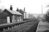
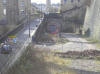
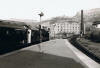
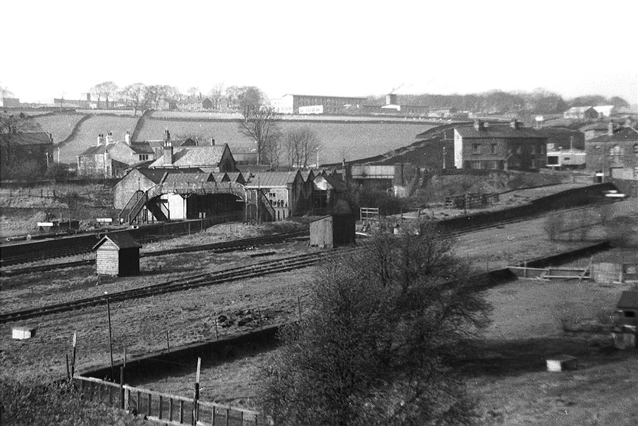
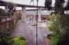 North
Bridge station North
Bridge station
Opened 25-03 -1880. Closed 23-05-1955. Freight 1974.
North
Bridge station facing east (30-04-06) : David Webdale
Taken from the cast iron footbridge, view of station site
& the north bridge. See Also Halifax section |
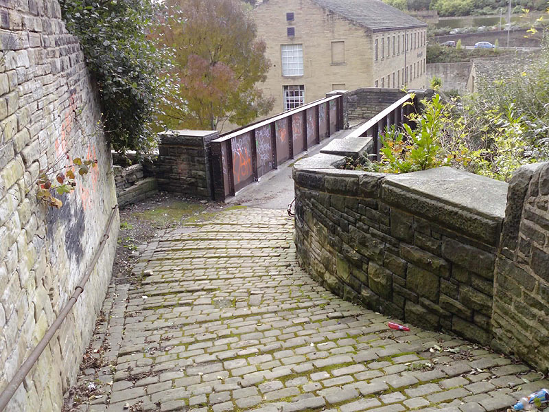
 North
Bridge station facing west (30-04-06) : David Webdale North
Bridge station facing west (30-04-06) : David Webdale
Facing back towards the footbridge I was standing
on in the previous photo.
This little cast iron bridge is the only survivor of the whole station.
Old lane tunnel visible in the background. |
 North
Bridge station facing west (30-04-06) : David Webdale North
Bridge station facing west (30-04-06) : David Webdale
Wider view lets us see the steep stone cobbled
snicket on the
left, leading up to the footbridge. |
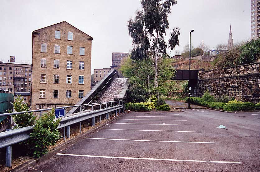
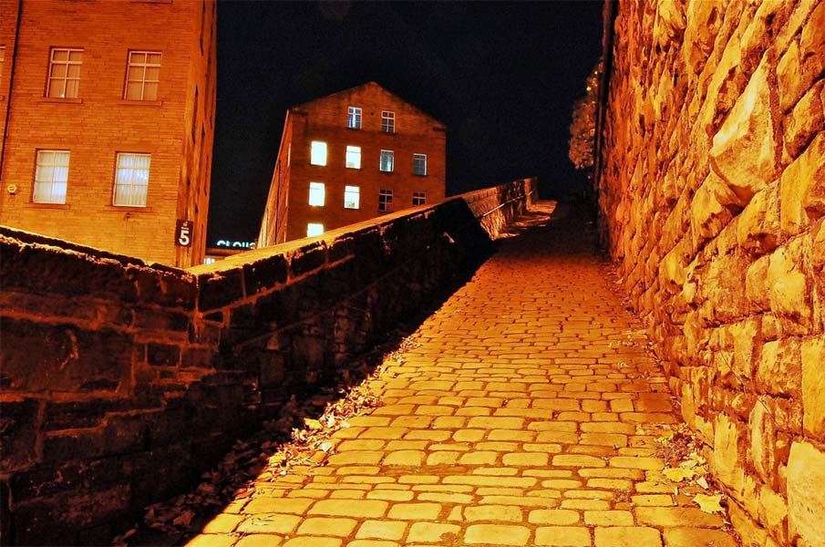
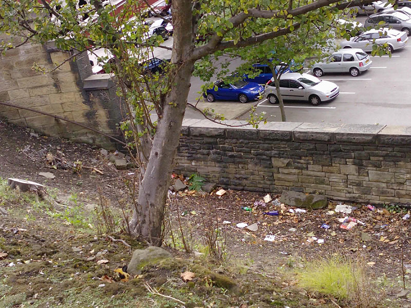
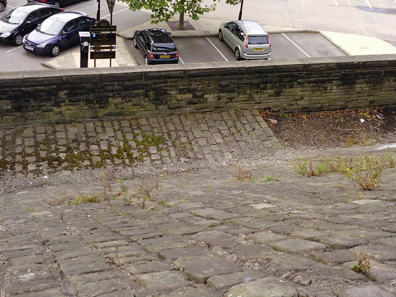
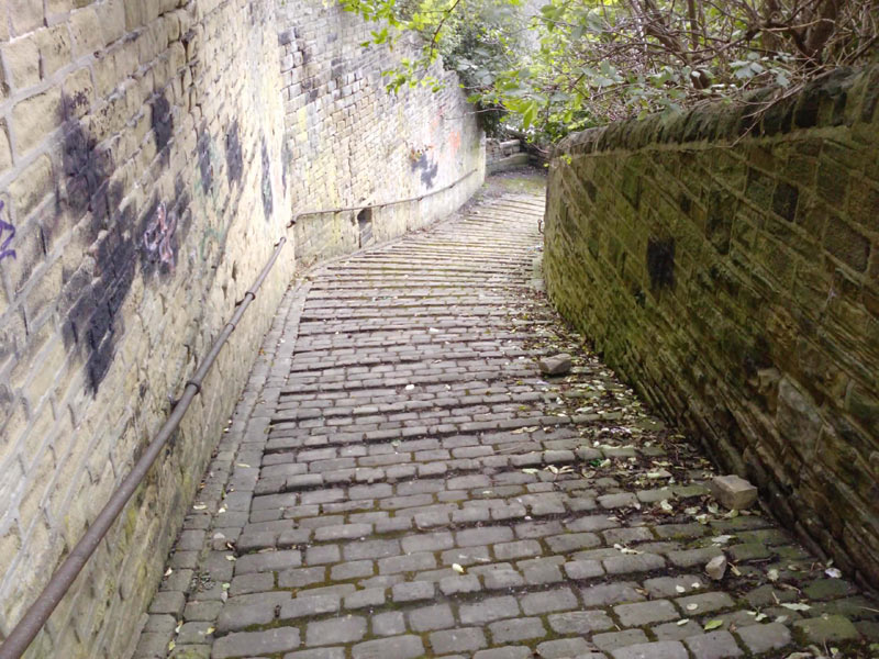
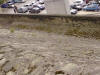
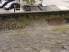
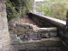
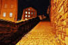 North
Bridge station stone cobbled snicket : Phill Davison North
Bridge station stone cobbled snicket : Phill Davison
An interesting story to go with this cobbled slope leading to the
footbridge -
http://www.flickr.com/photos/phill_dvsn/3030249249/in/photostream/ |
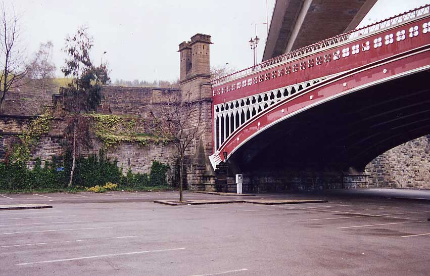
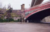 North
Bridge station entrance (30-04-06) : David Webdale North
Bridge station entrance (30-04-06) : David Webdale
The tasty North bridge itself was a higher road
bridge built over the North Bridge site, to allow for adequate clearance.
Bricked up station entrance was just to the left of those fancy towers
at the north end of the bridge. |
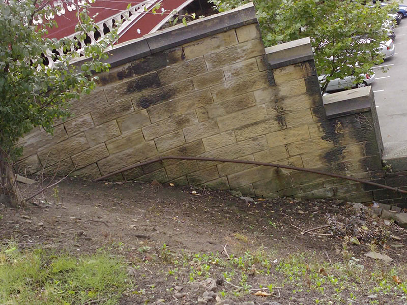
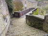
 North
Bridge (12-10-09) : Brandon Hatzer North
Bridge (12-10-09) : Brandon Hatzer
Near the old Halifax North Bridge Station the old
hand rails are still there! Which I thought was quote astounding. |
 North
Bridge (12-10-09) : Brandon Hatzer North
Bridge (12-10-09) : Brandon Hatzer
This is the bottom of the hand rail and I may be
wrong,
but I'm presuming the path started there going towards the old area of
the station. |
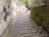
 North
Bridge (12-10-09) : Brandon Hatzer North
Bridge (12-10-09) : Brandon Hatzer
Helping my point that I believe it's a path to the
old station,
you can see the cobbled path which is popular in Halifax and is
overgrown but not removed. |
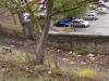
 North
Bridge (12-10-09) : Brandon Hatzer North
Bridge (12-10-09) : Brandon Hatzer
Another picture of the pathway and the 'North
Bridge Car Park' sign in the background for effect!
Along with the parking meter, you didn't get meters like that to park
the train.
|
 North
Bridge (12-10-09) : Brandon Hatzer North
Bridge (12-10-09) : Brandon Hatzer
I then started to walk off the bottom of Boothtown
Road (I probably got the road name wrong) to wards the Iron Bridge
above North Bridge Station showing the same type of hand rail that was
shown earlier closer to the bridge. |
 North
Bridge (12-10-09) : Brandon Hatzer North
Bridge (12-10-09) : Brandon Hatzer
The same steps looking up. At the very top you
turn right to the road that goes towards Boothtown.
You can just see at the top KFC and then further up is LIDL *sigh* |
 North
Bridge (12-10-09) : Brandon Hatzer North
Bridge (12-10-09) : Brandon Hatzer
The bottom of the steps I came down looking
straight at the iron bridge with Dean Clough in the background.
At least this would have looked not too far off this back when active,
though it's less smog now and more masses of graffito.
|
 North
Bridge (12-10-09) : Brandon Hatzer North
Bridge (12-10-09) : Brandon Hatzer
I daren't go on here, mainly didn't want to get my
work smarts dirty! But it's obviously a badly built wall to stop people
walking on the side where the path from earlier leads to. I'm not sure
how it went down to the station but of course whatever was there to get
you to the station has been long removed. The iron bridge starts
directly to the right. |
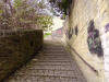
North Bridge (12-10-09) : Brandon Hatzer
 Many
pictures when looking on Flikr and other places of this slope looking up
but I thought I'd do one looking down. Was a benefit walking down here,
made me realise I need new shoes as my grips on my work shoes nearly had
me head over heels, not much looking after here so can be slippy
especially on the sections without a hand rail. Don't know how people
used this in the winters of old Many
pictures when looking on Flikr and other places of this slope looking up
but I thought I'd do one looking down. Was a benefit walking down here,
made me realise I need new shoes as my grips on my work shoes nearly had
me head over heels, not much looking after here so can be slippy
especially on the sections without a hand rail. Don't know how people
used this in the winters of old |
 North
Bridge (12-10-09) : Brandon Hatzer North
Bridge (12-10-09) : Brandon Hatzer
The bottle there kind of spoils it, but I've seen
many of the slope, but no pictures of the steps. Old school steps,
steeper than any health and safety officer would allow them now. Not
nice after dark walking up these! |
 North
Bridge (12-10-09) : Brandon Hatzer North
Bridge (12-10-09) : Brandon Hatzer
This is the wall next to where the North Bridge
Station would be. Noticed not too long ago the two 'hooks' on the wall,
I have no idea what they would be for, wondering if you could enlighten
me? |
 North
Bridge (12-10-09) : Brandon Hatzer North
Bridge (12-10-09) : Brandon Hatzer
The same picture as above just from a different
angle. |
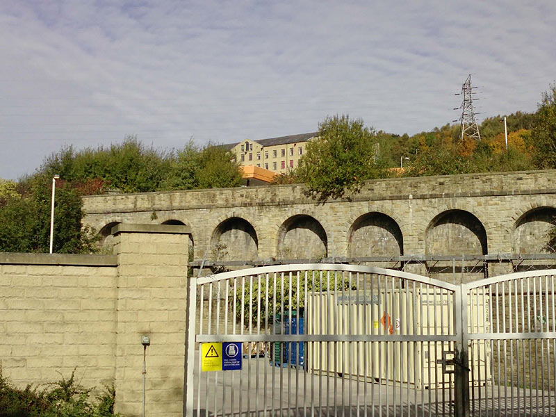
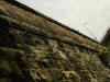
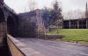
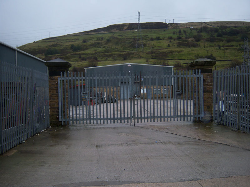
GNR North Bridge Goods Station
 Opened
25-03 -1880. Closed 1974. Opened
25-03 -1880. Closed 1974.
Retaining
wall (12-10-09) : Brandon Hatzer
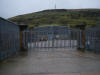
The car park gate is nice and poignant I guess. Sainsbury's petrol station
visible in background. |
 Retaining
wall (12-10-09) : Brandon Hatzer Retaining
wall (12-10-09) : Brandon Hatzer
Behind the gates is the Mulcture House Council building & car park. Wade
Street sign visible on the right. |
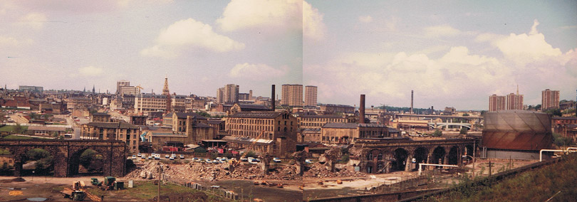
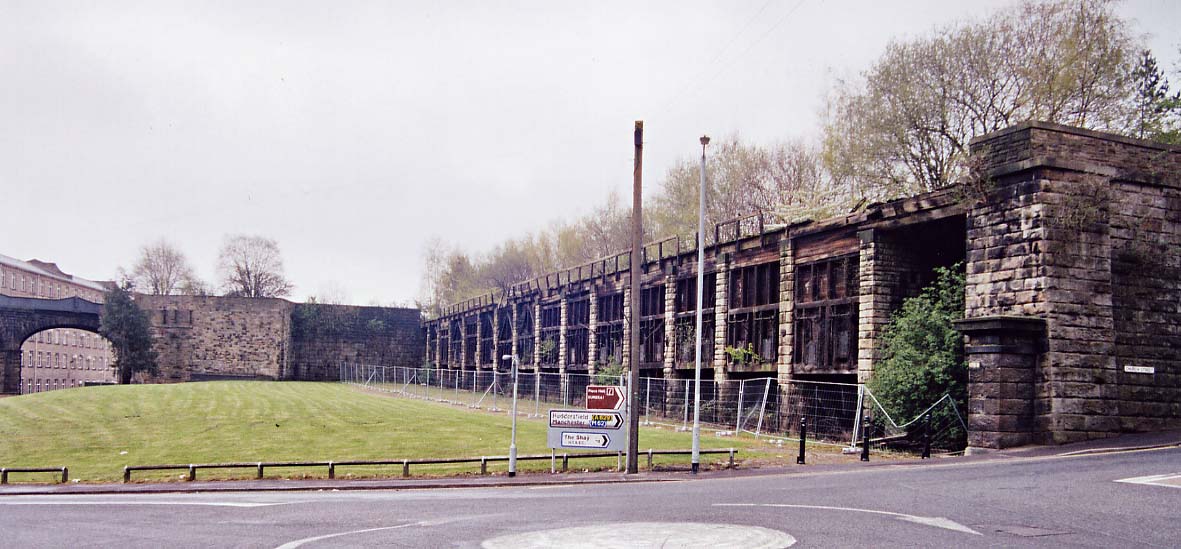
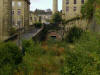
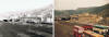
Halifax Viaduct GNR
 Halifax
Viaduct 1980s : Dave Heatley Halifax
Viaduct 1980s : Dave Heatley
Demolition of the viaduct linking Halifax Railway station with the GN
North Bridge site. Photo taken around the mid 80’s
What a great opportunity lost to link the two areas now! |
 Viaduct
facing west (30-04-06) : David Webdale Viaduct
facing west (30-04-06) : David Webdale
The remnants of the viaduct leading to North
bridge. See above. The viaduct leading off into Beacon Hill tunnel
along the left here. |
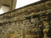
Coal drops
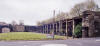 Coal
drops facing south (30-04-06) : David Webdale Coal
drops facing south (30-04-06) : David Webdale
Next
to the existing Halifax Old station these massive coal drops.
The stub of the viaduct to North bridge to the left of coal drops.
The still in use viaduct leading off to Beacon Hill on the far left.
Note : Brandon Hatzer
The coal drops in Halifax are listed Grade II
http://www.calderdale.gov.uk/environment/conservation/listedbuildings/
The description reads - Coal drops. 1874. Built for the Ovenden and
Halifax Junction Railway Co. Rock-faced ashlar with wooden bunkers. 15
wooden bunkers each supported between stone piers and to the north an
open shed, with beyond a battered wall topped with a parapet. These coal
drops are built into the slopping hillside. Each wooden bunker has 2
metal doors which were raised on an iron ratchet geared pulley system.
This is a rare and large scale example of railway coaldrops.
I understand if you've already seen this or already know this but
hearing it from my Council pretty much asserts they are listed, and so
they should be! Better than being knocked down or being converted into
flats like every other memory! |
 Coal
drops building facing west (22-04-06) : David Webdale Coal
drops building facing west (22-04-06) : David Webdale
Little building survives in the corner of the car
park above the coal drops. |
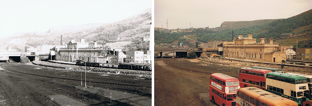
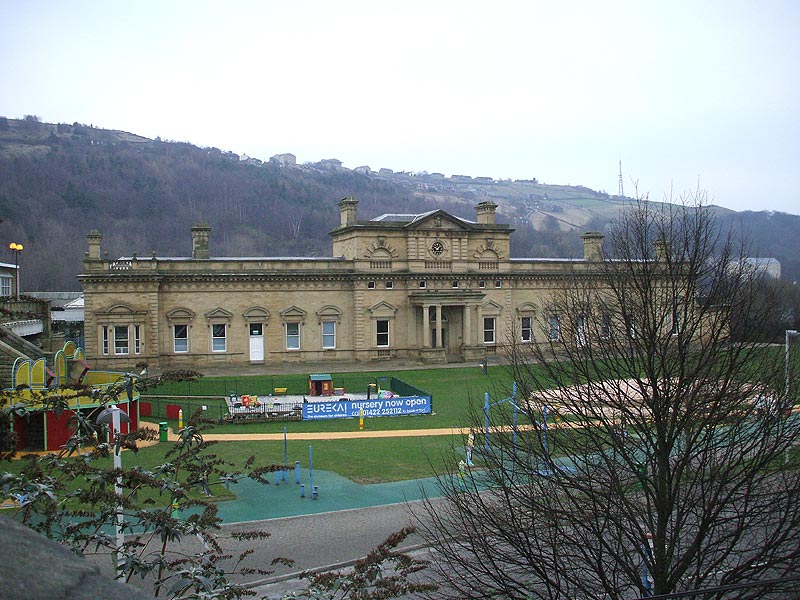
Halifax
Old Station
 Opened
1855 to present. Opened
1855 to present.
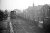
Halifax
Old Station (11-81, 08-82) : Dave Heatley
See Also Halifax section
B&W photo taken in Nov ’81 – GN platform being demolished and track
recently lifted into freight sidings.
Second photo taken in Aug 1982 showing the bus museum parked out in the
open before moving to Low Moor. |
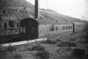
 Halifax
Station (1981) : Dave Heatley Halifax
Station (1981) : Dave Heatley
Class25 25125 dragging a failed DMU to Bradford – Hammond St Depot
perhaps. |
 Halifax
Station (16-12-07) : Andrew Stopford Halifax
Station (16-12-07) : Andrew Stopford
Shot of Halifax Station & disused platforms. |


.jpg)


/Halifax%20Queensbury/20210527_125846.jpg)
%20Viaduct.jpg)