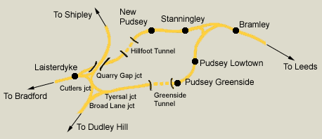
 Pudsey
Loop Pudsey
Loop
See Darren Hosker's Youtube feature
https://www.youtube.com/watch?v=XRugxhwfdvk |
Bramley station
See also Leeds Bradford (GNR)
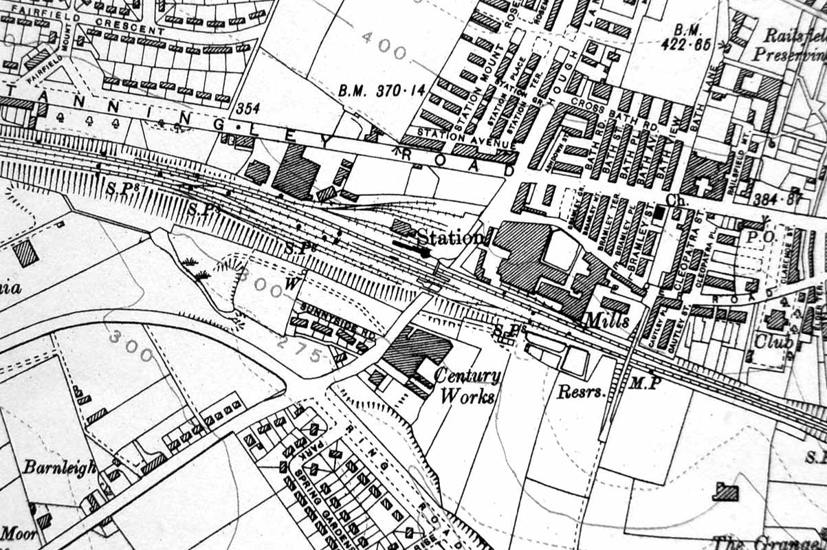
/Bramley_small.jpg) Station
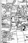
map (1850) : Malcolm Mallison Station
map (1850) : Malcolm Mallison
Plans of station taken from 1850 6 inch to the mile map. |
 Bramley
(c1933) : Malcolm Mallison Bramley
(c1933) : Malcolm Mallison
From the 1933 Survey- Bramley, Armley & Wortley, Pudsey Lowtown. |
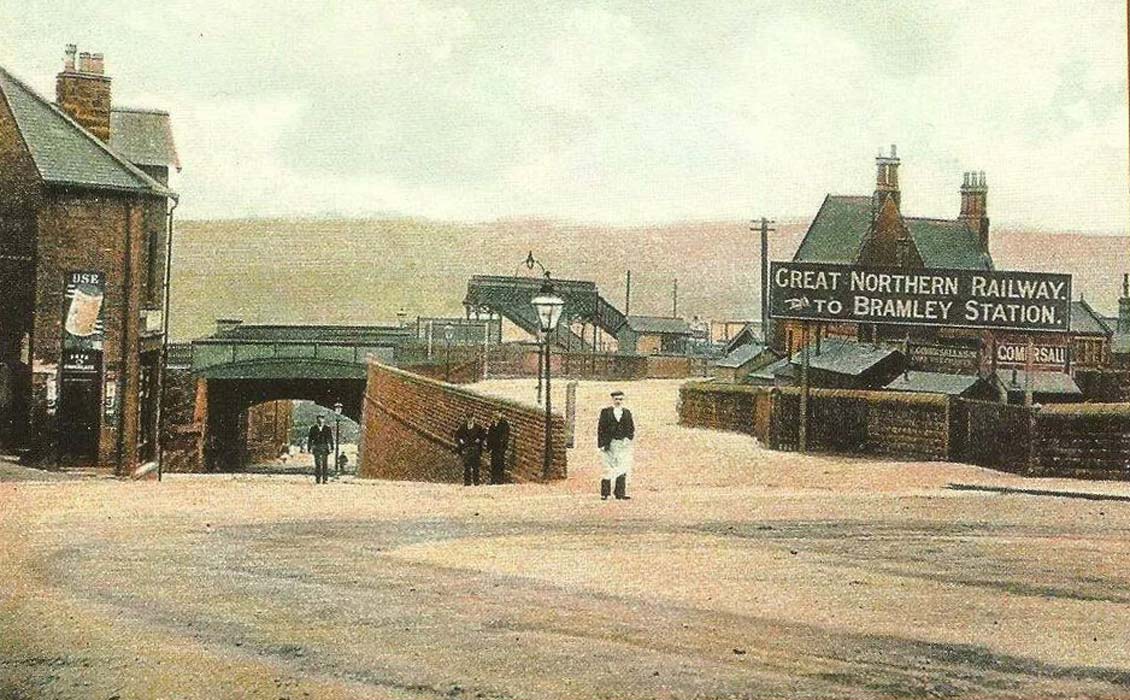
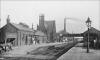 Bramley
station (nd) : Ian Jenkins Bramley
station (nd) : Ian Jenkins
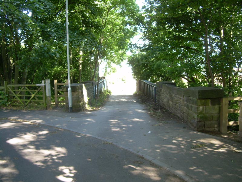
Bramley railway station. |
 Bramley
station (nd) : Ian Jenkins Bramley
station (nd) : Ian Jenkins
Bramley railway station. |
Stanningley Station
See also Leeds Bradford (GNR)
 Opened 01-08-1854. Closed 01-01-1968. Opened 01-08-1854. Closed 01-01-1968.
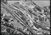
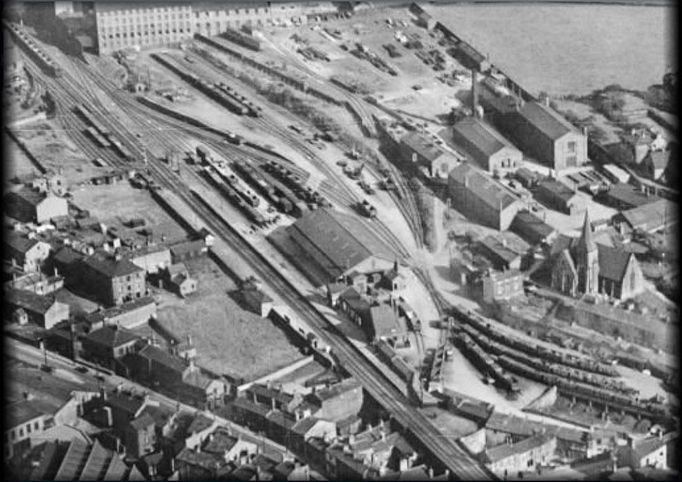
Stanningley station Aerial (nd) : Ian Jenkins
Stanningley Railway Station. |
/Stanningley_small.jpg) Stanningley
station map (1850) : Malcolm Mallison Stanningley
station map (1850) : Malcolm Mallison
Plans of station taken from 1850 6 inch to the
mile map. |
/011%20Stanningley_small.jpg) Stanningley
station map (1890) : Malcolm Mallison Stanningley
station map (1890) : Malcolm Mallison
6 inch maps from the 1890 survey. |
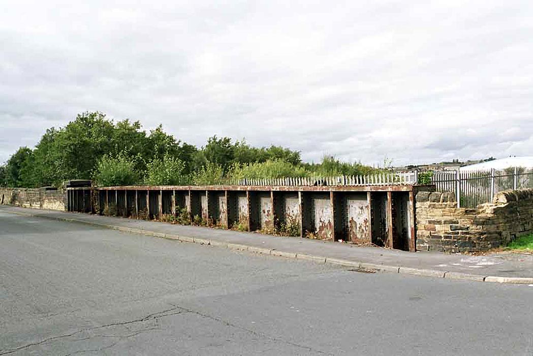
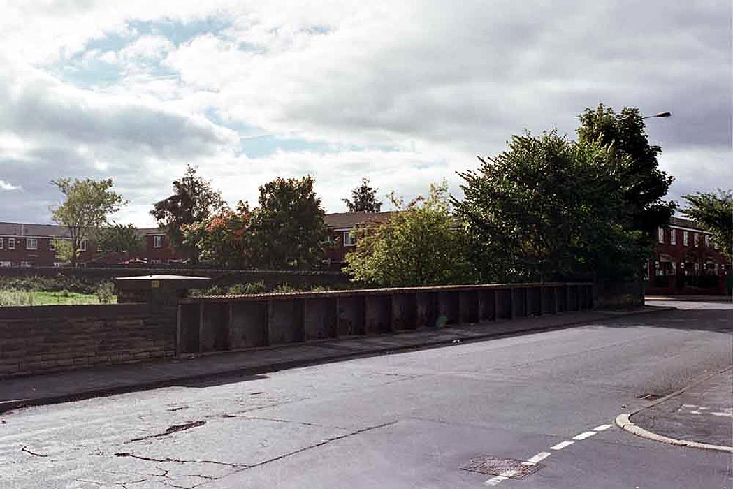
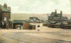
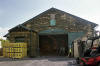
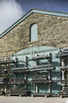
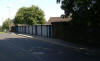
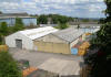
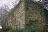
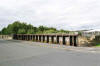
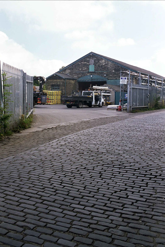
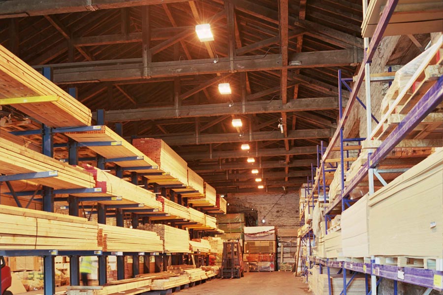
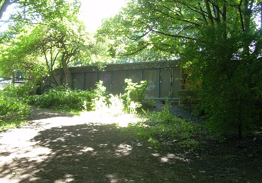
 Stanningley
station Goods shed (25-09-12) : Malcolm Mallison Stanningley
station Goods shed (25-09-12) : Malcolm Mallison
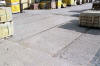
The goods shed at Stanningley station survives almost intact in a
builders’ merchant. My thanks to the staff at Gibbs & Dandy for their
permission and assistance. Here is a general view (partly obstructed by
Transit) showing stone setts in yard. |
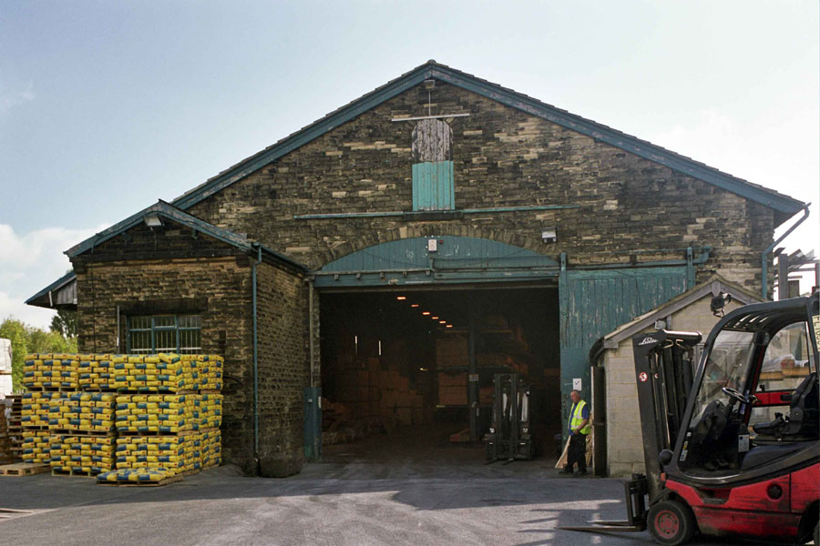
 Stanningley
station Goods shed (25-09-12) : Malcolm Mallison Stanningley
station Goods shed (25-09-12) : Malcolm Mallison
Western end. Left hand door appears to be only major component missing. |
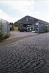
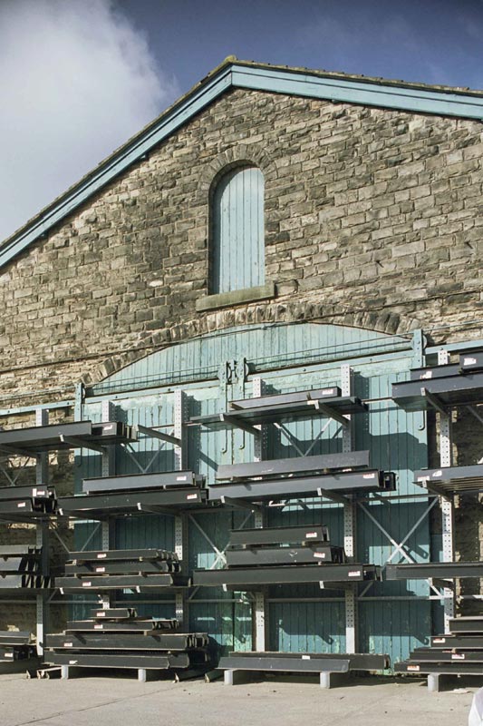
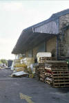 Stanningley
station Goods shed (25-09-12) : Malcolm Mallison Stanningley
station Goods shed (25-09-12) : Malcolm Mallison
Canopy on north side |
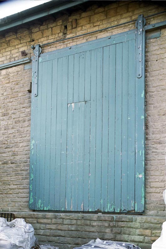
 Stanningley
station Goods shed (25-09-12) : Malcolm Mallison Stanningley
station Goods shed (25-09-12) : Malcolm Mallison
All side loading doors are in place, but only one isn’t obscured by
racking. |
 Stanningley
station Goods shed (25-09-12) : Malcolm Mallison Stanningley
station Goods shed (25-09-12) : Malcolm Mallison
Eastern end. See what I mean about racking. |
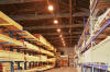 Stanningley
station Goods shed (25-09-12) : Malcolm Mallison Stanningley
station Goods shed (25-09-12) : Malcolm Mallison
Interior view, showing roof timbers. |
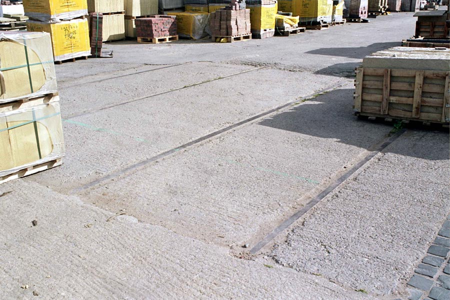
 Stanningley
station Goods shed (25-09-12) : Malcolm Mallison Stanningley
station Goods shed (25-09-12) : Malcolm Mallison
Short section of rail still visible in yard. |
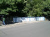
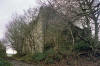
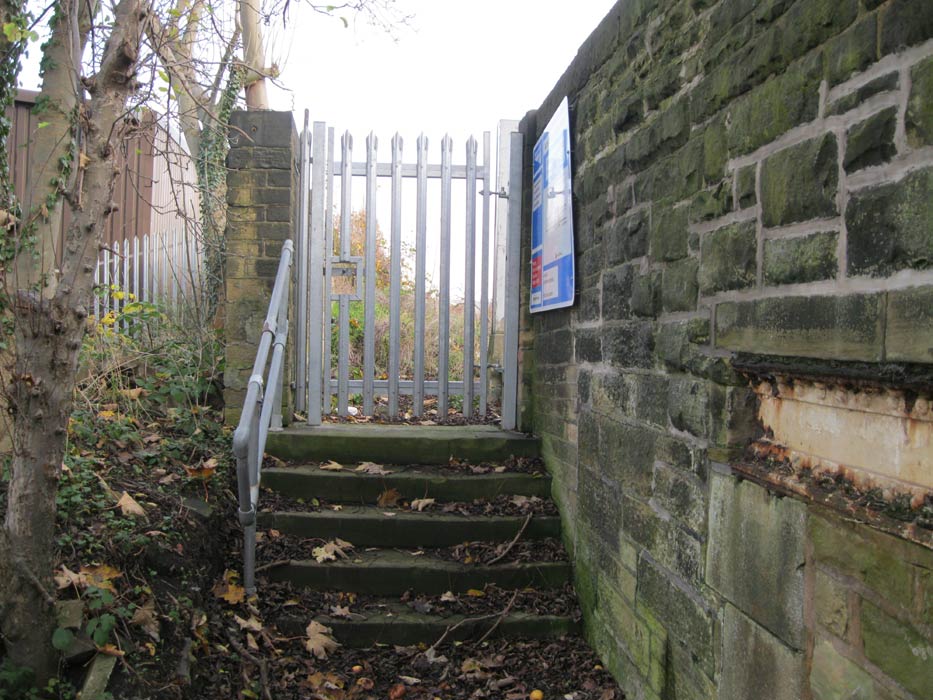
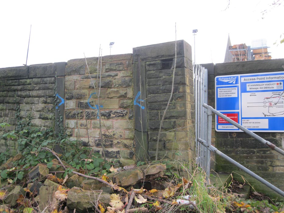
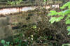 Stanningley
station subway (25-09-12) : Malcolm Mallison Stanningley
station subway (25-09-12) : Malcolm Mallison
Remains of pedestrian tunnel almost buried in undergrowth behind public
car park. |
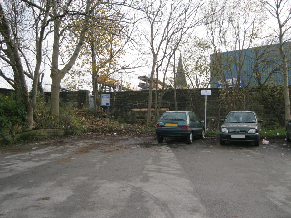
 Stanningley
station subway (25-11-14) : Rita Bostock Stanningley
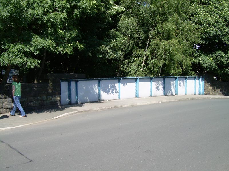
station subway (25-11-14) : Rita Bostock
Stanningley station entrance & subway off the B6157 Bradford road. |
 Stanningley
station
subway (25-11-14) : Rita Bostock Stanningley
station
subway (25-11-14) : Rita Bostock
Close up of the half buried subway entrance. |
 Stanningley
station entrance (25-11-14) : Rita Bostock Stanningley
station entrance (25-11-14) : Rita Bostock
Stanningley entrance & subway off the B6157 Bradford road. |
 Stanningley
station entrance (25-11-14) : Rita Bostock Stanningley
station entrance (25-11-14) : Rita Bostock
Stanningley station entrance & subway. |
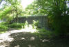
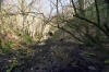
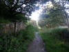
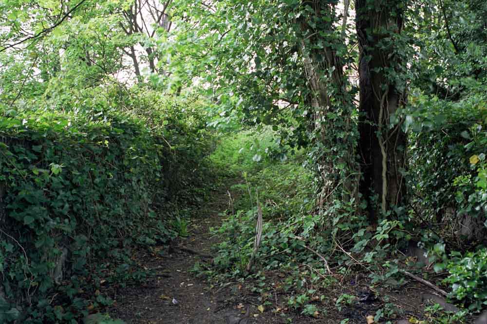
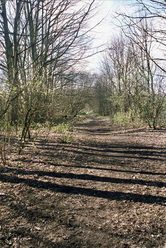
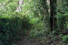 Trackbed
(29-05-15) : Malcolm Mallison Trackbed
(29-05-15) : Malcolm Mallison
No sign of anything from Bramley to Mount Pleasant
Road. Embankment and bridge at Swinnow Lane gone.
Everything destroyed though industrial estate and Stanningley Bypass.
New housing on north side on Mount Pleasant Road. |
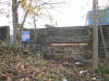
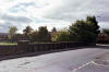
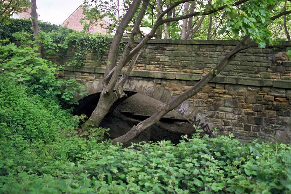
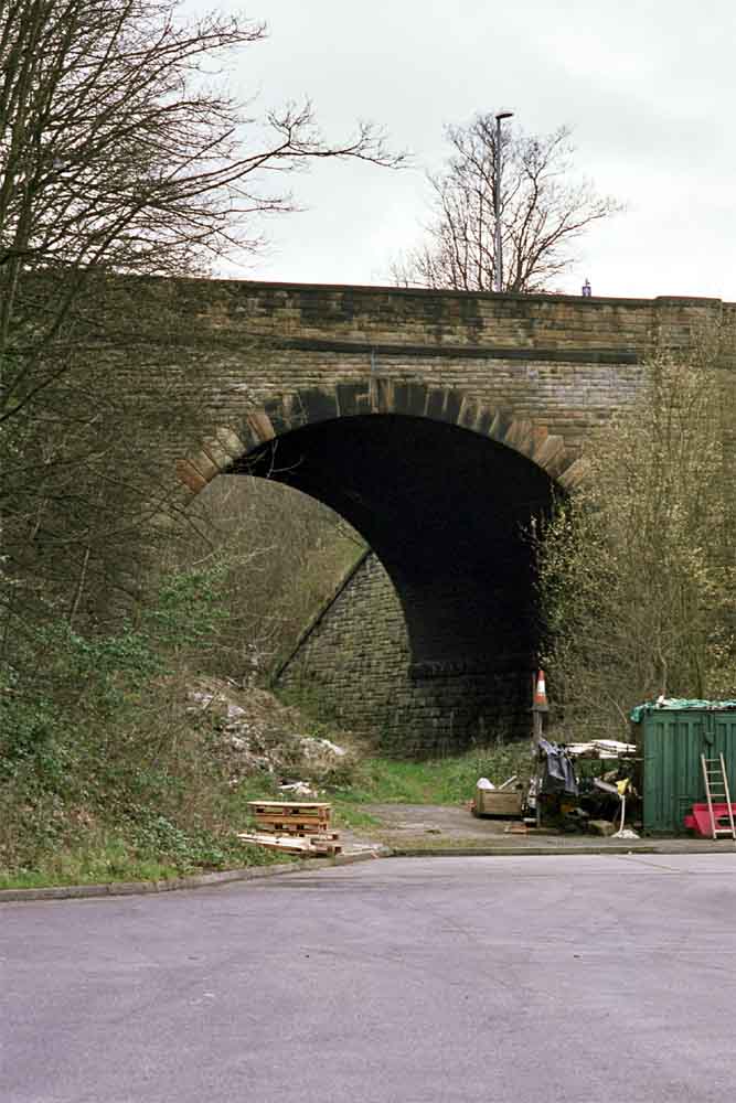
 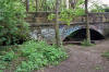  Bridge
(29-05-15) : Malcolm Mallison Bridge
(29-05-15) : Malcolm Mallison
A short section of trackbed can be walked from
Mount Pleasant Road to Lowtown, where I found this bridge- I assume once
gave access to a mill or something from The Lanes. Western end now
blocked by housing, and unused in decades. |
Pudsey Lowtown station
 Opened 01-04-1878.
Closed 15-06-1964. Opened 01-04-1878.
Closed 15-06-1964.
Pudsey Lowtown
(c1933) : Malcolm Mallison
From the 1933 Survey- Bramley, Armley & Wortley, Pudsey Lowtown. |
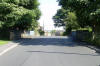
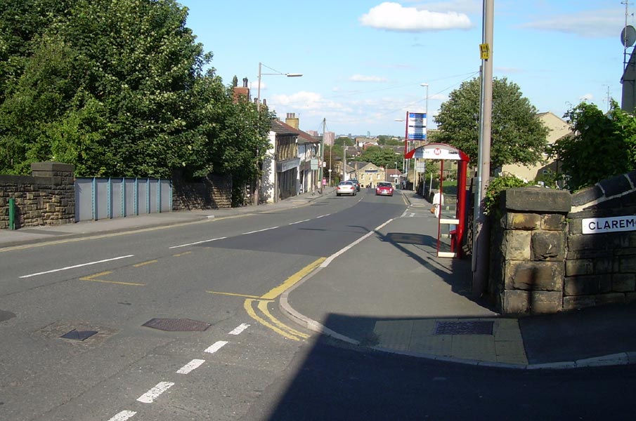
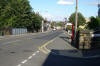 Low
Town Road B6154 (25-07-09) : David Webdale Low
Town Road B6154 (25-07-09) : David Webdale
Facing East. Pudsey Low Town station was situated on the right. New
houses built on the site.
See also Pudsey photo set on the Leeds & West Yorkshire
railway group -
http://www.flickr.com/photos/reinholdbehringer/sets/72157600062118665/ |
 Low
Town Road B6154 (25-07-09) : David Webdale Low
Town Road B6154 (25-07-09) : David Webdale
View of the bridge from down on the right. Standing on the site of the
old station. |
 Longfield
road (25-07-09) : David Webdale Longfield
road (25-07-09) : David Webdale
Down the bottom end of Longfield road, near Longfield Court. Small
overbridge allowing footpath access to nowhere.
Allotments to the right. |
 Longfield
road (25-07-09) : David Webdale Longfield
road (25-07-09) : David Webdale
Closer view of the brickwork. |
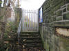
 Robin
lane (25-07-09) : David Webdale Robin
lane (25-07-09) : David Webdale
Facing north, Ravens Mount road on the right. |
 Robin
lane (25-07-09) : David Webdale Robin
lane (25-07-09) : David Webdale
The view of the right hand side of the bridge from the footpath. |
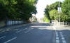
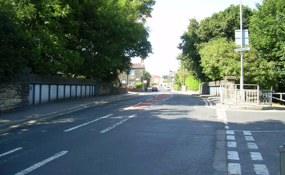
 Radcliffe
lane (25-07-09) : David Webdale Radcliffe
lane (25-07-09) : David Webdale
The View down Radcliffe Lane, facing east. |
 South
Parade (25-07-09) : David Webdale South
Parade (25-07-09) : David Webdale
Footpath crossing at the corner of South Parade, facing east towards
Littlemoor road. |
 New
Street (25-07-09) : David Webdale New
Street (25-07-09) : David Webdale
Facing east down New street. Pudsey Greenside station to the right.
Housing estate now built on the site. |
 New
Street (25-07-09) : David Webdale New
Street (25-07-09) : David Webdale
Opposite side of the road. That's my daughter skulking off down the
footpath. |
Pudsey Greenside Station
/013%20Pudsey%20Greenside_small.jpg) Opened 01-04-1878. Closed 13-06-1964. Opened 01-04-1878. Closed 13-06-1964.
Pudsey Greenside station map (1890) : Malcolm Mallison
6 inch maps from the 1890 survey. Pudsey Greenside was
still a single track terminus in 1890.
It wasn't until 1893 when the extension to Cutlers junction was
opened & the station became a double track through route. |
 Pudsey
Greenside (25-07-09) : David Webdale Pudsey
Greenside (25-07-09) : David Webdale
Looking over the bridge on Carlisle road down onto
the site of Pudsey Greenside. The big city of Leeds visible in the
distance. |
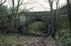
 Carlisle
road (04-06-14) : Malcolm Mallison Carlisle
road (04-06-14) : Malcolm Mallison
Bridge carrying Carlisle road (photographed through a factory fence). |
Pudsey
Greenside Tunnel
Note : Melvyn Aveyard (18-05-06)
I here locally that planning permission has now been granted to backfill
the Greenside tunnel & associated cuttings.
Don't know when this will happen.
Note : Graeme Bickerdike (23-11-06)
website - http://www.forgottenrelics.co.uk/
I took a trip out to Pudsey today to take a look at Greenside tunnel
before it gets lost under the dreaded landfill. No sign yet of work
getting underway.
I understand it will only affect the eastern approach cutting but the
portal will be sealed. Photo's below - |
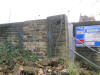
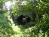
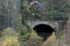
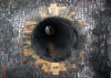
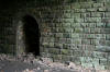
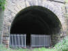
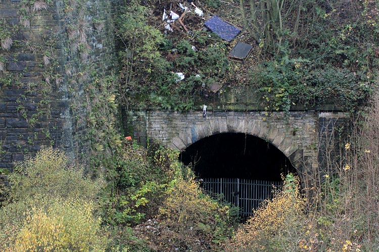
 Pudsey
Greenside tunnel eastern portal (23-11-06) : Graeme Bickerdike Pudsey
Greenside tunnel eastern portal (23-11-06) : Graeme Bickerdike
At the soon-to-be-lost eastern end, the sheer
approach cutting is already used as a rubbish tip.
Planning permission has been granted for this to be infilled. |
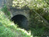
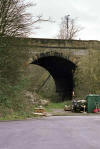
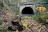
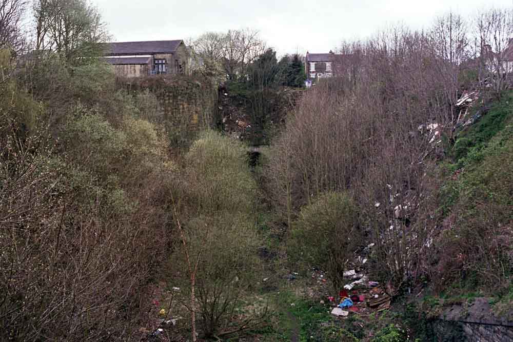
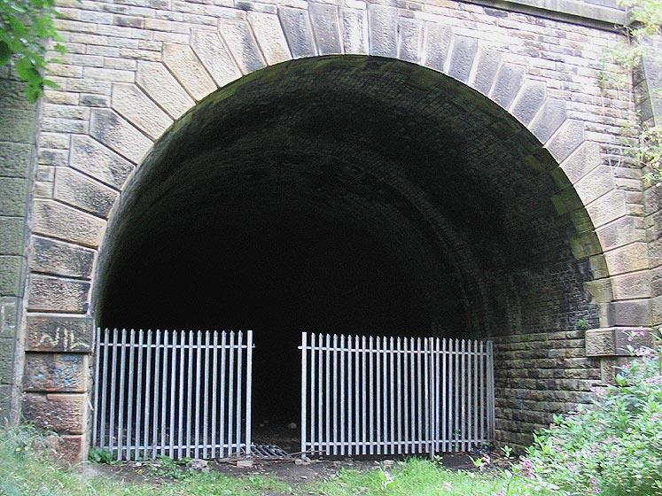
 Eastern
portal (04-06-14) : Malcolm Mallison Eastern
portal (04-06-14) : Malcolm Mallison
Looking west into cutting from Carlisle road bridge. Greenside Tunnel
eastern portal just visible through undergrowth and fly tipping. |
 Pudsey
Greenside tunnel eastern portal (23-11-06) : Graeme Bickerdike Pudsey
Greenside tunnel eastern portal (23-11-06) : Graeme Bickerdike
There’s either been a landslip or tipping close to
the portal, restricting access. This end is to be sealed.
|
 Pudsey
Greenside tunnel eastern portal (01-05-07) : Phill Davison
website -
http://flickr.com/photos/phill_dvsn/sets/72157594397421428/ Pudsey
Greenside tunnel eastern portal (01-05-07) : Phill Davison
website -
http://flickr.com/photos/phill_dvsn/sets/72157594397421428/
Detailed study of the Leeds end portal partly obscured by landslip or
tipping. |
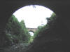 View out of the eastern portal
(31-07-05) : Rikj View out of the eastern portal
(31-07-05) : Rikj
The eastern portal
has an intact security fence, though once again this has been tunnelled
under.
This portal is in a cutting.
P.S. While Googling for info I found out that this eastern portal cutting
is
the one in danger of being land-filled.
This is in addition to the Midland
goods cutting. |
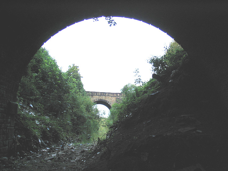
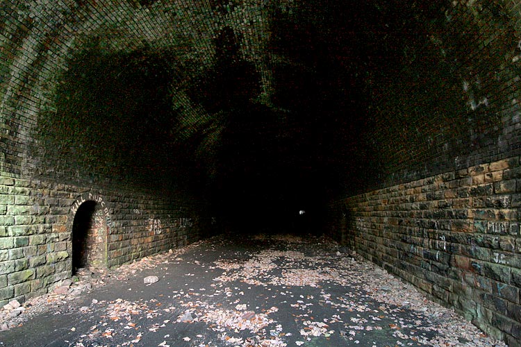
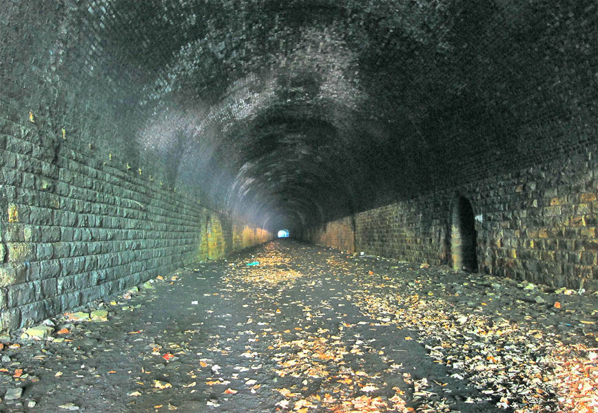
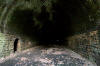 Pudsey
Greenside tunnel interior (23-11-06) : Graeme Bickerdike Pudsey
Greenside tunnel interior (23-11-06) : Graeme Bickerdike
The tunnel itself is 616 yards long, with a curve
to the south. The white splodge to the right of centre is light from the
eastern end.
The walls are stoned-lined whilst the roof is brick. |
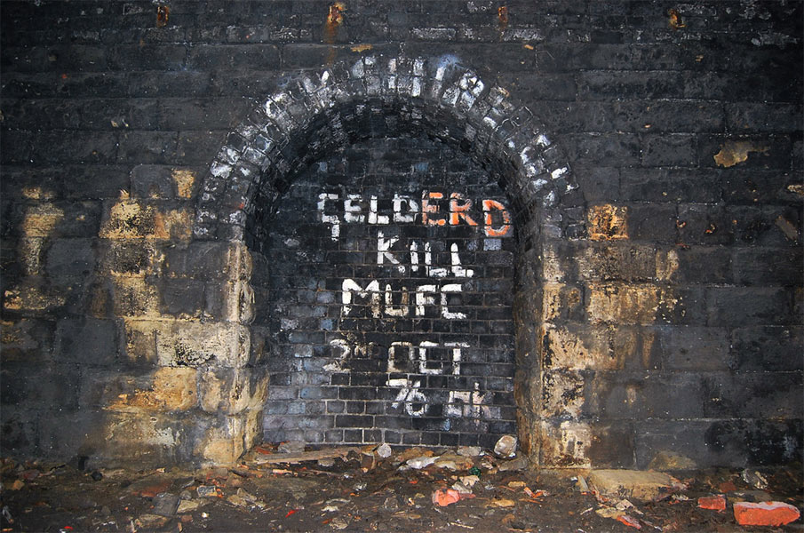
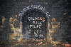 Refuge (16-04-10) : Phill
Davison Refuge (16-04-10) : Phill
Davison
See Phills photo stream on Flickr-
http://www.flickr.com/photos/phill_dvsn/476694432/in/photostream/
Old habits die hard. 2nd October 1976. Football hooligan graffiti in the
abandoned Pudsey Greenside railway tunnel.
Leeds lost 2-0.
|
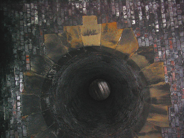
 The
airshaft (31-07-05) : Rikj The
airshaft (31-07-05) : Rikj
The tunnel is generally dry-ish with a couple of leaks in the arched
brick roof. The floor appears to have been graded by something like a
tarmac stripper and is ridged along its length.
All the refuges are intact but we saw no other artefacts.
One nice feature is the air-shaft, which looks to be capped with
concrete. |
 The
airshaft (16-04-10) : Phill Davison The
airshaft (16-04-10) : Phill Davison
This is the only ventilation shaft in Pudsey Greenside tunnel. It's
situated around 413 yards in from the East portal (Leeds end of the
tunnel) The brick lined shaft is around 40/50 feet deep. The top of this
shaft appears to be a circular depression/outline in a back garden on
West Royd Avenue. (see aerial image, and map below) |
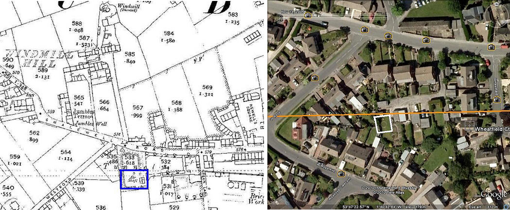
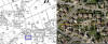 The
airshaft 1908 map & Google Earth (16-04-10) : Phill Davison The
airshaft 1908 map & Google Earth (16-04-10) : Phill Davison
The tunnel appears to be in someone's back garden on West Royd Avenue.
I've marked the circular depression on the Google aerial image & the
1908 map seems to confirm this is where the air shaft is situated today.
(See below) |
The Airshaft Map merge (02-06-10) :
Graeme Bickerdike
website - http://www.forgottenrelics.co.uk/
_small.jpg) The
attached might help in your/Phill D's search for Greenside Tunnel's
ventilation shaft (structure number BPL 14A SH1). The
attached might help in your/Phill D's search for Greenside Tunnel's
ventilation shaft (structure number BPL 14A SH1).
The MapMerge file is an overlay of a GoogleEarth image from 2009 with a
1908/9 map.
This technique works reasonably accurately - usually to within 10 feet
or so. It suggests that Greenside's shaft is beneath an access road to
garages off Wheatfield Court, behind Smalewell Road. It is around 240
yards from the tunnel's west portal. |
_small.jpg) The
Airshaft Circular depression (02-06-10) : Graeme Bickerdike The
Airshaft Circular depression (02-06-10) : Graeme Bickerdike
The other file shows the circular 'depression' spotted by PhillD on the
2009 GoogleEarth view. However this was not there in 2006 (inset). If
you look closely, the feature appears to have a shadow to its right,
suggesting that it is actually some sort of structure. |
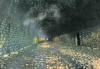 Tunnel (16-04-10) : Phill Davison See Phills photo stream on Flickr-
http://www.flickr.com/photos/phill_dvsn/476694432/in/photostream/ Tunnel (16-04-10) : Phill Davison See Phills photo stream on Flickr-
http://www.flickr.com/photos/phill_dvsn/476694432/in/photostream/
Inside the 616 yard tunnel.
|
_small.jpg) The
Airshaft (02-06-10) : Graeme Bickerdike The
Airshaft (02-06-10) : Graeme Bickerdike
I visited the tunnel yesterday and found that the access gates at both
ends had been dismantled. As a result I was able to capture the attached
view looking towards the east end from the bottom of the shaft. The
tunnel has an S-shaped curvature but you are always in sight of one
entrance. |
 Pudsey
Greenside tunnel interior (23-11-06) : Graeme Bickerdike
website - http://www.forgottenrelics.co.uk/ Pudsey
Greenside tunnel interior (23-11-06) : Graeme Bickerdike
website - http://www.forgottenrelics.co.uk/
The depth of the refuges is unusually generous.
Perhaps the Great Northern took trackworker safety more seriously than
its competitors or maybe it had a fatter workforce! |
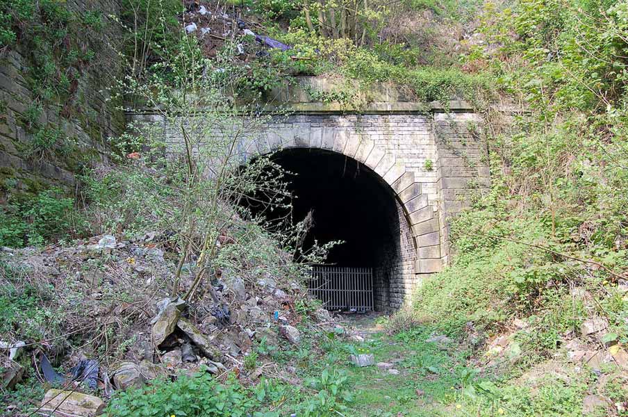
 Western
portal (31-07-05) : Rikj Western
portal (31-07-05) : Rikj
The security gate had been jacked off its hinges. Not sure why as the
padlock had also been removed. Don't know why they bothered doing that
either as it's possible to crawl under the fence anyway. The tunnel
itself shows little sign of vandalism,
graffiti or litter. There are unaccountably lots of pieces of wood
throughout the tunnel. |
 Western portal (23-11-06) : Graeme Bickerdike Western portal (23-11-06) : Graeme Bickerdike
Greenside’s western portal looks out over a
rusting oil drum and the ubiquitous shopping trolley.
Great autumn colours though. |
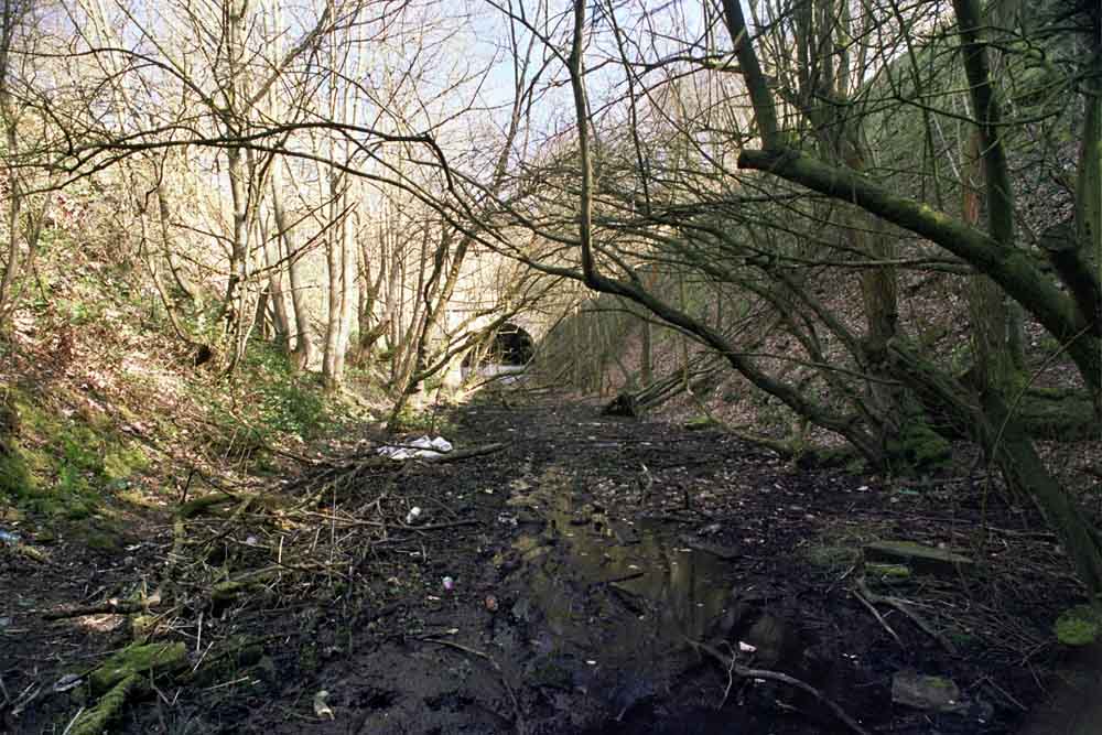
 Western
portal (04-06-14) : Malcolm Mallison Western
portal (04-06-14) : Malcolm Mallison
Tunnel western portal at far end of quagmire, in cutting. |
Pudsey
Greenside tunnel drunken exploration (12-12-05) : Des Phillips
A friend J was lodging in Pudsey after splitting up with
his girlfriend, late 2002. He used to go for last orders with a
beer-oriented mate H at the excellent Fox and Grapes; a pub just above
the West portal of Greenside tunnel. One night when I was visiting him
from Cambridge, after our normal powers of unimaginative common sense
were suitably anaesthetised, we decided that it would be a great idea to
bash the tunnel in darkness by the light of H's rather dim torch. Not
only that, but to take H's two Alsatians out for a nocturnal
subterranean walk, who treated the experience with alacrity as if it
were a walk in the park.
Greenside's a dry, rather pleasant tunnel to bash in comparison to some
others we'd done (by accidentally losing our way on country walks, of
course). Progress through the tunnel was interrupted by J and H stopping
to light roll-up fags... a stiff breeze through the tunnel making
lighting-up difficult. The Alsatians roamed and snuffled around
enthusiastically among the ridges left by the ballast scraping. J even
managed to make an alcophilic call on his mobile half-way through the
tunnel! Don't know how that worked unless we got some peculiar GHz
wave-guiding to the base-station! (I work in radio systems and still
don't know how we achieved that). |
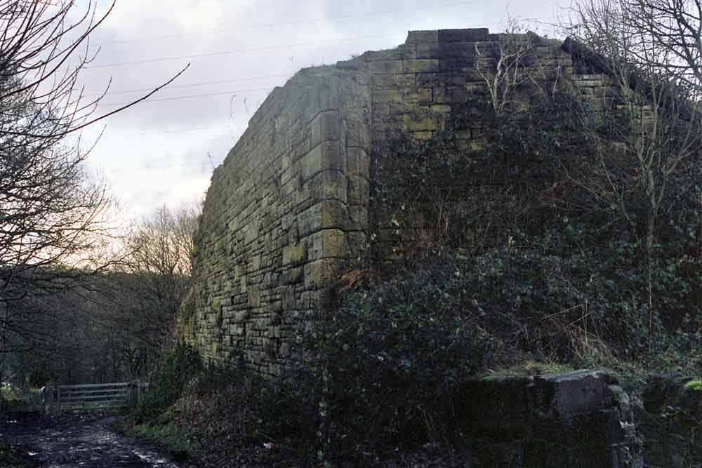
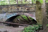
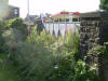
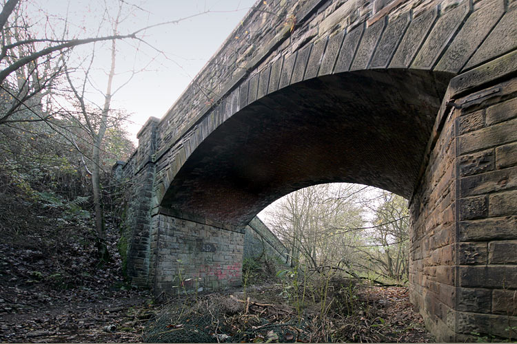
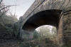 Bridge
(23-11-06) : Graeme Bickerdike Bridge
(23-11-06) : Graeme Bickerdike
Fifty yards from the western portal is a bridge which carried a
lane down the hill to Smalewell quarries.
Beyond it, the line crossed
Pudsey Beck on an embankment which was reputed to be the largest in
Europe. |
 Bridge (04-06-14) : Malcolm Mallison Bridge (04-06-14) : Malcolm Mallison
Footbridge below Windmill Hill. |
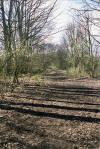 Trackbed (04-06-14) : Malcolm Mallison Trackbed (04-06-14) : Malcolm Mallison
180 degree turn from 004, looking along former trackbed. |
Embankment
/014%20Embankment_small.jpg) Embankment
(1890) : Malcolm Mallison Embankment
(1890) : Malcolm Mallison
6 inch maps from the 1890 survey.
The railway is still under construction in 1890, it wasn't until
1893 when the extension from Pudsey Greenside station to Cutlers
junction was opened. |
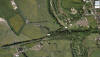 Embankment
Google screen shot (28-08-12) : Andrew Armitage Embankment
Google screen shot (28-08-12) : Andrew Armitage
A series of photos of the embankment between Greenside &
Tyersal & a screenshot from google maps showing where the following
photos were taken. |
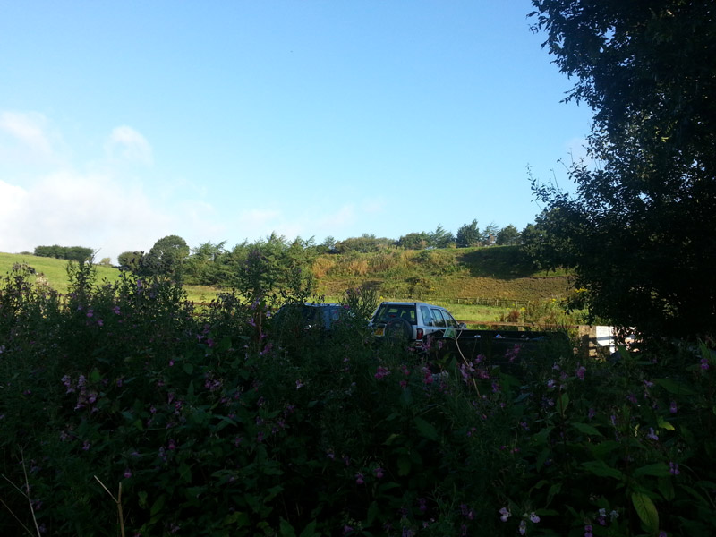
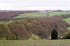
 1
Embankment (28-08-12) : Andrew Armitage 1
Embankment (28-08-12) : Andrew Armitage
The first image shows the entire embankment, which appears as a line of
trees. On the left, the embankment starts just under and to the right of
the two pylons. To the right of the pylon in the centre of the picture,
the power lines cross in front of the Bradford end of the embankment.
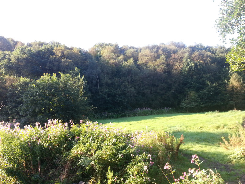
It’s really difficult to discern the embankment despite its size! |
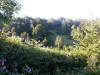 2
Embankment (28-08-12) : Andrew Armitage 2
Embankment (28-08-12) : Andrew Armitage
The second image shows one side of the embankment, close to its tallest
point (i.e. where it crosses the stream) |
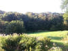 3
Embankment (28-08-12) : Andrew Armitage 3
Embankment (28-08-12) : Andrew Armitage
The third image shows the embankment as you cross the stream.
This is
how it typical appears throughout its length – a long side of a woody
hill.
|
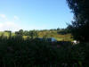
 4
Embankment (28-08-12) : Andrew Armitage 4
Embankment (28-08-12) : Andrew Armitage
Fourth image is approaching the gap in the embankment where it crosses
the path which becomes Tyersal Lane.
|
 5
Embankment (28-08-12) : Andrew Armitage 5
Embankment (28-08-12) : Andrew Armitage
Fifth image is a shot of the Bradford side. |
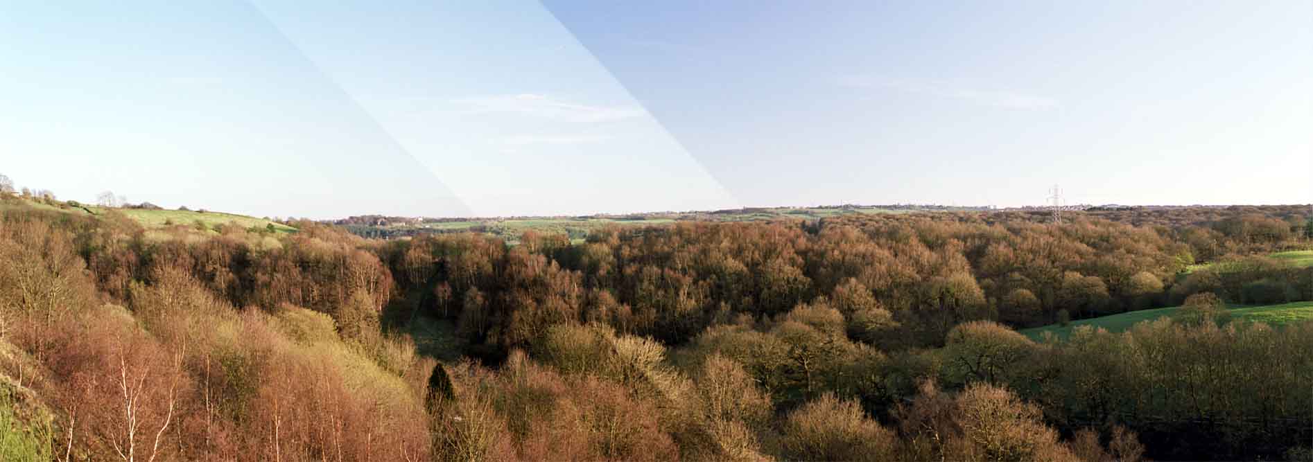
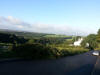
 Embankment (29-05-15) : Malcolm Mallison Embankment (29-05-15) : Malcolm Mallison
Panorama of embankment. |
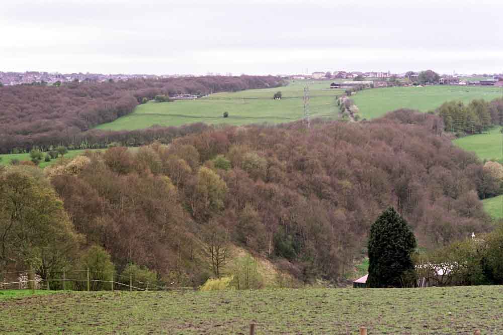
 Embankment (04-06-14) : Malcolm Mallison Embankment (04-06-14) : Malcolm Mallison
Embankment from farmyard just off Tyersal Lane. |
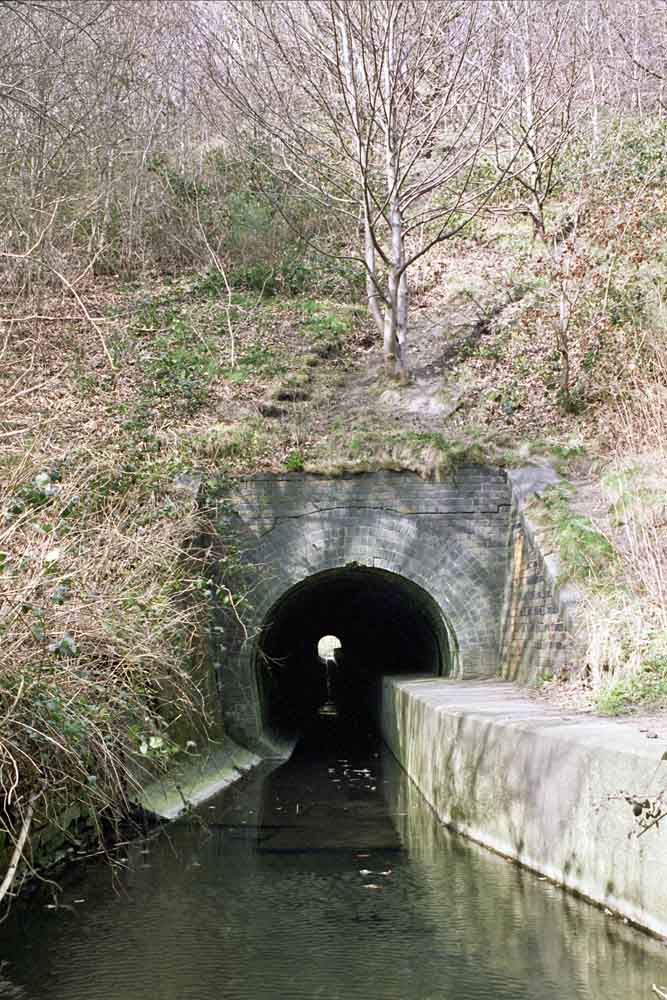
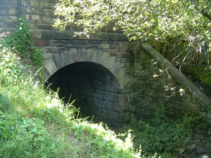
 Culvert (04-06-14) : Malcolm Mallison Culvert (04-06-14) : Malcolm Mallison
Culvert below embankment. |
   Tyersal
Lane
(04-06-14) : Malcolm Mallison Tyersal
Lane
(04-06-14) : Malcolm Mallison
Remains of bridge carrying track across Tyersal Lane. |
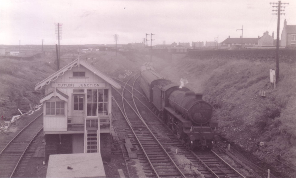
Cutlers
Junction
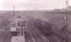 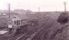 Cutlers Junction (c1960) :
Dennis Sefton Cutlers Junction (c1960) :
Dennis Sefton
Facing south. The Pudsey Loop line curves off to the
left, via Tyersall junction.
The line to Dudley Hill & Ardsley curves off to the right, via Broad
Lane junction . |
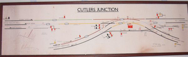
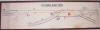 Cutlers
Junction signal box diagram : Mark Neale Cutlers
Junction signal box diagram : Mark Neale
The diagram is dated 29/4/63 signed A F Wigram Chief S&T Engineer. |
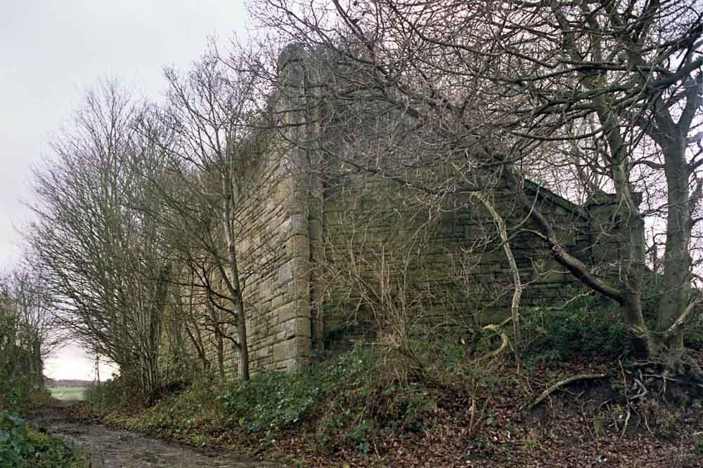
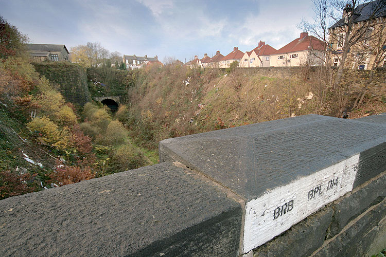
  Arkwright
St (nd) : Malcolm Mallison Arkwright
St (nd) : Malcolm Mallison
Parapet of bridge crossing Arkwright St. Cutting has been infilled.
(above photos taken from this bridge). |

/Bramley.jpg)

/Stanningley.jpg)
/011%20Stanningley.jpg)


/013%20Pudsey%20Greenside.jpg)


.jpg)
.jpg)
.jpg)


/014%20Embankment.jpg)