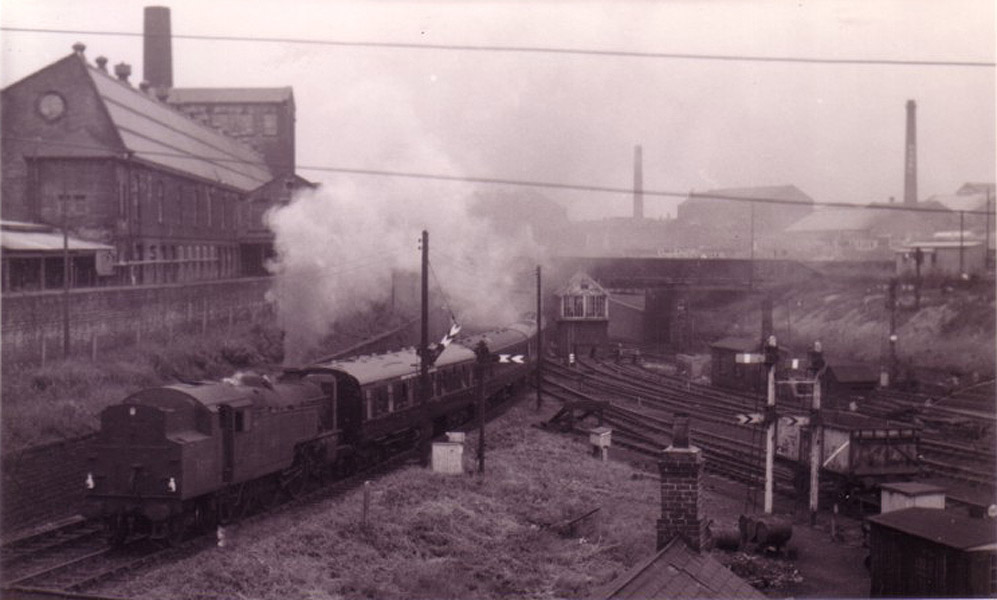
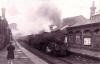
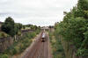
    Trains Illustrated 1957 Trains Illustrated 1957
See also Leeds Bradford
Trains
Illustrated 1957 : Simon Edgerton
The History of Railways between Leeds & Bradford
Rail tour of the West Riding 1 to 4 |
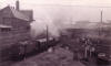
    Trains
Illustrated 1957 : Simon Edgerton Trains
Illustrated 1957 : Simon Edgerton
The History of Railways between Leeds & Bradford
Rail tour of the West Riding 5 to 8 |
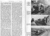
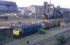
     Trains
Illustrated 1957 : Simon Edgerton Trains
Illustrated 1957 : Simon Edgerton
The History of Railways between Leeds & Bradford
Rail tour of the West Riding 9 to 13 |
 Leeds
west map Leeds
west map
Leeds
west map : David Webdale
See also Leeds west
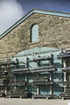
GNR Leeds Central station, Holbeck & Wortley. |
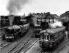 Leeds
Joint Central station & goods depot Leeds
Joint Central station & goods depot
Opened 1884. Closed 1967.
Leeds Central (n.d) : Dave Walbank
see Leeds West
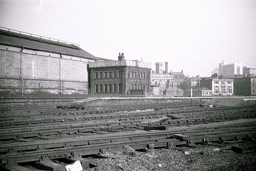
Leeds Central station |
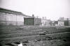 Leeds
Central (n.d) : Dave Walbank Leeds
Central (n.d) : Dave Walbank
Leeds Central station before demolition. |
Holbeck high level station
see Leeds West
 Holbeck
high level station (23-10-06) :
Phill Davison Website -
http://www.flckr.com/photos/phill_dvsn/ Holbeck
high level station (23-10-06) :
Phill Davison Website -
http://www.flckr.com/photos/phill_dvsn/
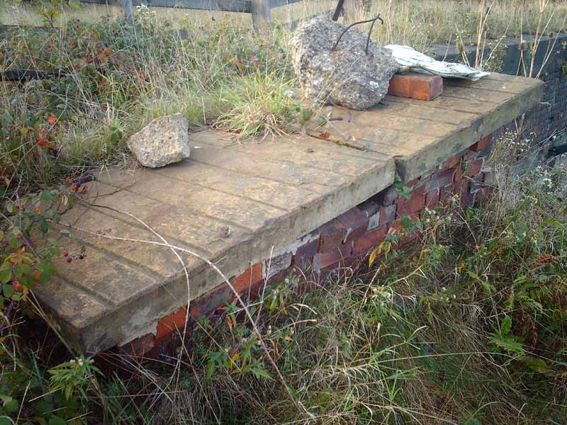
This is the only remains of the much photographed Holbeck high level
station. |
 Holbeck
high level station (23-10-06) :
Phill Davison Holbeck
high level station (23-10-06) :
Phill Davison
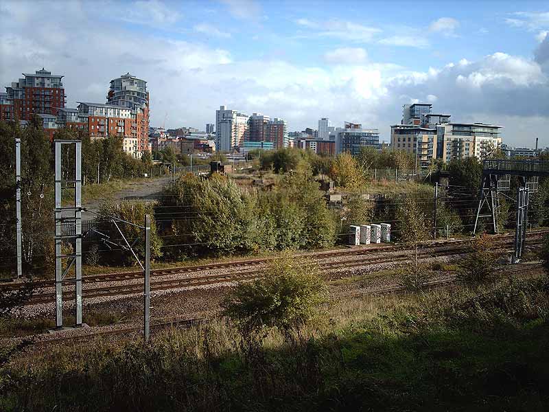
The view from Whitehall jnct looking over the removed bridge section towards
Leeds.
I’m stood on the exact spot where platform 1 of Holbeck high level
was. |
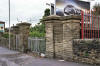
Armley & Wortley
/Armley_small.JPG) Station
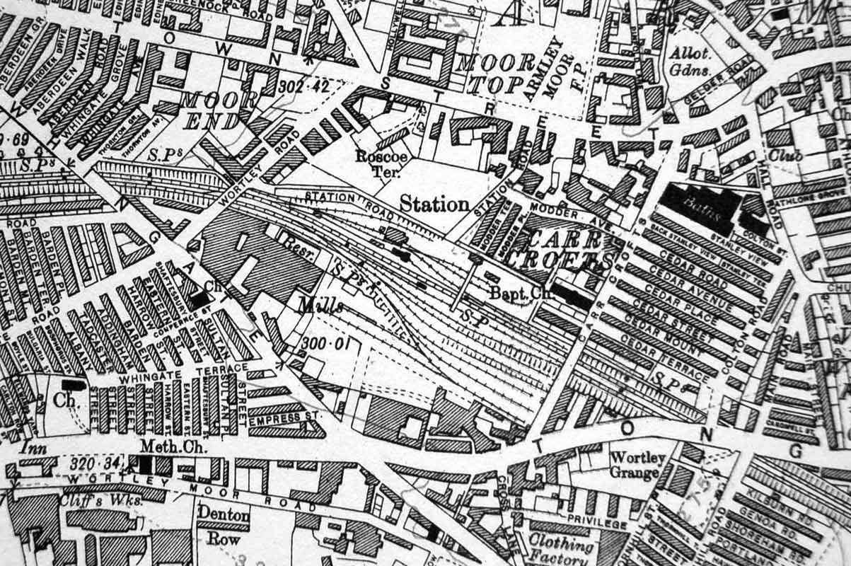
map (1850) : Malcolm Mallison Station
map (1850) : Malcolm Mallison
Plans of station taken from 1850 6 inch to the mile map. |
 Armley
& Wortley
(c1933) : Malcolm Mallison Armley
& Wortley
(c1933) : Malcolm Mallison
From the 1933 Survey- Bramley, Armley & Wortley, Pudsey Lowtown. |
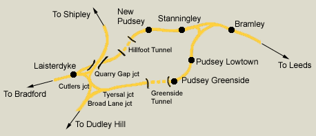
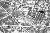
Laisterdyke
& Cutlers Junction
A closer view showing Bramley Stanningley, Laisterdyke & all the junctions around Tyersal.
Laisterdyke east junction (situated immediately to the east of Laisterdyke)
is not labelled on the map.
The Pudsey loop is also shown See
GNR Pudsey Loop
|
Bramley station See also
Pudsey Loop
/Bramley_small.jpg) Station
map (1850) : Malcolm Mallison Station
map (1850) : Malcolm Mallison
Plans of station taken from 1850 6 inch to the mile map. |
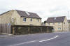
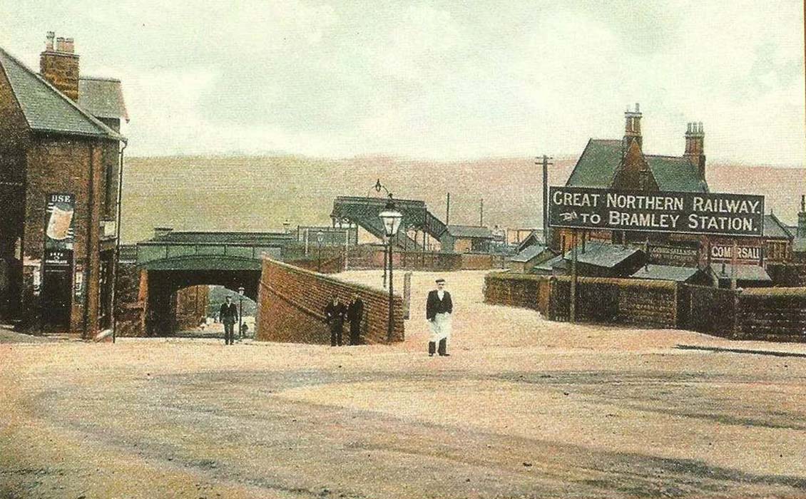
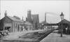 Bramley
station (nd) : Ian Jenkins Bramley
station (nd) : Ian Jenkins
Bramley railway station. |
 Bramley
station (nd) : Ian Jenkins Bramley
station (nd) : Ian Jenkins
Bramley railway station. |
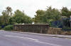
Stanningley Station See also
Pudsey Loop
 Opened 01-08-1854. Closed 01-01-1968. Opened 01-08-1854. Closed 01-01-1968.
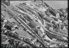
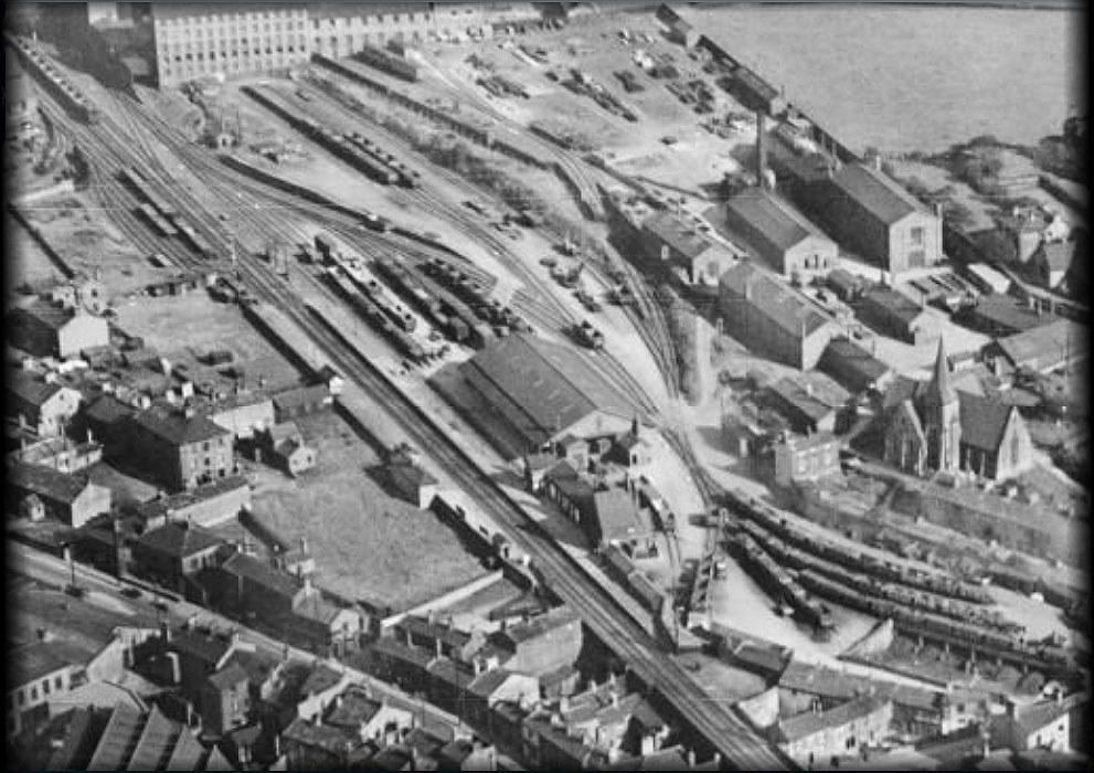
Stanningley station Aerial (nd) : Ian Jenkins
Stanningley Railway Station. |
/Stanningley_small.jpg) Stanningley
station map (1850) : Malcolm Mallison Stanningley
station map (1850) : Malcolm Mallison
Plans of station taken from 1850 6 inch to the
mile map. |
/011%20Stanningley_small.jpg) Stanningley
station map (1890) : Malcolm Mallison Stanningley
station map (1890) : Malcolm Mallison
6 inch maps from the 1890 survey. |
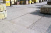
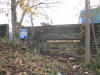
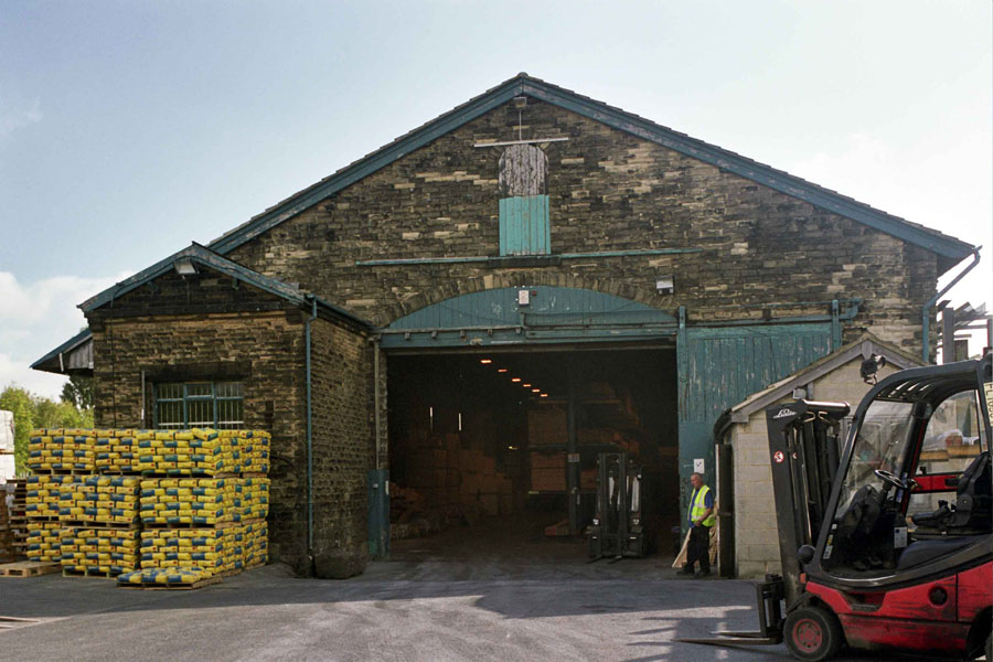
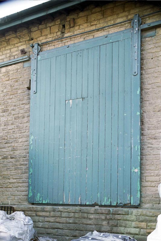
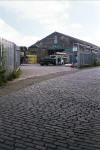 Stanningley
station Goods shed (25-09-12) : Malcolm Mallison Stanningley
station Goods shed (25-09-12) : Malcolm Mallison
The goods shed at Stanningley station survives almost intact in a
builders’ merchant. My thanks to the staff at Gibbs & Dandy for their
permission and assistance. Here is a general view (partly obstructed by
Transit) showing stone setts in yard. |
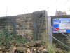
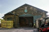 Stanningley
station Goods shed (25-09-12) : Malcolm Mallison Stanningley
station Goods shed (25-09-12) : Malcolm Mallison
Western end. Left hand door appears to be only major component missing. |
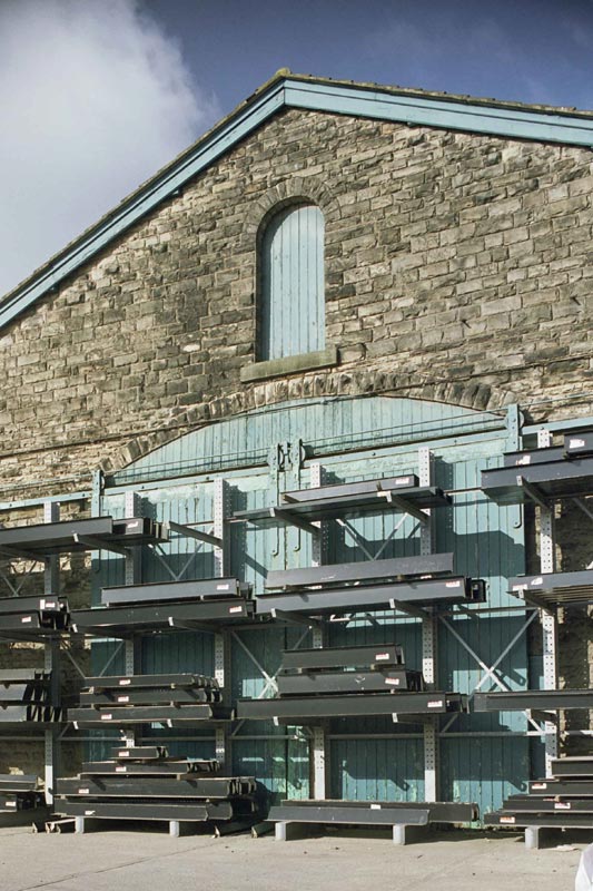
 Stanningley
station Goods shed (25-09-12) : Malcolm Mallison Stanningley
station Goods shed (25-09-12) : Malcolm Mallison
Canopy on north side |
 Stanningley
station Goods shed (25-09-12) : Malcolm Mallison Stanningley
station Goods shed (25-09-12) : Malcolm Mallison
All side loading doors are in place, but only one isn’t obscured by
racking. |
 Stanningley
station Goods shed (25-09-12) : Malcolm Mallison Stanningley
station Goods shed (25-09-12) : Malcolm Mallison
Eastern end. See what I mean about racking. |
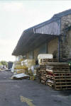
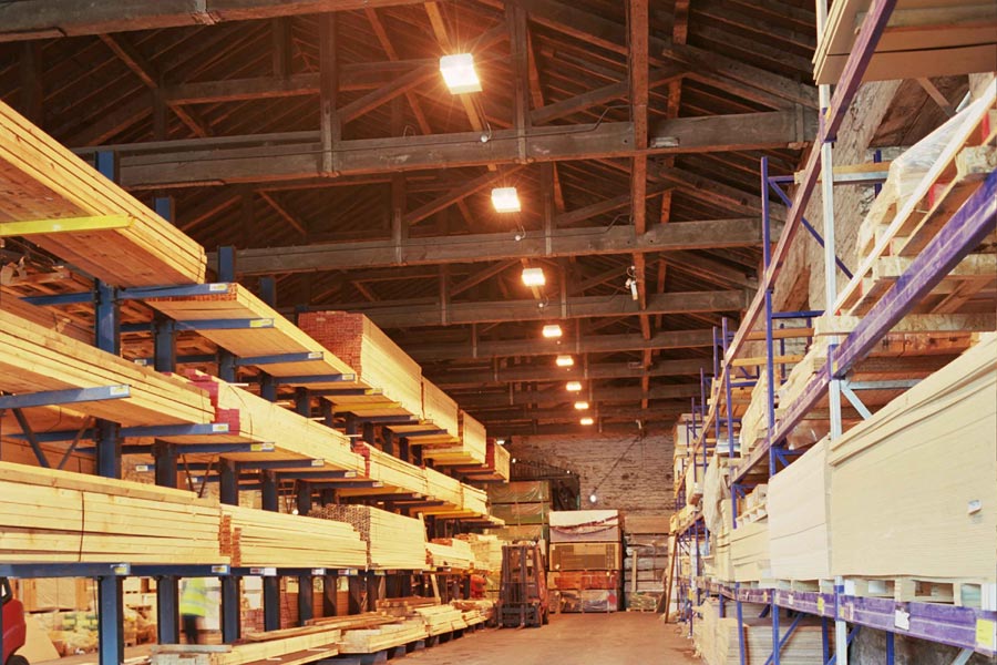
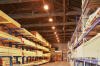 Stanningley
station Goods shed (25-09-12) : Malcolm Mallison Stanningley
station Goods shed (25-09-12) : Malcolm Mallison
Interior view, showing roof timbers. |
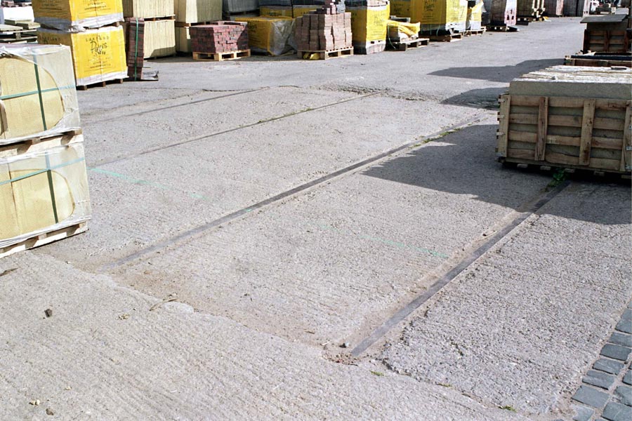
 Stanningley
station Goods shed (25-09-12) : Malcolm Mallison Stanningley
station Goods shed (25-09-12) : Malcolm Mallison
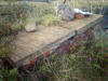
Short section of rail still visible in yard. |
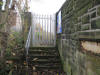
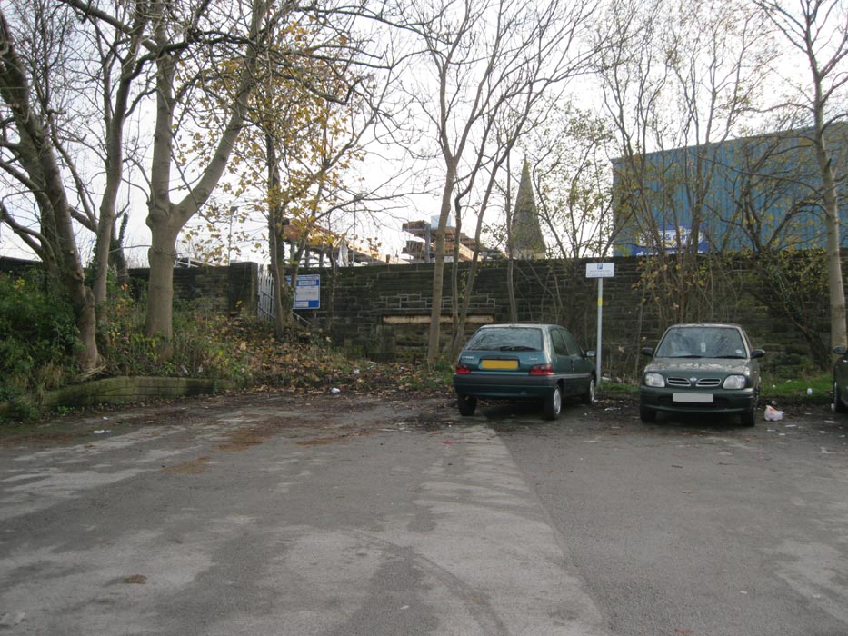
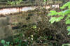 Stanningley
station subway (25-09-12) : Malcolm Mallison Stanningley
station subway (25-09-12) : Malcolm Mallison
Remains of pedestrian tunnel almost buried in undergrowth behind public
car park. |
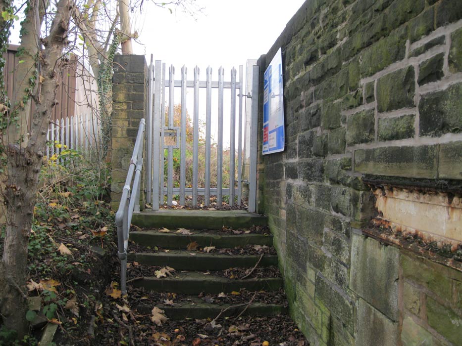
 Stanningley
station subway (25-11-14) : Rita Bostock Stanningley
station subway (25-11-14) : Rita Bostock
Stanningley station entrance & subway off the B6157 Bradford road. |
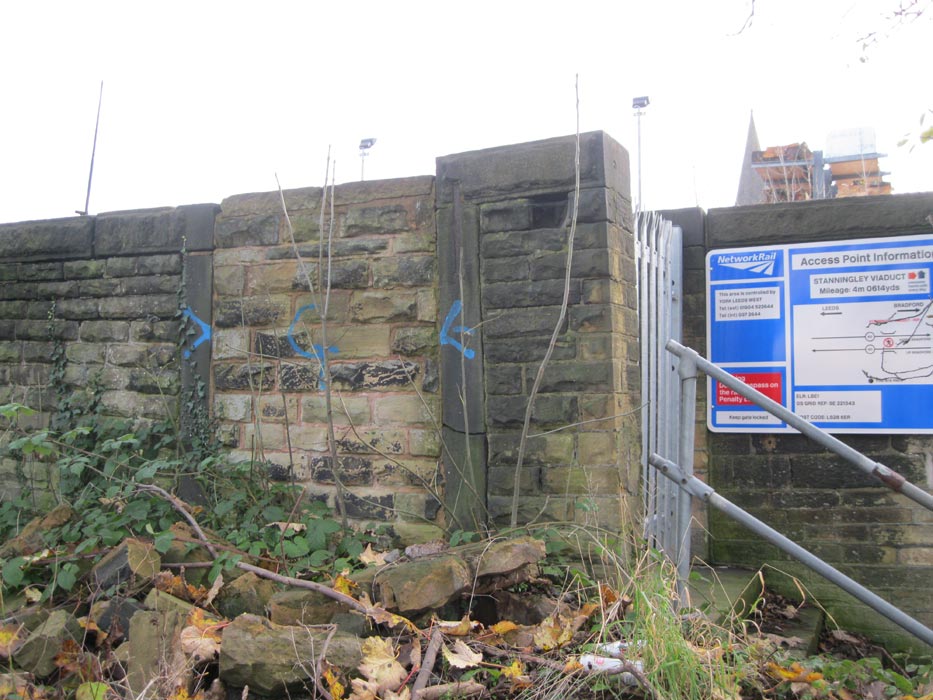
 Stanningley
station
subway (25-11-14) : Rita Bostock Stanningley
station
subway (25-11-14) : Rita Bostock
Close up of the half buried subway entrance. |
 Stanningley
station entrance (25-11-14) : Rita Bostock Stanningley
station entrance (25-11-14) : Rita Bostock
Stanningley entrance & subway off the B6157 Bradford road. |
 Stanningley
station entrance (25-11-14) : Rita Bostock Stanningley
station entrance (25-11-14) : Rita Bostock
Stanningley station entrance & subway. |
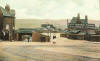
Quarry Gap Junction
& GNR Leeds Bradford - Laisterdyke Shipley Crossing
  Quarry Gap
Junction & GNR Leeds Bradford - Laisterdyke Shipley crossing (13-03-21) : Ryan Tiffany Quarry Gap
Junction & GNR Leeds Bradford - Laisterdyke Shipley crossing (13-03-21) : Ryan Tiffany
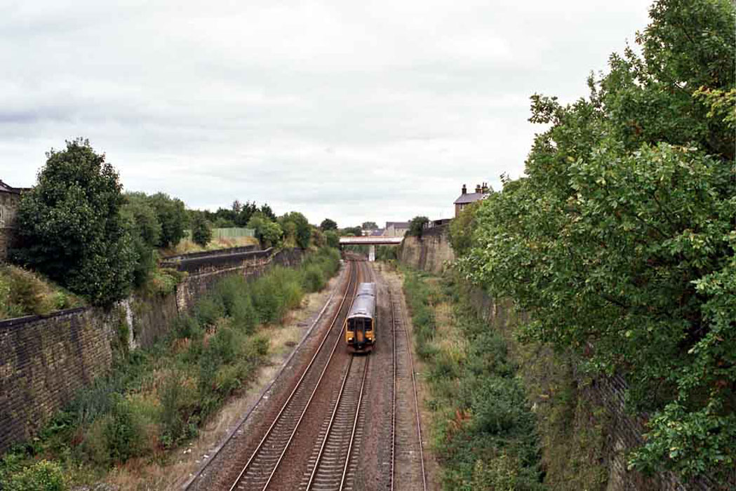
Quarry Gap was situated towards Laisterdyke on the Idle
Branch of the Great Northern. Anyway it is quite close to where I live
so took a walk to see what remains, there isn’t still a great deal to
see although the track bed seems to be buried under a huge amount of
landfill. The remains of the crossing are still there.
See also Laisterdyke Shipley |
Laisterdyke Station
/Laisterdike_small.JPG) Opened
20.8.1856 Closed 04-07-1966 Opened
20.8.1856 Closed 04-07-1966
Laisterdyke station map (1850) : Malcolm Mallison
Plans of station taken from 1850 6 inch to the mile map.
See also Laisterdyke Shipley & Ardsley - Laisterdyke |
/012%20Laisterdyke_small.jpg) Laisterdyke
station map (1890) : Malcolm Mallison Laisterdyke
station map (1890) : Malcolm Mallison
6 inch maps from the 1890 survey. |
Laisterdyke Station (c1960) :
Dennis Sefton
 Facing west towards Bradford. Facing west towards Bradford. |
 Laisterdyke
East Junction (c1960) :
Dennis Sefton Laisterdyke
East Junction (c1960) :
Dennis Sefton
The train on the left is taking the line to Cutlers
junction.
The tracks on the right lead off to Quarry Gap junction &
Leeds, via Pudsey & Stanningley. |
 Laisterdyke
(01-08-1986) : C/O Michael Kaye with permission from Paul Corrie Laisterdyke
(01-08-1986) : C/O Michael Kaye with permission from Paul Corrie
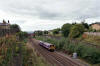
47513 at Laisterdyke 1 August 1986. |
  Laisterdyke station (nd) : Malcolm Mallison Laisterdyke station (nd) : Malcolm Mallison
Site of station from road bridges. Not a solitary remnant
of the station can be seen. |
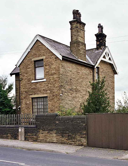
 Laisterdyke station (nd) : Malcolm Mallison Laisterdyke station (nd) : Malcolm Mallison
Station House on New Lane, now rather marooned in
post-industrial desert.
Note : Nicholas Kaye
The old station house that overlooked the station has now
been demolished and modern houses built on the land.
There is now nothing left of what was a grand and busy station. |
 Laisterdyke station (nd) : Malcolm Mallison Laisterdyke station (nd) : Malcolm Mallison
Presumed entrance on Laisterdyke. |
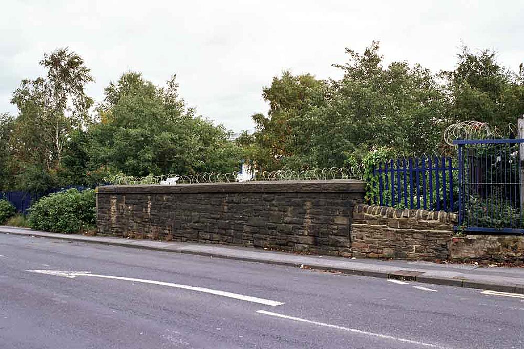
  Dick
Lane (nd) : Malcolm Mallison Dick
Lane (nd) : Malcolm Mallison
Parapet of bridge crossing Dick Lane. West side of road newly built on.
Cutting on east side silted up and overgrown. |
Adolphus Street Terminal See also
Bradford
 Adolphus
street terminal, newspaper cutting (1957) : Andrew Wilson Adolphus
street terminal, newspaper cutting (1957) : Andrew Wilson
Bradford's
other station the Adolphus street terminal. Built for the Leeds,
Bradford & Halifax Junction Railway in 1855.
It was taken over by the
Great Northern Railway but was too far out of the city centre & closed
to passengers in 1867.
It still handled goods in this picture from 1957. |
 Adolphus
street terminal (nd) : Malcolm Mallison Adolphus
street terminal (nd) : Malcolm Mallison
Went looking for the remains of Adolphus St station and the goods
sidings
http://www.britainfromabove.org.uk/image/epw054318.
This is all I could find on Dryden St. Getting my bearings as best I
could and cross referencing with the 1947 1:25000 OS map, this is the
north side of the original Adolphus St building. |

/Leeds%20Bradford%20(GNR).gif)


/Armley.JPG)
/Bramley.jpg)

/Stanningley.jpg)
/011%20Stanningley.jpg)


/Laisterdike.JPG)
/012%20Laisterdyke.jpg)