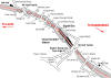
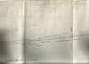
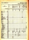
The Leeds New Line route maps
See page 1 for explanation |
|
You are here: Map 3 Heckmondwike
Walkley lane - Well street
|
|
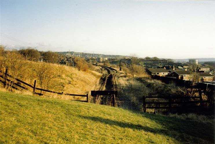
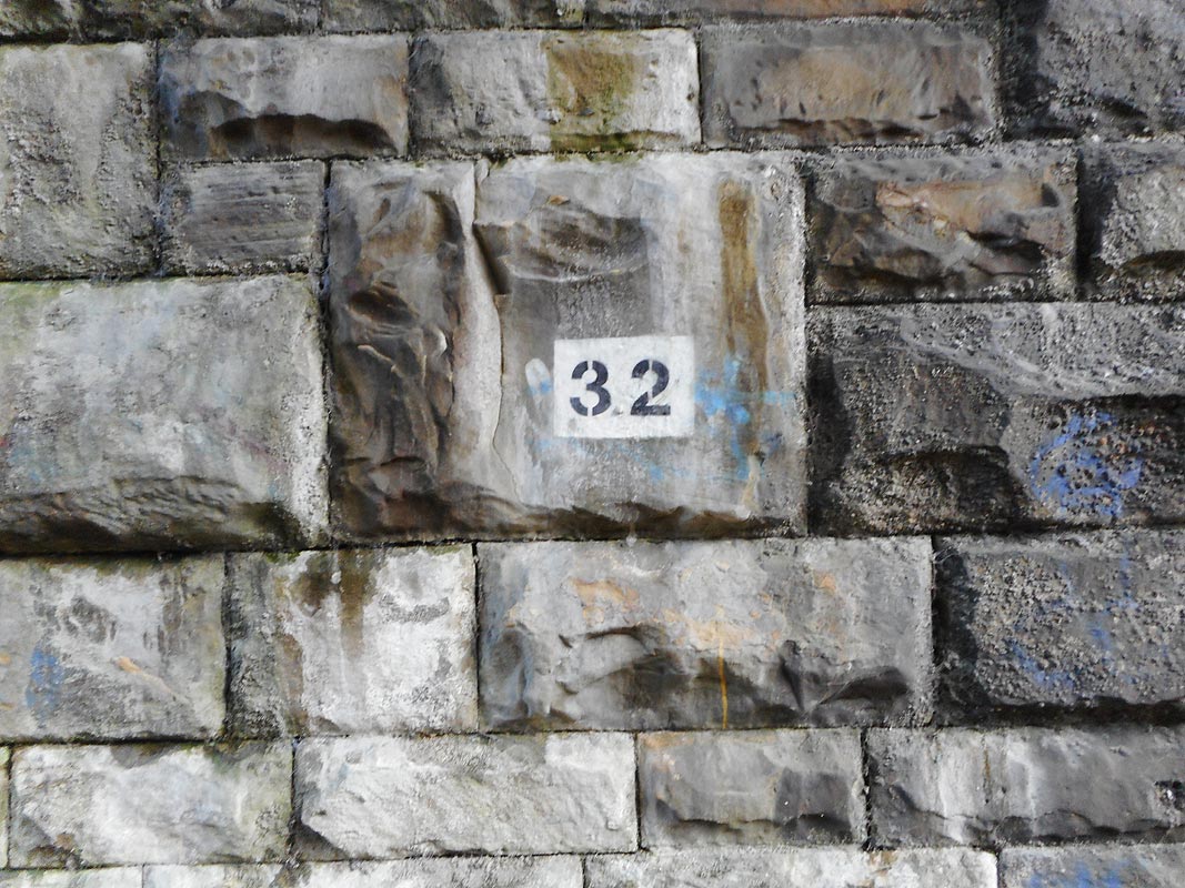
 Map 3 Heckmondwike Map 3 Heckmondwike
Walkley lane to Well street
L.N.W.R Leeds New Line shown in
red
Lancashire & Yorkshire
lines shown in blue
For the Lancashire & Yorkshire lines shown
on this
map -
see Mirfield to Low Moor
Ravensthorpe branch
|
 The
Leeds New Line part 3: Darren Hosker c/o Paul Holroyd The
Leeds New Line part 3: Darren Hosker c/o Paul Holroyd
Youtube from Darren Hosker
https://www.youtube.com/watch?v=H7kRAeeNlAU |
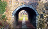
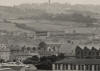
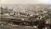
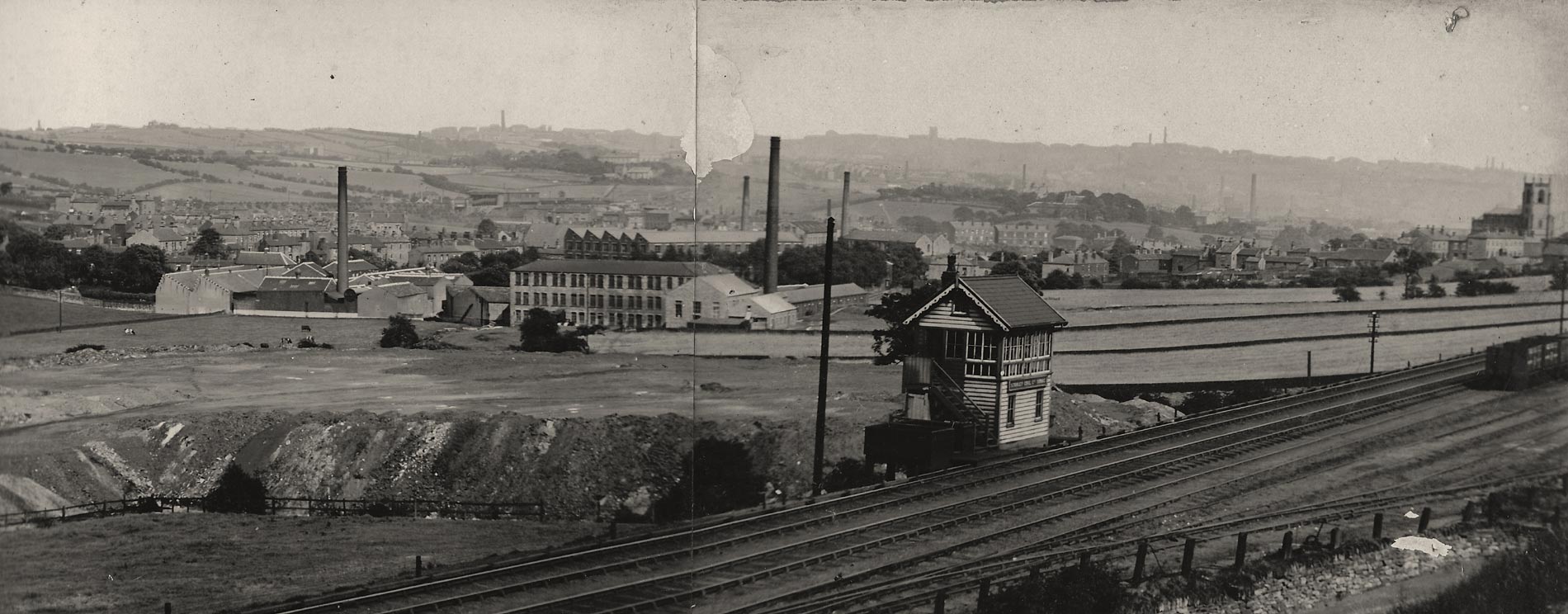
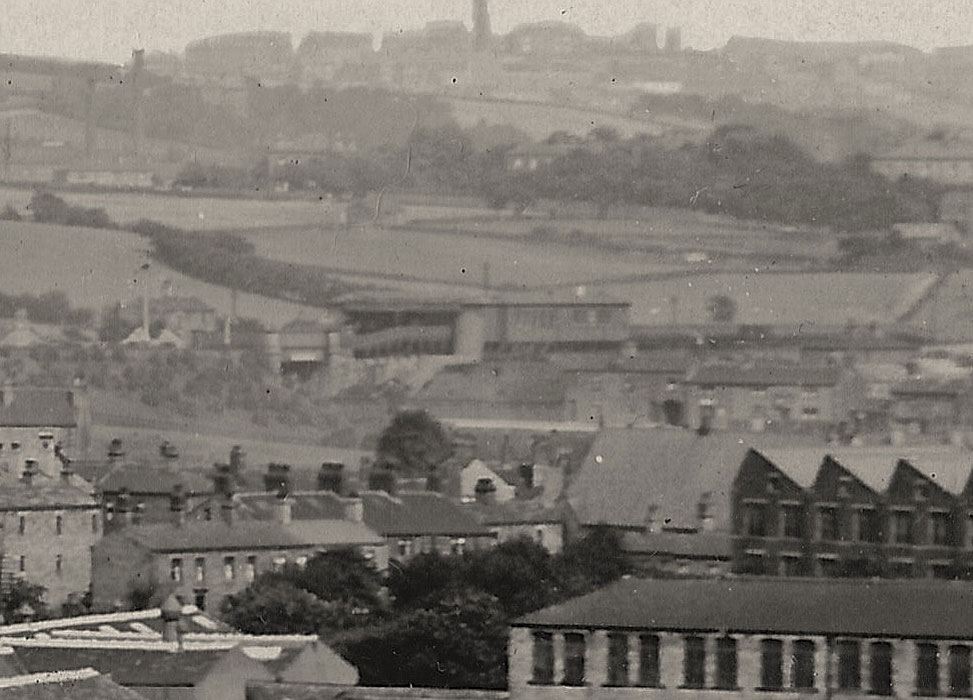
 Heckmondwike : c/o Graham Smith Heckmondwike : c/o Graham Smith
Aerial shots from Bradford Museums & Galleries website.
http://photos.bradfordmuseums.org/index.php?
The 4th of the 5 photos was listed as Bradford. It took me ages to work
out it was actually Heckmondwike looking towards the town from Dewsbury
Moor.
A lovely view of the New Line crossing over the line to Thornhill. |
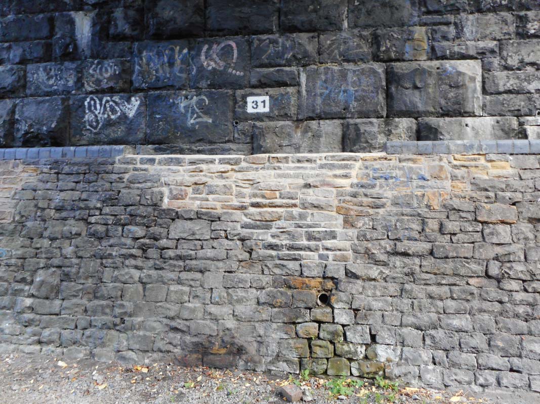
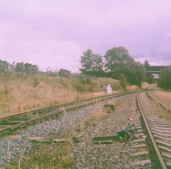
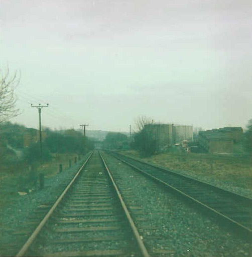
%20%20(9%20to%2025%20%2015-09-02)/9%2048ft%20cutting%20n%20west_small.jpg) 48
ft cutting facing N-West (15-09-02) : David Webdale
48
ft cutting facing N-West (15-09-02) : David Webdale
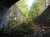
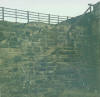
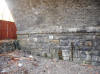
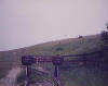
Taken from a footpath just off Walkley lane. Down in the bottom there is
Brunswick street bridge,
the first of 8 bridges through the middle
of Heckmondwike.
The house to the left of the church steeple is shown
close up next photo.
Note : Graham Smith (19-04-07)
The deep cutting next to Walkley Lane has had a lot of activity over the
last weeks. It looks like some sort of landfill activity. I am going to
contact Kirlees Council to find out what’s happening as there has been
no planning application as far as I know and I thought they were going
to make the whole of the old Spen Line onto a cycle path to join up with
the onther one along Dewsbury Moor.
Note : Graham Smith (26-10-17)
The deep cutting next to Walkley Lane and Walkley Terrace may be getting
infilled to allow the building of 96 houses.
What they are going to infill such a large cutting with isn't stated in
the application.
Application number 2017/93488
http://www.kirklees.gov.uk/beta/planning-applications/search-for-planning-applications/default.aspx
There is already a lot of ill feeling against this by the local
residents and I may be writing to the council before the 13th November
deadline to try to oppose this application.
|
%20%20(9%20to%2025%20%2015-09-02)/10%20house%20horton%20st%20&%20sunnyside%20n%20west_small.jpg) Horton street & Francis street Sunnyside facing N-West (15-09-02) Horton street & Francis street Sunnyside facing N-West (15-09-02)
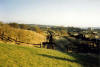
This smart looking house originally built on Church street, was moved in 1887.
It now stands here, on the corner of Horton street & Francis street
Sunnyside. Francis street was cut into two sections when the railway
came through.
The right hand half is called Sunnyside, as the houses all
face south. |
The 80 houses Francis street & Powel
street facing North (15-09-02) : David Webdale
%20%20(9%20to%2025%20%2015-09-02)/11%2080%20houses%20francis%20&%20powel%20st%20north_small.jpg) The L.N.W.R re-housed a number of people displaced by the construction of
the railway in Battyeford & Heckmondwike
126 houses were acquired by the L.N.W.R in various parts of
Heckmondwike. The L.N.W.R re-housed a number of people displaced by the construction of
the railway in Battyeford & Heckmondwike
126 houses were acquired by the L.N.W.R in various parts of
Heckmondwike.
60% were occupied by what the L.N.W.R called the labouring classes.
Plans were approved in 1894 to build 80 new houses at the top of Church
street.
The land was owned by Sir Francis Sharpe Powell Bart M.P. So the new streets were named Francis street & Powell street.
known locally as
the 80 houses.
Total Cost - Houses - £20,267 10s. Streets - £1,786.
The L.N.W.R
argued that they were loads better than the ones they replaced, probably true.
The end of each row has this
distinctive gable end. They're all built to the same design as the
12 houses on Littlemoor road in Battyeford.
(see map 1) |
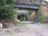
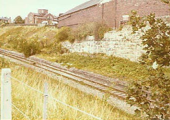
%20%20(9%20to%2025%20%2015-09-02)/24%20church%20st%20(south%2050%20yd%20tunnel%20in%20distance)%20n%20west_small.jpg) Church st
facing N-West (15-09-02) : David Webdale Church st
facing N-West (15-09-02) : David Webdale
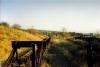
Back to railways, this is the view from the track bed facing in Leeds
direction. Directly in front is Church street bridge,
in the
distance is the south 50 yard tunnel.
It looks like rubbish has been
collected into piles ready for removal, I've heard this part of
the route was going to become a cycle path. |
%20Heckmondwike_small.jpg) 50
yard tunnel (18-11-07) : Ralph Rawlinson 50
yard tunnel (18-11-07) : Ralph Rawlinson
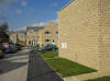
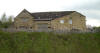
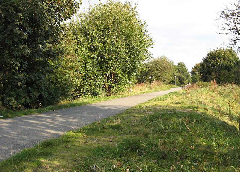
There is new residential building taking place within the cuttings at
Heckmondwike,
but allowances appear to be in place for a footpath link at both ends of
the housing estate. |
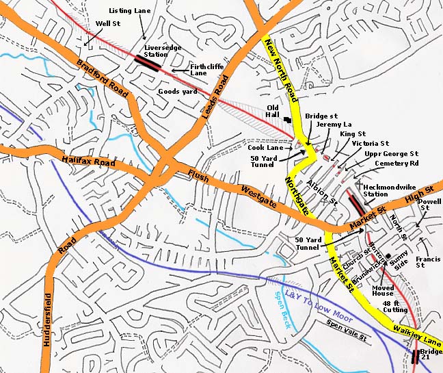
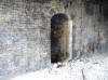
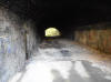
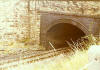
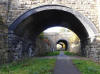
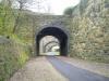
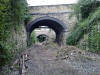
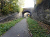
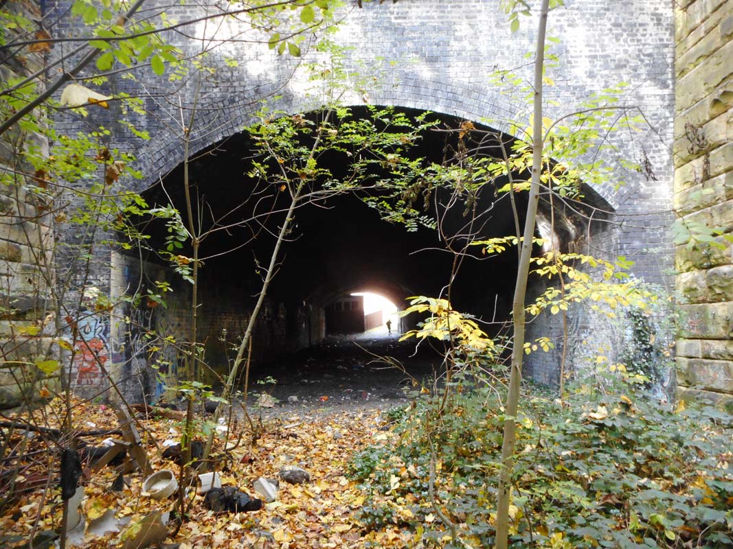
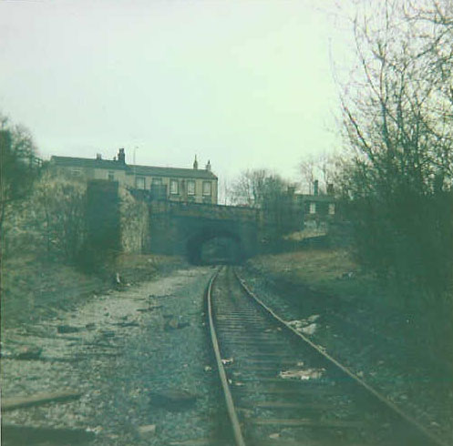
 South
portal 50 yard tunnel (25-10-20) : Paul Holroyd South
portal 50 yard tunnel (25-10-20) : Paul Holroyd
View of the tunnel underneath High Street, Heckmondwike, looking towards
to site of Heckmondwike Spen passenger station. |
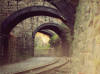
%20%20(9%20to%2025%20%2015-09-02)/23%20south%20portal%20south%2050%20yd%20tunnel%20s%20east_small.jpg) South
portal 50 yard tunnel (15-09-02) : David Webdale South
portal 50 yard tunnel (15-09-02) : David Webdale
Taken from the south 50 yard tunnel & facing back in the Huddersfield
direction towards Walkley Lane.
The bridges in the distance are Church street & Brunswick
street, respectively. |
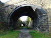
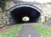
 South
portal 50 yard tunnel (25-10-20) : Paul Holroyd South
portal 50 yard tunnel (25-10-20) : Paul Holroyd
View from the tunnel underneath High Street, Heckmondwike, looking
towards Walkley Lane. |
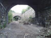
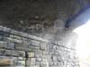
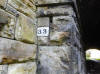
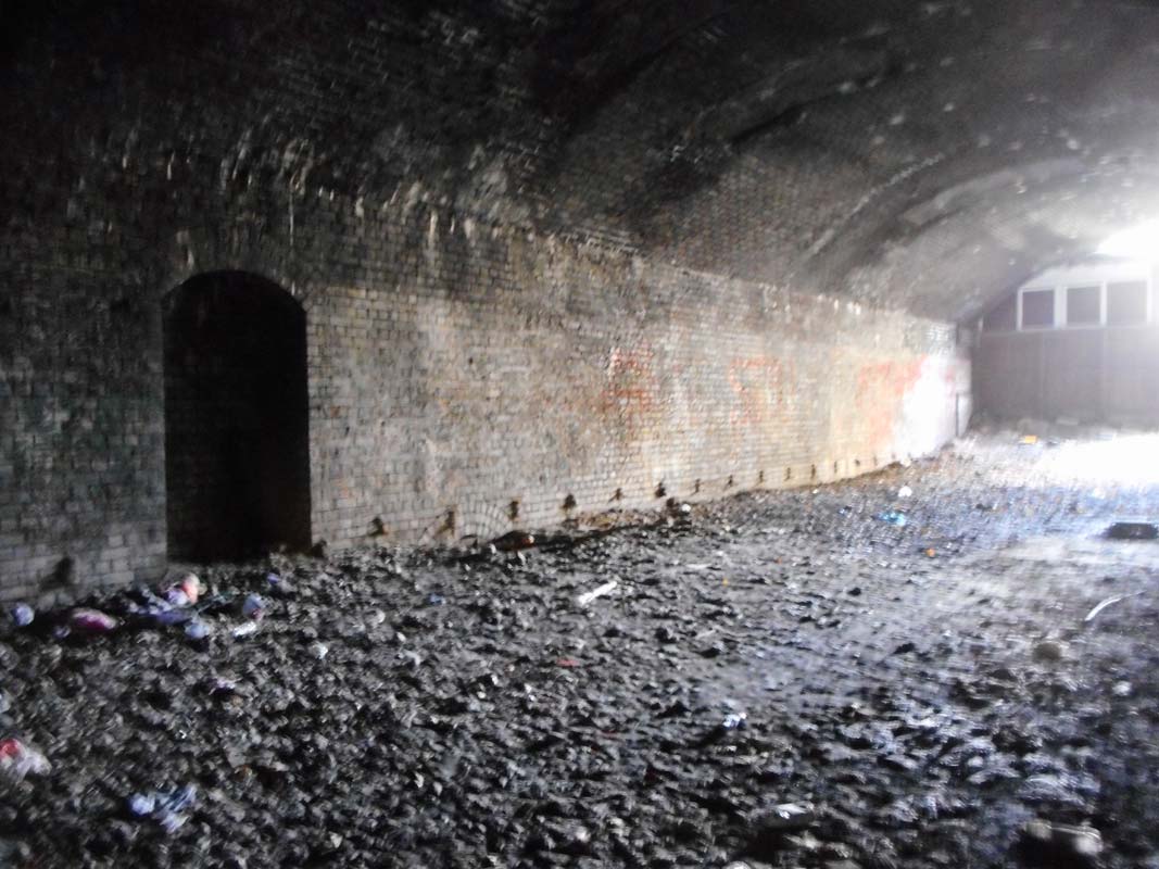
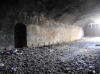 50
yard tunnel (25-10-20) : Paul Holroyd 50
yard tunnel (25-10-20) : Paul Holroyd
Platelayers' refuge inside the tunnel under High Street, Heckmondwike,
looking towards to site of Heckmondwike Spen passenger station. |
 50
yard tunnel (25-10-20) : Paul Holroyd 50
yard tunnel (25-10-20) : Paul Holroyd
Platelayers' refuge inside the tunnel under High Street, Heckmondwike |
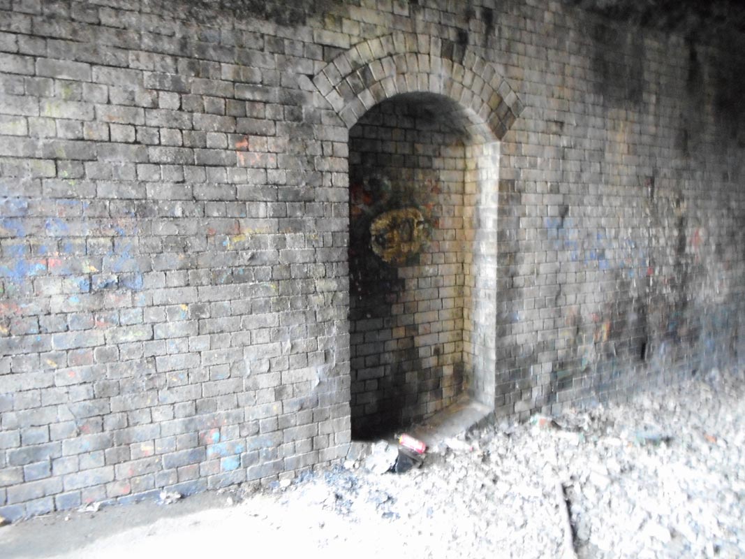
 50
yard tunnel (25-10-20) : Paul Holroyd 50
yard tunnel (25-10-20) : Paul Holroyd
Inside the tunnel under High Street, Heckmondwike |
 50
yard tunnel (25-10-20) : Paul Holroyd 50
yard tunnel (25-10-20) : Paul Holroyd
Inside the tunnel under High Street, Heckmondwike,
looking towards Walkley Lane. |
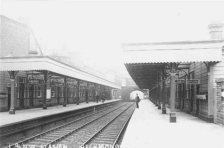
Heckmondwike
Spen station
Opened 01-10-1900. Closed 05-09-1953.
Heckmondwike Spen station map 1908 (Re-named Heckmondwike Spen
in 1924) : David Webdale
 Heckmondwike
Station is situated in cutting, between High street & Cemetery road. Foot &
vehicle access from High street. Heckmondwike
Station is situated in cutting, between High street & Cemetery road. Foot &
vehicle access from High street.
The station buildings were of timber
construction. Platforms were brick with stone flags.
Due to the terrain, the goods yard (opened1st of November 1900)
was situated further south between Walkley Lane & the L & Y Railway Ravensthorpe branch.
The line cut through a heavily populated area of
the old town.
This meant the railway had to buy up large amounts of
property.
The railway company was obliged to re-house people within one
mile of the houses they were demolishing.
This section of line between
the Lancashire & Yorkshire line at Heckmondwike Spen goods yard & the oil
terminal at Liversedge, remained open up until 1986 (one
track only). |
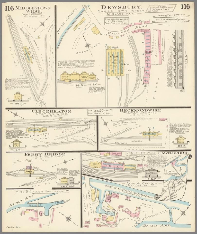
 Layout
Plans : Keith Looker Layout
Plans : Keith Looker
Cleckheaton, Heckmondwike |
 Heckmondwike Spen station (c1980)
: Paul Holroyd
Click here to see selection of
Spen Valley railway tickets & handbills. Heckmondwike Spen station (c1980)
: Paul Holroyd
Click here to see selection of
Spen Valley railway tickets & handbills.
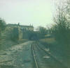
Heckmondwike Spen - the Huddersfield bound platform and the High Street
bridge. |
%20%20(9%20to%2025%20%2015-09-02)/14%20heck%20station%2050%20yd%20tunnel%20s%20east_small.jpg) Heckmondwike
station North portal south 50 yd tunnel facing S-East (15-09-02) : David Webdale Heckmondwike
station North portal south 50 yd tunnel facing S-East (15-09-02) : David Webdale
Taken from the site of Heckmondwike station.
Up on the left there looks
to be evidence of steps up on to High street (see next photo)
There were
wooden station buildings on both sides of the tracks. |
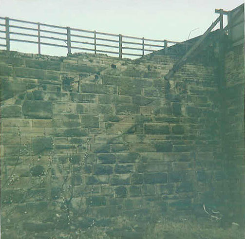
 Heckmondwike
Spen station staircase (1985) :
K Evans Heckmondwike
Spen station staircase (1985) :
K Evans
Heckmondwike Spen former staircase from platform to street level 1985. |
 Heckmondwike Spen
station (25-10-20) : Paul Holroyd Heckmondwike Spen
station (25-10-20) : Paul Holroyd
Tunnel under High Street, Heckmondwike |
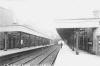
 Heckmondwike
Spen station facing S-East (1986)
:
K Evans Heckmondwike
Spen station facing S-East (1986)
:
K Evans
Same direction, further back.
There was an island platform on the right.
Up on High street, is the Robert Peel pub. |
 Heckmondwike Spen station (c1980)
: Paul Holroyd
website -
www.vintagecarriagestrust.org Heckmondwike Spen station (c1980)
: Paul Holroyd
website -
www.vintagecarriagestrust.org
Heckmondwike Spen station, looking towards Liversedge. The old swimming
baths are in the background. |
 Heckmondwike Spen
station (2007) : Graham Smith Heckmondwike Spen
station (2007) : Graham Smith
Same view in 2007. |
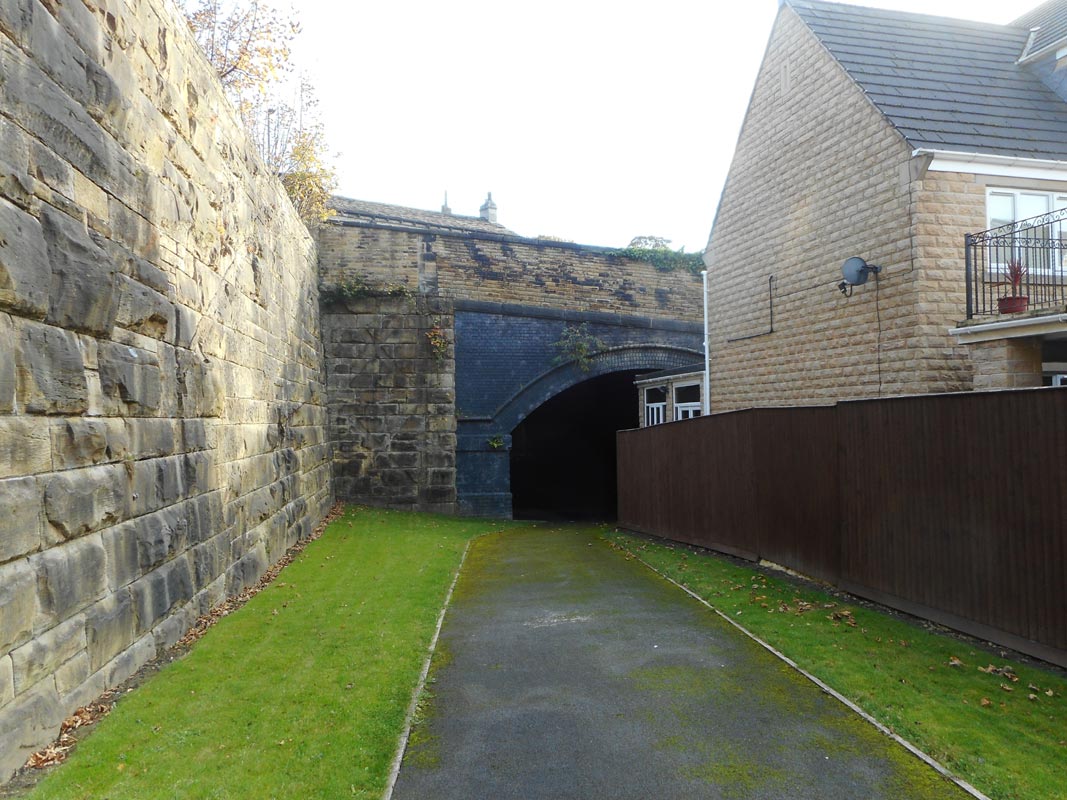
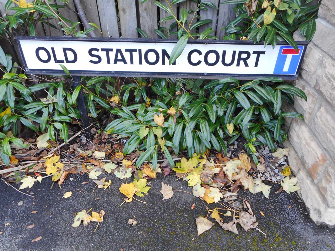
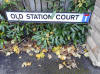 Heckmondwike Spen
station (25-10-20) : Paul Holroyd Heckmondwike Spen
station (25-10-20) : Paul Holroyd
There are two separate pedestrian access points to
Heckmondwike cutting from Old Station Court, which is a cul-de-sac. |
 Heckmondwike
Spen station facing S-East (1900s) : Paul B Heckmondwike
Spen station facing S-East (1900s) : Paul B
Post Card of Heckmondwike Spen station. |
%20%20(9%20to%2025%20%2015-09-02)/13%20heck%20station%20s%20east_small.jpg) Heckmondwike Spen
station facing S-East (15-09-02) : David Webdale Heckmondwike Spen
station facing S-East (15-09-02) : David Webdale
Same view in 2002, rapidly changing in 2006/7. see next photo's.
|
 Heckmondwike Spen
station facing S-East (23-07-06) : Paul B Heckmondwike Spen
station facing S-East (23-07-06) : Paul B
Just thought id send ya this picture, probably the last
chance to see where heckyspen station was before the whole area
becomes
unrecognizable with houses. |
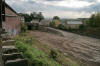 Heckmondwike Spen
station (08-10-06) : Graeme Bickerdike
website - http://www.forgottenrelics.co.uk/ Heckmondwike Spen
station (08-10-06) : Graeme Bickerdike
website - http://www.forgottenrelics.co.uk/
I passed through Heckmondwike on Sunday and discovered that the site of
the Spen station has been levelled in preparation
for a new housing
development. |
 Heckmondwike Spen
station (14-04-07) : Andrew Stopford Heckmondwike Spen
station (14-04-07) : Andrew Stopford
A shot of Heckmondwike Spen. Gone forever. |
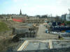
 Heckmondwike Spen
station facing S-East (2007) : Graham Smith Heckmondwike Spen
station facing S-East (2007) : Graham Smith
|
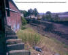
 Heckmondwike Spen station platform facing west (1986)
:
K Evans Heckmondwike Spen station platform facing west (1986)
:
K Evans
Still some evidence of a platform back in 1986. Cemetery road bridge
visible on the right |
%20%20(9%20to%2025%20%2015-09-02)/12%20heck%20station%20n%20west_small.jpg) Heckmondwike Spen station facing N-West (15-09-02)
: David Webdale Heckmondwike Spen station facing N-West (15-09-02)
: David Webdale
Standing on the track bed facing toward Liversedge.
The bridges are (in order
of appearance) - Cemetery road, Upper George street, Victoria street,
King street.
The first two bridges span three track widths. |
 Heckmondwike Spen
station facing N-West (2007) : Graham Smith Heckmondwike Spen
station facing N-West (2007) : Graham Smith
Same spot in 2007. |
 Heckmondwike Spen
station (25-10-20) : Paul Holroyd Heckmondwike Spen
station (25-10-20) : Paul Holroyd
Cemetery road bridge. |
 Heckmondwike Spen
station (25-10-20) : Paul Holroyd Heckmondwike Spen
station (25-10-20) : Paul Holroyd
Cemetery road bridge. |
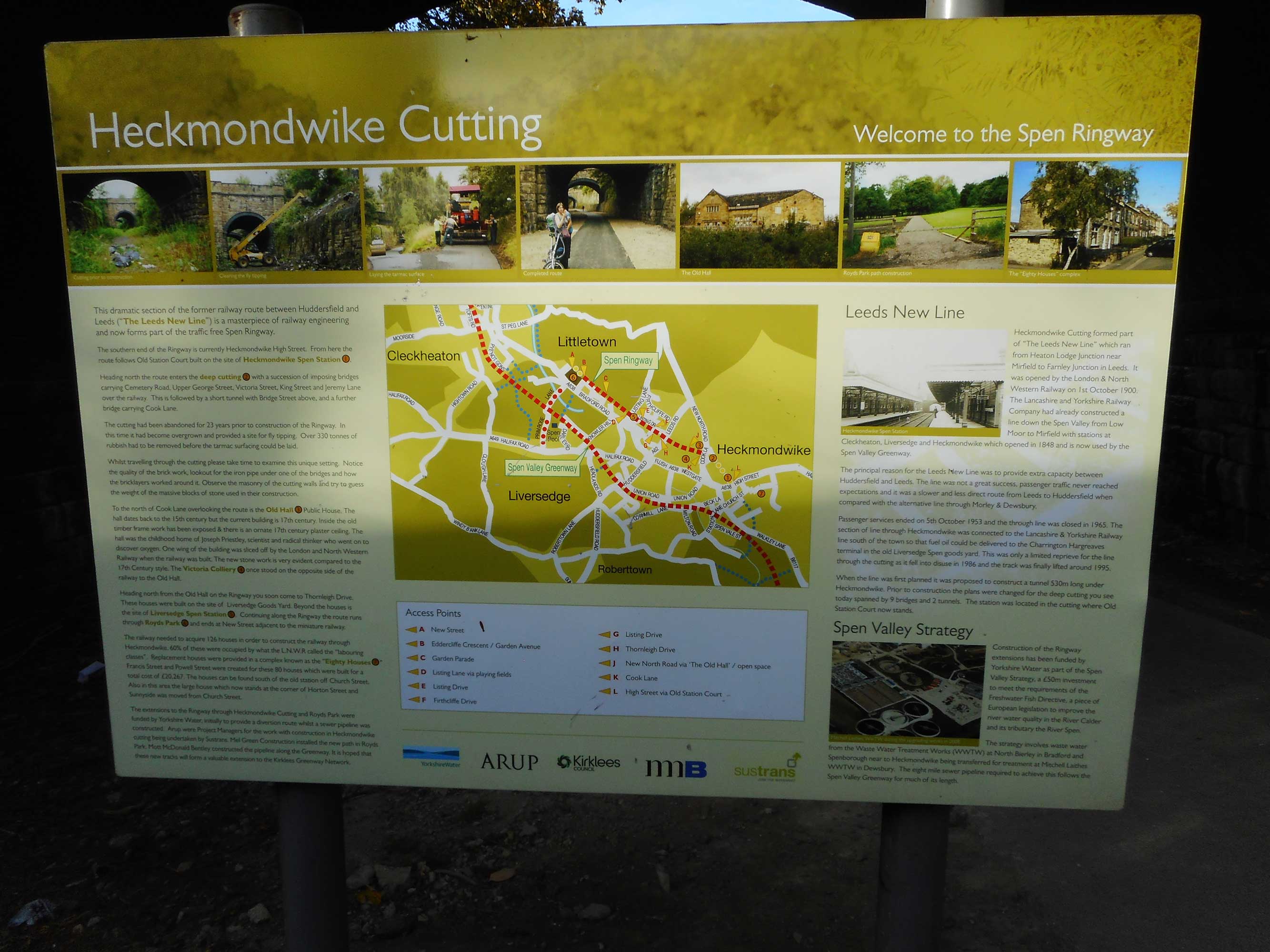
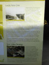  Heckmondwike Spen
station (25-10-20) : Paul Holroyd Heckmondwike Spen
station (25-10-20) : Paul Holroyd
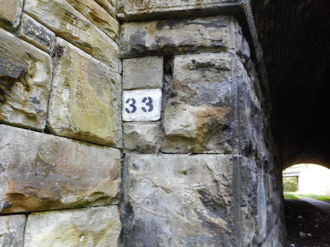
Information board in Heckmondwike cutting. |
 Heckmondwike Spen
station (25-10-20) : Paul Holroyd Heckmondwike Spen
station (25-10-20) : Paul Holroyd
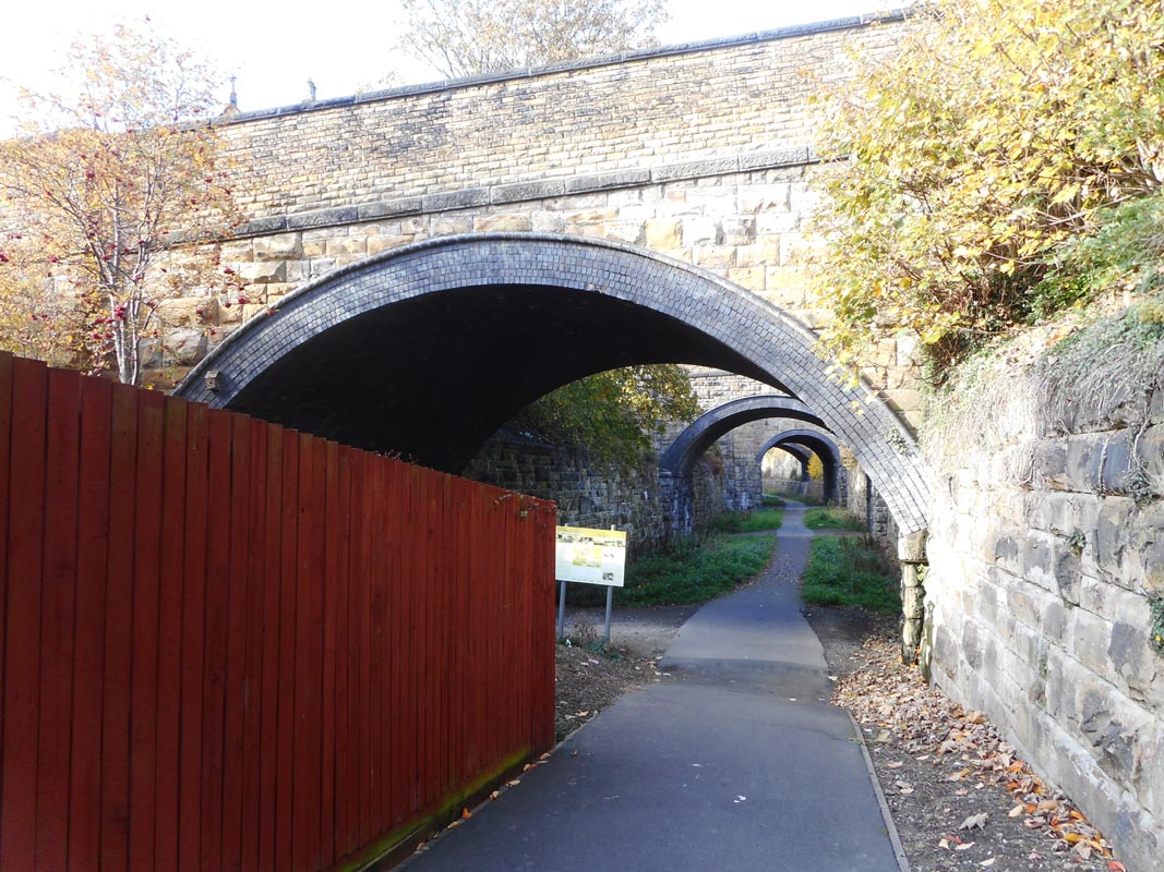
Upper George street, Victoria street & King street. |
 Heckmondwike Spen station (1981)
: c/o Paul Holroyd Click here to see selection of
Spen Valley railway tickets & handbills. Heckmondwike Spen station (1981)
: c/o Paul Holroyd Click here to see selection of
Spen Valley railway tickets & handbills.
Photographer unknown Paul Holroyd collection.
The remaining single track
from the Charrington Hargreaves oil terminal at Liversedge,
curves
through the cutting at Heckmondwike, 1981. |
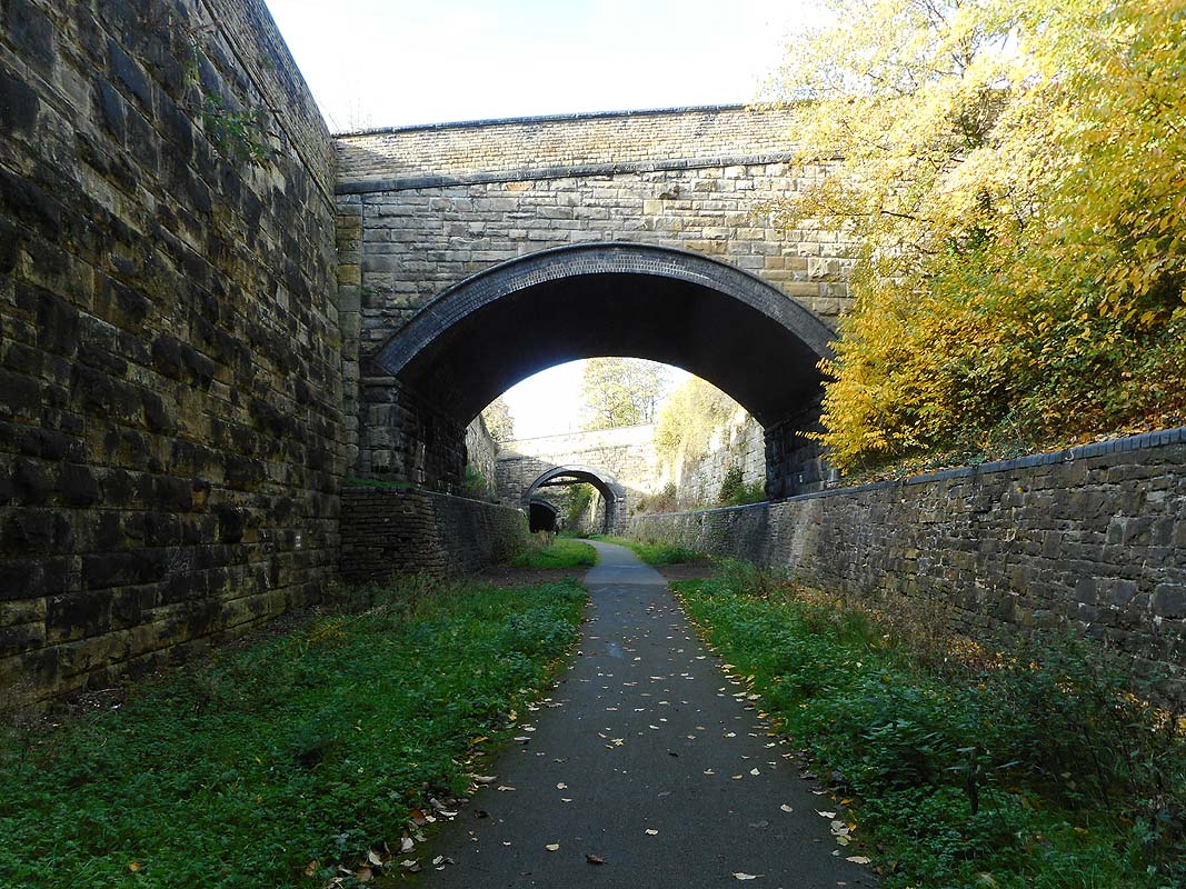
%20%20(9%20to%2025%20%2015-09-02)/16%20under%20king%20st%20s%20east_small1.jpg) Under
King street facing S-East (15-09-02) : David Webdale Under
King street facing S-East (15-09-02) : David Webdale
Taken from under King street bridge facing back toward the station. In
front, Victoria street bridge,
(spanning two track widths). Behind are
bridges Upper George street & Cemetery road, respectively. |
 Under
King street facing S-East (25-04-10) : David Webdale Under
King street facing S-East (25-04-10) : David Webdale
Same view as above in 2010. |
 Heckmondwike Spen
(25-10-20) : Paul Holroyd Heckmondwike Spen
(25-10-20) : Paul Holroyd
Victoria street bridge. |
 Heckmondwike Spen
(25-10-20) : Paul Holroyd Heckmondwike Spen
(25-10-20) : Paul Holroyd |
 Heckmondwike Spen
(25-10-20) : Paul Holroyd Heckmondwike Spen
(25-10-20) : Paul Holroyd |
 Heckmondwike Spen
(25-10-20) : Paul Holroyd Heckmondwike Spen
(25-10-20) : Paul Holroyd |
%20%20(9%20to%2025%20%2015-09-02)/15%20under%20king%20st%20n%20west_small.jpg) Under
King street facing N-West (15-09-02) : David Webdale Under
King street facing N-West (15-09-02) : David Webdale
Taken from under King street bridge, facing
opposite direction. In front is Jeremy lane, which looks to carry a
water or sewer pipe underneath.
Beyond is the north 50 yard tunnel under
Bridge street. |
  Jeremy
Lane (14-07-09) : Paul B Jeremy
Lane (14-07-09) : Paul B
Just recently been down onto the leeds new line (Spen Ringway as its
called now)
and it looks like someone is doing a clear up job on there. I took these
couple of shots for you to have a look. |
 Jeremy
Lane (25-04-10) : David Webdale Jeremy
Lane (25-04-10) : David Webdale
Close up of the tricky brickwork around the pipe. |
 Jeremy
Lane (25-10-20) : Paul Holroyd Jeremy
Lane (25-10-20) : Paul Holroyd |
 Jeremy
Lane (25-10-20) : Paul Holroyd Jeremy
Lane (25-10-20) : Paul Holroyd |
 Jeremy
Lane (25-10-20) : Paul Holroyd Jeremy
Lane (25-10-20) : Paul Holroyd |
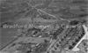
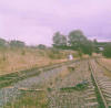
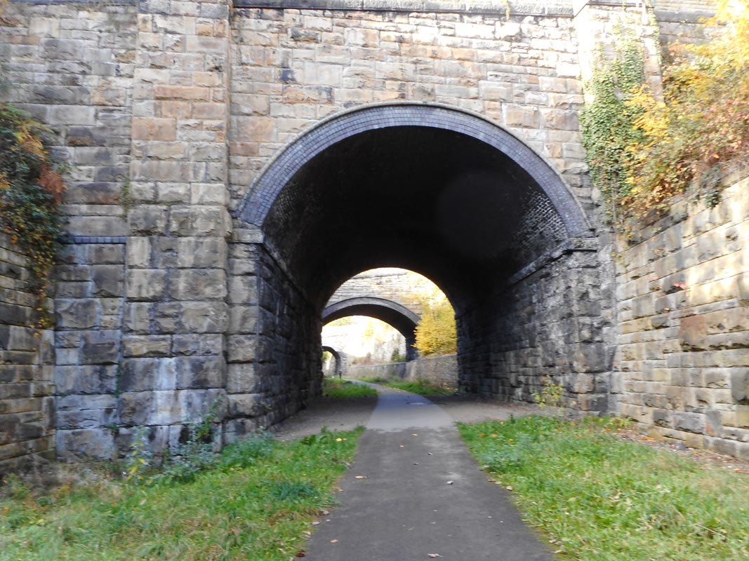
%20%20(9%20to%2025%20%2015-09-02)/17%2050%20yd%20tunnel%20n%20west_small.jpg) North 50
yard tunnel facing N-West (15-09-02) : David Webdale North 50
yard tunnel facing N-West (15-09-02) : David Webdale
The North 50 yard tunnel with Cook lane beyond. |
 North
50 yard tunnel (25-10-20) : Paul Holroyd North
50 yard tunnel (25-10-20) : Paul Holroyd |
 North
50 yard tunnel (25-10-20) : Paul Holroyd North
50 yard tunnel (25-10-20) : Paul Holroyd |
 Cook
Lane bridge (25-10-20) : Paul Holroyd Cook
Lane bridge (25-10-20) : Paul Holroyd |
 Cook
Lane bridge (25-10-20) : Paul Holroyd Cook
Lane bridge (25-10-20) : Paul Holroyd
There are still odd traces of where cables used to be. |
 Cook
Lane bridge facing s-east (22-07-06) : Norman Hirst Cook
Lane bridge facing s-east (22-07-06) : Norman Hirst
Facing back towards Heckmondwike. |
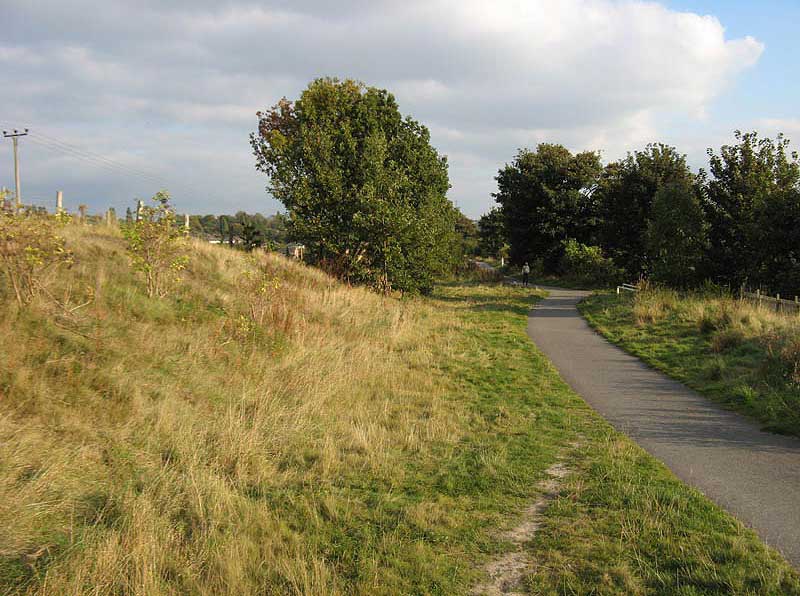
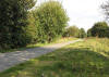
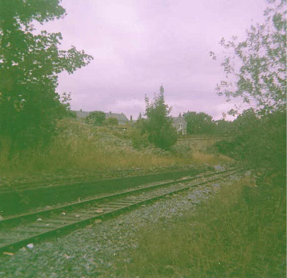
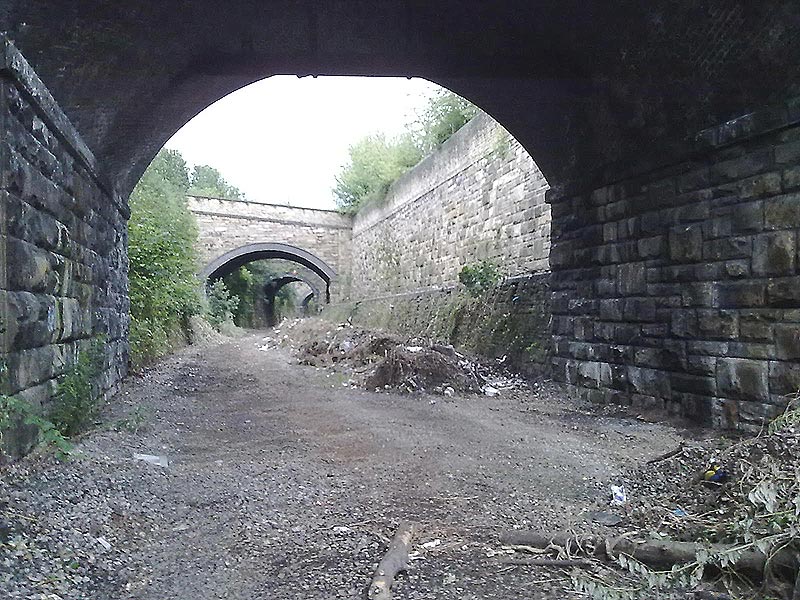
%20Heckmondwike_small.jpg) %20Heckmondwike_small.jpg) %20Heckmondwike_small.jpg) Heckmondwike (18-11-07) : Ralph Rawlinson Heckmondwike (18-11-07) : Ralph Rawlinson
Recent
shots along the route, from Railway Ramblers member Ralph Rawlinson.
The leader considers
that walking through the tunnels and bridges here
is the ultimate railway rambling experience! |
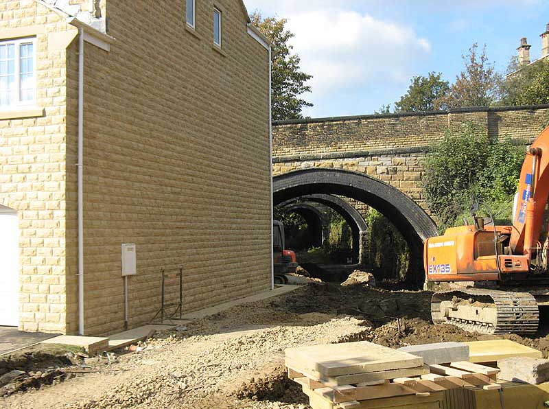
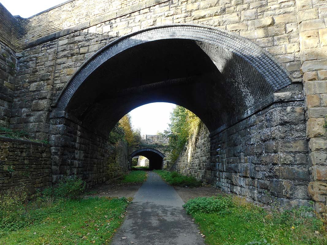
_small.jpg) _small.jpg) Heckmondwike (05-09-09) :
Graeme Bickerdike Heckmondwike (05-09-09) :
Graeme Bickerdike
Sustrans' new footpath which passes beneath the bridges
to the north of Heckmondwike Spen Station.
They are wonderful structures as, of course, is the cutting which they
span. |
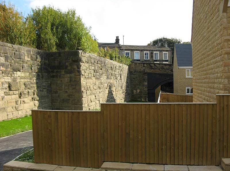
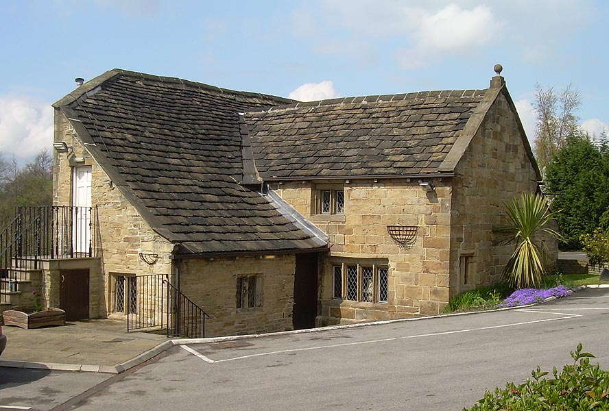
The Old Hall
%20%20(9%20to%2025%20%2015-09-02)/18%20old%20hall%20east_small.jpg) The
Old Hall facing East (15-09-02) : David Webdale The
Old Hall facing East (15-09-02) : David Webdale
At the other side of Cook lane is the Old Hall, dating
from the 15th century It was originally a timber house, now a pub.
|
 The
Old Hall (25-04-10) : David Webdale The
Old Hall (25-04-10) : David Webdale
The right hand wing of the building was sliced off
when the railway came through.
The original plans were to demolish the
building altogether, but the owners must have reached some sort of
agreement with the L.N.W.R |
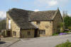 The
Old Hall (25-04-10) : David Webdale The
Old Hall (25-04-10) : David Webdale
View from the roadside. |
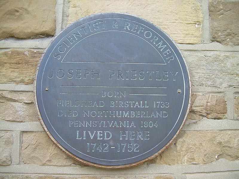
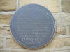 The
Old Hall (25-04-10) : David Webdale The
Old Hall (25-04-10) : David Webdale
Joseph Priestley, the discoverer of oxygen, lived
here as a boy & is commemorated by this blue plaque. |
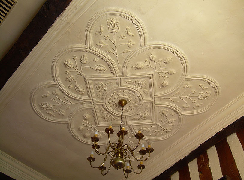
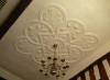 The
Old Hall (25-04-10) : David Webdale The
Old Hall (25-04-10) : David Webdale
The original construction was incorporated into
the 17th century modifications, which include this fancy plaster
ceiling.
The old timber frame work has been also been exposed. |
%20%20(9%20to%2025%20%2015-09-02)/19%20leeds%20rd%20bridge%20east_small.jpg) Leeds
road bridge facing East (15-09-02) : David Webdale Leeds
road bridge facing East (15-09-02) : David Webdale
Leeds road bridge, looking back towards Heckmondwike.
Bit boring
compared to the bridges we've just seen, looks to have been reinforced
or rebuilt at some time. |
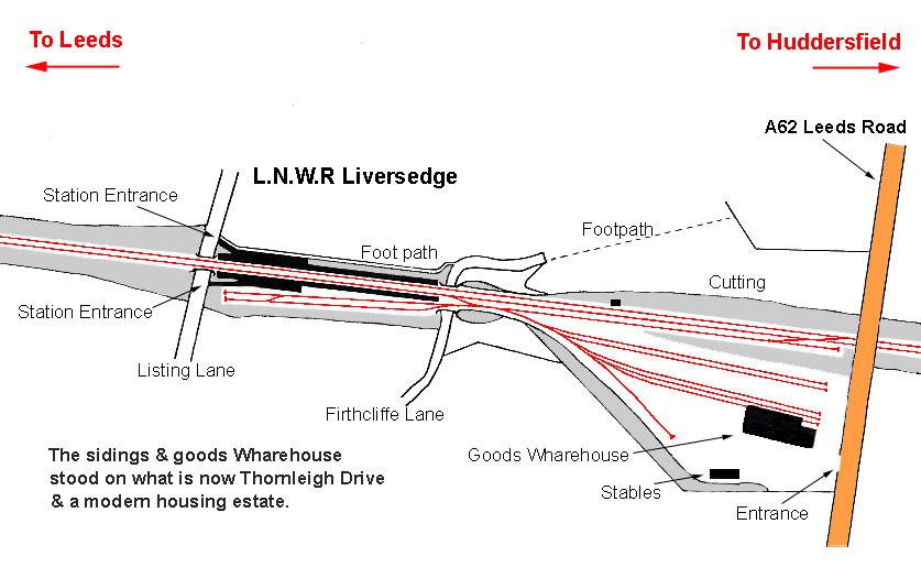
Liversedge Spen
station
Opened 01-10-1900. Closed 05-09-1953.
 Liversedge station map 1908 (Re-named Liversedge Spen
in 1924) : David Webdale Liversedge station map 1908 (Re-named Liversedge Spen
in 1924) : David Webdale
Situated between Listing Lane & Firthcliffe Lane.
Platforms & buildings of timber construction.
Goods yard opened on 1st November 1900. Situated between Firthcliffe
lane & Leeds road.
Consisting of 7 sidings, warehouse & stables.
The site of one of the last parts of the line to stay open. |
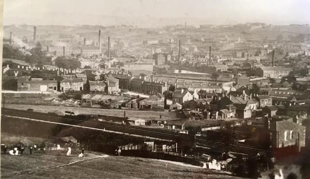
 Spenborough
(c1915) : Thomas Castle c/o Christopher Franz Spenborough
(c1915) : Thomas Castle c/o Christopher Franz
View from Stanley colliery. Liversedge Spen station next to Listing Lane
visible in the background on the left hand photo.
See close up next
photo.
The line in the foreground is the
L&Y Mirfield to Low Moor. |
 Spenborough
(c1915) : Thomas Castle c/o Christopher Franz Spenborough
(c1915) : Thomas Castle c/o Christopher Franz
Close up of above photo, Liversedge Spen station
next to Listing Lane. |
 Liversedge
Spen (2007) : Graham Smith Liversedge
Spen (2007) : Graham Smith
Facing back towards Heckmondwike & standing on the
exact spot of where the edge of the Leeds bound platform used to be. |
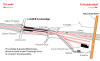
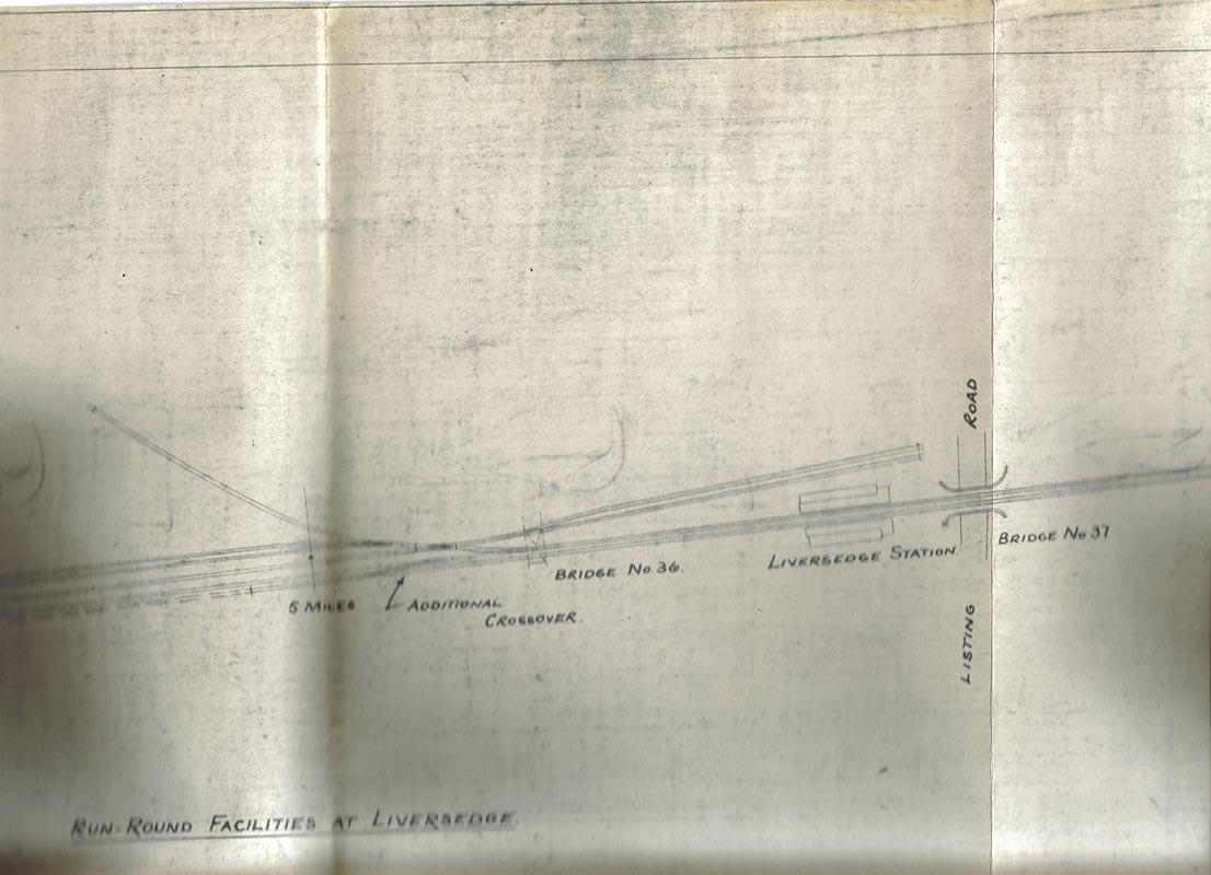
Liversedge
Spen Charrington Hargreaves Oil Terminal
 Plans
for run-round facilities for the Charrington Hargreaves oil depot
(22/12/65) : Paul Holroyd Plans
for run-round facilities for the Charrington Hargreaves oil depot
(22/12/65) : Paul Holroyd
A small part of the plans for building the connecting spur between
the L & Y and LNWR lines at Heckmondwike, and associated works.
There is a handwritten note saying "Plan enclosed with DE's letter
22/12/65" on my copy
Run-round facilities for the Charrington Hargreaves oil depot at
Liversedge Spen. |
    Timetables for the Charrington Hargreaves oil depot
(17/05/82) : Paul Holroyd Timetables for the Charrington Hargreaves oil depot
(17/05/82) : Paul Holroyd
Extracts from the 17 May 1982 - 3 October 1982 Working Timetable,
showing freight services to and from the Charrington Hargreaves Oil
Terminal at Liversedge Spen. |
Locomotives operating from Charrington Hargreaves : Paul Holroyd
A large number of the oil tanker trains were hauled by BR Standard
Class 9F 2-10-0 steam locomotives, but other locomotive classes did
appear.
Most of the following information is from the monthly
magazine, The Railway Observer, published by the Railway Correspondence
and Travel Society.
On 22 September 1964 ex-LMS Jubilee 4-6-0
locomotive no 45583 Assam worked the 01.25 Ellesmere Port-Liversedge.
On the same date 9F no 92046 worked the 19.30 Cleckheaton-Ellesmere Port
empty tankers.
On 1st October 1964 9F no 92109 worked the
Cleckheaton-Ellesmere Port empties.
On 5th November 1964 9F no 92214
hauled the Ellesmere Port – Liversedge.
On 22nd December 1964 9F no
92085 hauled the Liversedge-Ellesmere Port empties.
On 24th December
1964 9F no 92249 hauled the Liversedge-Ellesmere Port empties.
On 2nd
January 1965 9F no 92022 hauled the 01.24 Ellesmere Port-Liversedge.
On 29th January 1965 9F no 92124 hauled the Ellesmere Port-Liversedge.
On 2nd February 1965 ex-LMS Class 8F 2-8-0 locomotive no 48771 hauled
the Ellesmere Port-Liversedge.
On 8th May 1965 9F no 92109 was seen
at Cleckheaton Spen running round the tanker train.
On 3rd November
1966 9F no 92103 worked the Stanlow-Liversedge tanker train, dropping a
lead plug when it reached its destination.
The loco was hauled back
to Hillhouse Shed by ex-LMS Class 8F 2-8-0 steam locomotive no 48276.
In January 1967 English Electric Type 4 diesel locomotives, based at
Healey Mills depot, began operating the Stanlow-Liversedge tanker trains
throughout, replacing the BR Standard class 9F 2-10-0 locomotives which
were based at Birkenhead.
On 21st December 1968, English Electric
diesel loco 398 worked the Stanlow-Liversedge.
|
Heckmondwike
B.R Spur Facing Ravensthorpe (c1987) :
K Evans
In 1966 B.R made a new connection at Heckmondwike Spen Goods yard,
see Leeds New Line page 2
 between the L & Y Ravensthorpe branch &
The Leeds New Line to Liversedge Spen. between the L & Y Ravensthorpe branch &
The Leeds New Line to Liversedge Spen.
This was to supply the Charrington Hargreaves oil terminal at the former Liversedge Spen Goods
Yard.
This enabled the closure of the Heaton Lodge to Liversedge Spen Goods
section of line.
The yard was sold to Charrington Hargreaves in 1967. The terminal was
mothballed in 1986 |
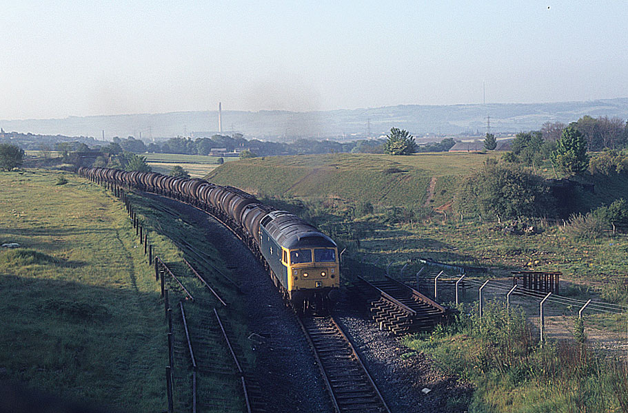
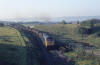 Heckmondwike
B.R Spur (c1980) : C/O Michael Kaye with permission from Paul Corrie Heckmondwike
B.R Spur (c1980) : C/O Michael Kaye with permission from Paul Corrie
Class 47 with tankers approaching Charrington Hargreaves
terminal. |
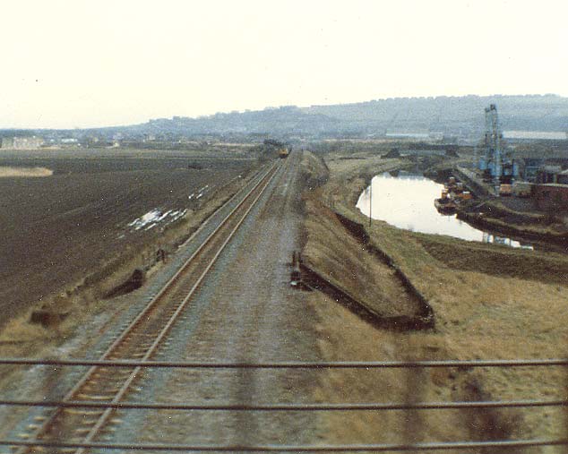
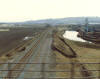 Ravensthorpe
Branch Charrington Hargreaves Oil Tankers (c1980) :
David Webdale Ravensthorpe
Branch Charrington Hargreaves Oil Tankers (c1980) :
David Webdale
The only photo I have of Oil tankers on their way to Charrington
Hargreaves oil Terminal at Heckmondwike,
on the old L&Y Ravensthorpe
branch. Taken from a moving Huddersfield to Leeds train. |
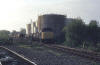 Charrington
Hargreaves oil terminal (c1980) : C/O Michael Kaye with permission from
Paul Corrie Charrington
Hargreaves oil terminal (c1980) : C/O Michael Kaye with permission from
Paul Corrie
Peak at Liversedge oil terminal. |
 Charrington
Hargreaves oil terminal facing east (1986) : K Evans Charrington
Hargreaves oil terminal facing east (1986) : K Evans
Leeds road bridge visible in the distance.
Liversedge goods yard was used as an oil terminal by Charrington
Hargreaves.
To supply the terminal
B.R made a connection from the L&Y Ravensthorpe branch to the Leeds New
Line in 1966. see page 2 |
 Charrington
Hargreaves (2007) : Graham Smith Charrington
Hargreaves (2007) : Graham Smith
Standing under the cable post shown in the above
photo. This was about 100 yards from where I used to live.
I bet the people in the house don't realise that the trains used to run
through their front rooms! |
 Charrington
Hargreaves oil terminal facing east (1986) : K Evans Charrington
Hargreaves oil terminal facing east (1986) : K Evans
A wider view from further back.
The yard was sold to Charrington Hargreaves in 1967. The terminal was
mothballed in 1986.
|
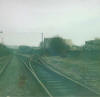
 Liversedge
Spen (1985) : K Evans Liversedge
Spen (1985) : K Evans
Liversedge Spen looking towards Heckmondwike 1985.
Nostalgia :
Graham Smith
Have a look at the tree in the centre of the photo. It covers a shallow
drainage ditch right next to the track.
Me and a friend used to hide
under the tree when the train came to Charrington Hargreaves during the
summer.
The wheels went past not 4 feet from you and you whole body used
to vibrate due to the engine noise.
The train usually went about 10-15
mph max.
One night it stopped right next to us and we had to stay hidden
while the crew walked about and smoked for about half an hour.
I also remember once when the train crew were arguing as they had
forgotten the key to the gate that closed off the sidings to the oil
tanks.
Eventually they reversed the loco and simply smashed through the
gates at about 20mph. They were sitting around bent double for about 6
months after that.
We used them as a make-shift see-saw as they formed a
almost perfect 270° curve. The gates are in the centre of the photo.
The trains didn't vary much and were generally 47308, 47373 or 47277.
The odd class 40 used to turn up, but the best was 45022 Lytham St Annes.
The only 'namer' I remembered seeing in about 10 years, although half
the trains used to arrive and leave in darkness.
I used to love to be
woken up by the noise of the train and the oil trucks clanging together.
Some of the neighbours didn't though. |
%20%20(9%20to%2025%20%2015-09-02)/20%20firthcliffe%20lane%20n%20east_small.jpg) Firthcliffe
lane facing N-East (15-09-02) : David Webdale Firthcliffe
lane facing N-East (15-09-02) : David Webdale
Spanning Firthcliffe lane, this bridge looks a bit tastier, stone with a
brick arch, a common design for this route.
To the right was Liversedge
goods yard & to the left was Liversedge station, just a footpath now.
(see Liversedge map 1908) |
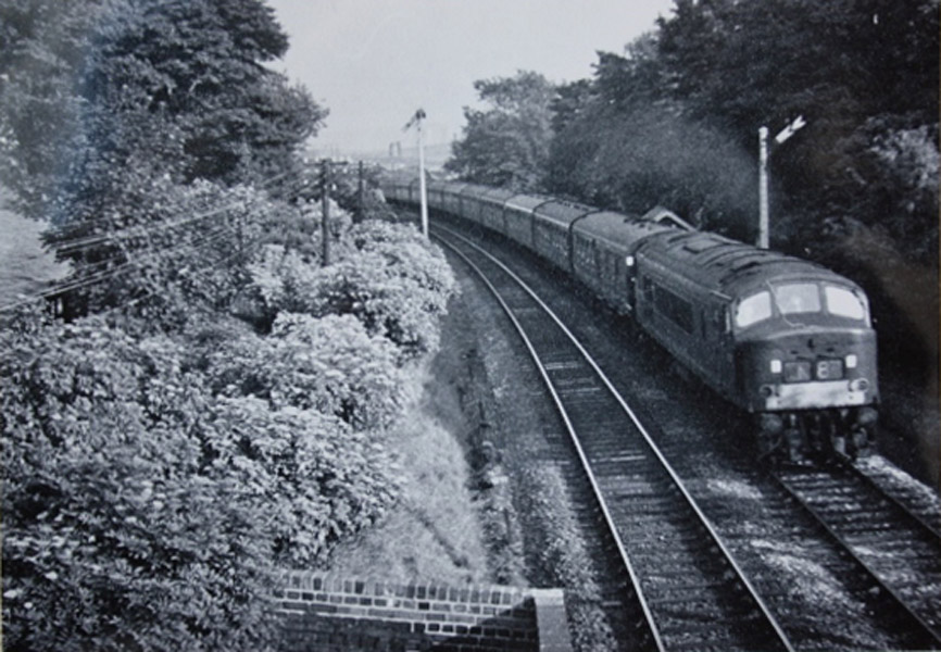
 Firthcliffe
lane (20-07-1963) Bernard Coomber
collection Firthcliffe
lane (20-07-1963) Bernard Coomber
collection
Photo taken 20 July 1963 showing a Peak class diesel loco shortly after
leaving Liversedge Spen on the Leeds 'new' line with a Liverpool to
Newcastle express. |
 Listing lane bridge facing west (1985)
: K Evans Listing lane bridge facing west (1985)
: K Evans
Liversedge Spen looking towards Cleckheaton 1985. |
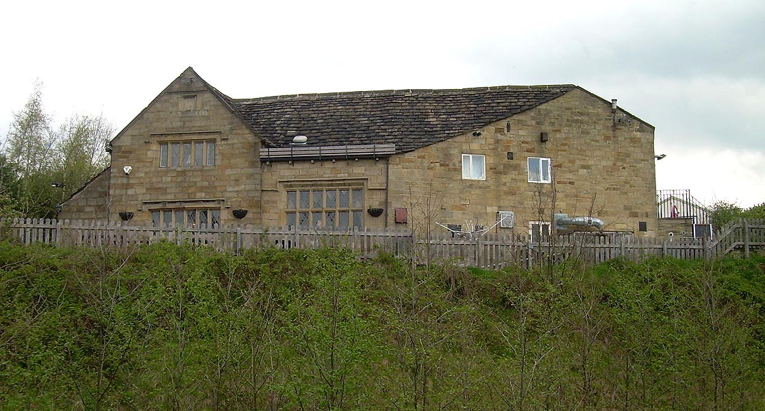
%20%20(9%20to%2025%20%2015-09-02)/21%20listing%20lane%20toby%20jug%20n%20east_small.jpg) Listing
lane N-East (15-09-02) : David Webdale Listing
lane N-East (15-09-02) : David Webdale
The only remaining iron deck bridge I've seen is this one crossing
Listing lane.
Liversedge station was situated just up to the right of
the bridge with entrances to each platform from Listing lane.
The Toby
Jug pub is on the right. |
 Listing
Lane (nd) : c/o Graham Smith Listing
Lane (nd) : c/o Graham Smith
Leeds New Line photos on a Facebook page showing just past Liversedge
Spen Station looking toward the bottom of Listing Lane.
https://www.facebook.com/groups/hightownliversedge
|
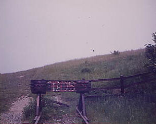
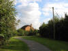
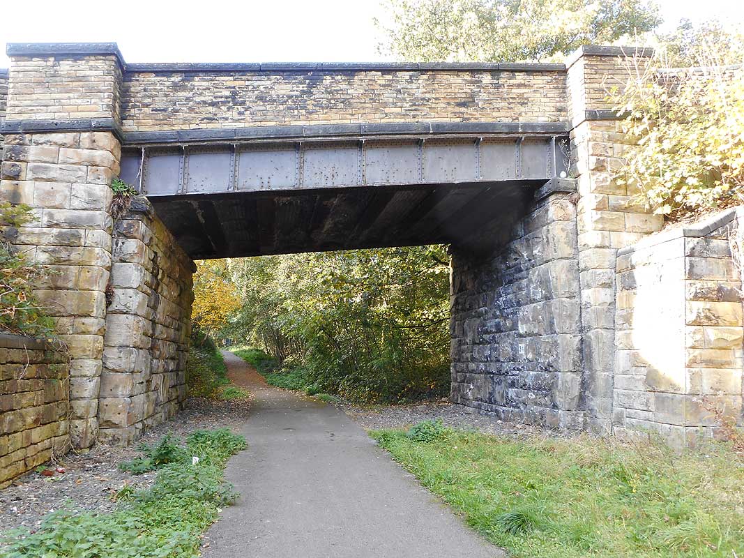
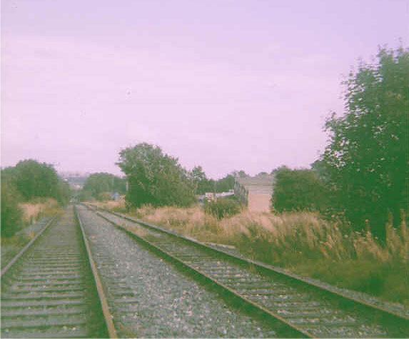
%20%20(9%20to%2025%20%2015-09-02)/22%20well%20st%20footpath%20north_small.jpg) Well
street footpath facing North (15-09-02) : David Webdale Well
street footpath facing North (15-09-02) : David Webdale
Taken from well street on the edge of a new housing estate,
this little
bridge provides footpath access to nowhere in particular.
The brickwork
& pointing still looking sharp, even after 100 years. |
 End
of the Line in 1985 End
of the Line in 1985
Liversedge Spen
: Paul Holroyd
website -
www.vintagecarriagestrust.org
The end of the line, just beyond Well street & the Charrington
Hargreaves oil depot at Liversedge Spen. |
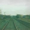
 Liversedge
Spen (1985) : Paul Holroyd Liversedge
Spen (1985) : Paul Holroyd
The end of the line: The run-round loop for the
Charrington Hargreaves oil depot at Liversedge Spen, circa 1985. |
 Near
Well Street Liversedge Spen (1985) : Paul Holroyd Near
Well Street Liversedge Spen (1985) : Paul Holroyd |
 Near
Well Street Liversedge Spen (2007) : Graham Smith Near
Well Street Liversedge Spen (2007) : Graham Smith
Exact same spot in 2007. |

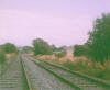
%20%20(9%20to%2025%20%2015-09-02)/9%2048ft%20cutting%20n%20west.jpg)
%20%20(9%20to%2025%20%2015-09-02)/10%20house%20horton%20st%20&%20sunnyside%20n%20west.jpg)
%20%20(9%20to%2025%20%2015-09-02)/11%2080%20houses%20francis%20&%20powel%20st%20north.jpg)
%20%20(9%20to%2025%20%2015-09-02)/24%20church%20st%20(south%2050%20yd%20tunnel%20in%20distance)%20n%20west.jpg)
%20Heckmondwike.jpg)
%20%20(9%20to%2025%20%2015-09-02)/23%20south%20portal%20south%2050%20yd%20tunnel%20s%20east.jpg)


%20%20(9%20to%2025%20%2015-09-02)/14%20heck%20station%2050%20yd%20tunnel%20s%20east.jpg)

%20%20(9%20to%2025%20%2015-09-02)/13%20heck%20station%20s%20east.jpg)


%20%20(9%20to%2025%20%2015-09-02)/12%20heck%20station%20n%20west.jpg)


%20%20(9%20to%2025%20%2015-09-02)/16%20under%20king%20st%20s%20east.jpg)

%20%20(9%20to%2025%20%2015-09-02)/15%20under%20king%20st%20n%20west.jpg)


%20%20(9%20to%2025%20%2015-09-02)/17%2050%20yd%20tunnel%20n%20west.jpg)


%20Heckmondwike.jpg)
%20Heckmondwike.jpg)
%20Heckmondwike.jpg)
.jpg)
.jpg)
%20%20(9%20to%2025%20%2015-09-02)/18%20old%20hall%20east.jpg)
%20%20(9%20to%2025%20%2015-09-02)/19%20leeds%20rd%20bridge%20east.jpg)


%20%20(9%20to%2025%20%2015-09-02)/20%20firthcliffe%20lane%20n%20east.jpg)

%20%20(9%20to%2025%20%2015-09-02)/21%20listing%20lane%20toby%20jug%20n%20east.jpg)
%20%20(9%20to%2025%20%2015-09-02)/22%20well%20st%20footpath%20north.jpg)