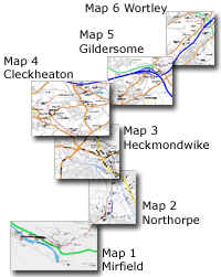
The Leeds New Line route maps
See page 1 for explanation |
You are here: Map 4 Cleckheaton
Well street - Oakwell Hall
|
|
|
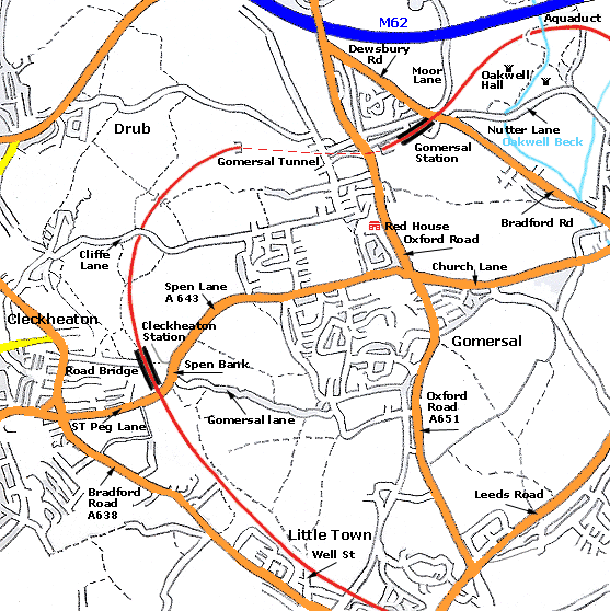 Map 4 Cleckheaton Map 4 Cleckheaton
Well street - Oakwell Hall
L.N.W.R Leeds New Line shown in red
|
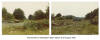
/Gomersal_small.jpg) Gomersal
Map (1931) : Malcolm Mallison Gomersal
Map (1931) : Malcolm Mallison
From the Six inch map 1931 Survey.
|
/Spen_small.jpg) Cleckheaton
Map (1931) : Malcolm Mallison Cleckheaton
Map (1931) : Malcolm Mallison
From the Six inch map 1931 Survey.
|
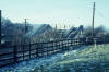
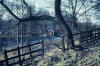
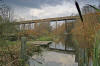
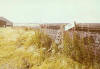
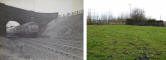
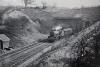
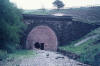
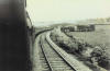
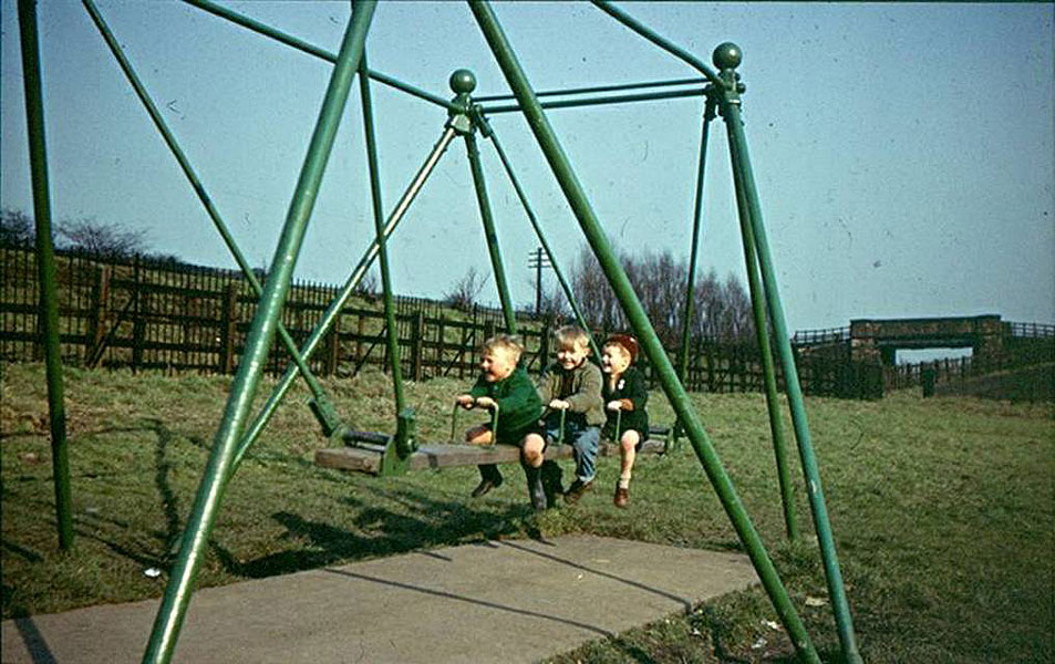
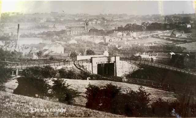
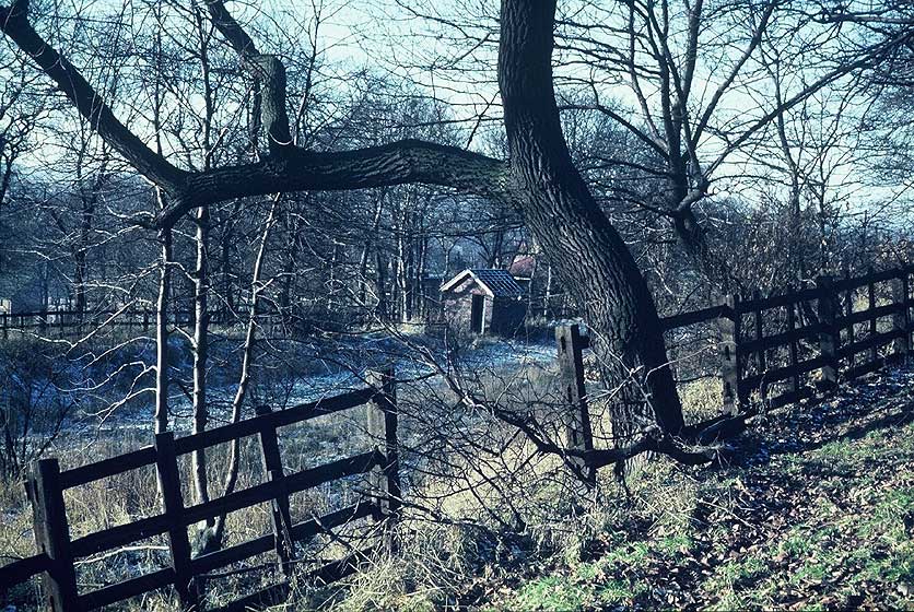
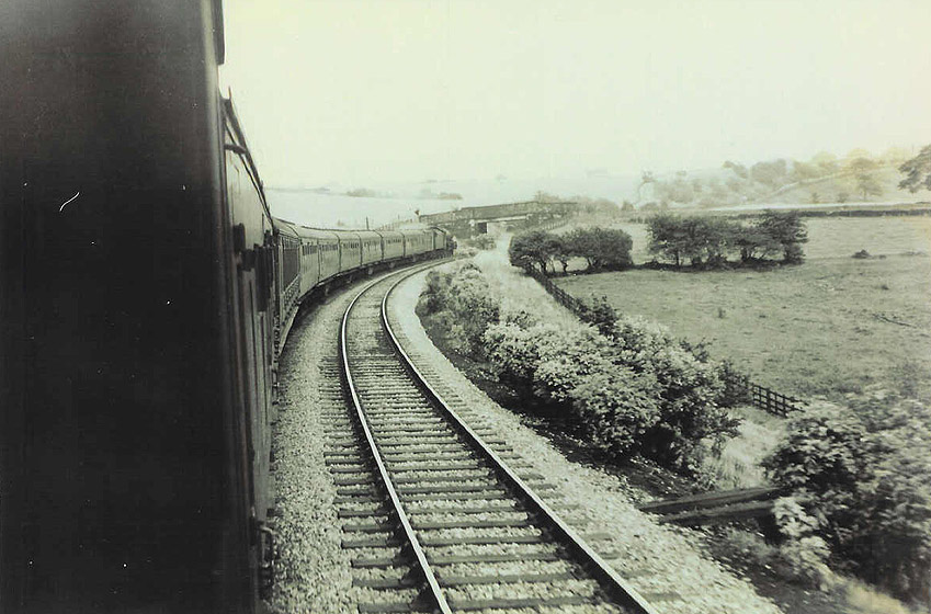
Rawfolds bridge (c1955) :
Graham Smith
  I
was checking out some old family slides and found one containing a long
forgotten bridge on the Leeds New Line. I
was checking out some old family slides and found one containing a long
forgotten bridge on the Leeds New Line.
I think this photo was taken in
the early to mid 50’s as some of the kids are older relations of mine I
think.
The bridge location is close to Royds Park at Rawfolds just a few
hundred yards on the Mirfield side of the Rawfolds footbridge. see map
below.
The line of poplar trees in the background are still there in front of
the garden nursery that’s on the site now.
I like the fact that in this photo there are the remains of the original
LNWR wrought iron railings that have been fronted by the more
recent
standard BR wooden fencing.
There are still some remains of this sort of
railing to be found at the deep cutting at the other side of Heckmondwike. |
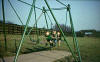
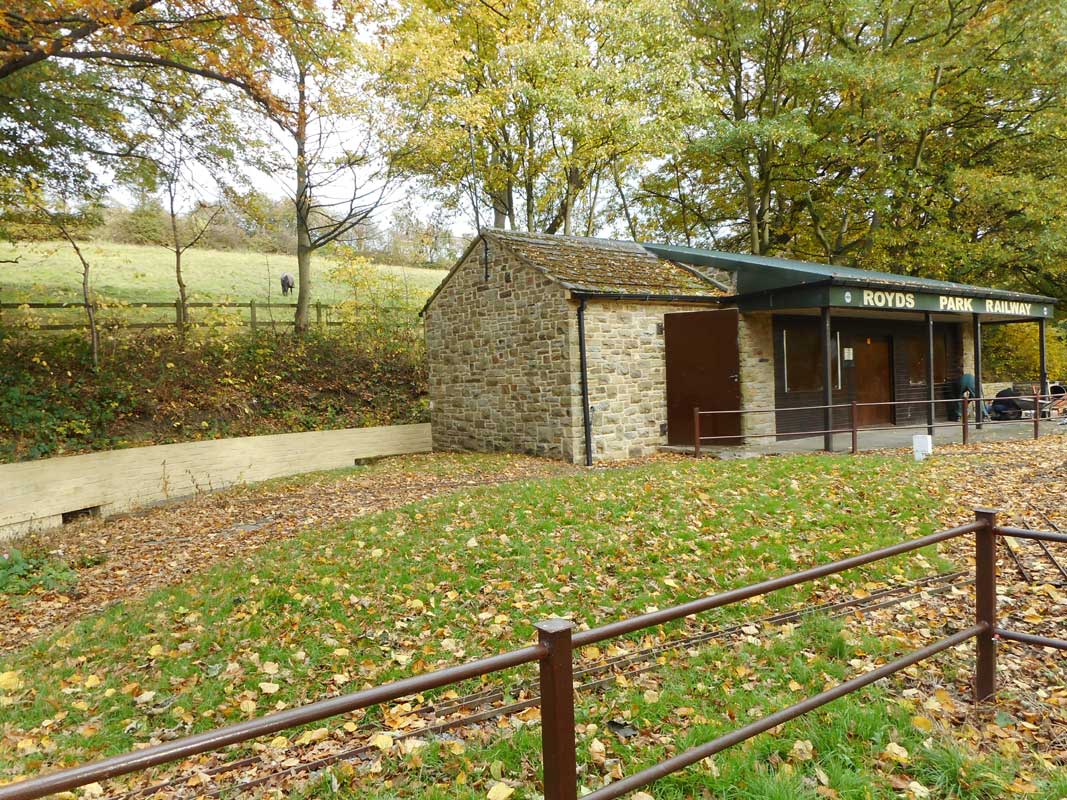
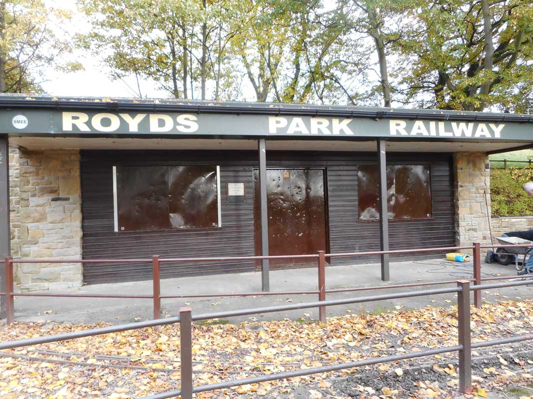
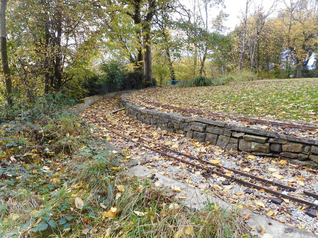
 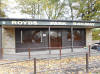 Royds
Park Miniature Railway (25-10-20) :
Paul Holroyd Royds
Park Miniature Railway (25-10-20) :
Paul Holroyd
The trackbed at Rawfolds is home to the Royds Park Miniature Railway
(formerly known as the Eddercliffe Miniature Railway),
operated by the Spenborough Model & Experimental Engineers Ltd
http://www.roydsparkrailway.co.uk |
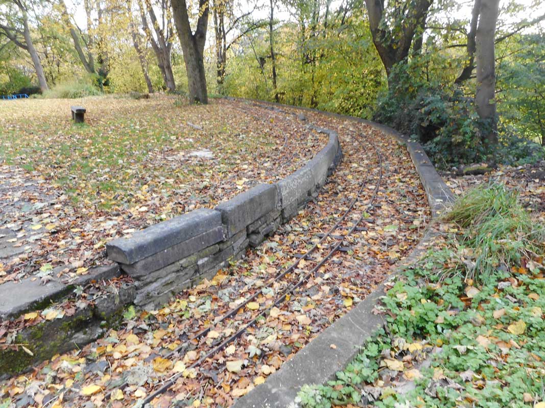
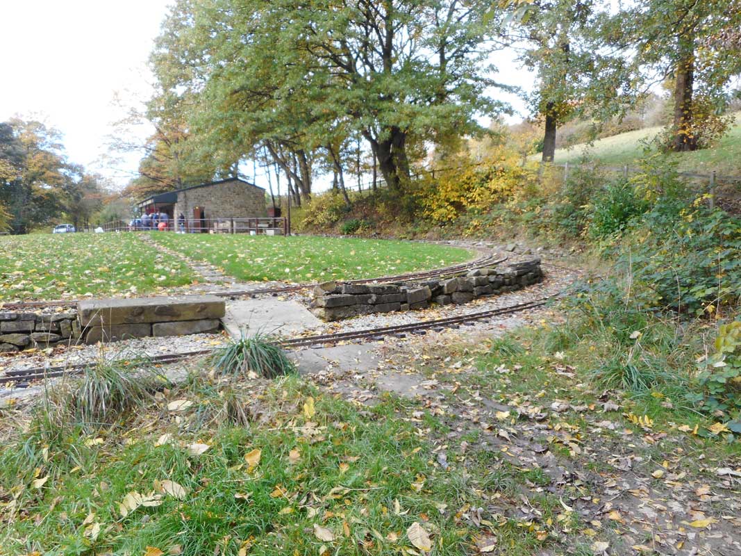
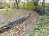 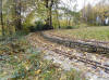 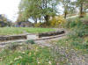 Royds
Park Miniature Railway (25-10-20) :
Paul Holroyd Royds
Park Miniature Railway (25-10-20) :
Paul Holroyd |
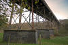
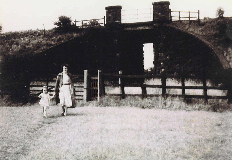
 Rawfolds bridge (nd) :
c/o Graham Smith Rawfolds bridge (nd) :
c/o Graham Smith
Leeds New Line photos on a Facebook page showing
the Rawfolds bridge.
https://www.facebook.com/groups/hightownliversedge
|
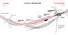
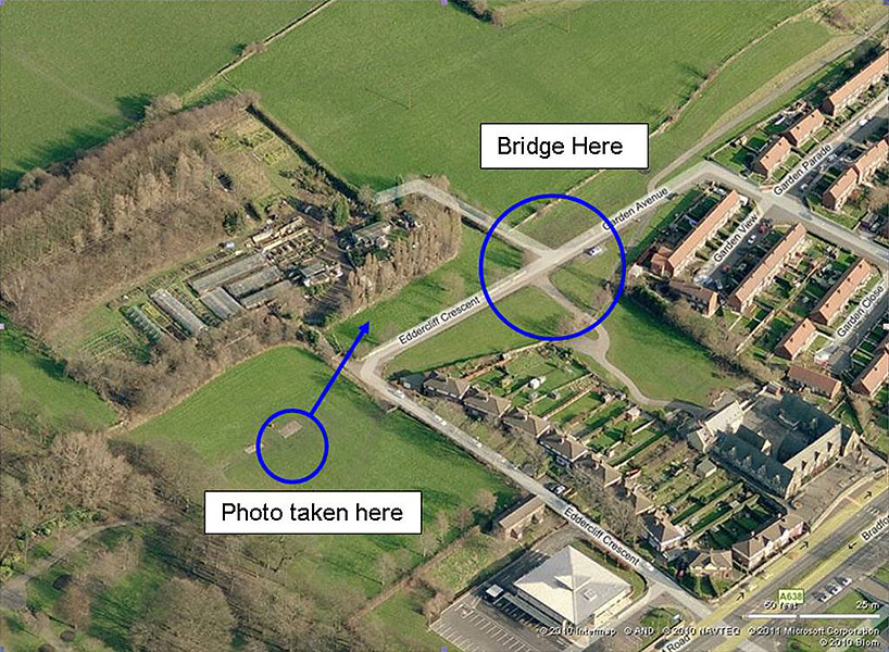
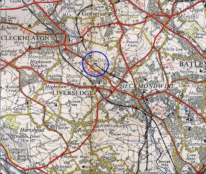
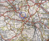 Rawfolds
bridge map (c1955) : Graham Smith Rawfolds
bridge map (c1955) : Graham Smith
I’ve highlighted the location of the bridge shown on the map. There’s
not a single trace of this bridge,
and I can’t remember any embankment
of footing remains as far back as 1971 which is a long ago as I
remember. |
 Rawfolds footbridge
(c1967 - 69) : Harry Naylor Holroyd courtesy Richard
Holroyd Rawfolds footbridge
(c1967 - 69) : Harry Naylor Holroyd courtesy Richard
Holroyd
Footbridge over the Leeds New Line near Rawfolds, between Liversedge
Spen and Cleckheaton Spen.
Looking towards Cleckheaton. circa 1967 - 1969
This was the location for the black and white photo of the Class 40
(next photo) |
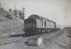
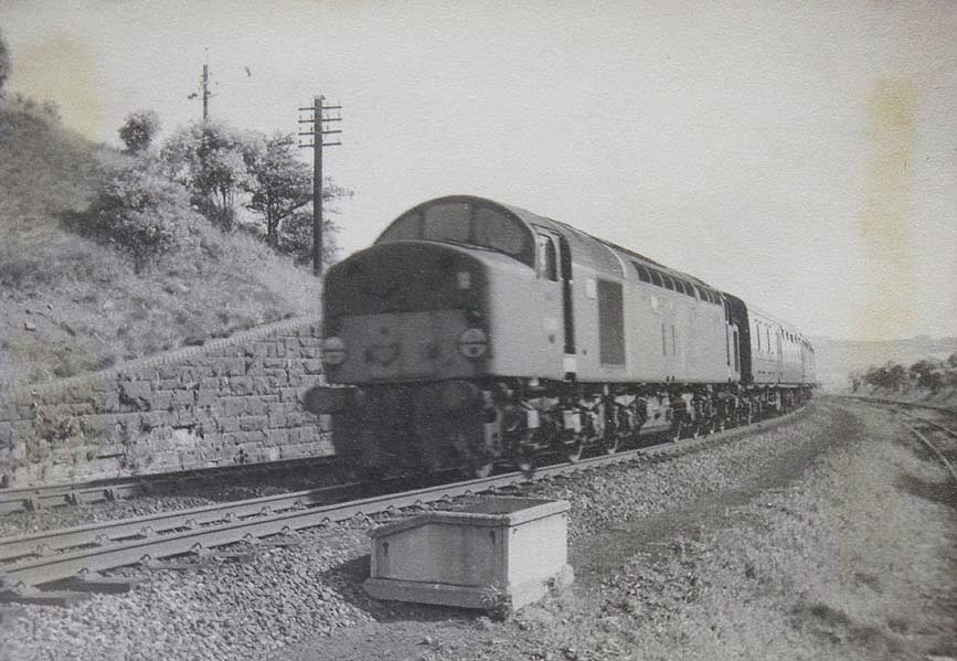
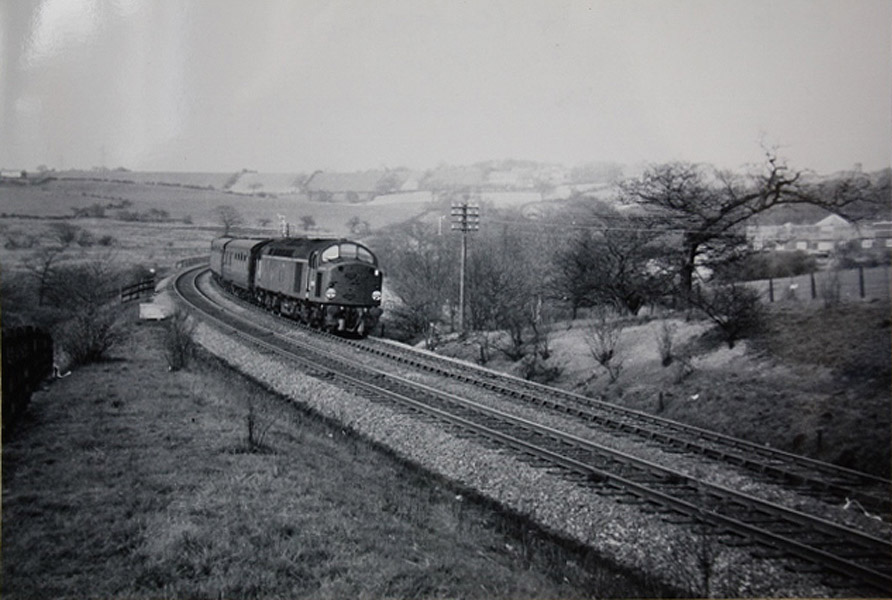
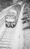 Rawfolds footbridge Class 40
(05-1964) : Harry Naylor Holroyd courtesy
Alan S Bagot website -
www.vintagecarriagestrust.org Rawfolds footbridge Class 40
(05-1964) : Harry Naylor Holroyd courtesy
Alan S Bagot website -
www.vintagecarriagestrust.org
An unidentified Class 40 near Rawfolds, between Cleckheaton Spen and
Liversedge Spen,
with what is probably a Newcastle to Liverpool train.
Click here to see
selection of Spen Valley railway tickets & handbills. |
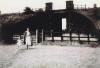
 Rawfolds Platelayers hut
(c1967 - 69) : Harry Naylor Holroyd courtesy
Richard Holroyd Rawfolds Platelayers hut
(c1967 - 69) : Harry Naylor Holroyd courtesy
Richard Holroyd
This platelayers hut stood near the bridge at Rawfolds circa 1967
- 1969.
The Spenborough Model & Experimental Engineers operate a miniature
railway near Royds Park, on the trackbed of the former Leeds New Line.
See http://www.spenborough.me.uk/8.html |
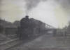
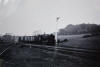
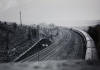
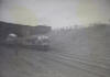
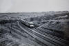
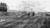
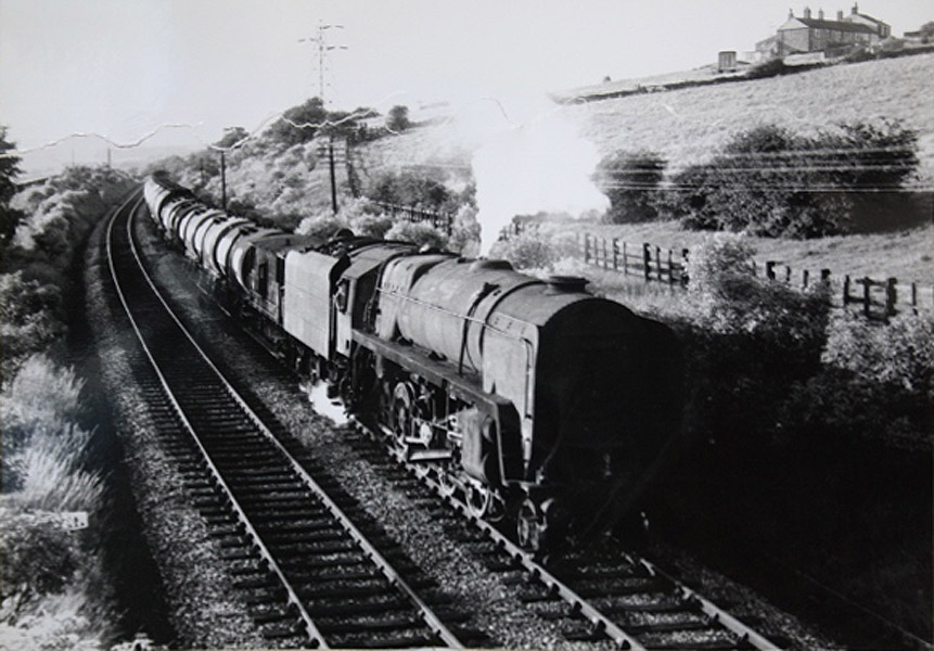
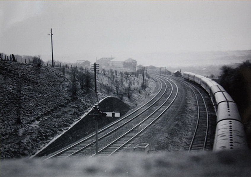
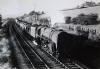 Rawfolds
bridge (10-08-1965) Bernard Coomber
collection Rawfolds
bridge (10-08-1965) Bernard Coomber
collection
Photo taken 10 August 1965 showing a class 9F number 92050 on the Leeds
'new' line heading south from Cleckheaton Spen with a train of empty oil
tanks probably from the Charrington Hargreaves fuel distribution depot
at Liversedge. The photograph was taken from the footbridge which was
situated directly at the top of Royds Park where the model railway track
is now situated. |
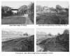
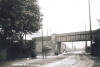
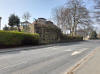
%20(5%20to10%2013-04-03)%20(11to19%2025-05-03)%20(20%20to%2025%2026-05-03)/1%20spen%20lane%20north_small.jpg) Spen Bank bridge facing North (04-01-03)
: David Webdale Spen Bank bridge facing North (04-01-03)
: David Webdale
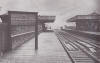
Cleckheaton station
platforms were up on the left hand side of the bridge. |
 Spen
Bank bridge (27-06-1966) :
Harry Naylor Holroyd courtesy Alan S Bagot
website -
www.vintagecarriagestrust.org Spen
Bank bridge (27-06-1966) :
Harry Naylor Holroyd courtesy Alan S Bagot
website -
www.vintagecarriagestrust.org
Four photographs of the bridge over Spen Bank,
shortly before demolition.
|
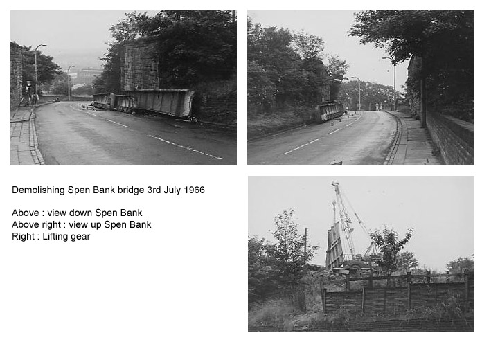
 Spen
Bank bridge (03-07-1966) :
Harry Naylor Holroyd courtesy Alan S Bagot Spen
Bank bridge (03-07-1966) :
Harry Naylor Holroyd courtesy Alan S Bagot
Three photo's of the demolition the bridge over Spen Bank.
|
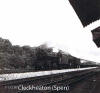
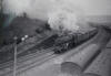
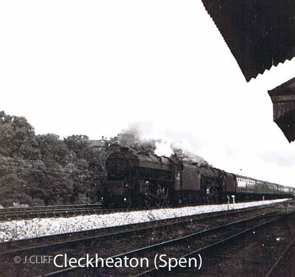
 Class
5 Cleckheaton Spen (1963) : Bernard Coomber Class
5 Cleckheaton Spen (1963) : Bernard Coomber
A class 5 heads for Leeds past the site of the old
Cleckheaton Spen station, circa 1963. |
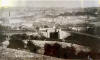
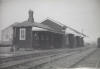
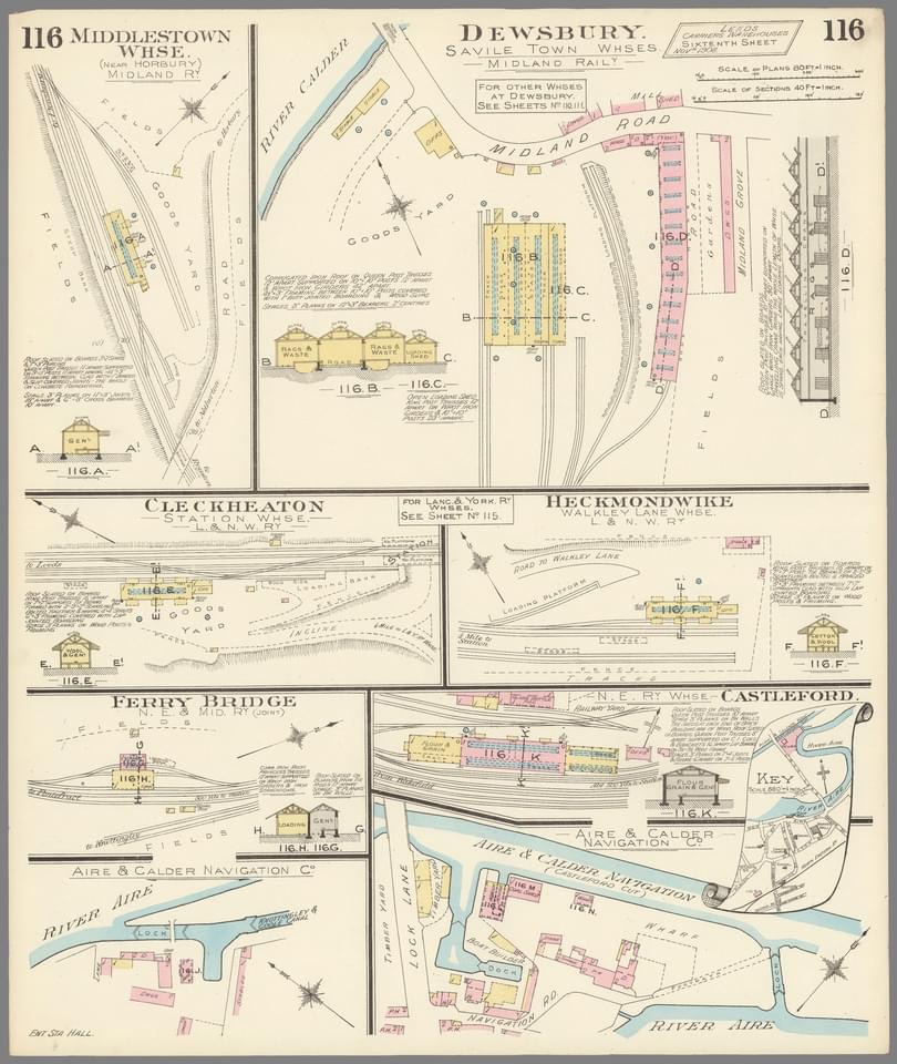
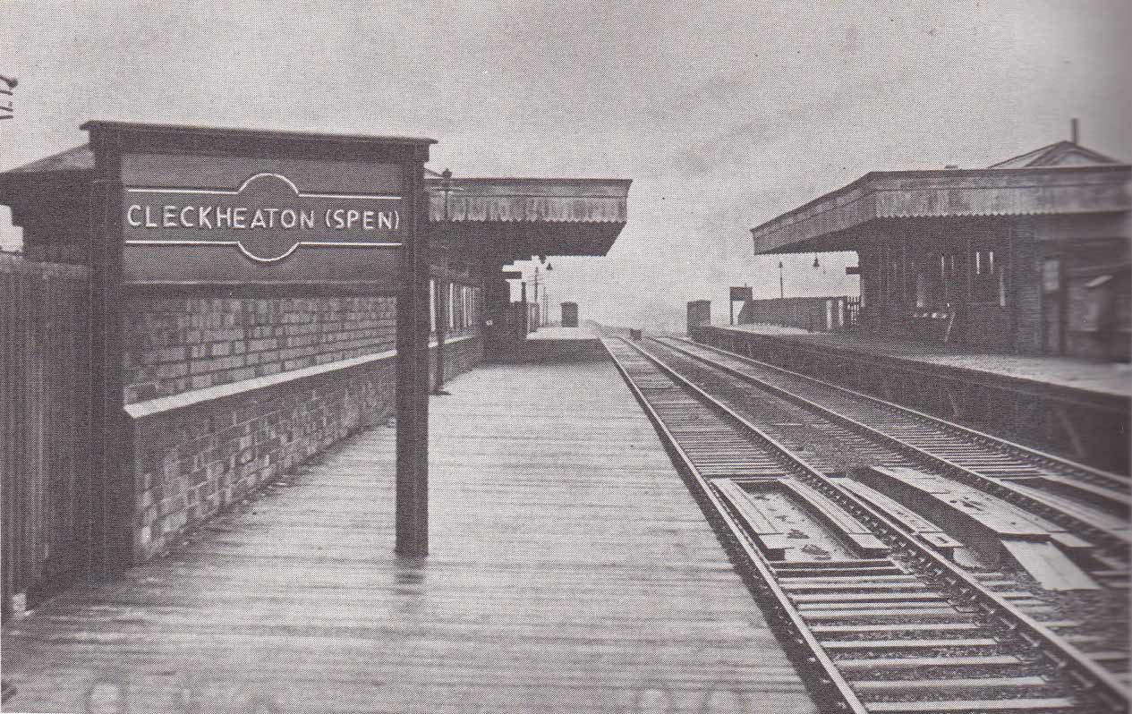
Cleckheaton Spen
station
Opened 01-10-1900. Closed 03-01-1953.
 Cleckheaton station Map 1908 (Re-named Cleckheaton
Spen in 1924) : David Webdale Cleckheaton station Map 1908 (Re-named Cleckheaton
Spen in 1924) : David Webdale
Due to the steep valley side, the whole area was built
on top of a one sided man made embankment. Situated on the west side of Spen lane,
platforms & buildings of
timber construction, including a subway & brick stables.
Access from town centre was via this massive road viaduct across the
valley.
The station included a big goods yard controlled by 2 signal boxes. Consisted of a warehouse tipping dock & cattle pen. |
 Layout
Plans : Keith Looker Layout
Plans : Keith Looker
Cleckheaton, Heckmondwike |
 The
Leeds New Line part 4: Darren Hosker c/o Paul Holroyd The
Leeds New Line part 4: Darren Hosker c/o Paul Holroyd
Youtube from Darren Hosker
https://www.youtube.com/watch?v=hT0gN55dXBA |
 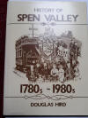 Cleckheaton
station : Douglas Hird collection c/o Paul Holroyd Cleckheaton
station : Douglas Hird collection c/o Paul Holroyd
This rare 1953 photo of Cleckheaton (Spen) appears on page 136 of
the book,
"History of Spen Valley 1780s-1980s" , written and
published in 1985 by Douglas Hird. |
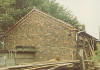
 Cleckheaton
Spen goods shed : Bernard Coomber Cleckheaton
Spen goods shed : Bernard Coomber
This building is of an entirely wooden
construction. |
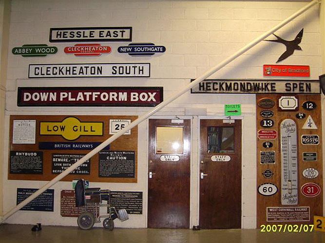
 Spen
Valley box boards (07-02-07) :
Paul Holroyd Spen
Valley box boards (07-02-07) :
Paul Holroyd
Now on display at Museum of Rail Travel, Ingrow Railway Centre. |
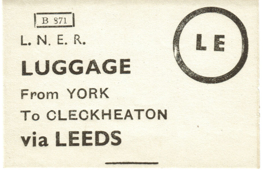
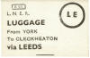 Luggage
label (06-09-08) :
Paul Holroyd Luggage
label (06-09-08) :
Paul Holroyd
LNER luggage label courtesy David Norman Carr website
- www.vintagecarriagestrust.org |
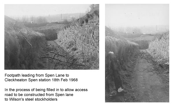
 Footpath 18th Feb 1968 :
Harry Naylor Holroyd courtesy Alan S Bagot Footpath 18th Feb 1968 :
Harry Naylor Holroyd courtesy Alan S Bagot
The footpath from Spen Lane to Cleckheaton Spen station was filled in prior to
construction
of an access
road leading to Wilson's Steel stockholders on the old trackbed. |
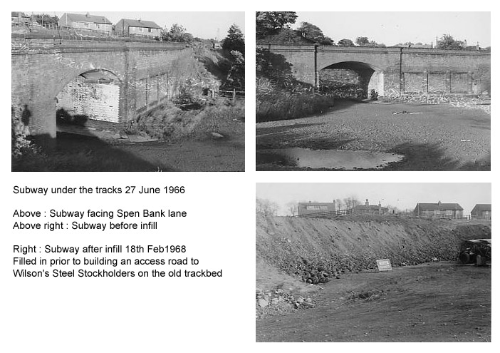
 Subway 27th June 1966 / 18th Feb 1968 :
Harry Naylor Holroyd courtesy Alan S Bagot Subway 27th June 1966 / 18th Feb 1968 :
Harry Naylor Holroyd courtesy Alan S Bagot
Three photo's of
the subway under the tracks before & after infilling.
The subway was filled in prior to construction of an access
road leading to
Wilson's Steel stockholders on the old trackbed.
Additional info
Paul Holroyd:
This bridge was built using red bricks. The platforms extended
across of the whole of this bridge, ending just before the bridge over
Spen Bank.
The passenger station buildings with their platform
awnings started where this red brick bridge ended
& ended roughly
halfway before the bridge over Spen Bank. |
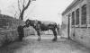 Stables :
Alan S Bagot collection Stables :
Alan S Bagot collection
Carter John Hosley with his horse at Cleckheaton
Spen stables. |
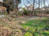
%20(5%20to10%2013-04-03)%20(11to19%2025-05-03)%20(20%20to%2025%2026-05-03)/2%20cleckheaton%20station%20south_small.jpg) Stables facing South (04-01-03)
: David Webdale Stables facing South (04-01-03)
: David Webdale
Stood on the site of Cleckheaton station, facing back towards Spen
lane.
The red brick stable block visible behind the lorry on the right. (see Cleckheaton station map). |
 Stables
(21 -08-1983) :
Alan S Bagot Stables
(21 -08-1983) :
Alan S Bagot
The stable block at Cleckheaton Spen in 1983. |
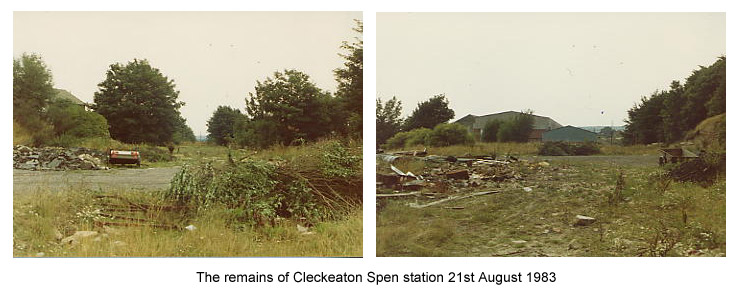
 Cleckheaton Spen
(21-08- 1983) :
Alan S Bagot Cleckheaton Spen
(21-08- 1983) :
Alan S Bagot
A couple of views of
the remains of Cleckheaton Spen back in 1983.
|
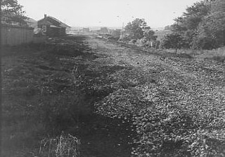
 Cleckheaton Spen
(27-06-1966) :
Harry Naylor Holroyd courtesy Alan S Bagot Cleckheaton Spen
(27-06-1966) :
Harry Naylor Holroyd courtesy Alan S Bagot
General view looking towards Gomersal 1966.
|
 Cleckheaton station Cleckheaton station
Photo: James Cliff
see Cleckheaton Central station website -
www.procast.co.uk |
%20(5%20to10%2013-04-03)%20(11to19%2025-05-03)%20(20%20to%2025%2026-05-03)/3%20cleckheaton%20road%20bridge%20west_small.jpg) Road
viaduct facing west (04-01-03) : David Webdale Road
viaduct facing west (04-01-03) : David Webdale
Taken from the station end of the road viaduct, looking towards
Cleckheaton town centre.
Looks rubbish from above, but spectacular from
below. (That's my missus, she's nuts). |
%20(5%20to10%2013-04-03)%20(11to19%2025-05-03)%20(20%20to%2025%2026-05-03)/4%20cleckheaton%20road%20bridge%20south_small.jpg) Road
viaduct facing South (04-01-03) : David Webdale Road
viaduct facing South (04-01-03) : David Webdale
Not much daylight this time of year.
Picturesque view of the viaduct &
embankment looking towards Cleckheaton Spen station. |
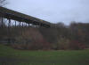 Road
viaduct (02-06) : Andrew Stopford Road
viaduct (02-06) : Andrew Stopford
The viaduct from Cleckheaton Spen into Cleckheaton (Feb
06) |
 Road
viaduct
- 1 (23-11-07) : Graeme Bickerdike Road
viaduct
- 1 (23-11-07) : Graeme Bickerdike
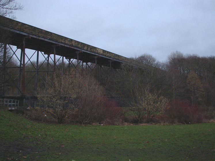
The pedestrian viaduct at Cleckheaton is around 450 feet long and spans
Mann Dam at Cleckheaton Bottoms. |
 Road
viaduct
- 2 (23-11-07) : Graeme Bickerdike Road
viaduct
- 2 (23-11-07) : Graeme Bickerdike
From an engineering perspective, this was no mean feat. |
 Road
viaduct
- 3 (23-11-07) : Graeme Bickerdike Road
viaduct
- 3 (23-11-07) : Graeme Bickerdike
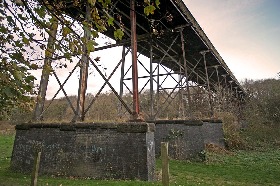
In 2001 a woman was badly injured after jumping 60 feet from the
structure.
She died later in hospital. The son of one of her friends had
done the same thing the year before. |
 Road
viaduct
- 4 (23-11-07) : Graeme Bickerdike Road
viaduct
- 4 (23-11-07) : Graeme Bickerdike
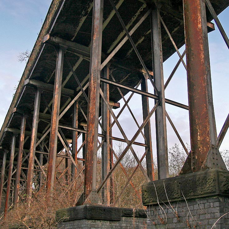
The supporting girders are anchored onto brick pillars. I didn't count
them but they must number about a dozen. |
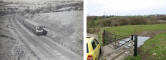
%20(5%20to10%2013-04-03)%20(11to19%2025-05-03)%20(20%20to%2025%2026-05-03)/6%20cleckheaton%20station%20round%20hill%20south_small.jpg) Station
round hill facing South (13-04-03) : David Webdale Station
round hill facing South (13-04-03) : David Webdale
Taken from the top of Round Hill. Cleckheaton town centre is visible in
the background. Looking down onto the goods yard area.
There was a mill
at the top of round hill, a footpath leads up to this area from the
valley bottom under the railway.
I found some derelict buildings, I
should have taken some photos. |
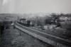
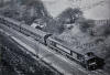
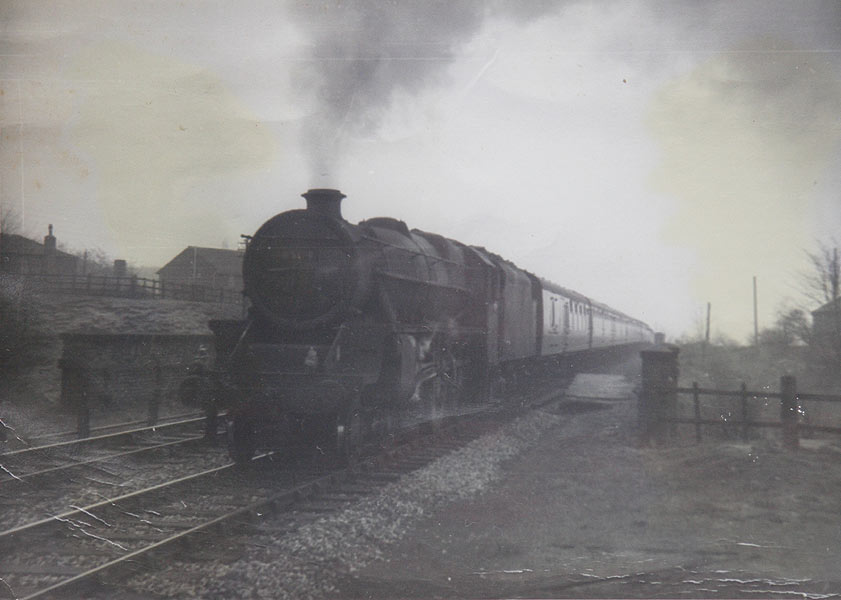
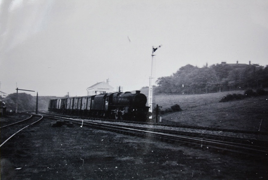
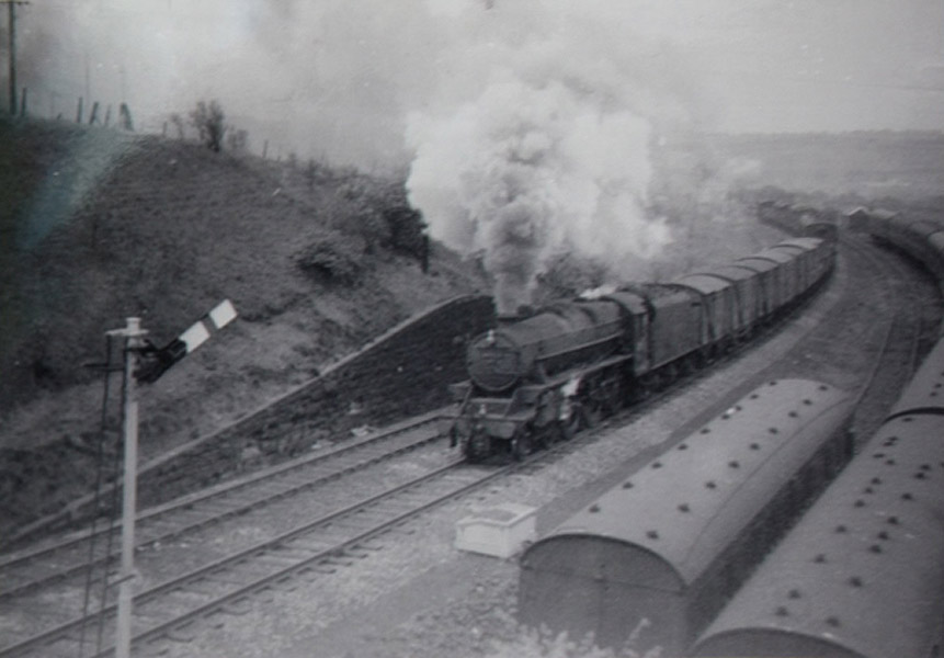
 Early
Transpennine DMU (1964) : Bernard Coomber Early
Transpennine DMU (1964) : Bernard Coomber
An early Transpennine DMU passing Cleckheaton Spen
signal box, heading for Huddersfield on the Leeds New Line circa 1964. |
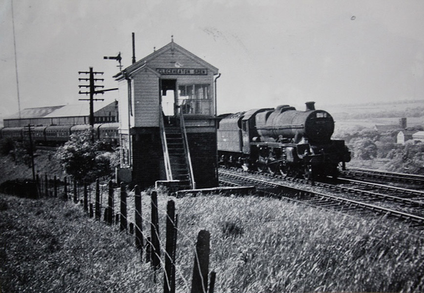
 Cleckheaton
Spen (01-06-1962) Bernard Coomber
collection Cleckheaton
Spen (01-06-1962) Bernard Coomber
collection
Photo taken 01 June 1962 ex LMS Black 5 45063 heads towards Cleckheaton
from Leeds on the Leeds New Line (LNWR) with a fitted fish train, the
top of Cleckheaton Spen signal box No2 is visible above the loco tender. |
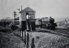 Cleckheaton
Spen (01-06-1963) Bernard Coomber collection Cleckheaton
Spen (01-06-1963) Bernard Coomber collection
Photo taken 01 June 1963 ex LMS Jubilee class 45558 'Manitoba' heads
towards Leeds on the Leeds New Line (LNWR), with a Newcastle bound express.It is seen here passing Cleckheaton Spen
signal box No2. On the
extreme right of the picture is St.John's Church Cleckheaton. |
 Underbridge (c1980)
: Paul Holroyd Underbridge (c1980)
: Paul Holroyd
Taken
circa 1980 showing the underbridge between Cleckheaton Spen goods yard
and the Cliffe Lane overbridge.
The footpath leads from Mann Dam to Roundhill Mill. |
 Cleckheaton Spen goods depot
(c1980) : Paul Holroyd Cleckheaton Spen goods depot
(c1980) : Paul Holroyd
Showing the gates of Cleckheaton Spen goods depot.
The viaduct over Mann Dam is to the left behind the photographer. |
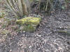
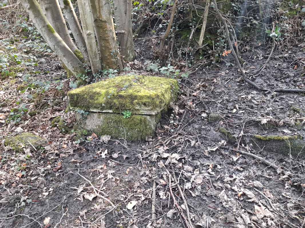
 Gradient post (c1980) : Paul Holroyd Gradient post (c1980) : Paul Holroyd
The gradient post on top of the underbridge carrying the footpath from
Mann Dam to Roundhill Mill.
The large white building is Wilson's Steel Stockholders
The smaller building was built later and is on the trackbed. |
 Cliffe
lane road bridge (1960) : Bernard Coomber Cliffe
lane road bridge (1960) : Bernard Coomber
English electric type 4 (now class 40) approaches Cliffe Lane road
bridge Cleckheaton with a Leeds bound express. circa 1960. |
 Cliffe
Lane road bridge (01-04-1962) Bernard Coomber
collection Cliffe
Lane road bridge (01-04-1962) Bernard Coomber
collection
Photo taken 01 April 1962 this view from Cliffe Lane road bridge looking
towards Cleckheaton, the large building in the middle distance is
Wilsons Steel Stockholders with Cleckheaton Spen signal box immediately
in front of it. The 2 lines on the right of the picture are sidings
regularly used to store empty carriage stock, this was known as the
Leeds New Line. |
 Cliffe
Lane road bridge (18-05-1963) Bernard Coomber
collection Cliffe
Lane road bridge (18-05-1963) Bernard Coomber
collection
Photo taken 18 May 1963 showing a Black 5 heading from Cleckheaton Spen
towards Leeds with an express fitted freight, the photograph is taken
from the Cliffe Lane road bridge looking south towards Cleckheaton on
the Leeds New Line (LNWR). |
 Cliffe
lane road bridge : Bernard Coomber (1963) / Graham Smith (2010) Cliffe
lane road bridge : Bernard Coomber (1963) / Graham Smith (2010)
An early Transpennine DMU passes under Cliffe lane
road bridge heading for Leeds. Circa 1963.
Then & now same location in 2010. |
 Cliffe
lane road bridge (1963) : Bernard Coomber Cliffe
lane road bridge (1963) : Bernard Coomber
Peak class loco passes under Cliffe lane road
bridge Cleckheaton heading for Leeds, circa 1963. |
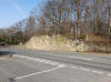
%20(5%20to10%2013-04-03)%20(11to19%2025-05-03)%20(20%20to%2025%2026-05-03)/7%20cliffe%20lane%20west_small.jpg) Cliffe
lane facing West (13-04-03) : David Webdale Cliffe
lane facing West (13-04-03) : David Webdale
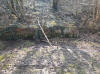
The railway passed under the road here. Only the bridge parapet on the
right hand side remains. |
%20(5%20to10%2013-04-03)%20(11to19%2025-05-03)%20(20%20to%2025%2026-05-03)/8%20cliffe%20lane%20north_small.jpg) Cliffe
lane facing North (13-04-03) : David Webdale Cliffe
lane facing North (13-04-03) : David Webdale
View from the bridge, facing in Leeds direction. Just down in the
bottom, hidden by trees is a stone bridge.
(see next photo). The route
follows the line of trees around to the right, towards Gomersal tunnel. |
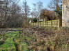
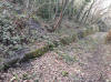
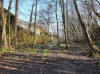
%20(5%20to10%2013-04-03)%20(11to19%2025-05-03)%20(20%20to%2025%2026-05-03)/9%20foot%20path%20east_small.jpg) Footpath
facing East (13-04-03) : David Webdale Footpath
facing East (13-04-03) : David Webdale
Taken from a footpath (see main map), between Cliffe lane & Gomersal
tunnel.
A new concrete slab spans the stone pillars, it looks like the old
railway route has been used for vehicle access.
Carrying on to the left
The line curves around into Gomersal tunnel. |
 Transpennine
DMU : Bernard Coomber (1965) / Graham Smith (2010) Transpennine
DMU : Bernard Coomber (1965) / Graham Smith (2010)
Early Transpennine DMU just emerged from Gommersal
tunnel, heading for Huddersfield, Circa 1965
& a before & after photo same location in 2010 |
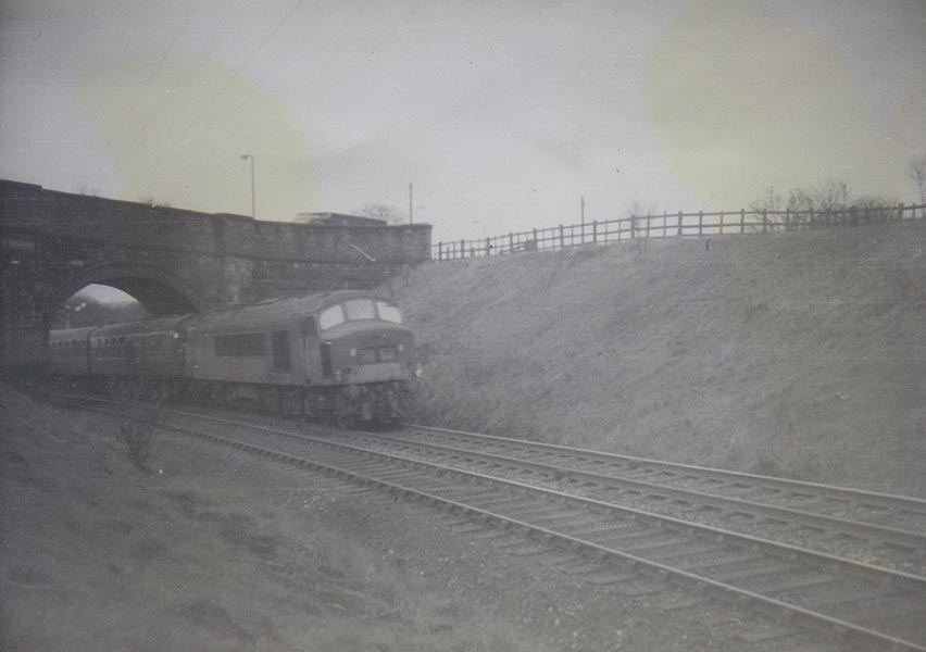
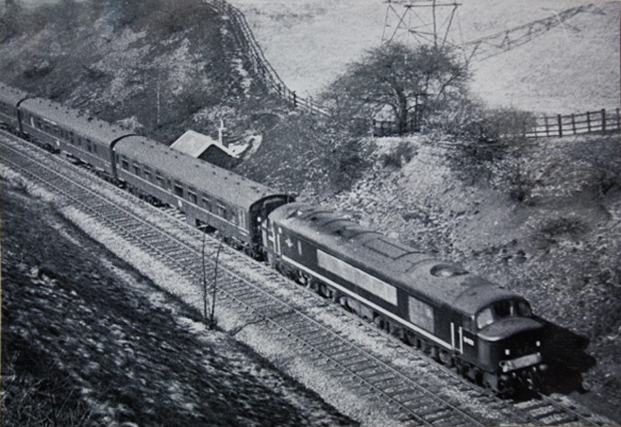
 Class
40 leaving Gomersal tunnel (25-04-1962) Bernard Coomber collection Class
40 leaving Gomersal tunnel (25-04-1962) Bernard Coomber collection
Photo taken 25 April 1962 having just emerged from Gomersal tunnel and
viewed from Cliffe Lane road bridge, this English Electric type 4 (now
class 40) is heading towards Cleckheaton on the Leeds New Line (LNWR)
with a Liverpool bound express.
|
 Class
40 leaving Gomersal tunnel (01-04-1962) Bernard Coomber collection Class
40 leaving Gomersal tunnel (01-04-1962) Bernard Coomber collection
Photo taken 01 April 1962 this view taken from Cliffe Lane road bridge
shows English Electric type 4 (now class 40) no. D271 having just
emerged from Gomersal tunnel it is heading towards Cleckheaton Spen on
the Leeds New Line (LNWR) with an express to Liverpool. |
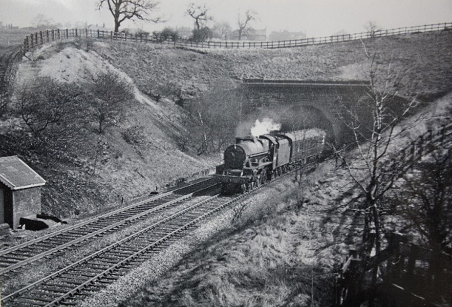
 Peak
class approaching Gomersal tunnel (03-1963) Bernard Coomber
collection Peak
class approaching Gomersal tunnel (03-1963) Bernard Coomber
collection
Date taken March 1963 showing a diesel peak class loco approaching
Gomersal tunnel from the Cleckheaton side this is on the Spen line known
as the Leeds 'new' line. |
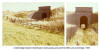
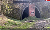
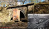
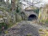
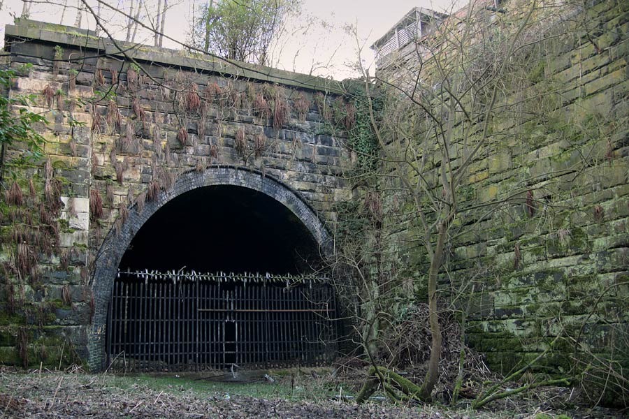
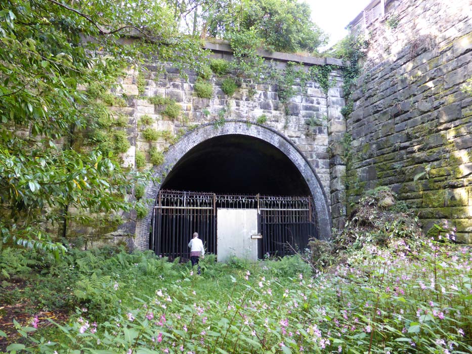
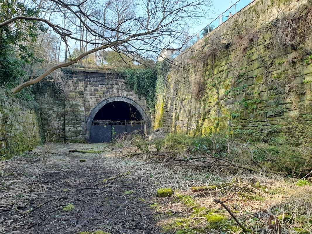
 Gomersal Tunnel Gomersal Tunnel
Gomersal tunnel West end (02-1963) Bernard Coomber
collection
Taken in February 1963 showing jubilee class 45698 'MARS' leaving the
Cleckheaton end of the Gomersal tunnel on the LNWR Leeds 'new' line.
The
tunnel mouth can still be seen but it is now bricked up. |
 Gomersal tunnel
Rumble video : AddventureTrips Gomersal tunnel
Rumble video : AddventureTrips
https://rumble.com/v2pdkys-gomersal-railway-tunnel.html |
 The
Leeds New Line part 5: Darren Hosker c/o Paul Holroyd The
Leeds New Line part 5: Darren Hosker c/o Paul Holroyd
Youtube from Darren Hosker
https://www.youtube.com/watch?v=BH78f6J24Wk |
 Gomersal
tunnel West end (c1967)
photo Paul Holroyd / Harry Naylor Holroyd
courtesy Richard Holroyd Gomersal
tunnel West end (c1967)
photo Paul Holroyd / Harry Naylor Holroyd
courtesy Richard Holroyd
The bricked up entrance back in 1969. |
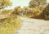
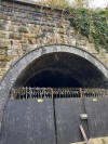
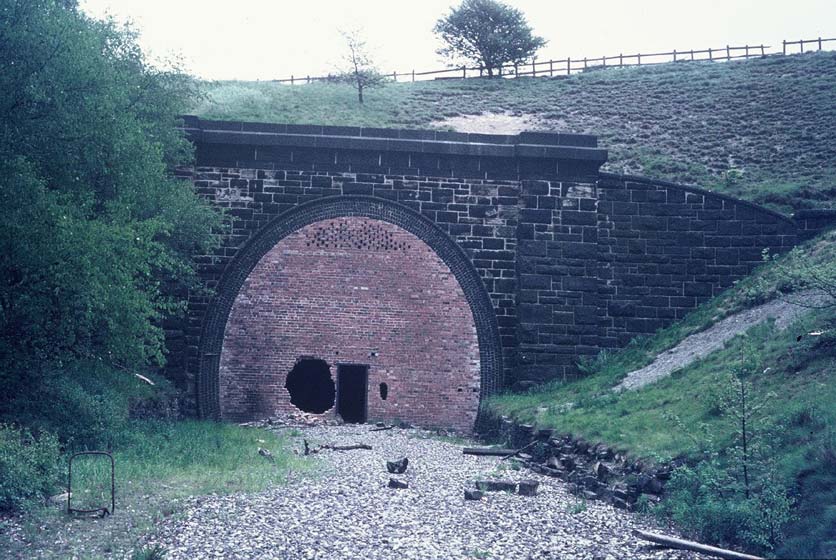
%20(5%20to10%2013-04-03)%20(11to19%2025-05-03)%20(20%20to%2025%2026-05-03)/10%20gomersal%20tunnel%20west%20end_small.jpg) Gomersal
tunnel West end (13-04-03) : David Webdale Gomersal
tunnel West end (13-04-03) : David Webdale
Completed in 1899. A straight 819 yards long,
built of blue engineering brick throughout with stone portals.
The
tunnel had only one ventilation shaft, it is short & straight, with
not much ground above.
Differing theories regarding the brick pillar in the entrance: -
Nigel Callaghan
I was most interested in that brick-built tower structure at the western
portal of Gomersal Tunnel. I've given it much tough and believe it might
have once contained some sort of filtration equipment for tests that
were once carried out inside the tunnel after its closure.
Tests of diesel fumes were also carried out in Lees Moor tunnel to test
and check for cancerous effects and a team from
St Bartholomew's Hospital in London visited the tunnel whilst the tests
were being conducted. I also believe similar tests were carried out in
in Savile Road Tunnel (or was it Soothill) one of those two anyway. I
think the small room at the top of the brick-tower might well have
housed filters or even chromatographs to monitor the air on whatever was
being tested. I have asked many people about that structure and so far
nobody seems to know.
Mark Hoyle (03-02-06)
I disagree with the email (Nigel Callaghan) about diesel fume testing. I
have been led to believe that the brick column in front of the portal
was all that materialised of British rails plans to fill in and restore
the landscape around the tunnel portal. the brick structure would have
allowed access into the tunnel, in case of emergency or maintenance. if
you venture around the back of the brick structure, you would find that
there is a staircase leading halfway up the structure, and at the top of
the stairs there is a doorway (no door) into the column, which when you
look inside, the column, you can see that there is another access hatch
at the top of the column. The authority responsible for the tunnel have
a lot of trouble with the structure, especially during the summertime,
when, people decide it is clever to set fires inside the tunnel, (wa***rs).
also the British rail property board occasionally turn up to inspect the
structure. In the centre recently a large section of it has collapsed,
however it is still possible to pass through the tunnel. British rail
acknowledge ownership of the structure, they have a website, which
acknowledges ownership of all there properties: -
http://www.brb.gov.uk/property
|
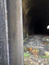
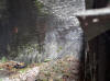
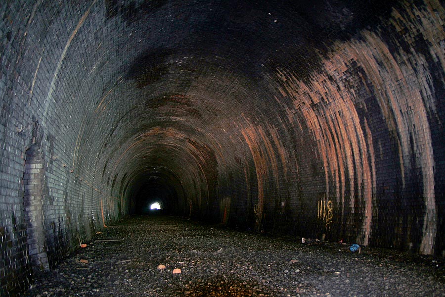
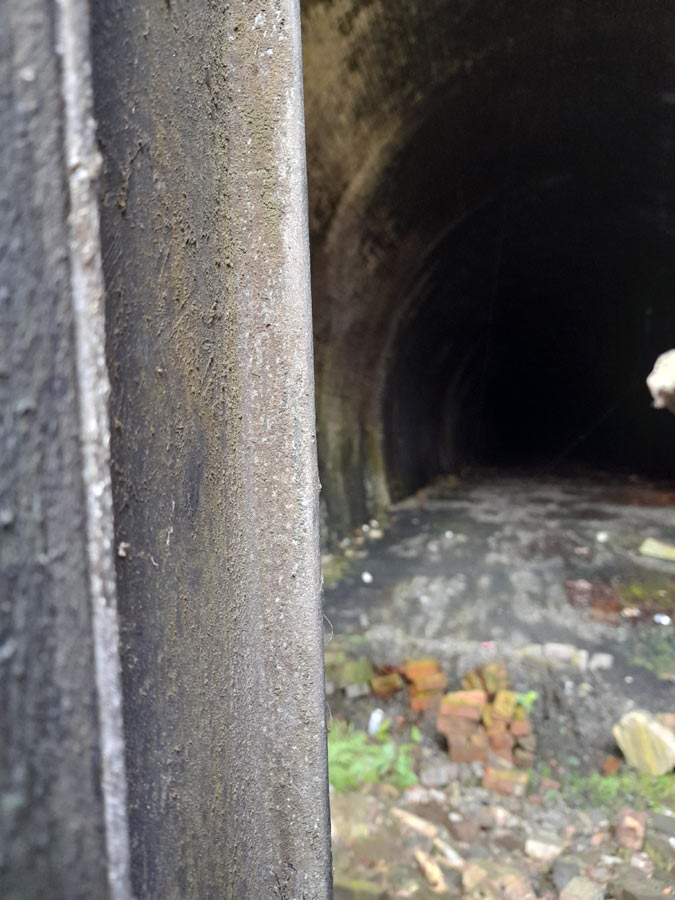
Gomersal tunnel (18-02-07) : Graeme Bickerdike
website -
http://www.forgottenrelics.co.uk/
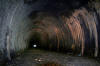 I
was surprised to find that the tunnel has a slight S-shape to it. From
the eastern portal, you can’t see the western end until you’re 100 yards
in, and even then it’s obscured. I didn’t venture too far but, for the
first 300 yards, the brickwork is in decent condition although very wet
in parts. This is the view looking west. There does appear to be a mound
of debris towards the other portal - perhaps this is the collapse which
Mark refers to. I
was surprised to find that the tunnel has a slight S-shape to it. From
the eastern portal, you can’t see the western end until you’re 100 yards
in, and even then it’s obscured. I didn’t venture too far but, for the
first 300 yards, the brickwork is in decent condition although very wet
in parts. This is the view looking west. There does appear to be a mound
of debris towards the other portal - perhaps this is the collapse which
Mark refers to. |
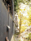
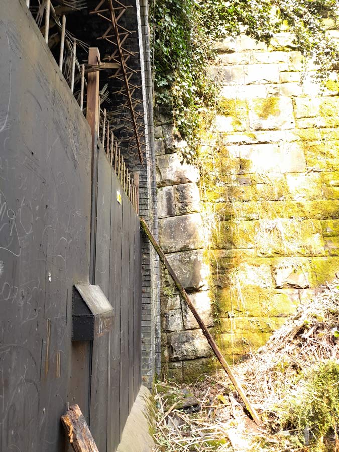
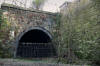 Gomersal
tunnel eastern portal
(18-02-07) : Graeme Bickerdike Gomersal
tunnel eastern portal
(18-02-07) : Graeme Bickerdike
This is the eastern portal and part of the huge retaining wall
which extends for around 100 yards on the north side of the former
station site. |
 Gomersal
tunnel eastern portal (04-08-14)
: Richard Bell Gomersal
tunnel eastern portal (04-08-14)
: Richard Bell
East end of Gomersal tunnel. |
 Gomersal
tunnel eastern portal (22-03-22)
:
Paul Holroyd Gomersal
tunnel eastern portal (22-03-22)
:
Paul Holroyd
Looking towards the eastern portal of Gomersal tunnel, the the
gardens of homes in Queen Street are on the right. Surprisingly, on the
day of Paul's visit, this part of the trackbed was considerably wetter
and muddier than the area immediately in front of the tunnel, |
 Gomersal
tunnel eastern portal (22-03-22)
:
Paul Holroyd Gomersal
tunnel eastern portal (22-03-22)
:
Paul Holroyd
The eastern portal of Gomersal tunnel, with the gardens of the
Queen Street houses on the right
There was a siding located on the left hand side in front of the
tunnel, with two sets of points connecting with the
Huddersfield-bound track.
|
 Gomersal
tunnel eastern portal (22-03-22)
:
Paul Holroyd Gomersal
tunnel eastern portal (22-03-22)
:
Paul Holroyd
Looking towards the eastern portal of Gomersal tunnel. |
 Gomersal
tunnel eastern portal (22-03-22)
:
Paul Holroyd Gomersal
tunnel eastern portal (22-03-22)
:
Paul Holroyd
Almost hidden by foliage, the top of the tunnel displays the 1899
build date. What lurks behind the locked gate? |
 Gomersal
tunnel eastern portal (22-03-22)
:
Paul Holroyd Gomersal
tunnel eastern portal (22-03-22)
:
Paul Holroyd
Interior view of the eastern end of Gomersal tunnel, looking
towards Cleckheaton |
 Gomersal
tunnel eastern portal (22-03-22)
:
Paul Holroyd Gomersal
tunnel eastern portal (22-03-22)
:
Paul Holroyd
Another view of the interior of Gomersal tunnel, eastern end. |
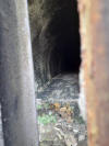 Gomersal
tunnel eastern portal (22-03-22)
:
Paul Holroyd Gomersal
tunnel eastern portal (22-03-22)
:
Paul Holroyd
Interior of Gomersal railway tunnel, looking towards Cleckheaton. |
 Gomersal
tunnel eastern portal (22-03-22)
:
Paul Holroyd Gomersal
tunnel eastern portal (22-03-22)
:
Paul Holroyd
A close up showing the blue engineering brick construction of the
tunnel, with the impressive stone retaining wall backing ojn to the
gardens of homes in Queen Street. |
 Gomersal
tunnel eastern portal (22-03-22)
:
Paul Holroyd Gomersal
tunnel eastern portal (22-03-22)
:
Paul Holroyd
Stone retaining wall, on the south side of the eastern portal of
Gomersal tunnel. |
 Gomersal
tunnel eastern portal (22-03-22)
:
Paul Holroyd Gomersal
tunnel eastern portal (22-03-22)
:
Paul Holroyd
The south side retaining wall sloping down from Gomersal tunnel's
eastern portal. |
 Gomersal
tunnel eastern portal (22-03-22)
:
Paul Holroyd Gomersal
tunnel eastern portal (22-03-22)
:
Paul Holroyd
The end of the south side retaining wall at Gomersal. |
 Gomersal
tunnel eastern portal (22-03-22)
:
Paul Holroyd Gomersal
tunnel eastern portal (22-03-22)
:
Paul Holroyd
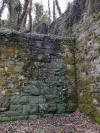
A little further on from the stone retaining wall, also on the
south side of the trackbed, is this brick wall. |
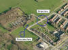
Gomersal station
Opened 01-10-1900. Closed 05-10-1953.
Gomersal
station map 1908 : David Webdale
 Situated next to the Eastern entrance to Gomersal tunnel.
Platforms & buildings of timber construction, including a subway. Situated next to the Eastern entrance to Gomersal tunnel.
Platforms & buildings of timber construction, including a subway.
The goods yard, situated south of the station, consisted of 4 sidings.
The massive buildings in the yard were originally used as a textile willeying shed and were
known locally as the Silk Mill.
After the railway had finished with them they became a soap factory &
ended their life as a scrap metal merchants.
Nothing of the station or goods yard remains now.
Note : Alan Hodgson
I'm doing a bit of research on the area around the
old Gomersal Station and noticed that mention is made of its goods
warehouses there being called 'the Silk Mill'. I beleive this is
inaccurate as old maps show the buildings to have been the now vanished
Broadroyd Mills which was actually a woollen textile concern.
I believe the confusion has arisen in that there was a smaller
single-building Silk Mill almost opposite the former entrance to the
railway station across Moor Lane, but which had no connection to the
railway. This still stands but since 1910 has been used as a venue for
various dance schools.
A bit more research as revealed that Broadroyd Mill was concerned with
woollens and silk processing, although my initial findings stand!
The
company occupying the site seemingly went bust and closed around the
time the LNWR were planning their 'Leeds New Line' through Gomersal,
thus leaving the railwaymen with a golden opportunity to snap it up and
convert the former mill into sidings and goods warehouse. |
 Gomersal
station facing east (nd) : Gareth Nolan Gomersal
station facing east (nd) : Gareth Nolan
Taken from near the signal box facing towards Leeds. (see photo below). |
%20(5%20to10%2013-04-03)%20(11to19%2025-05-03)%20(20%20to%2025%2026-05-03)/18%20gomersal%20station%20east_small.jpg) Gomersal
station facing east (25-05-03) : David Webdale Gomersal
station facing east (25-05-03) : David Webdale
The view towards Gomersal station facing
towards Leeds.
Taken from somewhere near where the signal box once stood, (see photo
above).
|
 Gomersal
tunnel eastern portal (22-03-22)
:
Paul Holroyd Gomersal
tunnel eastern portal (22-03-22)
:
Paul Holroyd
Taken in front of the eastern portal of Gomersal tunnel, looking
towards Birstall. |
 Gomersal
tunnel eastern portal (22-03-22)
:
Paul Holroyd Gomersal
tunnel eastern portal (22-03-22)
:
Paul Holroyd
Looking towards the site of the Dewsbury Road bridge, the tracked
is now obliterated by housing development. |
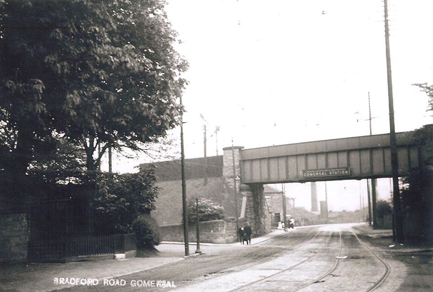
 Gomersal bridge
:
K Evans Gomersal bridge
:
K Evans
Taken from Bradford road. The station platforms
were up on the right.
The Station masters house was the toll gate house. The station masters
house is still standing a bit further up Moor Lane. |
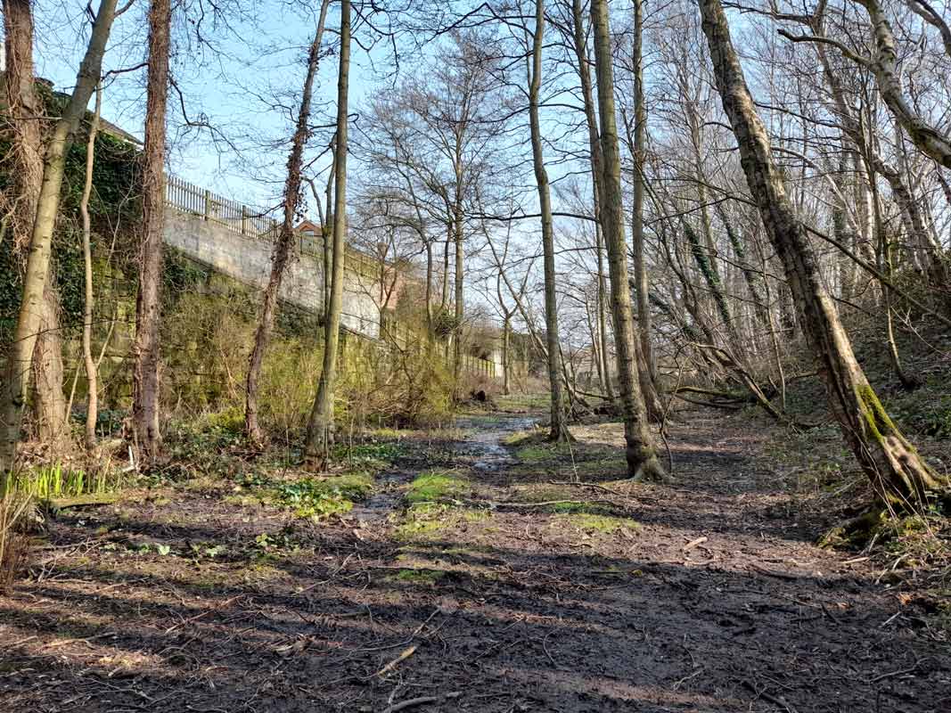
%20(5%20to10%2013-04-03)%20(11to19%2025-05-03)%20(20%20to%2025%2026-05-03)/13%20dewsbury%20road%20east_small.jpg) Gomersal
bridge facing North (25-05-03) : David Webdale Gomersal
bridge facing North (25-05-03) : David Webdale
Taken from Dewsbury road, facing in the opposite direction as the above
photo. The station platforms were just up to the
left, on top of the embankment behind those houses. An iron
deck bridge spanned the road. (see above photo) A road on the left, roughly in the same
place as it is now, lead into the goods yard. The warehouse was the
biggest on the line. |
%20(5%20to10%2013-04-03)%20(11to19%2025-05-03)%20(20%20to%2025%2026-05-03)/19%20dewsbury%20road%20north_small.jpg) Gomersal bridge facing East
(25-05-03) : David Webdale Gomersal bridge facing East
(25-05-03) : David Webdale
Closer view of the bus stop. From here the line enters the
grounds of Oakwell Hall on an embankment. |
 Gomersal
Bridge (22-03-22)
:
Paul Holroyd Gomersal
Bridge (22-03-22)
:
Paul Holroyd
The end of the south side retaining wall at Gomersal.The Oakwell
Hall side abutment of the bridge over Dewsbury Road, Gomersal, with the
trackbed clearly visible. Note that the bus stop has been moved
since the previous photo was taken.. |
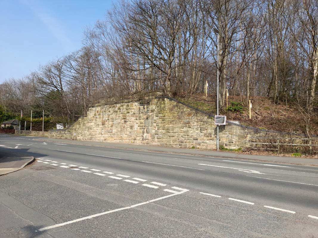
%20(5%20to10%2013-04-03)%20(11to19%2025-05-03)%20(20%20to%2025%2026-05-03)/14%20dewsbury%20road%20south_small.jpg) Gomersal
bridge facing South (25-05-03) : David Webdale Gomersal
bridge facing South (25-05-03) : David Webdale
Remnants of Gomersal bridge. Taken from the junction of Moor lane &
Dewsbury road. |
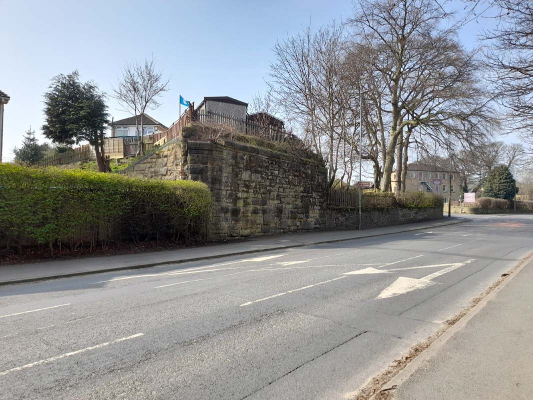
Gomersal Bridge (22-03-22)
:
Paul Holroyd
 The
bridge abutment in Dewsbury Road, where the platforms of Gomersal
station once ended, clearly showing the housing development on the
former trackbed. The
bridge abutment in Dewsbury Road, where the platforms of Gomersal
station once ended, clearly showing the housing development on the
former trackbed.
The building on the edge of Moor Lane is
now known as "Dancing House". The Spenborough Urban District
Official Handbook 1947-48, published by Pyramid Press Limited,
states:
"The Stevenson School of Ballroom Dancing, Cambridge Hall, Moor
Lane, Gomersal, is without a doubt, the oldest and most reliable,
having been established since 1910. Thousands of Spenborough
inhabitants will remember the founders - the late Mr. and Mrs. Tom
Stevenson, who, during their years progressed with the times from
the "Old Time" dances, to the most up--to-date modern style.Miss
D.U. Stevenson, their daughter, who assisted them for many years, is
still progressing with the same high standard of teaching in
partnership with her husband, Mr. E.B. Taylor. "
|
%20(5%20to10%2013-04-03)%20(11to19%2025-05-03)%20(20%20to%2025%2026-05-03)/20%20red%20house_small.jpg) The Red House
: David Webdale website -
http://www.bronte-country.com/redhse.html The Red House
: David Webdale website -
http://www.bronte-country.com/redhse.html
Nothing to do with railways,
but If you're in Gomersal, you may
as well visit the red house on Oxford Road.
Most of its a bit Bronte sisters, but they do have some railway &
industrial stuff, covering the surrounding areas. |
%20(5%20to10%2013-04-03)%20(11to19%2025-05-03)%20(20%20to%2025%2026-05-03)/15%20oakwell%20hall%20footbridge%20north_small.jpg) Oakwell
Hall footbridge facing North (25-05-03) : David Webdale Oakwell
Hall footbridge facing North (25-05-03) : David Webdale
This my be Warren lane bridge (see next photo, looks similar) At Birstall the line had to deviate around the perimeter of Oakwell
Hall grounds. |
 Warren
Lane Bridge
:
K Evans Warren
Lane Bridge
:
K Evans
Train Approaching Warren Lane Bridge - The bridge
near Oakwell Hall.
The Train is on what is now the footpath around the Oakwell Hall Park. |
%20(5%20to10%2013-04-03)%20(11to19%2025-05-03)%20(20%20to%2025%2026-05-03)/16%20oakwell%20hall%20aquaduct%20north_small.jpg) Oakwell
Hall aqueduct facing North (25-05-03) : David Webdale Oakwell
Hall aqueduct facing North (25-05-03) : David Webdale
Hundred yards or so towards Leeds an aqueduct was made to channel a small watercourse, then called Nova
Beck, over the line, since renamed Imaginatively Oakwell beck. Looks like a couple of bits of old R.S.J to me, seems to work
though. The cutting is deep here. |
 Oakwell Hall bridge
:
K Evans Oakwell Hall bridge
:
K Evans
A bridge (now gone and land raised slightly) in
Oakwell Hall Grounds - Behind the bridge is a pond that Oakwell Hall
refer to as Colliery Pond - which is in accurate. If you visit the pond
there is a concrete ledge and the pond actually formed part of this
underpass under the railway. |

/Gomersal.jpg)
/Spen.jpg)


%20(5%20to10%2013-04-03)%20(11to19%2025-05-03)%20(20%20to%2025%2026-05-03)/1%20spen%20lane%20north.jpg)


%20(5%20to10%2013-04-03)%20(11to19%2025-05-03)%20(20%20to%2025%2026-05-03)/2%20cleckheaton%20station%20south.jpg)

%20(5%20to10%2013-04-03)%20(11to19%2025-05-03)%20(20%20to%2025%2026-05-03)/3%20cleckheaton%20road%20bridge%20west.jpg)
%20(5%20to10%2013-04-03)%20(11to19%2025-05-03)%20(20%20to%2025%2026-05-03)/4%20cleckheaton%20road%20bridge%20south.jpg)


%20(5%20to10%2013-04-03)%20(11to19%2025-05-03)%20(20%20to%2025%2026-05-03)/6%20cleckheaton%20station%20round%20hill%20south.jpg)


%20(5%20to10%2013-04-03)%20(11to19%2025-05-03)%20(20%20to%2025%2026-05-03)/7%20cliffe%20lane%20west.jpg)
%20(5%20to10%2013-04-03)%20(11to19%2025-05-03)%20(20%20to%2025%2026-05-03)/8%20cliffe%20lane%20north.jpg)
%20(5%20to10%2013-04-03)%20(11to19%2025-05-03)%20(20%20to%2025%2026-05-03)/9%20foot%20path%20east.jpg)

%20(5%20to10%2013-04-03)%20(11to19%2025-05-03)%20(20%20to%2025%2026-05-03)/10%20gomersal%20tunnel%20west%20end.jpg)


%20(5%20to10%2013-04-03)%20(11to19%2025-05-03)%20(20%20to%2025%2026-05-03)/18%20gomersal%20station%20east.jpg)

%20(5%20to10%2013-04-03)%20(11to19%2025-05-03)%20(20%20to%2025%2026-05-03)/13%20dewsbury%20road%20east.jpg)
%20(5%20to10%2013-04-03)%20(11to19%2025-05-03)%20(20%20to%2025%2026-05-03)/19%20dewsbury%20road%20north.jpg)
%20(5%20to10%2013-04-03)%20(11to19%2025-05-03)%20(20%20to%2025%2026-05-03)/14%20dewsbury%20road%20south.jpg)
%20(5%20to10%2013-04-03)%20(11to19%2025-05-03)%20(20%20to%2025%2026-05-03)/20%20red%20house.jpg)
%20(5%20to10%2013-04-03)%20(11to19%2025-05-03)%20(20%20to%2025%2026-05-03)/15%20oakwell%20hall%20footbridge%20north.jpg)
%20(5%20to10%2013-04-03)%20(11to19%2025-05-03)%20(20%20to%2025%2026-05-03)/16%20oakwell%20hall%20aquaduct%20north.jpg)